1980s Maps of Hawaiʻi County, Hawaii
Explore 75 historic maps of Hawaiʻi County from the 1980s. These maps offer a rare glimpse into what life looked like during the 1980s — showing old roads, neighborhoods, homes, and landmarks that have changed or disappeared over time.
Whether you're researching your family's past, planning a metal detecting trip, or studying how Hawaiʻi County's landscape evolved across the 1980s, these high-resolution maps are a powerful tool for exploring the history of this region.
- Focus on a specific era: All maps on this page are from the 1980s, giving you a focused view of this time period.
- See what’s changed: Compare century-old streets, trails, and buildings to today's modern landscape using overlays and satellite layers.
- Research with precision: Use these maps for genealogy, historical research, land use analysis, or educational projects.
- View, download, or print: Maps are fully viewable online in high resolution, and can be downloaded or printed for your own records.
Start exploring Hawaiʻi County's history through authentic maps from the 1980s. This is your window into the past.
Hawaiʻi County, HI maps
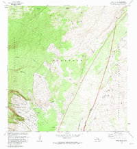
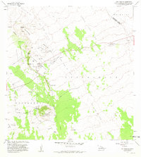
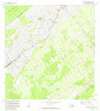
(75)- 1980 Map of Keaau Ranch, 1981 Print
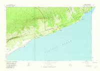
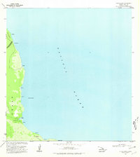 1980 Keaau Ranch1981 Print · USGSThe Puna coastline of Hawaii Island is shown here in the early 1980s, highlighting the remote settlements and ranch lands of the eastern shore. Researchers can trace the rugged shoreline from Kaloli Point to Anapuka, locating family-named sites like Keaau Ranch and Wahine Maka Nui.
 - 1980 Map of Papaaloa, 1981 Print
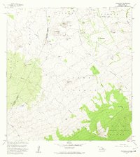
 1980 Papaaloa1981 Print · USGSThe Hamakua Coast of Hawaii Island appears in the early eighties as a network of homesteads and deep river gulches. Genealogists can trace family locations through numerous tracts like the Papaaloa Homesteads and find landmarks such as Kapehu Camp or the Tidal Wave Memorial.2 unique versions available
 - 1980 Map of Pahoa South, 1981 Print
 1980 Pahoa South1981 Print · USGSThe Puna District of Hawaii comes into focus during the early eighties, showing a landscape shaped by recent volcanic activity and modern homesteading. Researchers can trace the path of the Lava Flow of 1955 through coastal tracts or locate historic sites like Kaniahiku Village and the Old Railroad Grade.
 - 1980 Map of Hawaii County Sheet 1, 1984 Print
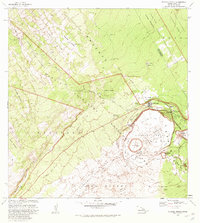
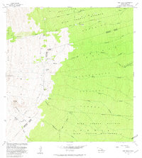
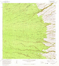
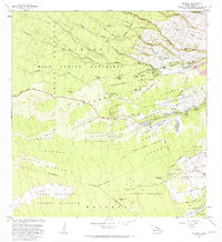
 1980 Hawaii County Sheet 11984 Print · USGSThe Big Island's diverse terrain and transition into the 1980s are shown here, from the northern coast to the high mountain saddles. Genealogists and historians can trace homesteads and local roads near Kailua, Kukuihaele, and the Ahualoa area.
 - 1980 Map of Hawaii County Sheet 3, 1984 Print
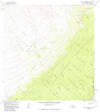
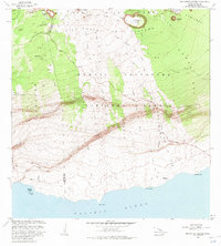
 1980 Hawaii County Sheet 31984 Print · USGSThe Big Island's South Kona and Kau districts are captured here in the early 1980s, from the historic coffee lands to the southern tip. Researchers can trace the layout of coastal villages and sugar-era settlements like Milolii, Pahala, and the City of Refuge Nat Historical Pk.
 - 1980 Map of Hawaii County Sheet 2, 1985 Print
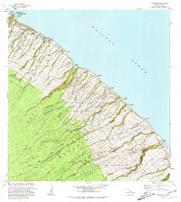
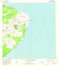
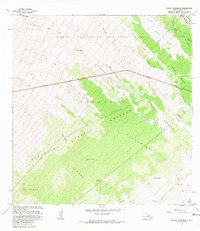
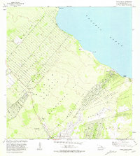
 1980 Hawaii County Sheet 21985 Print · USGSThe eastern coast of the Big Island is captured here in the early eighties, showcasing the intersection of active volcanic landforms and historic plantation towns. Researchers can trace family roots through settlements like Laupahoehoe and Papaikou, or explore the road networks around Kilauea Crater and General Lyman Field.
 - 1981 Map of Puu Hou
 1981 Puu Hou1981 Print · USGSThe southern volcanic coastline of Hawaii Island is captured in the early 1980s, showcasing a landscape shaped by massive basaltic eruptions. Researchers can locate coastal settlements like Waialua and trace historical paths through the Lava Flow of 1887 and Lava Flow of 1868.
 - 1981 Map of Wood Valley
 1981 Wood Valley1981 Print · USGSThe slopes of Mauna Loa and Kilauea meet in the early 1980s, revealing a landscape of historic ranching and active volcanic rift zones. Researchers can trace the layout of the Wood Valley Homesteads, the Kapapala Ranch, and the dramatic Great Crack.2 unique versions available
 - 1981 Map of Kapoho
 1981 Kapoho1981 Print · USGSThe Puna coastline is captured here in the early eighties, showing a landscape transformed by the Lava Flow of 1960 and earlier eruptions. Researchers can find archaeological sites like Kukii Heiau, coastal landmarks like Cape Kumukahi, and local features such as Green Lake.
 - 1981 Map of Kilauea Crater
 1981 Kilauea Crater1981 Print · USGSThe volcanic heart of Hawaii Island comes alive in this early 1980s record of Kilauea's evolving landscape and park infrastructure. Trace the reach of recent eruptions through the Lava Flow of 1974 and locate landmarks like the Volcano House or the Kilauea Military Camp.3 unique versions available
 - 1981 Map of Keaiwa Reservoir
 1981 Keaiwa Reservoir1981 Print · USGSThe volcanic terrain of Hawaii's Kau District comes into sharp focus during the early 1980s, revealing a landscape defined by historic eruptions. Trace the path of the Lava Flow of 1950 and locate remote landmarks like the Noguchi Tunnel and Keaiwa Reservoir.2 unique versions available
 - 1981 Map of Kalapana
 1981 Kalapana1981 Print · USGSCoastal Puna is captured here in the early eighties, just before volcanic activity fundamentally changed this shoreline. Researchers can trace the layout of Kalapana and find cultural landmarks like the Petroglyphs Puuloa, Wahaula Heiau, and Queens Bath.2 unique versions available
 - 1981 Map of Makahalau
 1981 Makahalau1981 Print · USGSThe high slopes of the Big Island are documented here in the early eighties, where ranching outposts meet the forest line. Genealogists and local historians can trace the foundations of Mana, the Cem near Nienie, and landmarks like Paliaalii.2 unique versions available
 - 1981 Map of Pua Akala
 1981 Pua Akala1981 Print · USGSThe high slopes of Mauna Kea meet the windward forest reserves in the early eighties. Researchers can trace remote outposts like Kanakaleonui Cabin, the Laumaia (Site), and Spring Water Camp along the historic Keanakolu Road.
 - 1981 Map of Kahuku Ranch
 1981 Kahuku Ranch1981 Print · USGSKa'u's volcanic landscape is captured here in the early eighties, showcasing the intersection of active geology and ranching life. Researchers can find old agricultural sites at Kahuku Ranch and trace sacred locations like Heiau o Malino.
 - 1981 Map of Puu Anahulu
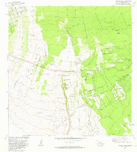
 1981 Puu Anahulu1981 Print · USGSThe volcanic landscape of North Kona and South Kohala is captured here in the early 1980s, shaped by the massive Lava Flow of 1859. Researchers can trace local ranching history at Puu Waawaa Ranch and the distinctive Puu Anahulu Homesteads.
 - 1981 Map of Kipuka Pakekake
 1981 Kipuka Pakekake1981 Print · USGSThe volcanic slopes of Hawaii Island are preserved here in the early eighties, showing where ancient forests survived as kipukas amidst fresh flows. Trace rugged 4WD tracks across the Ainapo and find remote landmarks like Maluikeao and the Rain Shed.2 unique versions available
 - 1981 Map of Papa
 1981 Papa1981 Print · USGSSouth Kona in the early eighties reveals a landscape defined by volcanic history and upland forestry. Genealogists can trace family lands at Papa Homesteads or locate cultural markers like the Hoopuloa Church Monument and old industrial sites like Ohia Mill.
 - 1981 Map of Akaka Falls
 1981 Akaka Falls1981 Print · USGSThe Big Island's windward coast is mapped here in the early eighties, showing the transition from forest reserves to coastal agriculture. Genealogists and historians can trace old land divisions like Honomu Homesteads and landmarks like Mauna Kea Mem Park.2 unique versions available
 - 1981 Map of Mountain View
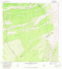
 1981 Mountain View1981 Print · USGSThe Puna District comes into focus during the early 1980s as agricultural camps transitioned into established residential communities. Genealogists and historians can trace old homestead boundaries and plantation life through Ninemile Camp, Kurtistown, and the Ola A Homesteads.
 - 1981 Map of Pahoa North
 1981 Pahoa North1981 Print · USGSThe Puna coastline and the burgeoning subdivisions north of Pahoa are documented here in the early eighties. Genealogists and historians can locate family holdings in the Nanawale Homesteads or trace the historical site of Makuu and Honolulu Landing.2 unique versions available
 - 1981 Map of Manuka Bay
 1981 Manuka Bay1981 Print · USGSThe southwestern Hawaii coastline in the early 1980s reveals a volatile landscape where the South Kona and Kau districts meet. Researchers can trace ancient cultural sites like the Heiau near Manuka Bay or geological features like Lava Tubes and the islands of land known as Kipuka Malua.
 - 1981 Map of Mauna Loa
 1981 Mauna Loa1981 Print · USGSThe summit of Mauna Loa is captured here in the early eighties, documenting decades of volcanic transformation across the high caldera. Researchers can trace the extent of the LAVA FLOW OF 1975 and locate landmarks like the Mauna Loa Cabin and Jaggars Cave.2 unique versions available
 - 1981 Map of Piihonua
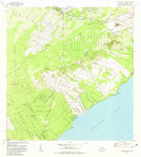
 1981 Piihonua1981 Print · USGSThe Hilo district in the early eighties shows the intersection of volcanic history and early island settlement. Researchers can trace the Lava Flow of 1881 past the Kaumana Cem or locate old waterworks like the Olaa Flume Spring.2 unique versions available
 - 1981 Map of Makaopuhi Crater
 1981 Makaopuhi Crater1981 Print · USGSThe Hawaii coast near the East Rift Zone is captured here during a period of intense volcanic transformation. Researchers can trace the progression of major eruptions and identify the locations of former settlements like Kealakomo (Site) and Ainahou Ranch.3 unique versions available
Showing maps 1-25 of 75
Top cities of Hawaiʻi County
Frequently asked questions
- What are the different types of historical maps available for Hawaiʻi County?
- What is the oldest map of Hawaiʻi County?
- Where can I purchase historical maps of Hawaiʻi County for my home or office?
- Where can I download high-res historical maps of Hawaiʻi County?
- Are there historical topographic maps available for Hawaiʻi County?
- Is there historical aerial imagery available for Hawaiʻi County?
- Where are historical maps of Hawaiʻi County sourced from?