Old Maps of Fremont County, Idaho for Metal Detecting
Plan your next treasure hunt with 88 historic maps of Fremont County. Find old homesites, ghost towns, trails, and gathering spots that may be lost to time — perfect for identifying promising metal detecting locations.
- Locate forgotten sites: Uncover places like long-lost settlements, abandoned rail lines, or gathering spots.
- Plan better hunts: Use map overlays combined with LiDAR or satellite views to narrow in on historically rich areas.
- Made for detectorists: Thousands of hobbyists use these maps to discover relics, coins, and hidden history.
Use these historic maps to boost your research and find new opportunities beneath the surface of Fremont County.
Fremont County, ID maps
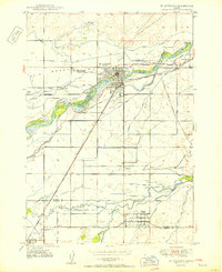
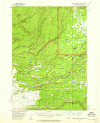
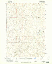
(88)- 1948 Map of Parker, 1973 Print
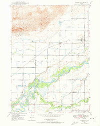 1948 Parker1973 Print · USGSCovers Fremont County, including Sugar City, Parker, and other nearby areas2 unique versions available
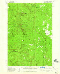
 - 1949 Map of Newdale, 1966 Print
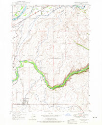 1949 Newdale1966 Print · USGSCovers Fremont County, including Newdale, Madison County, and other nearby areas2 unique versions available
 - 1950 Map of Parker
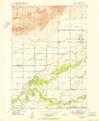 1950 Parker1950 Print · USGSCovers Fremont County, including Sugar City, Parker, and other nearby areas
 - 1950 Map of Newdale
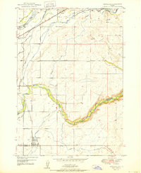 1950 Newdale1950 Print · USGSCovers Fremont County, including Newdale, Madison County, and other nearby areas
 - 1950 Map of St Anthony
 1950 St Anthony1950 Print · USGSCovers Fremont County, including St. Anthony, Sugar City, and other nearby areas3 unique versions available
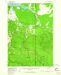
 - 1950 Map of Hebgen Dam, 1954 Print
 1950 Hebgen Dam1954 Print · USGSCovers Fremont County, including Kirkwood, Clark Springs, and other nearby areas7 unique versions available
 - 1950 Map of Upper Red Rock Lake, 1954 Print
 1950 Upper Red Rock Lake1954 Print · USGSCovers Fremont County, including Beaverhead County, Clark County, and other nearby areas3 unique versions available
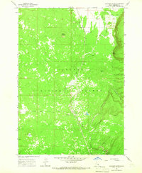
 - 1951 Map of Plano, 1953 Print
 1951 Plano1953 Print · USGSCovers Fremont County, including Madison County, Jefferson County, and other nearby areas2 unique versions available
 - 1955 Map of Dubois
 1955 Dubois1955 Print · USGSCovers Fremont County, including Dubois, Lima, and other nearby areas4 unique versions available
 - 1955 Map of Idaho Falls, 1963 Print
 1955 Idaho Falls1963 Print · USGSCovers Fremont County, including Idaho Falls, Blackfoot, and other nearby areas5 unique versions available
 - 1955 Map of Ashton, 1967 Print
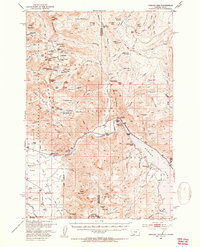
 1955 Ashton1967 Print · USGSCovers Fremont County, including West Yellowstone, Ashton, and other nearby areas4 unique versions available
 - 1955 Map of Driggs, 1967 Print
 1955 Driggs1967 Print · USGSCovers Fremont County, including Idaho Falls, Rexburg, and other nearby areas3 unique versions available
 - 1957 Map of Warm River Butte, 1958 Print
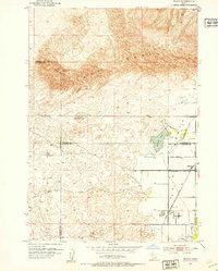
 1957 Warm River Butte1958 Print · USGSCovers Fremont County, including Teton County, United States, and other nearby areas3 unique versions available
 - 1957 Map of Buffalo Lake, 1959 Print
 1957 Buffalo Lake1959 Print · USGSCovers Fremont County, including Gallatin County, Teton County, and other nearby areas2 unique versions available
 - 1958 Map of Driggs
 1958 Driggs1958 Print · USGSCovers Fremont County, including Idaho Falls, Rexburg, and other nearby areas2 unique versions available
 - 1958 Map of Dubois
 1958 Dubois1958 Print · USGSCovers Fremont County, including Dubois, Lima, and other nearby areas2 unique versions available
 - 1958 Map of Idaho Falls
 1958 Idaho Falls1958 Print · USGSCovers Fremont County, including Idaho Falls, Blackfoot, and other nearby areas2 unique versions available
 - 1958 Map of Ashton
 1958 Ashton1958 Print · USGSCovers Fremont County, including West Yellowstone, Ashton, and other nearby areas
 - 1958 Map of West Yellowstone, 1960 Print
 1958 West Yellowstone1960 Print · USGSCovers Fremont County, including West Yellowstone, Railroad Summer Home Area, and other nearby areas3 unique versions available
 - 1960 Map of Ashton
 1960 Ashton1960 Print · USGSCovers Fremont County, including West Yellowstone, Ashton, and other nearby areas
 - 1962 Map of Driggs
 1962 Driggs1962 Print · USGSCovers Fremont County, including Idaho Falls, Rexburg, and other nearby areas
 - 1964 Map of Hatchery Butte, 1965 Print
 1964 Hatchery Butte1965 Print · USGSCovers Fremont County, including United States, Idaho, and other nearby areas2 unique versions available
 - 1964 Map of Dubois NE, 1965 Print
 1964 Dubois NE1965 Print · USGSCovers Fremont County, including Clark County, United States, and other nearby areas
 - 1964 Map of Island Park, 1965 Print
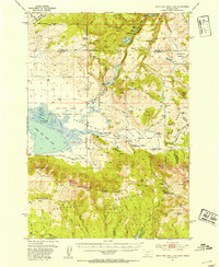
 1964 Island Park1965 Print · USGSCovers Fremont County, including Island Park, Big Springs, and other nearby areas3 unique versions available
 - 1964 Map of Island Park Dam, 1966 Print
 1964 Island Park Dam1966 Print · USGSCovers Fremont County, including Island Park, Box Canyon, and other nearby areas3 unique versions available
Showing maps 1-25 of 88
Top cities of Fremont County
- St. Anthony historical maps
- Ashton historical maps
- Teton historical maps
- Parker historical maps
- Island Park historical maps
- Warm River historical maps
Frequently asked questions
- What are the different types of historical maps available for Fremont County?
- What is the oldest map of Fremont County?
- Where can I purchase historical maps of Fremont County for my home or office?
- Where can I download high-res historical maps of Fremont County?
- Are there historical topographic maps available for Fremont County?
- Is there historical aerial imagery available for Fremont County?
- Where are historical maps of Fremont County sourced from?