1960s Maps of Fremont County, Idaho
Explore 32 historic maps of Fremont County from the 1960s. These maps offer a rare glimpse into what life looked like during the 1960s — showing old roads, neighborhoods, homes, and landmarks that have changed or disappeared over time.
Whether you're researching your family's past, planning a metal detecting trip, or studying how Fremont County's landscape evolved across the 1960s, these high-resolution maps are a powerful tool for exploring the history of this region.
- Focus on a specific era: All maps on this page are from the 1960s, giving you a focused view of this time period.
- See what’s changed: Compare century-old streets, trails, and buildings to today's modern landscape using overlays and satellite layers.
- Research with precision: Use these maps for genealogy, historical research, land use analysis, or educational projects.
- View, download, or print: Maps are fully viewable online in high resolution, and can be downloaded or printed for your own records.
Start exploring Fremont County's history through authentic maps from the 1960s. This is your window into the past.
Fremont County, ID maps
(32)- 1960 Map of Ashton
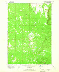
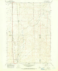
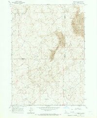
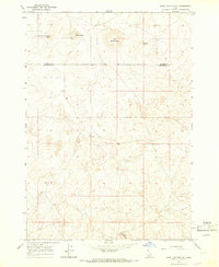
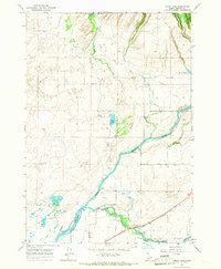
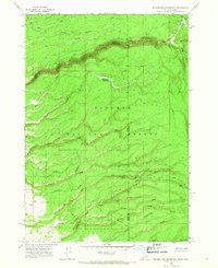
 1960 Ashton1960 Print · USGSThe Idaho-Montana-Wyoming borderlands at the dawn of the sixties show a landscape defined by the Continental Divide and early wilderness tourism. Genealogists and historians can trace rail-stop settlements like Trude Siding, old outposts like Warm River, and early lodging at Snowball Inn.
 - 1962 Map of Driggs
 1962 Driggs1962 Print · USGSThe Idaho-Wyoming borderlands are captured here in the early sixties, showing the peaks and valleys of the northern Rockies. Genealogists and historians can trace rail lines like the Union Pacific RR and isolated outposts like the National Elk Refuge or the Fort Hall Indian Reservation.
 - 1964 Map of Hatchery Butte, 1965 Print
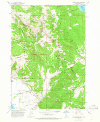
 1964 Hatchery Butte1965 Print · USGSFremont County's timbered uplands are captured here in the mid-1960s, showing the intersection of the Union Pacific railroad and the Targhee National Forest. Researchers can trace the rail line through Eccles or locate recreation sites like Pineview Campground and Lily Pond.2 unique versions available
 - 1964 Map of Dubois NE, 1965 Print
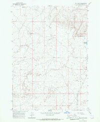
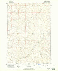 1964 Dubois NE1965 Print · USGSSoutheastern Clark County remains a high-desert expanse of ranching and creek drainages during the mid-1960s. Genealogists and local historians can locate the Jacoby Ranch and trace the winding course of Camas Creek near the county line.
 - 1964 Map of Island Park, 1965 Print
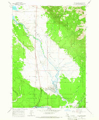
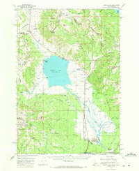
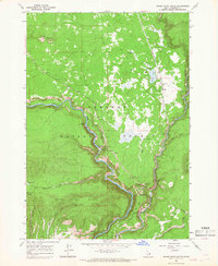
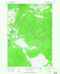 1964 Island Park1965 Print · USGSEastern Idaho was a landscape of federal forestry and growing tourism in the 1960s. Genealogists and historians can trace the foundations of local recreation at the Island Park Reservoir, Macks Inn PO, and the Union Pacific rail corridor.3 unique versions available
 - 1964 Map of Island Park Dam, 1966 Print
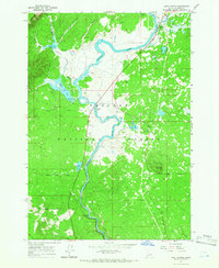
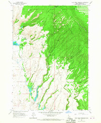
 1964 Island Park Dam1966 Print · USGSFremont County, Idaho, is shown in the mid-1960s during a period of burgeoning outdoor recreation and water management. Researchers can trace ranching and reservoir life through features like McCrea Ranch, the Island Park Dam, and I P Bills Island.3 unique versions available
 - 1964 Map of Hamer, 1966 Print
 1964 Hamer1966 Print · USGSHamer thrived as a transportation and irrigation hub in eastern Idaho during the mid-1960s. Genealogists and local historians can trace the town's development along the Union Pacific tracks and explore the wetlands of the Camas National Wildlife Refuge.2 unique versions available
 - 1964 Map of Camas, 1966 Print
 1964 Camas1966 Print · USGSEastern Idaho's high-desert landscape comes into focus in the mid-1960s as a vital railroad and water corridor. Genealogists and historians can trace the Union Pacific line through Jones Crossing and locate early landmarks like the Cem and Gaging Station near the creek.2 unique versions available
 - 1964 Map of Targhee Pass, 1966 Print
 1964 Targhee Pass1966 Print · USGSThe high alpine country of the Idaho-Montana border comes alive in this mid-century survey of the Continental Divide. Trace early mountain routes through Targhee Pass, discover the location of the Targhee Cem, and see the footprint of the ski lift at Lionhead.4 unique versions available
 - 1964 Map of Targhee Peak, 1966 Print
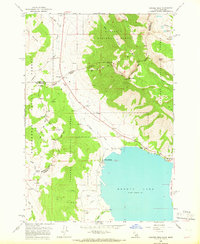 1964 Targhee Peak1966 Print · USGSThe Idaho-Montana borderlands at the Continental Divide are captured here in the mid-1960s, showing the high-country interface between three National Forests. Genealogists and historians can trace family-named outposts like Wild Rose Ranch and Staley Springs along the northern shores of Henrys Lake.2 unique versions available
 - 1964 Map of Dubois SE, 1966 Print
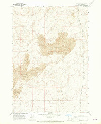
 1964 Dubois SE1966 Print · USGSFremont and Clark Counties are captured in the mid-1960s, showing a high-desert landscape defined by vast desert geography. Researchers can locate remote water sources like a Water Tank and follow the route of a primitive Jeep Trail through the Sand Dunes.
 - 1964 Map of Sawtell PK, 1966 Print
 1964 Sawtell PK1966 Print · USGSThe high alpine border between Idaho and Montana comes into sharp focus during the mid-sixties, centered on the rugged peaks of the Centennial Mountains. Researchers can trace the Continental Divide and identify specific landmarks like Sawtell Peak, Lake Marie, and Bootjack Pass.
 - 1964 Map of Big Springs, 1966 Print
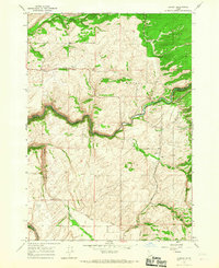
 1964 Big Springs1966 Print · USGSBig Springs and the surrounding Idaho forest lands are captured here in the mid-sixties as the region balanced railroad industry with mountain recreation. Researchers can trace the Union Pacific line, locate the Big Springs Airstrip, and explore the high country around Mount Two Top.2 unique versions available
 - 1964 Map of Last Chance, 1966 Print
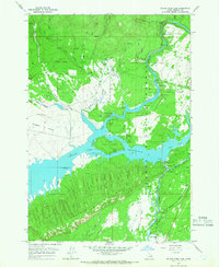
 1964 Last Chance1966 Print · USGSHenrys Fork and the surrounding Targhee National Forest are captured here in the mid-1960s, a time of active ranching and emerging river recreation. Genealogists and researchers can trace the roads around Last Chance, the historic Railroad Ranch, and the Osborne Bridge.3 unique versions available
 - 1964 Map of Sage Junction NE, 1966 Print
 1964 Sage Junction NE1966 Print · USGSThe volcanic plains of eastern Idaho are captured here in the early sixties, showing the transition from the Snake River Plain toward the northern highlands. Trace the primitive routes through Big Grassy Butte and Gerber Butte where lonely wells and a Jeep Trail mark the high desert.2 unique versions available
 - 1964 Map of Henrys Lake, 1972 Print
 1964 Henrys Lake1972 Print · USGSThe Idaho-Montana border country is documented here in the early 1960s, a time when ranching life and mountain recreation coexisted. Genealogists and historians can trace local landmarks like Targhee Cem, the Johnson Ranch, and the Lionhead Ski Area.2 unique versions available
 - 1965 Map of Black Knoll, 1967 Print
 1965 Black Knoll1967 Print · USGSFremont County, Idaho, is recorded here in the mid-1960s as a sparsely settled landscape defined by its high-desert geology. Genealogists and historians can trace the primitive roads and water sources that supported early cattlemen, from the prominent Black Knoll to the seasonal flow of Sand Creek.
 - 1965 Map of Lamont, 1967 Print
 1965 Lamont1967 Print · USGSEastern Idaho in the mid-1960s reveals a high-altitude rail and farming landscape on the edge of the Targhee National Forest. Local historians can trace the Union Pacific line through Lamont and find landmarks like the rural Grain Elevator and Pinochle Road.2 unique versions available
 - 1965 Map of Lemon Lake, 1967 Print
 1965 Lemon Lake1967 Print · USGSEastern Idaho's river-driven economy is on full display in the mid-sixties, where the confluence of the Henrys Fork and Falls River dictates the landscape. Trace the historical irrigation network through the Farmers Own Canal and the Union Pacific rail corridor.2 unique versions available
 - 1965 Map of Split Butte, 1967 Print
 1965 Split Butte1967 Print · USGSFremont County, Idaho, is shown in the mid-1960s as a landscape of conservation and high-desert terrain. Researchers can locate the Sand Creek Wildlife Management Area Headquarters and trace early access routes like the Jeep Trail near Split Butte.
 - 1965 Map of Ashton, 1967 Print
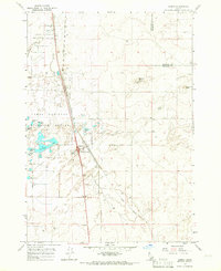
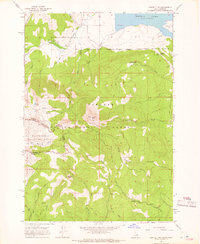
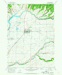 1965 Ashton1967 Print · USGSAshton and Marysville serve as the focal points of this Idaho agricultural landscape during the mid-sixties. Researchers can trace the complex irrigation network of the Farmers Own Canal or locate local landmarks like the Ashton Fish Hatchery and Ashton Dam.3 unique versions available
 - 1965 Map of Lookout Butte, 1967 Print
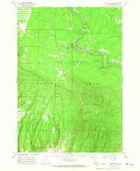 1965 Lookout Butte1967 Print · USGSFremont County's high forest and river country are captured here in the mid-1960s, showing the intersection of the Targhee wilderness and the Snake River headwaters. Trace early river crossings at Hatchery Ford (Site) and explore the steep drainages of Big Bend Ridge including Anderson Mill Canyon.2 unique versions available
 - 1965 Map of Mc Renolds Reservoir, 1967 Print
 1965 Mc Renolds Reservoir1967 Print · USGSThe high forest lands of the Idaho-Wyoming border come to life in the mid-1960s, showing a landscape defined by deep canyons and mountain meadows. You can trace early backcountry routes like the Rim Trail and find isolated landmarks such as McRenolds Reservoir and Coyote Meadows.3 unique versions available
 - 1965 Map of Snake River Butte, 1967 Print
 1965 Snake River Butte1967 Print · USGSUpper Henrys Fork and the surrounding Targhee National Forest are captured in the mid-sixties before modern developments altered the wilderness. Trace the path of the Union Pacific past Gerrit or locate historical recreation sites like the Bear Gulch Ski Area.
 - 1965 Map of Blue Creek Reservoir, 1967 Print
 1965 Blue Creek Reservoir1967 Print · USGSFremont County's high-country water systems are meticulously documented here in the mid-1960s. Genealogists and researchers can trace family-named landmarks and infrastructure like Mikesell Reservoir No 1, Griffith Springs, and the Fogg Millsite Well.2 unique versions available
Showing maps 1-25 of 32
Top cities of Fremont County
- St. Anthony historical maps
- Ashton historical maps
- Teton historical maps
- Parker historical maps
- Island Park historical maps
- Warm River historical maps
Frequently asked questions
- What are the different types of historical maps available for Fremont County?
- What is the oldest map of Fremont County?
- Where can I purchase historical maps of Fremont County for my home or office?
- Where can I download high-res historical maps of Fremont County?
- Are there historical topographic maps available for Fremont County?
- Is there historical aerial imagery available for Fremont County?
- Where are historical maps of Fremont County sourced from?