1980s Maps of Fremont County, Idaho
Explore 18 historic maps of Fremont County from the 1980s. These maps offer a rare glimpse into what life looked like during the 1980s — showing old roads, neighborhoods, homes, and landmarks that have changed or disappeared over time.
Whether you're researching your family's past, planning a metal detecting trip, or studying how Fremont County's landscape evolved across the 1980s, these high-resolution maps are a powerful tool for exploring the history of this region.
- Focus on a specific era: All maps on this page are from the 1980s, giving you a focused view of this time period.
- See what’s changed: Compare century-old streets, trails, and buildings to today's modern landscape using overlays and satellite layers.
- Research with precision: Use these maps for genealogy, historical research, land use analysis, or educational projects.
- View, download, or print: Maps are fully viewable online in high resolution, and can be downloaded or printed for your own records.
Start exploring Fremont County's history through authentic maps from the 1980s. This is your window into the past.
Fremont County, ID maps
(18)- 1980 Map of Circular Butte
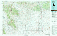
 1980 Circular Butte1980 Print · USGSEastern Idaho at the start of the eighties shows a landscape of federal research and agricultural expansion. Trace the growth of nuclear history at the Idaho National Engineering Laboratory and early settlements like Monteview, Terreton, and Sage Junction.
 - 1983 Map of Dubois
 1983 Dubois1983 Print · USGSEastern Idaho's high-country ranching and research landscape is captured here in the early 1980s. Local researchers can trace the Union Pacific line through Dubois, locate the sprawling U S Sheep Experiment Station, or find the former location of Winsper (Site).
 - 1986 Map of Madison Arm
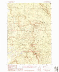
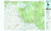
 1986 Madison Arm1986 Print · USGSThe high mountain basins of the Montana-Idaho border are captured here in the mid-1980s, centered on the expansive waters of Hebgen Lake. Researchers can trace the Old Railroad Grade, locate the remote Basin Cabin, and map the rugged line of the Continental Divide.2 unique versions available
 - 1986 Map of Latham Spring
 1986 Latham Spring1986 Print · USGSThe Idaho-Montana borderlands are captured here in the mid-1980s, centered on the high-elevation drainages of the Targhee National Forest. Local history researchers can trace a remote Trail and find landmarks like Latham Spring and the Thirsty Black Creek Canyon.
 - 1986 Map of Reas Pass
 1986 Reas Pass1986 Print · USGSThe high mountain border between Idaho and Montana is captured here in the mid-1980s at the height of the Continental Divide. Researchers can trace the path of the Old Railroad Grade as it navigates Reas Pass and the banks of the Madison River.
 - 1986 Map of Buffalo Lake NE
 1986 Buffalo Lake NE1986 Print · USGSThe high wilderness where Idaho, Montana, and Wyoming meet is captured here in the mid-1980s at the junction of three major protected forests. Trace the Continental Divide as it winds past the headwaters of Black Canyon Creek and Thirsty Creek in Yellowstone National Park.
 - 1986 Map of Buffalo Lake
 1986 Buffalo Lake1986 Print · USGSThe Idaho-Wyoming border comes alive in the mid-1980s where the backcountry of the Teton and Yellowstone wilderness meets. Researchers can trace the remote headwaters of Buffalo Lake, find the high point of Snow Creek Butte, and follow the winding path of Cascade Creek.
 - 1986 Map of Big Grassy
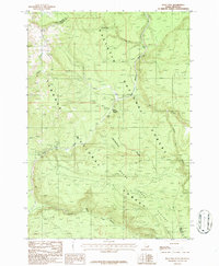
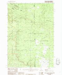
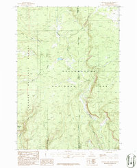
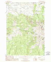
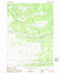
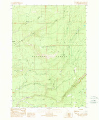
 1986 Big Grassy1986 Print · USGSThe high wilderness of Fremont County is captured here in the mid-1980s, centered on the high ridges of Targhee National Forest. Local historians can trace the rugged drainage of Partridge Creek or locate landmarks like Black Mountain and Big Grassy.
 - 1988 Map of Hidden Lake Bench
 1988 Hidden Lake Bench1988 Print · USGSThe Montana-Idaho border highlands are captured here in the late eighties, featuring the remote wilderness of the Beaverhead National Forest. Researchers can trace the high-country Continental Divide and locate sites like Lost Mine or the waters of Elk Lake.
 - 1988 Map of Earthquake Lake
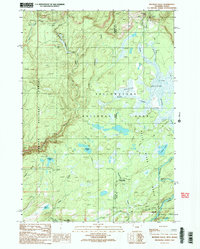
 1988 Earthquake Lake1988 Print · USGSThe Madison River valley in the late 1980s reveals the permanent geological changes following the 1959 earthquake. Researchers can locate the massive Madison Slide and Earthquake Lake, as well as the Earthquake Memorial and a high-altitude Quarry.
 - 1988 Map of Mount Jefferson
 1988 Mount Jefferson1988 Print · USGSThe Montana-Idaho borderlands in the late eighties are defined here by high-mountain divides and federal land management. Outdoor historians and researchers can trace the reaches of the United States Sheep Experiment Station and remote water sources like Fruin Spring and Blair Lake.
 - 1988 Map of Rexburg, 1989 Print
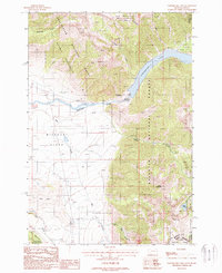
 1988 Rexburg1989 Print · USGSThe Upper Snake River Valley in the late eighties shows a region shaped by water and agriculture. Genealogists and historians can locate family plots at the Rexburg Cemetery or trace the early paths of the Union Pacific Railroad through towns like Sugar City and Newdale.
 - 1988 Map of Hebgen Dam, 1989 Print
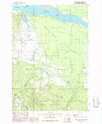
 1988 Hebgen Dam1989 Print · USGSThe upper Madison River valley near the Montana-Idaho border appears here in the late eighties, just decades after the massive 1959 quake. Researchers can trace the water levels of Earthquake Lake, locate the Hebgen Dam, and find family sites at the Trailer Park.
 - 1989 Map of Bechler Falls
 1989 Bechler Falls1989 Print · USGSThe southwestern corner of Yellowstone at the Idaho-Wyoming border was a remote backcountry hub in the late eighties. Researchers can trace the junction of the Bechler River Trail and find landmarks like Bechler Falls and the Bechler River Ranger Station.2 unique versions available
 - 1989 Map of Porcupine Lake
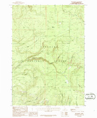
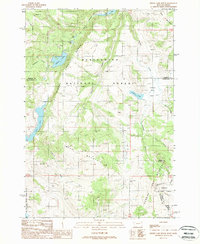
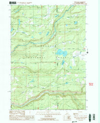
 1989 Porcupine Lake1989 Print · USGSFremont County's high ridges and river valleys are captured here in the late 1980s as the Falls River waters this forest landscape. Trace the paths of the Yellowstone Canal and the Marysville Canal or locate landmarks like the Porcupine Ranger Station.
 - 1989 Map of Ashton
 1989 Ashton1989 Print · USGSEastern Idaho at the end of the 1980s is captured here as a landscape of river-fed agriculture and high-altitude wilderness. Researchers can trace the Union Pacific line through Ashton and find old settlements like Kilgore and Idmon near the Targhee National Forest border.2 unique versions available
 - 1989 Map of Warm River Butte
 1989 Warm River Butte1989 Print · USGSFremont County, Idaho, is shown in the late 1980s as a densely forested wilderness shaped by the waters of the Targhee National Forest. Researchers can trace old mountain water sources like Warm River Spring, Otter Springs, and the prominent Warm River Butte.
 - 1989 Map of Sheep Falls
 1989 Sheep Falls1989 Print · USGSThe Idaho-Wyoming borderlands appear here in the late eighties, dominated by forest service management and river systems. Researchers can locate remote outposts like the Granite Creek Cow Camp and trace the drainage of the Falls River past Sheep Falls.2 unique versions available
End of results
Showing maps 1-18 of 18
Top cities of Fremont County
- St. Anthony historical maps
- Ashton historical maps
- Teton historical maps
- Parker historical maps
- Island Park historical maps
- Warm River historical maps
Frequently asked questions
- What are the different types of historical maps available for Fremont County?
- What is the oldest map of Fremont County?
- Where can I purchase historical maps of Fremont County for my home or office?
- Where can I download high-res historical maps of Fremont County?
- Are there historical topographic maps available for Fremont County?
- Is there historical aerial imagery available for Fremont County?
- Where are historical maps of Fremont County sourced from?