1960s Maps of Valley County, Idaho
Explore 33 historic maps of Valley County from the 1960s. These maps offer a rare glimpse into what life looked like during the 1960s — showing old roads, neighborhoods, homes, and landmarks that have changed or disappeared over time.
Whether you're researching your family's past, planning a metal detecting trip, or studying how Valley County's landscape evolved across the 1960s, these high-resolution maps are a powerful tool for exploring the history of this region.
- Focus on a specific era: All maps on this page are from the 1960s, giving you a focused view of this time period.
- See what’s changed: Compare century-old streets, trails, and buildings to today's modern landscape using overlays and satellite layers.
- Research with precision: Use these maps for genealogy, historical research, land use analysis, or educational projects.
- View, download, or print: Maps are fully viewable online in high resolution, and can be downloaded or printed for your own records.
Start exploring Valley County's history through authentic maps from the 1960s. This is your window into the past.
Valley County, ID maps
(33)- 1960 Map of Elk City
 1960 Elk City1960 Print · USGSThe Central Idaho wilderness and Bitterroot Range are captured here during the peak of mid-century industrial mining. Researchers can trace remote backcountry settlements like Burgdorf and Warren, alongside major mineral sites including the Blackbird Mine and Ima Mine.2 unique versions available
 - 1960 Map of Challis
 1960 Challis1960 Print · USGSCentral Idaho’s high backcountry is detailed here in the early sixties, showing the remote ranching and mining life across five national forests. Genealogists and researchers can trace family holdings at the Silva Ranch or Jones Ranch and find historic sites like Redfish Lake Lodge and Clayton.
 - 1961 Map of Greyhound Ridge, 1963 Print
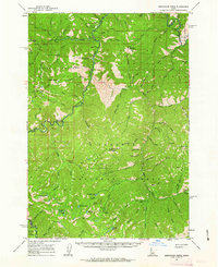 1961 Greyhound Ridge1963 Print · USGSThe Salmon River backcountry comes alive in the early sixties as a hub of remote mining and federal forest management. Genealogists and historians can locate remote outposts like Pistol Creek Ranch Airstrip, the Greyhound Mine, and the Middle Fork Guard Sta.2 unique versions available
 - 1961 Map of Chinook Mtn, 1963 Print
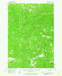 1961 Chinook Mtn1963 Print · USGSThe remote Idaho backcountry comes into focus during the early sixties, showing the intersection of three national forests. Researchers can trace high-altitude mining operations like the Franklin D Mine and locate backcountry access points such as Morgan Airstrip and Sulphur Creek Ranch.2 unique versions available
 - 1962 Map of Mormon Mtn, 1963 Print
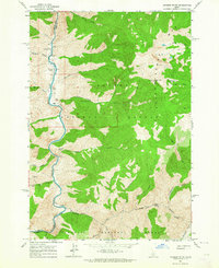
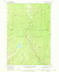
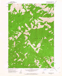 1962 Mormon Mtn1963 Print · USGSValley County, Idaho, is seen here in the early 1960s as a high-altitude wilderness of national forest lands and mountain ridges. Researchers can locate remote landmarks such as the Rush Creek Point Lookout and the high pass at Bear Trap Saddle.2 unique versions available
 - 1962 Map of Vinegar Hill, 1963 Print
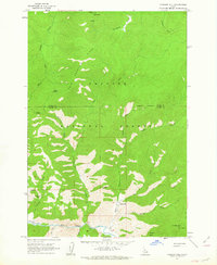 1962 Vinegar Hill1963 Print · USGSThe Idaho wilderness in the early sixties is mapped here as a remote network of high peaks and vital backcountry airfields. Researchers can trace the isolated locations of Mile Hi Landing Strip, Caswell Crossing, and Vinegar Hill.3 unique versions available
 - 1962 Map of Bear Creek Point, 1963 Print
 1962 Bear Creek Point1963 Print · USGSThe Idaho wilderness in the early sixties is documented here as a vast network of protected lands and river drainages. Trace the boundary between the Salmon National Forest and Boise National Forest or follow the path of Sheep Creek and the Middle Fk Salmon R.2 unique versions available
 - 1962 Map of Puddin Mtn, 1964 Print
 1962 Puddin Mtn1964 Print · USGSThe Idaho wilderness in the early sixties is documented here as the Middle Fork Salmon River winds through the forest boundary. Researchers can trace early river crossings and remote camps like the Big Creek Bridge and Rattlesnake Or Campground.2 unique versions available
 - 1962 Map of Papoose Peak, 1964 Print
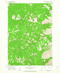
 1962 Papoose Peak1964 Print · USGSThe high divide between Idaho and Valley counties is captured in the early sixties, showing the wilderness interface of two national forests. Backcountry travelers and researchers can trace the Coyote Springs Trail and the Stoddard Trail near landmarks like Papoose Peak.
 - 1962 Map of Aggipah Mtn, 1964 Print
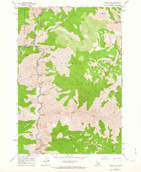
 1962 Aggipah Mtn1964 Print · USGSCentral Idaho's wilderness remains largely untouched in the early sixties, centered on the dramatic descent of the Middle Fork Salmon River. Backcountry travelers and historians can trace routes to Stoddard Creek Lookout, the jagged Bighorn Crags, and the alpine shores of Ship Island Lake.3 unique versions available
 - 1962 Map of Norton Ridge, 1964 Print
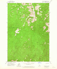
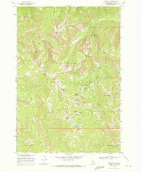
 1962 Norton Ridge1964 Print · USGSCentral Idaho in the early sixties was a land of high ridges and forest service outposts. You can trace the primitive Trail systems connecting isolated sites like Mitchell Ranch, Norton Ridge Lookout, and the Middle Fork Salmon River.3 unique versions available
 - 1962 Map of Shellrock Peak, 1964 Print
 1962 Shellrock Peak1964 Print · USGSThe Idaho wilderness comes into focus in the early sixties at the meeting point of three national forests. Geologists and hikers can trace high-altitude routes between Shellrock Peak, the waters of Norton Lake, and the remote Brush Creek Summit.2 unique versions available
 - 1962 Map of Dave Lewis Peak, 1964 Print
 1962 Dave Lewis Peak1964 Print · USGSThe Idaho backcountry in the early sixties is shown here as a wilderness of high peaks and river canyons. Researchers can locate remote landmarks like the Petroglyphs near Big Creek Gorge, the riverside Soldier Bar, and high-altitude Mines.2 unique versions available
 - 1962 Map of Ramey Hill, 1964 Print
 1962 Ramey Hill1964 Print · USGSThe Idaho wilderness in the early 1960s is centered here on the confluence of the Middle Fork Salmon River and Loon Creek. Researchers can trace remote backcountry landmarks like the Tappen Ranch, Simplot Airstrip, and the Loon Creek Lookout.3 unique versions available
 - 1963 Map of Challis
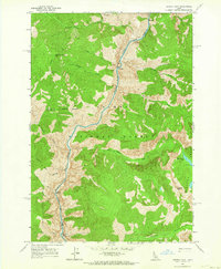
 1963 Challis1963 Print · USGSCentral Idaho's mountain corridors and mining districts appear in detail during the early sixties, highlighting the remote settlements of Challis and Stanley. Researchers can trace the legacy of the gold and silver rushes through labels for Bonanza, the Bayhorse Mine, and the Falconberry ranch.
 - 1963 Map of Aparejo Point, 1964 Print
 1963 Aparejo Point1964 Print · USGSThe Middle Fork Salmon River corridor is captured in the early sixties, showing the vital role of mountain airstrips and isolated ranches. Researchers can locate remote landmarks like the Mormon Ranch, the Bernard Bridge, and the Bernard Landing Field amidst the high Yellowjacket Mountains.3 unique versions available
 - 1963 Map of Sliderock Ridge, 1965 Print
 1963 Sliderock Ridge1965 Print · USGSCuster and Valley Counties remained a remote wilderness in the early sixties, defined by high-elevation ridges and the river-cut valleys of the backcountry. Genealogists and historians can trace isolated landmarks like Cougar Creek Ranch, the Little Creek Guard Station, and Mahoney Creek Airstrip.3 unique versions available
 - 1963 Map of Granite Lake, 1965 Print
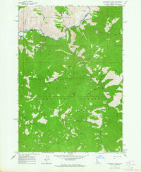
 1963 Granite Lake1965 Print · USGSThe high timber and water systems of the Payette National Forest are shown here as they appeared in the early 1960s. Researchers can trace historic landmarks like Sater Meadows, the Brundage Reservoir, and the remote Landing site.3 unique versions available
 - 1963 Map of Black Tip, 1965 Print
 1963 Black Tip1965 Print · USGSThe Salmon River Mountains in the early sixties reveal a landscape of high-altitude lakes and forest drainages. Researchers can trace the rugged transition from Lava Ridge down to Payette Meadows and the shores of Upper Payette Lake.3 unique versions available
 - 1963 Map of Hazard Lake, 1965 Print
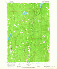
 1963 Hazard Lake1965 Print · USGSThe Payette National Forest backcountry is captured here in the early 1960s, showing a landscape defined by high alpine lakes and forest service infrastructure. Researchers can trace remote sites like the Hard Creek Guard Station, Big Hazard Lake, and the uniquely named Disappointment Lake.3 unique versions available
 - 1963 Map of Brundage Mtn, 1965 Print
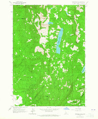 1963 Brundage Mtn1965 Print · USGSThe high backcountry of the Payette National Forest is captured here in the early 1960s, showing the early development of mountain recreation. Trace the original trails and infrastructure around Brundage Mtn Ski Area, Goose Lake, and the remote Twin Lakes.
 - 1969 Map of Loon Lake, 1971 Print
 1969 Loon Lake1971 Print · USGSThe high backcountry of the Payette National Forest was a remote wilderness of trails and meadows during the late sixties. Explorers and researchers can trace the historic Loon Creek Pack Trail to Loon Lake or follow the waters of Whangdoodle Creek.2 unique versions available
 - 1969 Map of Edwardsburg, 1971 Print
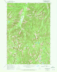 1969 Edwardsburg1971 Print · USGSThe remote mining country of central Idaho is captured here in the late sixties, highlighting the isolated settlements of Edwardsburg and Logan. Researchers can trace old mountain routes like the Pack Trail and locate the Sunday Mine near Logan Mountain.2 unique versions available
 - 1969 Map of Profile Gap, 1971 Print
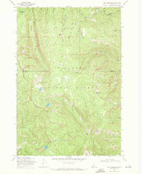
 1969 Profile Gap1971 Print · USGSThe high Idaho backcountry of the late sixties is defined here by its remote mining claims and steep alpine topography. Trace the network of jeep trails and pack trails connecting sites like the Moscow Mine, Profile Gap, and Crater Lake.2 unique versions available
 - 1969 Map of Pony Meadows, 1971 Print
 1969 Pony Meadows1971 Print · USGSThe Salmon River Mountains of central Idaho appear here in the late sixties, showing a wilderness of mining trails and alpine meadows. Trace early mountain access via the Pack Trail and Jeep Trail reaching Keystone Meadows and the high-altitude Steamboat Lake.2 unique versions available
Showing maps 1-25 of 33
Top cities of Valley County
Frequently asked questions
- What are the different types of historical maps available for Valley County?
- What is the oldest map of Valley County?
- Where can I purchase historical maps of Valley County for my home or office?
- Where can I download high-res historical maps of Valley County?
- Are there historical topographic maps available for Valley County?
- Is there historical aerial imagery available for Valley County?
- Where are historical maps of Valley County sourced from?