2000-2009 Maps of Valley County, Idaho
Explore 43 historic maps of Valley County from 2000-2009. These maps offer a rare glimpse into what life looked like during the 2000s — showing old roads, neighborhoods, homes, and landmarks that have changed or disappeared over time.
Whether you're researching your family's past, planning a metal detecting trip, or studying how Valley County's landscape evolved across the 2000s, these high-resolution maps are a powerful tool for exploring the history of this region.
- Focus on a specific era: All maps on this page are from the 2000s, giving you a focused view of this time period.
- See what’s changed: Compare century-old streets, trails, and buildings to today's modern landscape using overlays and satellite layers.
- Research with precision: Use these maps for genealogy, historical research, land use analysis, or educational projects.
- View, download, or print: Maps are fully viewable online in high resolution, and can be downloaded or printed for your own records.
Start exploring Valley County's history through authentic maps from the 2000s. This is your window into the past.
Valley County, ID maps
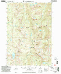
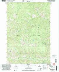
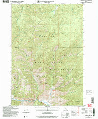
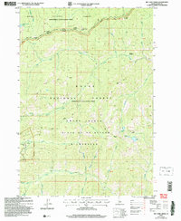
(43)- 2004 Map of Fitsum Peak, 2007 Print
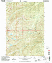 2004 Fitsum Peak2007 Print · USGSValley County wilderness is documented here in the early 2000s within the Payette National Forest. Trace backcountry routes like the Buckhorn Trail and Krassel Trail as they follow the forks of Buckhorn Creek.
 - 2004 Map of Paddy Flat, 2007 Print
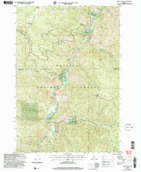
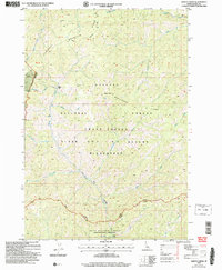
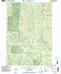 2004 Paddy Flat2007 Print · USGSValley County high country is shown in this forest survey from the mid-2000s, featuring the prominent peaks and alpine lakes of the region. Researchers can trace historic trails and mountain landmarks like Jughandle Mountain, the Kennally Creek Horse Camp, and old mines near Twin Peaks.
 - 2004 Map of Wolf Fang Peak, 2007 Print
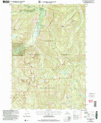
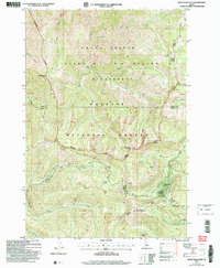 2004 Wolf Fang Peak2007 Print · USGSThe Idaho wilderness at the turn of the twenty-first century reveals a landscape of high peaks and isolated mining history. Researchers can trace early extraction sites like the McCrae Mine and Independence Mine or locate landmarks such as Wolf Fang Peak.
 - 2004 Map of Brundage Mountain, 2007 Print
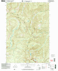
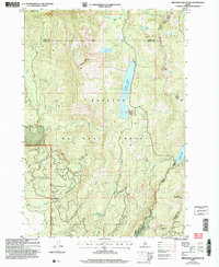 2004 Brundage Mountain2007 Print · USGSAdams and Valley counties meet at this high-elevation point in the Payette National Forest during the early 2000s. Researchers can trace alpine water routes and recreation sites from the Brundage Mtn Ski Area to Goose Lake and Granite Mtn.
 - 2004 Map of Box Lake, 2007 Print
 2004 Box Lake2007 Print · USGSHigh in the Payette National Forest during the early 2000s, this landscape is defined by its glacial lakes and peaks. Researchers can trace remote alpine features like South Loon Mtn, Lick Creek Summit, and the secluded waters of Box Lake or Sisters Lakes.
 - 2004 Map of Pilot Peak, 2007 Print
 2004 Pilot Peak2007 Print · USGSThe Salmon River canyon in the Idaho backcountry was a landscape of remote outposts and high-altitude lookouts at the turn of the century. Trace the isolation of Shiefer and Hays Station or locate the historic Pony Mine and the rugged Lookout atop Pilot Peak.
 - 2004 Map of Edwardsburg, 2007 Print
 2004 Edwardsburg2007 Print · USGSThe mountain settlement of Edwardsburg is captured here in the early 2000s, positioned at the threshold of Idaho's protected backcountry. Researchers can trace historic mining activity at Sunday Mine and explore high-altitude landmarks like Missouri Ridge and Bear Lake.
 - 2004 Map of Blackmare, 2007 Print
 2004 Blackmare2007 Print · USGSHigh-country Idaho wilderness in the early 2000s centers on the divide between the Payette National Forest and Boise National Forest. Trace backcountry routes like the Blackmare Trail to remote peaks and lookouts including Blackmare Lookout and Miners Peak Lookout.
 - 2004 Map of Center Mountain, 2007 Print
 2004 Center Mountain2007 Print · USGSThe Idaho backcountry in the early 2000s remains a landscape of deep drainage basins and remote summits within the Payette National Forest. Historians and hikers can trace the Monumental Trail to the old Thunder City (Site) or locate landmarks like Snowslide Peak and Big Creek Ridge.
 - 2004 Map of Dave Lewis Peak, 2007 Print
 2004 Dave Lewis Peak2007 Print · USGSDeep in the Idaho wilderness during the early 2000s, this area shows a landscape accessible only by air and trail. Genealogists and researchers can locate Soldier Bar, the Grave near the river, and remote Mines along the steep slopes.
 - 2004 Map of Safety Creek, 2007 Print
 2004 Safety Creek2007 Print · USGSThe Salmon River backcountry is captured here in the early 2000s, showing a land defined by high-elevation mining and wilderness conservation. Researchers can trace the heritage of remote outposts like Belleco (Site) and find former workings at the Venable Mine and Sunnyside Mine.
 - 2004 Map of Black Tip, 2007 Print
 2004 Black Tip2007 Print · USGSThe high peaks and glacial lakes of the Payette National Forest are documented here in the early 2000s. Researchers can trace historic routes like the Wagon Road and locate remote landmarks such as Black Tip and Upper Payette Lake.
 - 2004 Map of Rainbow Peak, 2007 Print
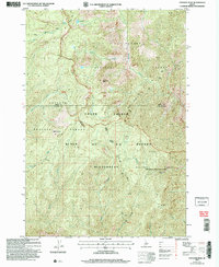
 2004 Rainbow Peak2007 Print · USGSThe high backcountry of Valley County is shown here in the early 2000s, centered on the historic mining district near Thunder Mtn. You can trace the rugged access via Monumental Road to find the Dewey Mine, Sunnyside Mine, and the Twentieth Century Mill (Site).
 - 2004 Map of Victor Peak, 2007 Print
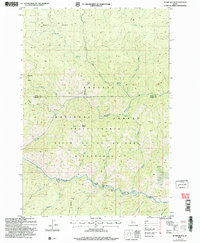
 2004 Victor Peak2007 Print · USGSHigh mountain basins in the Idaho backcountry are revealed here as they appeared in the early 2000s. Researchers can trace historical routes like the Warren Road or locate isolated mining Prospect sites near Josephine Lake and Victor Peak.
 - 2004 Map of Big Creek, 2007 Print
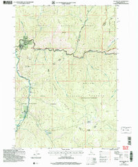
 2004 Big Creek2007 Print · USGSCentral Idaho’s backcountry is revealed in this 2004 survey, showing the deep wilderness at the turn of the millennium. Researchers can locate remote mining sites like the Golden Hand Mine and the vital Landing Strip at Big Creek.
 - 2004 Map of Williams Peak, 2007 Print
 2004 Williams Peak2007 Print · USGSThe high backcountry of Valley County is captured here in the early 2000s at the confluence of the South Fork Salmon River and Secesh River. Researchers can locate old mining sites like Zena and Prospect, alongside historic forest stations and camps including Browns Camp and Logging Camp.
 - 2004 Map of Vinegar Hill, 2007 Print
 2004 Vinegar Hill2007 Print · USGSCentral Idaho in the early 2000s reveals a high-country landscape of forest and wilderness. Researchers can trace the drainage of Big Creek and locate the Cabin Creek Landing Strip near Vinegar Hill.
 - 2004 Map of Meadows, 2007 Print
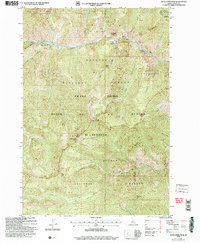
 2004 Meadows2007 Print · USGSMeadows and McCall were reaching a modern equilibrium in the early 2000s as recreation and ranching shaped this Idaho landscape. Researchers can locate the Meadows Valley Cem, the site of Lardo, and the historic Packer Johns Cabin State Park.
 - 2004 Map of Papoose Peak, 2007 Print
 2004 Papoose Peak2007 Print · USGSThe Idaho backcountry at the turn of the millennium remains a vast primitive landscape centered on the Frank Church - River of No Return Wilderness. Map collectors can trace the high-altitude trails to Papoose Peak and find the secluded Papoose Lake.
 - 2004 Map of Acorn Butte, 2007 Print
 2004 Acorn Butte2007 Print · USGSCentral Idaho's backcountry reveals its mining and wilderness history in this early 2000s study of the Salmon River country. Researchers can trace historic access routes like the Bismark Trail and locate the Snowshoe Mine or unique river landmarks like Over Easy Bar.
 - 2004 Map of Big Chief Creek, 2007 Print
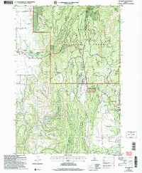
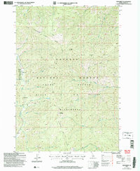
 2004 Big Chief Creek2007 Print · USGSIn the early 2000s, this area of Valley County shows a landscape managed for wilderness and mining history within the Boise National Forest. Researchers can locate the Springfield Mine and trace historical access along the Old Thunder Mtn Road near Kiwah Meadow.
 - 2004 Map of Yellow Pine, 2007 Print
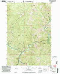
 2004 Yellow Pine2007 Print · USGSRemote Idaho mountain life and aviation history converge here in the early 2000s at the edge of the wilderness. Researchers can trace historic family landmarks like the Abstein Place or Bryant Ranch and locate the Pioneer Cem near the banks of Johnson Creek.
 - 2004 Map of Monument, 2007 Print
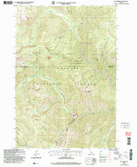
 2004 Monument2007 Print · USGSValley County is shown in the early 2000s as a preserved wilderness of steep ridges and isolated backcountry outposts. Researchers can trace remote aviation history at Dovel Landing Strip or locate high-country landmarks like Monument and Milk Lake.
 - 2004 Map of Granite Lake, 2007 Print
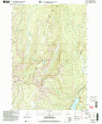
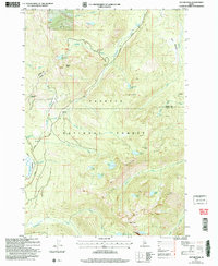
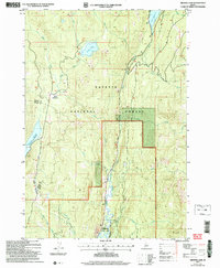 2004 Granite Lake2007 Print · USGSValley and Adams County, Idaho, are shown at the turn of the millennium as a haven of national forest lands and high-mountain reservoirs. Researchers can trace historic access routes like Warren Wagon Road and locate specific sites like Sater Meadows and Ponderosa State Park.
 - 2004 Map of McCall, 2007 Print
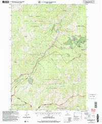
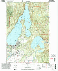 2004 McCall2007 Print · USGSMcCall sits at the gateway to the Idaho backcountry in this early 2000s survey, where the town meets the shores of Payette Lake. Researchers can trace the development of the McCall Airport or locate local landmarks like the Cem and Ponderosa State Park.
Showing maps 1-25 of 43
Top cities of Valley County
Frequently asked questions
- What are the different types of historical maps available for Valley County?
- What is the oldest map of Valley County?
- Where can I purchase historical maps of Valley County for my home or office?
- Where can I download high-res historical maps of Valley County?
- Are there historical topographic maps available for Valley County?
- Is there historical aerial imagery available for Valley County?
- Where are historical maps of Valley County sourced from?