Old Maps of Jefferson County, Illinois for Hiking & Exploration
Hike through history with 119 historic maps of Jefferson County. Explore old trails, ghost towns, and forgotten backroads — perfect for outdoor adventurers and local explorers.
- Rediscover forgotten places: Map out old mining camps, roads, and footpaths that no longer exist on modern maps.
- Layer with modern tools: Combine with LiDAR or satellite views to plan hikes through historical terrain.
- Made for exploration: Popular among hikers, overlanders, and local history lovers.
Use these maps to find adventure and explore the hidden past of Jefferson County.
Jefferson County, IL maps
(119)- 1926 Map of Duquoin
 1926 Duquoin1926 Print · USGSSouthern Illinois coal country is at its industrial peak in the mid-twenties, with thriving rail towns and active collieries. You can trace early 20th-century family roots at Young's Chapel or locate old operations like the Big Ben Mine and Old Keller Mine.3 unique versions available
 - 1933 Map of Mount Vernon
 1933 Mount Vernon1933 Print · USGSMount Vernon and the surrounding Jefferson County countryside are captured here in the early 1930s as a vital crossroads of rail and road. Genealogists can trace family roots through dozens of rural landmarks like Old Shiloh Ch, George College Sch, and Atkinson Cem.3 unique versions available
 - 1939 Map of Ina, 1958 Print
 1939 Ina1958 Print · USGSJefferson and Franklin Counties appear here as they were in the late 1930s, showing a landscape of fertile prairies and growing rail towns. Researchers can trace dozens of family-named schools and landmarks like King College, the STATE GAME FARM, and the Antioch Ch cemetery.2 unique versions available
 - 1940 Map of Mount Vernon
 1940 Mount Vernon1940 Print · USGSMount Vernon and the surrounding Jefferson County countryside are captured here during the late Depression years. Researchers can trace rural family life through dozens of named country schools and churches like George College Sch, Old Shiloh Ch, and Atkinson Cem.2 unique versions available
 - 1942 Map of McLeansboro, 1961 Print
 1942 McLeansboro1961 Print · USGSHamilton County in the early 1940s was a landscape of tightly-knit farming communities and small rail stops. Genealogists can trace family roots through a remarkable number of local landmarks like Piopolis, Seminary Sch, and Union Hill Cem.2 unique versions available
 - 1943 Map of Ina
 1943 Ina1943 Print · USGSSouthern Illinois during the mid-forties reveals a complex grid of rural schools, coal-town rail spurs, and early collegiate outposts. Genealogists can trace family roots through dozens of local landmarks like Williams Chapel, Mason Cem, and the vanished desks of Hungry Hill Sch.2 unique versions available
 - 1943 Map of Ashley, 1967 Print
 1943 Ashley1967 Print · USGSSouthern Illinois during the early 1940s is captured here as a thriving rail and agricultural hub. Genealogists can locate specific family-linked landmarks like the Blissville Polling House, Conta Colliery, and the Odd Fellows Cem.
 - 1945 Map of McLeansboro
 1945 McLeansboro1945 Print · USGSIn the mid-1940s, this portion of Southern Illinois was a landscape of steam-era rail junctions and tight-knit rural school districts. Genealogists can trace family roots through scores of rural landmarks, from Knight Prairie and Piopolis to the Sulphur Springs Sch.2 unique versions available
 - 1946 Map of Ashley
 1946 Ashley1946 Print · USGSSouthern Illinois at the end of the war was a landscape of concentrated rail corridors and rural school districts. Genealogists can trace family roots through dozens of local landmarks like St Michael Cem, Oniontown, and the Blissville Polling House.
 - 1947 Map of Wayne City
 1947 Wayne City1947 Print · USGSSouthern Illinois in the mid-1940s is captured here at a time when small rural schools and country churches still defined the local geography. Researchers can trace the rail-centered growth of Wayne City and Bluford or locate family sites like Garrison Temple, Thomason Cem, and Berry Sch.3 unique versions available
 - 1958 Map of Belleville, 1973 Print
 1958 Belleville1973 Print · USGSSouthern Illinois during the mid-twentieth century reveals a landscape of industrial growth and massive new reservoirs. Genealogists and historians can trace the paths of the Illinois Central RR through towns like Centralia or locate landmarks such as Emerald Mound and the Looking Glass Prairie.3 unique versions available
 - 1962 Map of Belleville
 1962 Belleville1962 Print · USGSSouthern Illinois in the late fifties reveals a landscape of industrial growth and ancient landmarks before the full expansion of the interstate system. Genealogists can trace family names and rural post offices near Centralia, Salem, and the historic Monks Mound.
 - 1964 Map of Opdyke, 1966 Print
 1964 Opdyke1966 Print · USGSJefferson County in the mid-sixties shows a landscape shaped by the Southern and Louisville and Nashville railroads. Genealogists can locate family-named landmarks like Arnold Cem, Old Orchard Cem, and the rural Lebanon Ch.2 unique versions available
 - 1965 Map of Harmony, 1966 Print
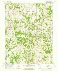 1965 Harmony1966 Print · USGSJefferson and Marion counties are captured here in the mid-sixties, a period when rural schoolhouses and family cemeteries still anchored the community. Genealogists can trace local roots at Old Panther Fork Cem, Union Chapel, and Farrington Sch.
 - 1965 Map of Mount Vernon, 1966 Print
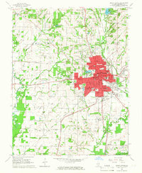 1965 Mount Vernon1966 Print · USGSMid-century Mount Vernon is shown here as a bustling hub of rail transport and civic institutions. Genealogists and historians can trace family roots through numerous country landmarks like Old Shiloh Cem, Wolf Prairie Cem, and the McClellan Sch.2 unique versions available
 - 1965 Map of Kell, 1968 Print
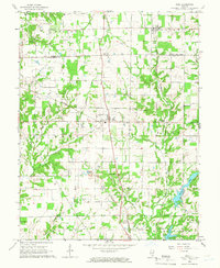 1965 Kell1968 Print · USGSSouthern Illinois at the mid-century reveals a landscape defined by crossroads settlements and a network of parish life along the Marion and Jefferson County line. Family historians can trace deep roots through local landmarks like Old Covenanter Cem, Dix, and the Zion Grove Ch.2 unique versions available
 - 1973 Map of Shields, 1975 Print
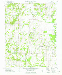 1973 Shields1975 Print · USGSWayne and Jefferson counties come alive in the early seventies, showing a landscape defined by the Orchardville Oil Field and rural river crossings. Trace family roots at the McConaughhay Cem, locate the old Ten Foot Oak Ch, or follow the Skillet Fork to Greathouse Ford.
 - 1973 Map of Bluford, 1975 Print
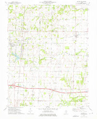 1973 Bluford1975 Print · USGSJefferson and Wayne Counties appear here in the early 1970s as centers of rail transport and petroleum production. Researchers can trace family history through landmarks like Long Prairie Cem, Bluford Sch, and the Markham City Oil Field.2 unique versions available
 - 1974 Map of Dahlgren, 1977 Print
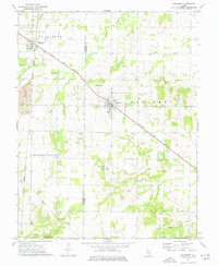 1974 Dahlgren1977 Print · USGSSouthern Illinois prairie life in the mid-1970s is centered on the rail junctions of Dahlgren and Belle Rive. Genealogists can trace family names through dozens of rural sites, including St Johns Cem, Sugar Camp Ch, and Little Egypt Youth Camp.
 - 1974 Map of Spring Garden, 1977 Print
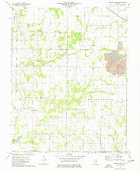 1974 Spring Garden1977 Print · USGSJefferson County's rural and industrial character is preserved here in the mid-1970s, as traditional farmsteads share the land with emerging energy extraction. Genealogists can trace deep local roots through Spring Garden, Fitzgerrell Cem, and numerous country churches like New Hope Ch.
 - 1974 Map of Woodlawn, 1978 Print
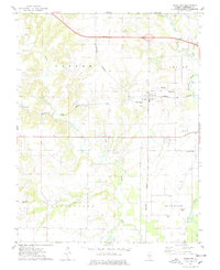 1974 Woodlawn1978 Print · USGSJefferson County in the mid-seventies shows a landscape defined by the BIG MUDDY RIVER and a dense network of country cemeteries. Genealogists can trace family roots through sites like Reynolds Cem, Slade Cem, and Black Cem, or locate the small settlement of Roaches.
 - 1974 Map of Walnut Hill, 1978 Print
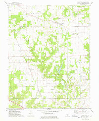 1974 Walnut Hill1978 Print · USGSMarion and Jefferson counties are shown here in the mid-seventies, captured at the intersection of the regional railroad network and the local oil industry. Researchers can trace family sites at Gaston Cem, Grand Prairie Sch, and the small settlement of Cravat.
 - 1974 Map of Irvington, 1978 Print
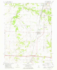 1974 Irvington1978 Print · USGSSouthern Illinois oil production and rail transport define this mid-1970s landscape near the Washington and Jefferson county line. Trace local history through the Irvington Oil Field, the Gulf Mobile and Ohio railroad, and family-named sites like Harres Cemetery.
 - 1974 Map of Ashley, 1978 Print
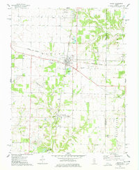 1974 Ashley1978 Print · USGSWashington and Jefferson counties are captured here in the mid-1970s, showcasing a landscape shaped by rail junctions and oil extraction. Genealogists can trace family roots through several rural sites including St Michael Cem, Liberty Cem, and Brick Cem.
 - 1975 Map of Ina, 1977 Print
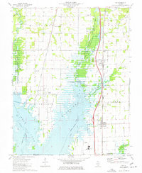 1975 Ina1977 Print · USGSSouthern Jefferson County is captured during the 1970s as the filling of Rend Lake reshapes the landscape around the Chicago and Eastern Illinois Railroad. Researchers can trace the heritage of Ina and Nason, find ancestral sites like Cub Prairie Cem, or locate the original Elk Prairie Ch.
Showing maps 1-25 of 119
Top cities of Jefferson County
- Mount Vernon historical maps
- Spring Garden historical maps
- Ina historical maps
- Bluford historical maps
- Woodlawn historical maps
- Dix historical maps
See more
Frequently asked questions
- What are the different types of historical maps available for Jefferson County?
- What is the oldest map of Jefferson County?
- Where can I purchase historical maps of Jefferson County for my home or office?
- Where can I download high-res historical maps of Jefferson County?
- Are there historical topographic maps available for Jefferson County?
- Is there historical aerial imagery available for Jefferson County?
- Where are historical maps of Jefferson County sourced from?