2020s Maps of Indianapolis, Indiana
Explore 12 historic maps of Indianapolis from the 2020s. These maps offer a rare glimpse into what life looked like during the 2020s — showing old roads, neighborhoods, homes, and landmarks that have changed or disappeared over time.
Whether you're researching your family's past, planning a metal detecting trip, or studying how Indianapolis's landscape evolved across the 2020s, these high-resolution maps are a powerful tool for exploring the history of this region.
- Focus on a specific era: All maps on this page are from the 2020s, giving you a focused view of this time period.
- See what’s changed: Compare century-old streets, trails, and buildings to today's modern landscape using overlays and satellite layers.
- Research with precision: Use these maps for genealogy, historical research, land use analysis, or educational projects.
- View, download, or print: Maps are fully viewable online in high resolution, and can be downloaded or printed for your own records.
Start exploring Indianapolis's history through authentic maps from the 2020s. This is your window into the past.
Indianapolis, IN maps
(12)- 2022 Map of McCordsville, 2022 Print
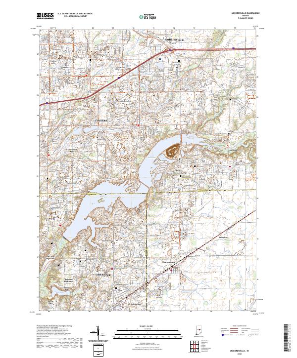 2022 McCordsville2022 Print · USGSThe suburban and lakeside developments northeast of Indianapolis are captured here in the early twenty-first century as the region expanded. Genealogists and local historians can locate numerous family burial sites like Helm Cem and Salem Cem or trace the early paths of Oaklandon and Woodbury.
 - 2022 Map of Acton, 2022 Print
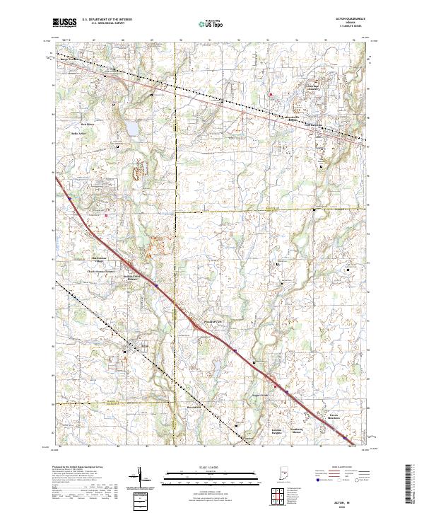 2022 Acton2022 Print · USGSThe rural communities southeast of Indianapolis are captured in this detailed study of the tri-county border area. Researchers can trace family roots through numerous burial grounds, including Mount Pleasant Methodist Church Cem and New Palestine Cem.
 - 2022 Map of Beech Grove, 2022 Print
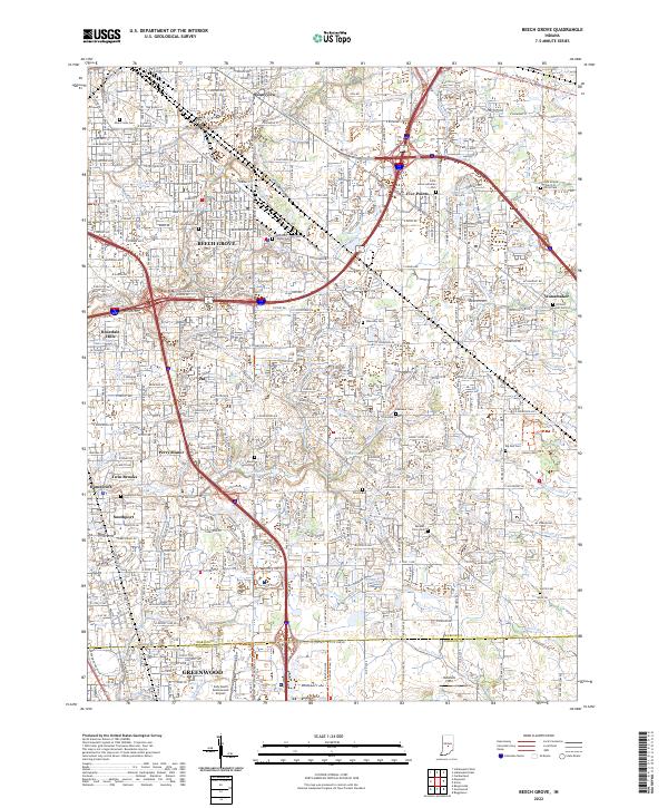 2022 Beech Grove2022 Print · USGSThe Beech Grove and Southport suburbs of Indianapolis are shown in high detail during the early 2020s. Researchers can locate numerous local burial grounds including New Crown Cem, Southport Cem, and the Zion United Church of Christ Cem.
 - 2022 Map of Zionsville, 2022 Print
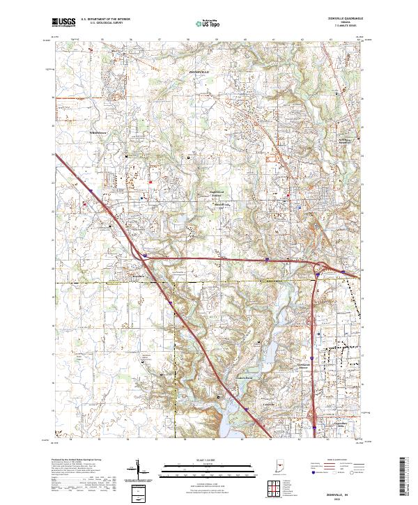 2022 Zionsville2022 Print · USGSZionsville and the Boone County borderlands are captured here in their contemporary layout of suburban growth and preserved history. Researchers can trace the heritage of local families and settlements through the Lincoln Memory Gardens Cem, Traders Point, and the Zionsville Rail Trail.
 - 2022 Map of Bridgeport, 2022 Print
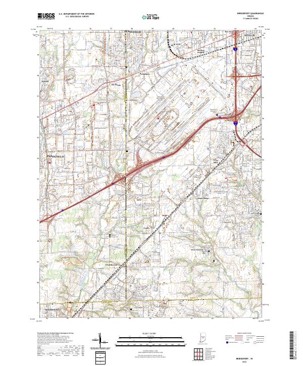 2022 Bridgeport2022 Print · USGSThe southwestern edge of the Indianapolis metro area is shown here in the early 2020s, where airport infrastructure meets older town centers. Researchers can trace historic cemeteries and small communities like West Newton and Camby alongside the Vandalia Rail-Trl.
 - 2022 Map of Carmel, 2022 Print
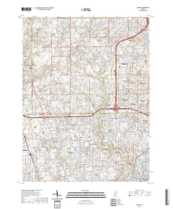 2022 Carmel2022 Print · USGSThe northern suburbs of Indianapolis are captured in a period of intense growth as agricultural land gives way to dense residential planning. Local historians can trace the paths of Little Eagle Creek and the Monon Rail Trl past landmarks like Poplar Ridge Cem and Eagle Village.
 - 2022 Map of Clermont, 2022 Print
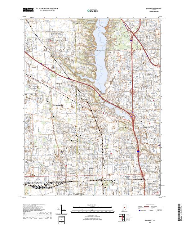 2022 Clermont2022 Print · USGSGreater Indianapolis expands westward in the early 2020s as residential growth surrounds the waters of Eagle Creek Reservoir. Researchers can locate numerous historical burial grounds like Jones Chapel Cem and Old Union Cem among the modern streets of Clermont and Speedway.
 - 2022 Map of Indianapolis West, 2022 Print
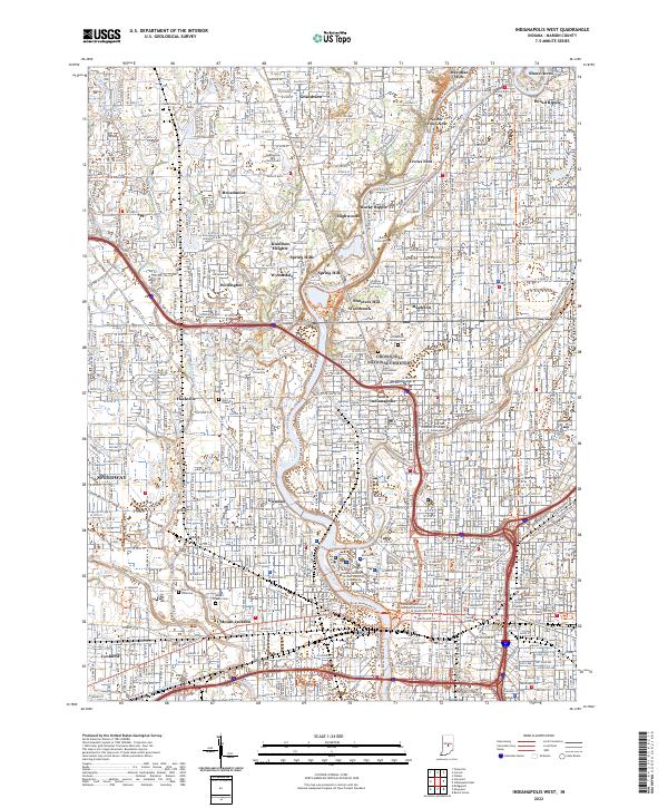 2022 Indianapolis West2022 Print · USGSWestern Indianapolis at the start of the 2020s shows a landscape where historic canal infrastructure and riverbanks meet modern academic and civic centers. Genealogists and historians can trace the borders of Crown Hill National Cem or locate the Grave of President Harrison and Floral Park Cem.
 - 2022 Map of Indianapolis East, 2022 Print
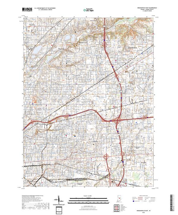 2022 Indianapolis East2022 Print · USGSMarion County's eastern suburbs and historic communities appear here in the early twenty-first century, showing the dense intersection of transit and local life. Trace family roots and local landmarks from Memorial Park Cem to Martin University and Brendonwood.
 - 2022 Map of Maywood, 2022 Print
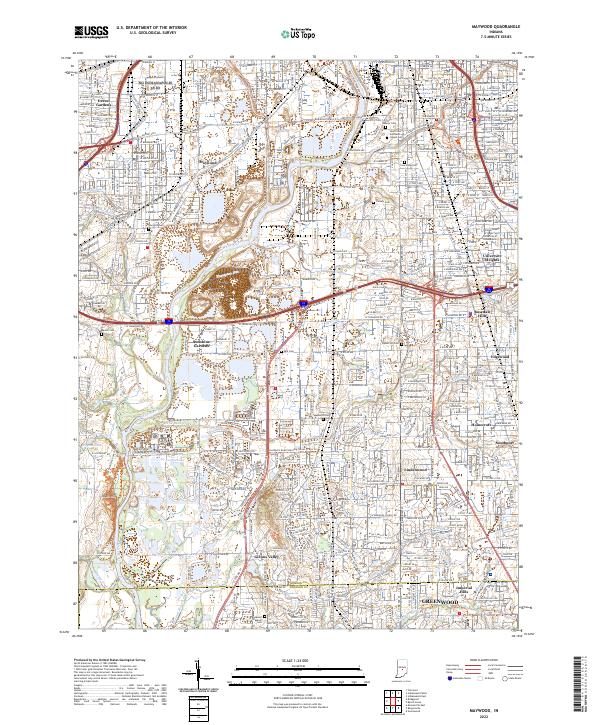 2022 Maywood2022 Print · USGSSouth of Indianapolis in the early 2020s, the river and rail corridors weave through long-established neighborhoods and expansive cemeteries. Genealogists and local historians can trace the grounds of Calvary Cemetery or locate the historic campus of the University of Indianapolis.
 - 2023 Map of Cumberland, 2023 Print
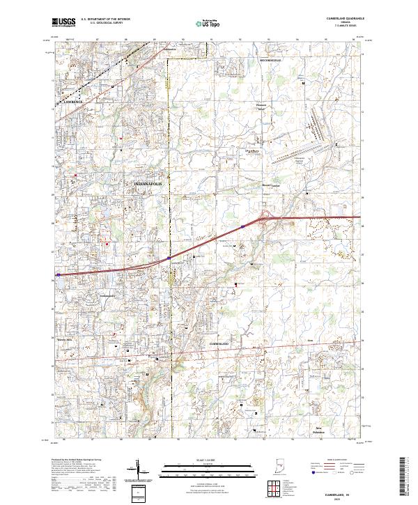 2023 Cumberland2023 Print · USGSCumberland and the eastern reaches of Indianapolis are captured in this recent survey during a period of continued suburban growth. Researchers can locate numerous local landmarks including Cumberland Cem, Mount Comfort, and the Saint John United Church of Christ Cem.
 - 2023 Map of Fishers, 2023 Print
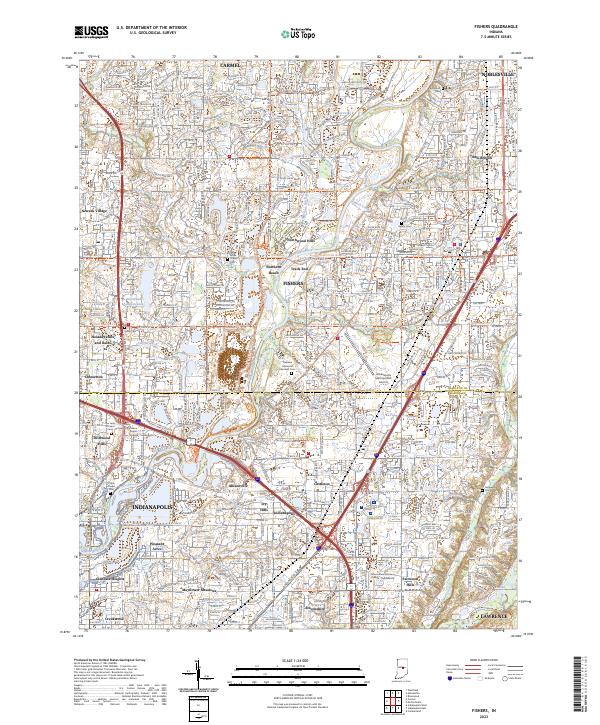 2023 Fishers2023 Print · USGSThe northern suburbs of Indianapolis are captured in this modern survey during a period of intense growth. Local researchers can trace the suburban evolution of Fishers and Carmel, identifying landmarks like Oaklawn Memorial Gardens Cem and the Indianapolis Metropolitan Airport.
End of results
Showing maps 1-12 of 12
Top cities near Indianapolis
- Carmel historical maps
- Fishers historical maps
- Noblesville historical maps
- Greenwood historical maps
- Westfield historical maps
- Lawrence historical maps
See more
Top neighborhoods of Indianapolis
- Belle Arbor historical maps
- Hunters Crossing historical maps
- Indian Creek Estates historical maps
- Julietta historical maps
- Lakeside historical maps
- Drexel Gardens historical maps
See more
Frequently asked questions
- What are the different types of historical maps available for Indianapolis?
- What is the oldest map of Indianapolis?
- Where can I purchase historical maps of Indianapolis for my home or office?
- Where can I download high-res historical maps of Indianapolis?
- Are there historical topographic maps available for Indianapolis?
- Is there historical aerial imagery available for Indianapolis?
- Where are historical maps of Indianapolis sourced from?