1970s Maps of Graves County, Kentucky
Explore 3 historic maps of Graves County from the 1970s. These maps offer a rare glimpse into what life looked like during the 1970s — showing old roads, neighborhoods, homes, and landmarks that have changed or disappeared over time.
Whether you're researching your family's past, planning a metal detecting trip, or studying how Graves County's landscape evolved across the 1970s, these high-resolution maps are a powerful tool for exploring the history of this region.
- Focus on a specific era: All maps on this page are from the 1970s, giving you a focused view of this time period.
- See what’s changed: Compare century-old streets, trails, and buildings to today's modern landscape using overlays and satellite layers.
- Research with precision: Use these maps for genealogy, historical research, land use analysis, or educational projects.
- View, download, or print: Maps are fully viewable online in high resolution, and can be downloaded or printed for your own records.
Start exploring Graves County's history through authentic maps from the 1970s. This is your window into the past.
Graves County, KY maps
(3)- 1977 Map of Cuba
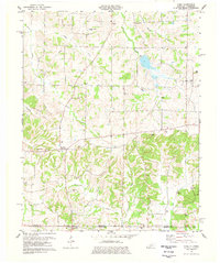 1977 Cuba1977 Print · USGSGraves County, Kentucky, and the Tennessee borderlands are captured here in the late seventies, showing a landscape defined by small farms and creek bottoms. Genealogists can trace family names through dozens of sites like Neale Cem and Adams Cem or locate community anchors such as Pilot Oak and Little Bethel Ch.
 - 1977 Map of Fancy Farm
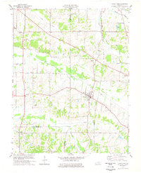 1977 Fancy Farm1977 Print · USGSWestern Kentucky’s agricultural heartland is documented here in the late seventies, showing the tri-county intersection of Graves, Carlisle, and Hickman. Genealogists can locate family sites like Dodson Cem or follow the Illinois Central Gulf rail line past Fancy Farm.
 - 1978 Map of Lynnville
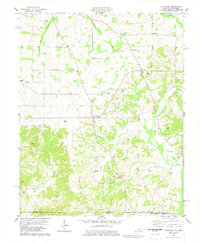 1978 Lynnville1978 Print · USGSThe Kentucky-Tennessee borderlands in the late seventies reveal a landscape of tight-knit rural communities and family legacies. Genealogists can trace ancestral sites at Kesterson Cem, Pittman Cem, and the border-straddling village of Boydsville.
End of results
Showing maps 1-3 of 3
Top cities of Graves County
Frequently asked questions
- What are the different types of historical maps available for Graves County?
- What is the oldest map of Graves County?
- Where can I purchase historical maps of Graves County for my home or office?
- Where can I download high-res historical maps of Graves County?
- Are there historical topographic maps available for Graves County?
- Is there historical aerial imagery available for Graves County?
- Where are historical maps of Graves County sourced from?