1990s Maps of Graves County, Kentucky
Explore 5 historic maps of Graves County from the 1990s. These maps offer a rare glimpse into what life looked like during the 1990s — showing old roads, neighborhoods, homes, and landmarks that have changed or disappeared over time.
Whether you're researching your family's past, planning a metal detecting trip, or studying how Graves County's landscape evolved across the 1990s, these high-resolution maps are a powerful tool for exploring the history of this region.
- Focus on a specific era: All maps on this page are from the 1990s, giving you a focused view of this time period.
- See what’s changed: Compare century-old streets, trails, and buildings to today's modern landscape using overlays and satellite layers.
- Research with precision: Use these maps for genealogy, historical research, land use analysis, or educational projects.
- View, download, or print: Maps are fully viewable online in high resolution, and can be downloaded or printed for your own records.
Start exploring Graves County's history through authentic maps from the 1990s. This is your window into the past.
Graves County, KY maps
(5)- 1993 Map of Farmington, 1996 Print
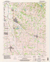 1993 Farmington1996 Print · USGSGraves County in the early nineties reflects a deep agricultural heritage centered on Farmington and Sedalia. Family researchers can trace ancestral locations through several burial sites like Smyrna Cem and landmarks such as the Woolen Mill.
 - 1993 Map of Melber, 1996 Print
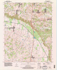 1993 Melber1996 Print · USGSWestern Kentucky at the close of the twentieth century remains a landscape of quiet crossroads and family homesteads. Genealogists can trace local lineages at Liberty Cem and Purchase Cem or explore the rural hubs of Melber and Folsomdale.
 - 1993 Map of Westplains, 1996 Print
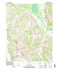 1993 Westplains1996 Print · USGSGraves County, Kentucky, is shown in the early nineties as the region's modern highway system integrated with its historic rural settlements. Genealogists and local researchers can trace family landmarks and forgotten crossings like Hopewell Church, Sand Hill Cem, and Old Casey Bridge.
 - 1994 Map of Hickory, 1996 Print
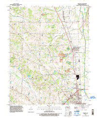 1994 Hickory1996 Print · USGSGraves County in the mid-1990s shows a landscape of traditional farming communities adapting to modern transit corridors. Researchers can trace family sites along Jewell Nance Road, locate historic burials at Old Union Cem, and see the local impact of the Purchase Parkway.
 - 1994 Map of Mayfield, 1996 Print
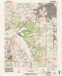 1994 Mayfield1996 Print · USGSIn the mid-1990s, Graves County remained a hub of rail transport and clay mining around the city of Mayfield. Trace family roots and old property lines near Pryorsburg, Rozzelle Church, and the Illinois Central Railroad.
End of results
Showing maps 1-5 of 5
Top cities of Graves County
Frequently asked questions
- What are the different types of historical maps available for Graves County?
- What is the oldest map of Graves County?
- Where can I purchase historical maps of Graves County for my home or office?
- Where can I download high-res historical maps of Graves County?
- Are there historical topographic maps available for Graves County?
- Is there historical aerial imagery available for Graves County?
- Where are historical maps of Graves County sourced from?