Old Maps of Graves County, Kentucky for Hiking & Exploration
Hike through history with 129 historic maps of Graves County. Explore old trails, ghost towns, and forgotten backroads — perfect for outdoor adventurers and local explorers.
- Rediscover forgotten places: Map out old mining camps, roads, and footpaths that no longer exist on modern maps.
- Layer with modern tools: Combine with LiDAR or satellite views to plan hikes through historical terrain.
- Made for exploration: Popular among hikers, overlanders, and local history lovers.
Use these maps to find adventure and explore the hidden past of Graves County.
Graves County, KY maps
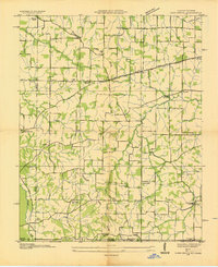
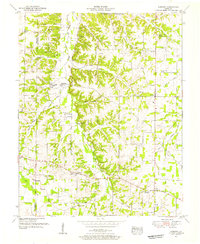
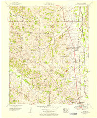
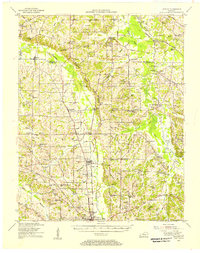
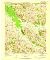
(129)- 1936 Map of Farmington
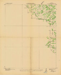 1936 Farmington1936 Print · USGSFarmington and the surrounding Graves County landscape appear here in the mid-1930s as rural electrification begins to take hold. Genealogists and local historians can trace family locations near Smyrna Ch, Cope Sch, and the settlement of Vulton Creek.
 - 1936 Map of Melber
 1936 Melber1936 Print · USGSWestern Kentucky in the mid-1930s was a landscape of small schools and essential drainage projects along the McCracken and Graves county line. Researchers can trace rural community hubs like Houser Grove Ch and Boaz Sch or follow the Illinois Central rail line.
 - 1936 Map of Oak Level
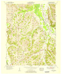
 1936 Oak Level1936 Print · USGSIn the mid-thirties, this corner of Kentucky was a patchwork of family farms and rural schools. Genealogists can trace family names through landmarks like Riley Cem, Hale Spring, and many country schools such as Oak Level Sch.
 - 1936 Map of Elva
 1936 Elva1936 Print · USGSMarshall and McCracken Counties were deeply agricultural and river-dependent in the mid-1930s. Researchers can trace family homesteads near Mt Moriah Ch, navigate the rail stops at Elva, or locate vanished crossings like Harris Hill Ford.
 - 1936 Map of Lynn Grove
 1936 Lynn Grove1936 Print · USGSSouthern Calloway County in the mid-1930s shows a landscape of small farming communities and country churches before many were consolidated. Researchers can trace family roots through sites like Salem Ch Cem, Paschall Sch, and the crossroads at Lynn Grove.
 - 1936 Map of Symsonia
 1936 Symsonia1936 Print · USGSWestern Kentucky at the edge of the Graves and McCracken county line is documented here in the mid-1930s. Researchers can trace family roots through numerous local landmarks like Boaz Cem, Hard Money, and the community of Symsonia.
 - 1936 Map of Benton
 1936 Benton1936 Print · USGSWestern Kentucky's rural Marshall County is captured here in the mid-1930s, showing a landscape defined by river fords and small family settlements. Genealogists can trace hundreds of specific locations, from C C C Camp No 519 to Oak Level and Tatumsville.
 - 1936 Map of Westplains
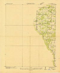
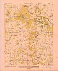
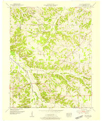
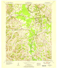
 1936 Westplains1936 Print · USGSGraves County in the mid-1930s is documented here through its network of country schools, churches, and drainage ditches. Genealogists can trace family roots at Rickman Cem or Arnett Cem and locate community centers like Westplains and Hicksville.
 - 1936 Map of Kirksey
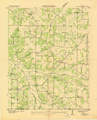
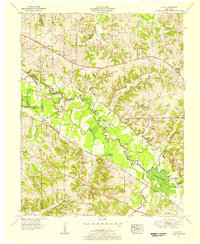
 1936 Kirksey1936 Print · USGSCalloway County is captured here in the mid-1930s as the Tennessee Valley Authority began documenting the river basins. Genealogists can locate family-named landmarks like Wyatt Sch, Mt Hebron Cem, and the crossroads at Coldwater.
 - 1951 Map of Kirksey, 1955 Print
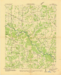
 1951 Kirksey1955 Print · USGSCalloway County and the surrounding river bottoms are documented here in the early fifties, showing a rural Kentucky landscape of crossroads towns and family farms. Researchers can locate early church sites like Mt Hebron Church and vanished features like the Clay Pits near Kirksey.3 unique versions available
 - 1951 Map of Farmington, 1955 Print
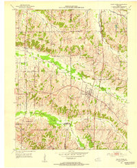
 1951 Farmington1955 Print · USGSGraves County, Kentucky, is shown in detail during the early fifties, following the ridge of the Tennessee Valley Divide. Researchers can trace family roots through numerous local landmarks, including Sedalia Sch, Bethlehem Church, and Swann Cem.3 unique versions available
 - 1951 Map of Oak Level, 1955 Print
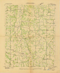
 1951 Oak Level1955 Print · USGSIn the early fifties, the rural communities of Marshall and Graves County remained centered on family-named hilltops and country parishes. Genealogists can trace family roots through numerous sites like Bondurant Cem, Oak Level Church, and Harvey.
 - 1951 Map of Melber, 1956 Print
 1951 Melber1956 Print · USGSThe rural borderlands of Graves and McCracken Counties come into focus in this early 1950s study of the western Kentucky landscape. Genealogists can trace family names across dozens of sites like Tittsworth Cem and Allcock Cem, or locate rural landmarks like Diggs Chapel and the Illinois Central rail line.2 unique versions available
 - 1951 Map of Hickory, 1956 Print
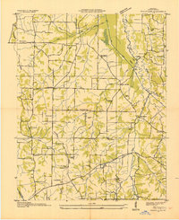
 1951 Hickory1956 Print · USGSGraves County at mid-century centers on the busy Illinois Central Railroad and the rural communities north of Mayfield. Researchers can trace dozens of family burial sites like Albritton Cem or visit local landmarks like the County War Memorial Fairgrounds.2 unique versions available
 - 1951 Map of Elva, 1956 Print
 1951 Elva1956 Print · USGSWestern Kentucky's rural river bottoms and early highway corridors are captured here in the early fifties. Genealogists can trace family landmarks and community centers such as Bethlehem Ch, Belton Cem, and the crossing at McCoy Ford Bridge.2 unique versions available
 - 1951 Map of Symsonia, 1956 Print
 1951 Symsonia1956 Print · USGSWestern Kentucky at the start of the fifties shows a landscape of river forks and small settlements like Symsonia and Hardmoney. Genealogists can trace family names through landmarks like Thompson Cem, Neece Chapel, and the Freemont Sch.2 unique versions available
 - 1951 Map of Westplains, 1956 Print
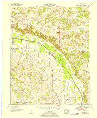
 1951 Westplains1956 Print · USGSGraves County in the early 1950s is a landscape of high ridges and winding river bottoms divided by the Tennessee Valley Divide. Researchers can locate numerous family landmarks and rural hubs, including Spence Chapel, the Hardeman Sch, and the Old Casey Bridge.2 unique versions available
 - 1951 Map of Hickory, 1957 Print
 1951 Hickory1957 Print · USGSIn the early 1950s, this area of Graves and McCracken County was a patchwork of small tobacco farms and rail-stop towns. Researchers can locate hundreds of family sites, from the Clay Pits near Hickory to remote landmarks like Neece Chapel and Old Casey Bridge.
 - 1951 Map of Murray, 1957 Print
 1951 Murray1957 Print · USGSMid-century Calloway County centers on the growing campus of Murray State Teachers College and the vital Nashville Chattanooga and St Louis rail line. Researchers can trace rural family sites at Taylors Store, Backusburg, and the many cemeteries like Bazzell Cem scattered across the Tennessee Valley Divide.
 - 1951 Map of Lynn Grove, 1964 Print
 1951 Lynn Grove1964 Print · USGSCalloway County and the Tennessee borderlands appear here in the early 1950s, a rural landscape shaped by the Tennessee Valley Divide. Researchers can trace old family sites near Lynn Grove, Wiswell, and Taylors Store, or find local heritage at Sinking Spring Church and Brush Island Cem.2 unique versions available
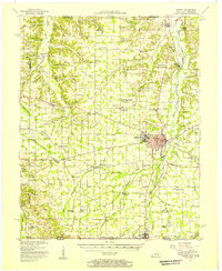
 - 1952 Map of Mayfield, 1953 Print
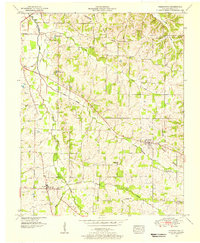
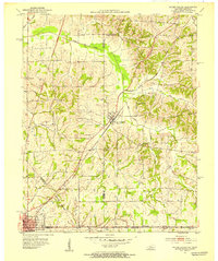
 1952 Mayfield1953 Print · USGSMid-century Graves County is centered on the industrial and rail hub of Mayfield, where the railroad connects the town to its rural southern neighbors. Genealogists can locate family names and burial sites at Maplewood Cem, Bethel Cem, and the small settlement of Pryorsburg.
 - 1952 Map of Dublin, 1953 Print
 1952 Dublin1953 Print · USGSGraves and Hickman counties come together in this early 1950s survey of the Jackson Purchase. Genealogists can trace family names and rural hubs including Dublin, the Illinois Central rail line, and numerous landmarks like McClure Chapel and Mason Cem.
 - 1952 Map of Cuba, 1953 Print
 1952 Cuba1953 Print · USGSWestern Kentucky and Northwest Tennessee meet in the early fifties along a borderland of productive farmsteads and rural crossroads. Genealogists and local historians can trace family roots at Old Bethlehem Cem, Poyners Chapel, and the divided community of Dukedom.
 - 1952 Map of Fancy Farm, 1953 Print
 1952 Fancy Farm1953 Print · USGSFancy Farm and the surrounding rural crossroads of Western Kentucky are captured here in the early fifties. Genealogists and local historians can trace family roots through sites like Emmaus Cem, the village of Kirbyton, and the Illinois Central rail line.
 - 1952 Map of Water Valley, 1953 Print
 1952 Water Valley1953 Print · USGSIn the early 1950s, the border between Kentucky and Tennessee was a landscape of rail-driven towns and winding bayous. Genealogists and historians can trace family roots through landmarks like Camp Beauregard Cem, the settlement of Feliciana, and the Illinois Central rail line.
Showing maps 1-25 of 129
Top cities of Graves County
Frequently asked questions
- What are the different types of historical maps available for Graves County?
- What is the oldest map of Graves County?
- Where can I purchase historical maps of Graves County for my home or office?
- Where can I download high-res historical maps of Graves County?
- Are there historical topographic maps available for Graves County?
- Is there historical aerial imagery available for Graves County?
- Where are historical maps of Graves County sourced from?