2020s Maps of Graves County, Kentucky
Explore 16 historic maps of Graves County from the 2020s. These maps offer a rare glimpse into what life looked like during the 2020s — showing old roads, neighborhoods, homes, and landmarks that have changed or disappeared over time.
Whether you're researching your family's past, planning a metal detecting trip, or studying how Graves County's landscape evolved across the 2020s, these high-resolution maps are a powerful tool for exploring the history of this region.
- Focus on a specific era: All maps on this page are from the 2020s, giving you a focused view of this time period.
- See what’s changed: Compare century-old streets, trails, and buildings to today's modern landscape using overlays and satellite layers.
- Research with precision: Use these maps for genealogy, historical research, land use analysis, or educational projects.
- View, download, or print: Maps are fully viewable online in high resolution, and can be downloaded or printed for your own records.
Start exploring Graves County's history through authentic maps from the 2020s. This is your window into the past.
Graves County, KY maps
(16)- 2022 Map of Cuba, 2022 Print
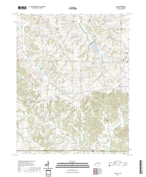 2022 Cuba2022 Print · USGSThe Kentucky and Tennessee state line runs through this rural landscape in the early 2020s, dominated by small settlements and family farms. Genealogists can locate dozens of historic burial sites such as Colley Family Cem, Pilot Oak, and Old Bethlehem Cem.
 - 2022 Map of Farmington, 2022 Print
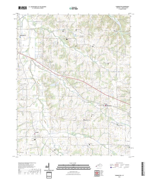 2022 Farmington2022 Print · USGSGraves County persists as a landscape of rural family heritage and small-town hubs in the early twenty-first century. Genealogists and local historians can trace legacy landholdings and community focal points through a high density of burial grounds, including the Nesler Family Cem, Farmington Cem, and Harmony Primitive Baptist Church Cem.
 - 2022 Map of Fancy Farm, 2022 Print
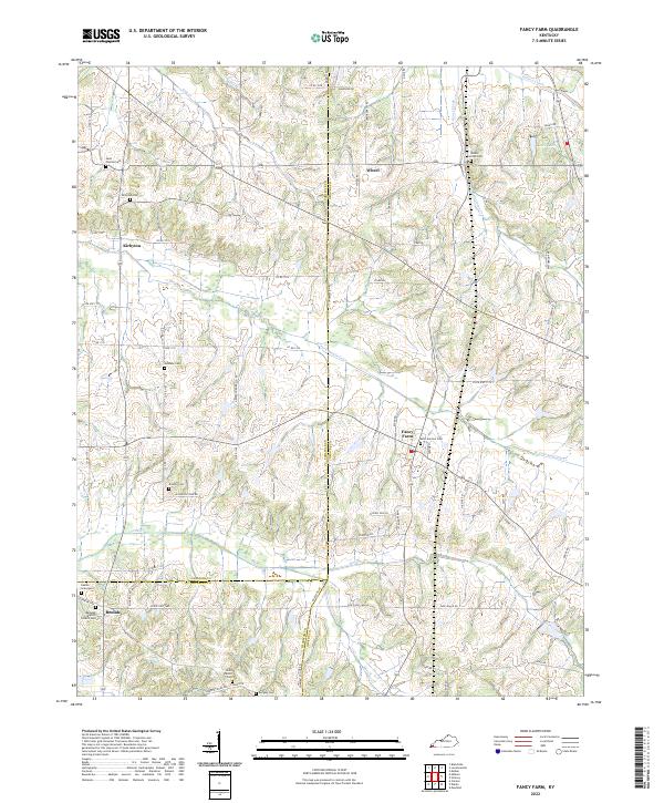 2022 Fancy Farm2022 Print · USGSFancy Farm and the surrounding tri-county corner of Graves, Carlisle, and Hickman counties are shown here in modern detail. Researchers can locate numerous family burial sites and rural parishes, from Saint Jerome Cem and Beulah Baptist Church Cem to the secluded Rambo Graveyard.
 - 2022 Map of Kirksey, 2022 Print
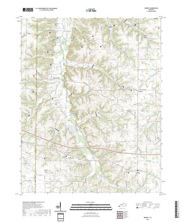 2022 Kirksey2022 Print · USGSWestern Kentucky's agricultural heartland and the Tennessee Valley Divide are documented here in the early twenty-first century. Genealogists and local historians can locate dozens of family burial sites, from Yandell Cem to the Stella Goshen Cem near Stella.
 - 2022 Map of Oak Level, 2022 Print
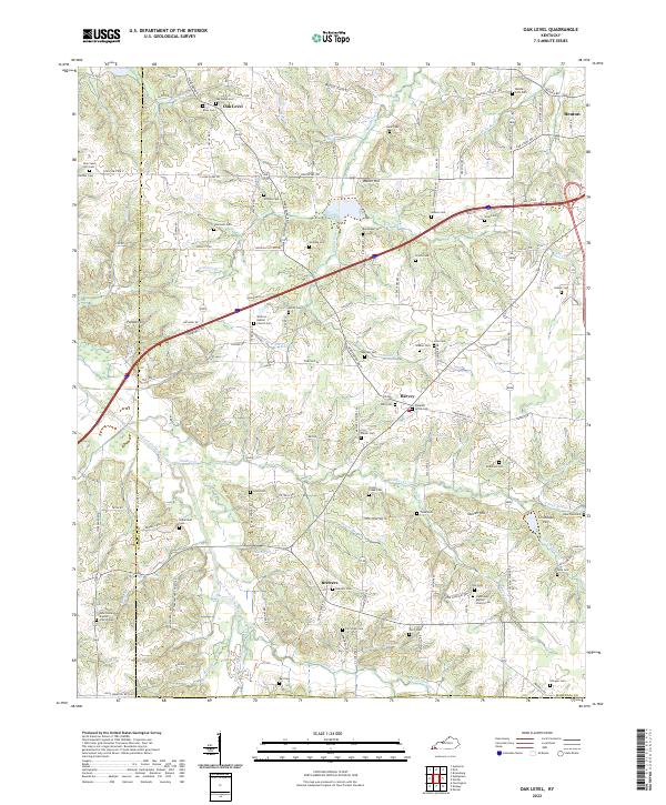 2022 Oak Level2022 Print · USGSWestern Kentucky's rural landscape comes alive in this survey of the communities near the West Fork Clarks River. Researchers can trace family sites across a dense network of country cemeteries and churches, including Oak Level Cem and Vanzora Baptist Church Cem.
 - 2022 Map of Melber, 2022 Print
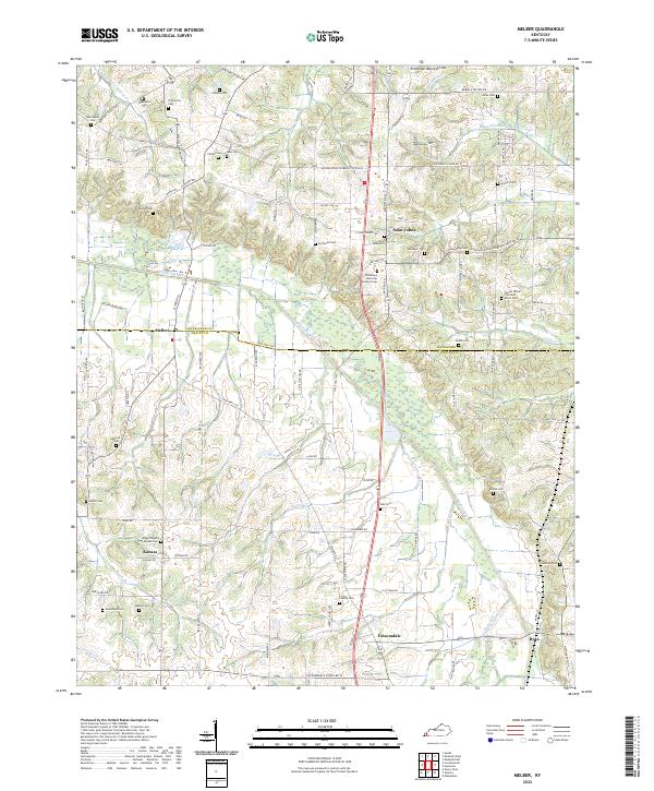 2022 Melber2022 Print · USGSThe rural Kentucky borderlands of McCracken and Graves Counties are captured here in the early twenty-first century. Genealogists can trace family names through numerous rural burial sites like Allcock Cem, Diggs Chapel - Kansas Cem, and Thompson Cem.
 - 2022 Map of Westplains, 2022 Print
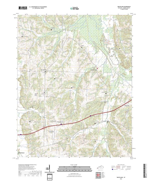 2022 Westplains2022 Print · USGSGraves County in the early 2020s remains a landscape of traditional family-named settlements and rural churchyards. Researchers can trace ancestral locations like the Puryear Family Cem and Honeycutt Cem or explore the area around Clear Springs.
 - 2022 Map of Mayfield, 2022 Print
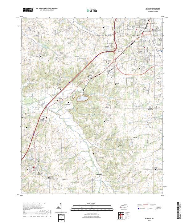 2022 Mayfield2022 Print · USGSGraves County at the start of the 2020s shows a landscape where historic rural settlements like Pryorsburg and Wingo still anchor the community. Researchers can trace family roots through numerous local burial sites, including the Blane Family Cem, Saint Josephs Cem, and Anderson Cem.
 - 2022 Map of Lovelaceville, 2022 Print
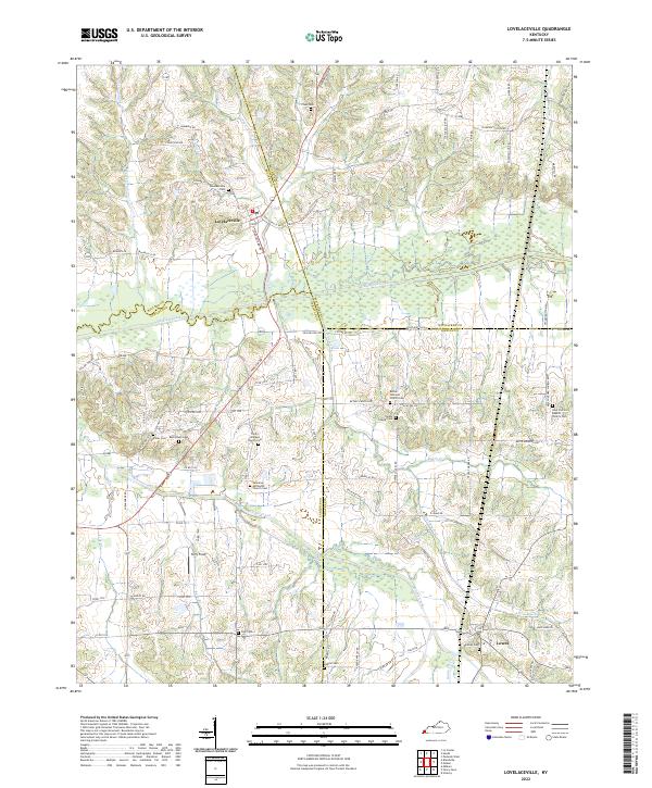 2022 Lovelaceville2022 Print · USGSWestern Kentucky's rural landscape comes alive in this survey of the four-county junction area near the turn of the decade. Researchers can trace family roots at Lovelaceville Cem or locate church sites like Owens Chapel Cem and Lowes.
 - 2022 Map of Dublin, 2022 Print
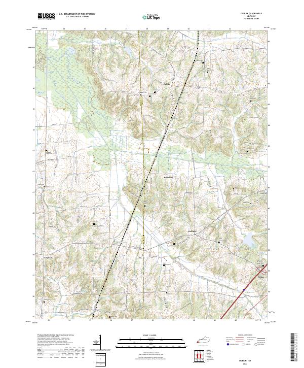 2022 Dublin2022 Print · USGSWestern Kentucky's rural borderlands are documented here in the early 2020s, showing a landscape defined by the winding Obion Creek. Genealogists will find a wealth of family history in numerous small burying grounds like Unity Baptist Cemetery, Dublin Cemetery, and Lain-Scholes Cemetery.
 - 2022 Map of Symsonia, 2022 Print
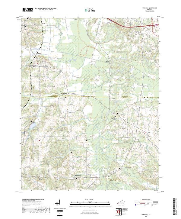 2022 Symsonia2022 Print · USGSWestern Kentucky farmland and the river bottoms south of the Clarks River are captured in this modern survey. Researchers can trace family history through numerous landmarks like Hardmoney Baptist Church, Symsonia Cem, and Carters Mill Cem.
 - 2022 Map of Hickory, 2022 Print
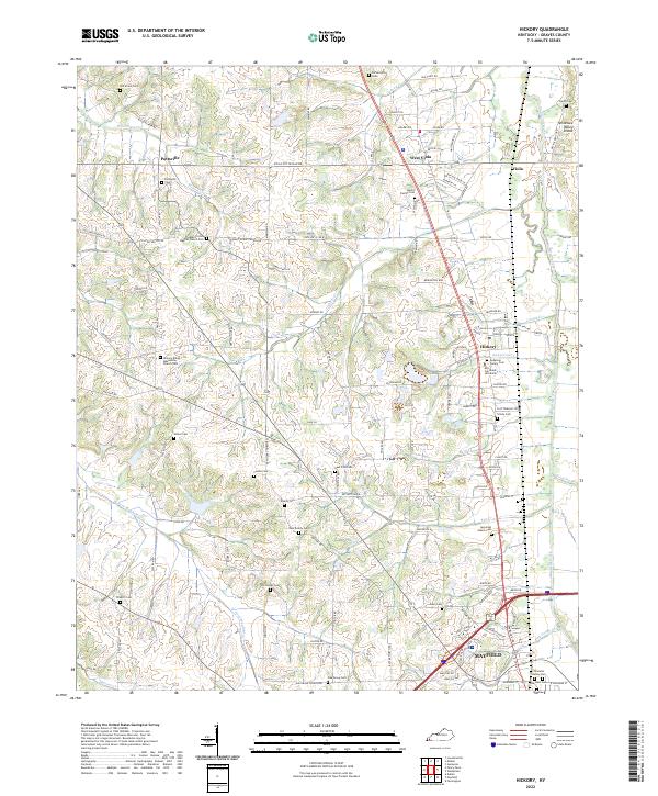 2022 Hickory2022 Print · USGSNorth of Mayfield in the early 2020s, this area of Graves County remains a landscape of small settlements and deep-rooted family history. Genealogists can trace numerous local sites such as the Pottsville Cem, Sellars Cem, and the Hickory Amish Mennonite Church Cem.
 - 2022 Map of Elva, 2022 Print
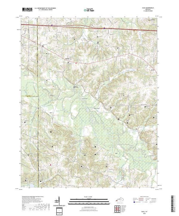 2022 Elva2022 Print · USGSMarshall County's riparian landscape is documented here in the early twenty-first century, centered on the wetlands of the Clarks River. Genealogists and local historians can locate numerous family burial sites like Oakland Cem and Armstrong - Maple Hill Cem alongside landmarks such as Harris Hill Ford.
 - 2022 Map of Water Valley, 2022 Print
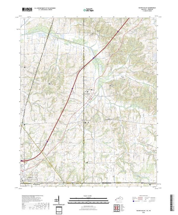 2022 Water Valley2022 Print · USGSThe borderlands of Kentucky and Tennessee come into focus in the early 2020s, centered on the community of Water Valley. Researchers can trace dozens of local burial sites and landmarks including Pleasant Hill Cemetery African American, Camp Beauregard Cemetery, and the historic Feliciana settlement area.
 - 2022 Map of Lynnville, 2022 Print
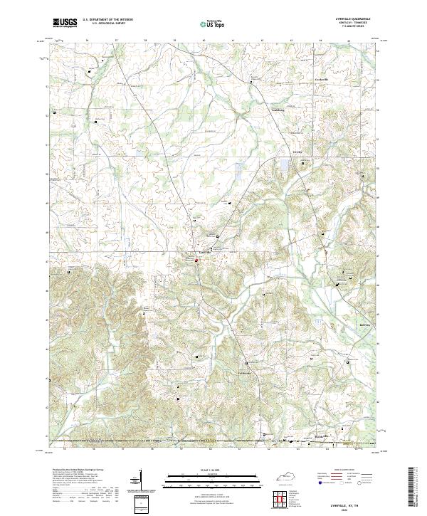 2022 Lynnville2022 Print · USGSThe Kentucky-Tennessee borderlands come alive in this survey of the region south of Lynnville. Genealogists can trace family connections through dozens of local burial sites, including the Old Beech Grove Cem, Rhodes Chapel Cem, and Mooney Cem.
 - 2022 Map of Lynn Grove, 2022 Print
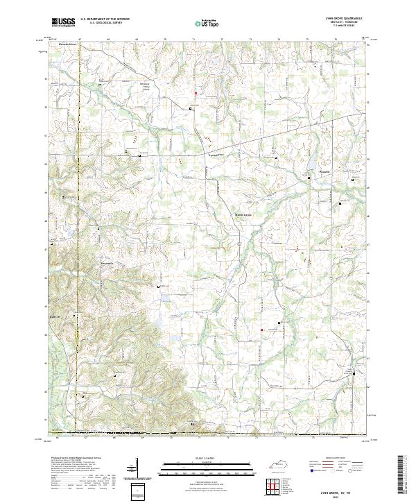 2022 Lynn Grove2022 Print · USGSCalloway County and the Kentucky-Tennessee borderlands appear in great detail during the early 2020s. Genealogists can trace family names at Salem Cem, Harmony Cem, and South Pleasant Grove Cem near the Middle Fork Clarks River.
End of results
Showing maps 1-16 of 16
Top cities of Graves County
Frequently asked questions
- What are the different types of historical maps available for Graves County?
- What is the oldest map of Graves County?
- Where can I purchase historical maps of Graves County for my home or office?
- Where can I download high-res historical maps of Graves County?
- Are there historical topographic maps available for Graves County?
- Is there historical aerial imagery available for Graves County?
- Where are historical maps of Graves County sourced from?