1950s Maps of Calcasieu Parish, Louisiana
Explore 34 historic maps of Calcasieu Parish from the 1950s. These maps offer a rare glimpse into what life looked like during the 1950s — showing old roads, neighborhoods, homes, and landmarks that have changed or disappeared over time.
Whether you're researching your family's past, planning a metal detecting trip, or studying how Calcasieu Parish's landscape evolved across the 1950s, these high-resolution maps are a powerful tool for exploring the history of this region.
- Focus on a specific era: All maps on this page are from the 1950s, giving you a focused view of this time period.
- See what’s changed: Compare century-old streets, trails, and buildings to today's modern landscape using overlays and satellite layers.
- Research with precision: Use these maps for genealogy, historical research, land use analysis, or educational projects.
- View, download, or print: Maps are fully viewable online in high resolution, and can be downloaded or printed for your own records.
Start exploring Calcasieu Parish's history through authentic maps from the 1950s. This is your window into the past.
Calcasieu Parish, LA maps
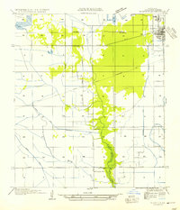
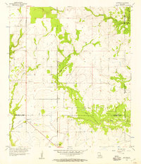
(34)- 1950 Map of Fenton
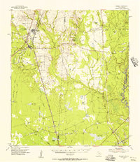
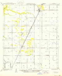 1950 Fenton1950 Print · USGSJefferson Davis Parish in the mid-twentieth century is shown here as a landscape of rail-side settlements and winding bayous. Genealogists can trace family footprints through rural sites like Rose Hill School, Woodlawn, and the Woodlawn Cem.
 - 1950 Map of Hecker
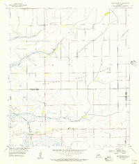
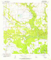
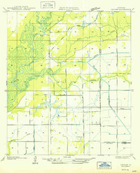 1950 Hecker1950 Print · USGSSouthwestern Louisiana's wetlands and early agricultural infrastructure are visible here in the years following the mid-1930s field surveys. Trace the Old Logging Railroad Grade and the engineering of the Louisiana Irrigation Canal near Hecker.
 - 1952 Map of Lake Charles
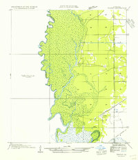
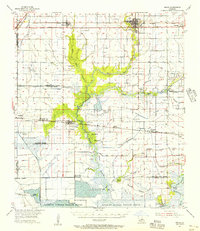
 1952 Lake Charles1952 Print · USGSSouthwest Louisiana is captured here in the mid-fifties, showing a landscape defined by the rise of the petrochemical industry and deep-water navigation. Researchers can trace family roots through numerous small-town settlements and oil developments like Nibletts Bluff, the Lockport Oil Field, and Starks.
 - 1954 Map of Toomey
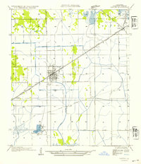
 1954 Toomey1954 Print · USGSThe Louisiana-Texas borderlands in the mid-fifties are defined here by the winding Sabine River and the marshes of Calcasieu Parish. Researchers can locate Nibletts Bluff on the riverbank or trace family names at the Comier Cemetery near Toomey.
 - 1954 Map of Vinton
 1954 Vinton1954 Print · USGSCoastal Louisiana prairie meets early industrial growth in the mid-fifties as the Southern Pacific railroad connects these Calcasieu Parish towns. Genealogists can locate family homes and properties in Vinton, Edgerly, and the small settlement of Ged near Ged Lake.
 - 1954 Map of Sulphur
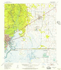
 1954 Sulphur1954 Print · USGSCalcasieu Parish reveals its industrial and rural character in the mid-1950s as settlements like Sulphur and Brimstone expand along the rail lines. Researchers can trace historic water routes and local landmarks including the Choupique Sch, Carlyss, and Spring Gully.
 - 1954 Map of West Lake
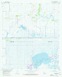
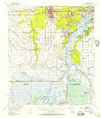
 1954 West Lake1954 Print · USGSCoastal Calcasieu Parish is captured here in the mid-1950s as the shipping and rail industries reshaped the marshland. Researchers can trace family sites at Farquhar Cemetery, visit the old Vincent Sch, or locate the historic Vincent Landing along the Calcasieu River.
 - 1954 Map of Phoenix Lake
 1954 Phoenix Lake1954 Print · USGSThe Louisiana-Texas borderlands are captured here in the mid-fifties, showing a landscape defined by wetlands and the Sabine River. Researchers can trace early infrastructure like Burton Shell Road and named landmarks such as Sassafras Island or Phoenix Lake.
 - 1954 Map of Lake Charles, 1964 Print
 1954 Lake Charles1964 Print · USGSSouthwest Louisiana in the mid-fifties is defined by its massive petroleum industry and its complex network of bayous and rail lines. Researchers can trace the development of the Sulphur Mines Oil Field or locate historic settlements like Longville and De Quincy.3 unique versions available
 - 1955 Map of Black Lake
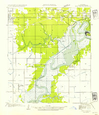
 1955 Black Lake1955 Print · USGSThe marshy transition between Calcasieu and Cameron Parishes is captured here in the mid-fifties, during a peak period of coastal energy expansion. Researchers can trace the industrial footprint of the West Hackberry Oil and Gas Field or locate family sites at Moss Cem and Landry Cem.4 unique versions available
 - 1955 Map of Moss Bluff, 1956 Print
 1955 Moss Bluff1956 Print · USGSCoastal Louisiana's river country comes to life in this mid-century survey of the Calcasieu basin north of Lake Charles. Trace historical river crossings and early settlements like Indian Bayou Ferry, Moss Bluff, and the Bagdad Cem.4 unique versions available
 - 1955 Map of Westlake, 1956 Print
 1955 Westlake1956 Print · USGSCalcasieu Parish in the mid-1950s shows a region defined by the petroleum industry and expanding rail networks. Researchers can trace the development of Sulphur and Mossville, or locate family sites like Burleson Cem and St Johns Sch.4 unique versions available
 - 1955 Map of Orange, 1956 Print
 1955 Orange1956 Print · USGSThe Texas-Louisiana borderlands in the mid-fifties center on the industrial hubs and vast marshlands of the Sabine River. Genealogists and historians can locate community sites like Reed Cem, Crossroad Ch, and the Gum Cove Ferry crossing.
 - 1955 Map of Iowa, 1956 Print
 1955 Iowa1956 Print · USGSCalcasieu Parish in the mid-fifties is defined by its intersection of heavy rail and emerging energy fields. Genealogists and historians can trace rail-side settlements like Iowa and Chalkley alongside the sprawling Iowa Oil and Gas Field.3 unique versions available
 - 1955 Map of Lake Charles SE, 1956 Print
 1955 Lake Charles SE1956 Print · USGSCoastal Louisiana prairie and marshlands meet in the mid-fifties at the boundary of Calcasieu and Cameron Parishes. Genealogists can locate rural landmarks such as Holmwood, Sweet Lake Ch, and the Sweet Lake Pumping Station.3 unique versions available
 - 1955 Map of Welsh, 1956 Print
 1955 Welsh1956 Print · USGSCoastal Louisiana prairie and marshlands meet in the mid-fifties, showing the agricultural and industrial landscape of Jefferson Davis Parish. Trace family roots at Broussard Cem or follow the old Southern Pacific line through Lacassine and Welsh.4 unique versions available
 - 1955 Map of Lake Charles SW, 1956 Print
 1955 Lake Charles SW1956 Print · USGSCoastal prairies and marshlands meet in Calcasieu and Cameron Parishes during the mid-fifties, showing a landscape defined by water and early energy extraction. Researchers can locate family landmarks like Hebert Cem or trace the old routes of Sweet Lake Ferry and Coulée Hippolyte.3 unique versions available
 - 1955 Map of Lake Charles, 1956 Print
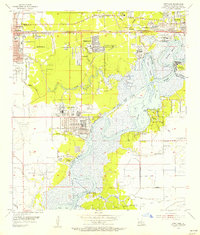
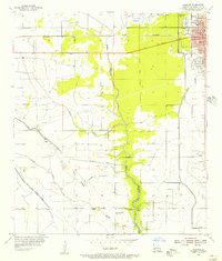
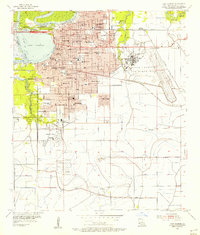 1955 Lake Charles1956 Print · USGSCalcasieu Parish undergoes a post-war transformation in the mid-fifties as urban growth reaches toward the new air base. Genealogists and historians can trace the foundations of McNeese State College and locate family plots in Highland Cemetery or LeBleu Cem.4 unique versions available
 - 1955 Map of Moss Lake, 1956 Print
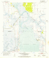 1955 Moss Lake1956 Print · USGSThe coastal marshlands of Calcasieu and Cameron Parish are shown here during the mid-fifties industrial boom. Researchers can trace historic water crossings and family sites like Ellender Ferry, Dutch Cove Cem, and the old settlement at Hackberry.3 unique versions available
 - 1955 Map of Bessmay, 1956 Print
 1955 Bessmay1956 Print · USGSIn the mid-1950s, the borderlands between Texas and Louisiana were a landscape of rail-connected timber towns and emerging oil fields. Researchers can trace family history through sites like Morse Cemetery and Nichols Creek Church, or locate rail junctions at Bessmay and Buna.2 unique versions available
 - 1955 Map of Sulphur, 1956 Print
 1955 Sulphur1956 Print · USGSCalcasieu Parish in the mid-fifties shows a landscape of rising industry and expanding neighborhoods around the rail lines. Genealogists and local historians can trace the early layout of Sulphur and locate sites like the Roseland Cem and the settlement of Brimstone.3 unique versions available
 - 1955 Map of Sulphur, 1956 Print
 1955 Sulphur1956 Print · USGSCalcasieu Parish in the mid-fifties is a landscape of rapid industrial growth centered on the sulfur and oil fields. Researchers can trace the roots of local communities through the Mimosa-Pines Cem, the Salem Sch, and the Black Bayou Ferry crossing.3 unique versions available
 - 1955 Map of Lake Charles, 1956 Print
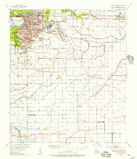 1955 Lake Charles1956 Print · USGSMid-century Lake Charles is shown as a thriving railroad and educational hub before its late-twentieth-century industrial shifts. Researchers can trace family roots through neighborhood schools like Henry Heights Sch or locate ancestors at LeBleu Cem and Highland Cem.3 unique versions available
 - 1956 Map of Gaytine, 1957 Print
 1956 Gaytine1957 Print · USGSSouthwest Louisiana in the mid-fifties is seen here as a landscape of rural bayous and timber-era rail stops. Researchers can trace the Southern Pacific line through small settlements like Gaytine and Turps or follow the waters of Marsh Bayou.2 unique versions available
 - 1956 Map of Buhler, 1957 Print
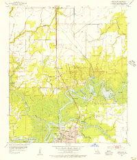
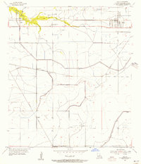
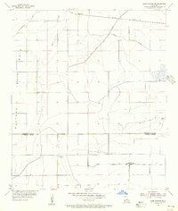
 1956 Buhler1957 Print · USGSCalcasieu Parish in the mid-fifties remains a world of river crossings and rail lines as the region transitions toward industrial growth. Genealogists and local historians can trace family sites like Lyle Cem and Royer Cem or locate the historic Dunn Ferry crossing.4 unique versions available
Showing maps 1-25 of 34
Top cities of Calcasieu Parish
- Lake Charles historical maps
- Sulphur historical maps
- Westlake historical maps
- Vinton historical maps
- DeQuincy historical maps
- Iowa historical maps
See more
Frequently asked questions
- What are the different types of historical maps available for Calcasieu Parish?
- What is the oldest map of Calcasieu Parish?
- Where can I purchase historical maps of Calcasieu Parish for my home or office?
- Where can I download high-res historical maps of Calcasieu Parish?
- Are there historical topographic maps available for Calcasieu Parish?
- Is there historical aerial imagery available for Calcasieu Parish?
- Where are historical maps of Calcasieu Parish sourced from?