1950s Maps of Rapides Parish, Louisiana
Explore 23 historic maps of Rapides Parish from the 1950s. These maps offer a rare glimpse into what life looked like during the 1950s — showing old roads, neighborhoods, homes, and landmarks that have changed or disappeared over time.
Whether you're researching your family's past, planning a metal detecting trip, or studying how Rapides Parish's landscape evolved across the 1950s, these high-resolution maps are a powerful tool for exploring the history of this region.
- Focus on a specific era: All maps on this page are from the 1950s, giving you a focused view of this time period.
- See what’s changed: Compare century-old streets, trails, and buildings to today's modern landscape using overlays and satellite layers.
- Research with precision: Use these maps for genealogy, historical research, land use analysis, or educational projects.
- View, download, or print: Maps are fully viewable online in high resolution, and can be downloaded or printed for your own records.
Start exploring Rapides Parish's history through authentic maps from the 1950s. This is your window into the past.
Rapides Parish, LA maps
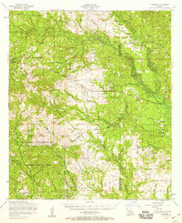
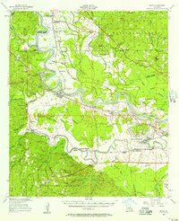
(23)- 1951 Map of Steep Gully, 1952 Print
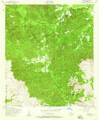
 1951 Steep Gully1952 Print · USGSThe timberlands of central Louisiana come alive in the early 1950s as a network of parish lines and logging grades. Trace old family roots at Occupy Ch No 1, locate the Plainview Lookout Tower, or follow the Tenmile Creek bottomlands.
 - 1952 Map of Lake Charles
 1952 Lake Charles1952 Print · USGSSouthwest Louisiana is captured here in the mid-fifties, showing a landscape defined by the rise of the petrochemical industry and deep-water navigation. Researchers can trace family roots through numerous small-town settlements and oil developments like Nibletts Bluff, the Lockport Oil Field, and Starks.
 - 1953 Map of Alexandria, 1963 Print
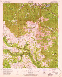
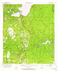
 1953 Alexandria1963 Print · USGSCentral Louisiana during the early fifties is mapped here at the intersection of the piney woods and the Red River valley. Genealogists and historians can trace the rail-and-river network connecting towns like Alexandria, Natchitoches, and the grounds of Camp Beauregard.3 unique versions available
 - 1954 Map of Pawnee
 1954 Pawnee1954 Print · USGSThe timber country of Rapides and Allen Parishes is documented here at mid-century, showing a landscape defined by wood and water. Researchers can locate the Union Hill Sch, trace the old Logging Railroad grades, and find family names near Bethel Cem.
 - 1954 Map of Leander, 1958 Print
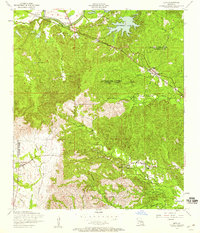
 1954 Leander1958 Print · USGSIn the mid-1950s, this portion of Louisiana shows the evolving landscape of Fort Polk and the timber-rich Kisatchie National Forest. Researchers can trace old logging routes like the dismantled railroad and locate sites like the Floctaw School and Hicks Crossing.2 unique versions available
 - 1954 Map of Temple, 1959 Print
 1954 Temple1959 Print · USGSCentral Louisiana parish borders meet in the mid-1950s within the wooded reaches of the Kisatchie National Forest. Genealogists can locate family landmarks like Comrade Cemetery, Burnstown, and the winding path of a dismantled railroad.2 unique versions available
 - 1954 Map of Lena, 1959 Print
 1954 Lena1959 Print · USGSCentral Louisiana in the mid-fifties reveals a landscape of parish border settlements and river-valley transport along the Cane River. Researchers can locate family landmarks like Bay Spring Cemetery and Wise Memorial Chapel or trace the Texas and Pacific rail line through Galbraith Station.3 unique versions available
 - 1954 Map of Jericho, 1959 Print
 1954 Jericho1959 Print · USGSCentral Louisiana in the mid-fifties reveals a landscape of working timber lands and quiet rural settlements. Researchers can trace the path of the dismantled railroad or locate family roots near Pisgah Church, Clifton, and the Hill Cemetery.4 unique versions available
 - 1954 Map of Gorum, 1959 Print
 1954 Gorum1959 Print · USGSNatchitoches and Rapides Parishes are shown in the mid-fifties as the timber industry reshaped the deep woods. Trace family history through Bolton Cemetery, explore the small community of Gorum, and locate the old route of the Dismantled railroad.2 unique versions available
 - 1954 Map of Leander SE, 1959 Print
 1954 Leander SE1959 Print · USGSRapides and Vernon Parishes in the mid-fifties reveal a landscape of timber-driven development and military expansion. Genealogists and historians can trace the paths of a Dismantled railroad and locate rural landmarks like Mount Moriah Church and Doyle Cemetery.
 - 1954 Map of Chopin, 1959 Print
 1954 Chopin1959 Print · USGSCentral Louisiana in the mid-fifties shows a landscape defined by timber and the Cane River valley. Genealogists and historians can trace numerous remote cemeteries and churches, such as Gorum Cem, Holy Family Church, and the logging community at Zimmerman Camp.2 unique versions available
 - 1954 Map of Sieper, 1959 Print
 1954 Sieper1959 Print · USGSRapides Parish and Vernon Parish come into focus in the mid-1950s, showing the rural communities and timber-hauling routes of central Louisiana. Researchers can trace the path of a dismantled railroad and locate early sites like Pisgah Church or the Smith Cemetery.
 - 1954 Map of Lake Charles, 1964 Print
 1954 Lake Charles1964 Print · USGSSouthwest Louisiana in the mid-fifties is defined by its massive petroleum industry and its complex network of bayous and rail lines. Researchers can trace the development of the Sulphur Mines Oil Field or locate historic settlements like Longville and De Quincy.3 unique versions available
 - 1955 Map of Alexandria
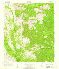
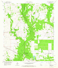
 1955 Alexandria1955 Print · USGSCentral Louisiana in the mid-fifties is a landscape of river-port cities, sprawling timberlands, and massive military reservations. Genealogists and historians can trace the rail networks of the Texas & Pacific RR and locate sites like Camp Polk Military Reservation and Natchitoches.
 - 1956 Map of Colfax, 1957 Print
 1956 Colfax1957 Print · USGSGrant and Winn Parishes come into focus during the mid-1950s, showing a landscape defined by forest reserves and rail-line settlements. Genealogists and historians can trace local roots through landmarks like Hebron Ch & Cem, Summerfield Sch, and McNeeley.3 unique versions available
 - 1956 Map of Forest Hill, 1957 Print
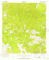 1956 Forest Hill1957 Print · USGSRapides Parish was a landscape of timber and rural industry in the mid-fifties, shaped by the Missouri Pacific rail line and forest preserves. Genealogists and historians can trace family-named sites like Swann Cem, Elmer, and Amiable Ch.3 unique versions available
 - 1956 Map of Boyce, 1957 Print
 1956 Boyce1957 Print · USGSLouisiana's Red River valley in the mid-fifties reveals a landscape transitioning from traditional rail-and-river commerce to a burgeoning military presence. Trace family roots through dozens of rural sites like Hotwells, the Second Evening Star Ch, and Lacour Cem.3 unique versions available
 - 1957 Map of Alexandria, 1958 Print
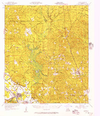
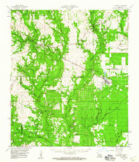
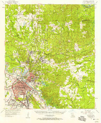 1957 Alexandria1958 Print · USGSThe Red River valley in the late fifties shows the post-war growth of Alexandria and Pineville amidst a landscape of military and state institutions. Genealogists and historians can locate dozens of neighborhood schools, cemeteries like Sardis Cem, and the early layout of Camp Beauregard.2 unique versions available
 - 1957 Map of Alexandria, 1958 Print
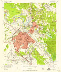 1957 Alexandria1958 Print · USGSAlexandria and Pineville sit at a major rail and river crossroads during the late fifties, serving as a hub for military and state institutions. Genealogists can trace family roots at the Alexandria National Cem or locate historic campuses like Louisiana College and Bolton High Sch.2 unique versions available
 - 1957 Map of Lecompte, 1958 Print
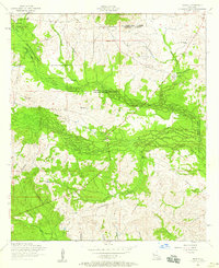
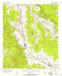 1957 Lecompte1958 Print · USGSCentral Louisiana in the mid-fifties reveals a landscape defined by the intricate winding of Bayou Boeuf and the fertile grounds of Bench Slough Plantation. Researchers can trace the heritage of local communities through landmarks like Lecompte Sch, Wise Cem, and the tracks of the Rock Island and Pacific RR.3 unique versions available
 - 1959 Map of Buckeye, 1960 Print
 1959 Buckeye1960 Print · USGSLouisiana parish lines converge in this late-fifties landscape of complex bayous and oil fields. Researchers can trace rural family roots through numerous local landmarks like Marthas Chapel, Guillory Cem, and the old settlement of Buckeye.2 unique versions available
 - 1959 Map of Steep Gully, 1960 Print
 1959 Steep Gully1960 Print · USGSVernon and Rapides parishes meet in this late 1950s survey of central Louisiana's piney woods and creek bottoms. Local researchers can trace old family sites and rural landmarks like Occupy Ch No 1, the Plainview School, and the Plainview Lookout Tower.3 unique versions available
 - 1959 Map of Elizabeth, 1960 Print
 1959 Elizabeth1960 Print · USGSLouisiana's timberlands and rural parishes are captured here in the mid-twentieth century, showing the rail-dependent corridor between Pitkin and Elizabeth. Researchers can locate numerous country churches and cemeteries like Shady Grove Ch and Hamilton Cem, or trace the winding course of Sixmile Creek.2 unique versions available
End of results
Showing maps 1-23 of 23
Top cities of Rapides Parish
- Alexandria historical maps
- Pineville historical maps
- Ball historical maps
- Glenmora historical maps
- Lecompte historical maps
- Boyce historical maps
See more
Frequently asked questions
- What are the different types of historical maps available for Rapides Parish?
- What is the oldest map of Rapides Parish?
- Where can I purchase historical maps of Rapides Parish for my home or office?
- Where can I download high-res historical maps of Rapides Parish?
- Are there historical topographic maps available for Rapides Parish?
- Is there historical aerial imagery available for Rapides Parish?
- Where are historical maps of Rapides Parish sourced from?