Old Maps of Rapides Parish, Louisiana for Academic Research
Study the evolution of Rapides Parish with 285 high-resolution historic maps. Whether you're teaching, researching, or modeling changes in land use, these maps provide essential visual documentation of urban, environmental, and geographic change.
- Analyze long-term change: Track patterns in development, transportation, and natural features.
- Ideal for environmental or urban studies: Support academic projects with primary historical map data.
- Use in the classroom or lab: Educators and researchers rely on these maps to bring historical context to life.
These maps are a powerful tool for teaching, research, and visualizing how Rapides Parish has changed over the decades.
Rapides Parish, LA maps
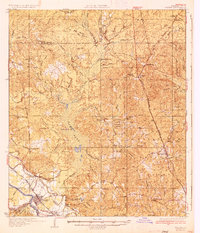
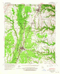
(285)- 1932 Map of Boyce NE
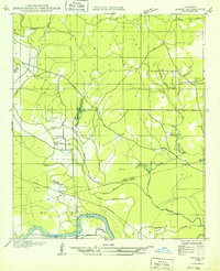 1932 Boyce NE1932 Print · USGSThe border of Grant and Rapides Parishes is captured here in the early 1930s as the national forest and river bottomlands converge. Local historians can trace family locations near Frazier Cem, Mt Pleasant Sch, and the winding banks of Rigolette Bayou.
 - 1932 Map of Boyce SW
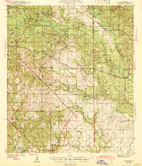
 1932 Boyce SW1932 Print · USGSRapides Parish in the early thirties is a landscape of rural post offices and emerging federal forests. Genealogists can trace family landmarks like the Texada Cem, Wilda Po, and local country schools such as Laurel Hill Sch.
 - 1932 Map of Colfax SW
 1932 Colfax SW1932 Print · USGSThe Red River valley of Central Louisiana is captured here in the early 1930s as a landscape of rail-connected settlements and complex waterways. Genealogists and historians can trace the foundations of Colfax and locate rural landmarks like Lee Chapel, Ferenzi Ch, and the Lutesville Gravel Pit.
 - 1935 Map of Pawnee
 1935 Pawnee1935 Print · USGSCentral Louisiana's timber country is captured in the mid-1930s, showing the early infrastructure of the Rapides and Allen parish line. Researchers can trace the Logging Railroad and locate vanished landmarks like the Union Hill Sch and Bethel Cem.
 - 1935 Map of Turkey Creek
 1935 Turkey Creek1935 Print · USGSLouisiana's central parish borderlands come alive in the mid-1930s, showing a landscape defined by meandering bayous and early industrial corridors. Trace the path of the Texas Louisiana and Gulf RR or find family landmarks like Johnson Ldg and Lake Cove Sch.
 - 1935 Map of Lecompte, 1949 Print
 1935 Lecompte1949 Print · USGSThe Red River valley south of Alexandria comes into focus in the mid-1930s, showing a landscape defined by meandering bayous and critical rail lines. Genealogists can locate family landmarks like Spring Hill Cem, St Johns Ch, and the town of Cheneyville.
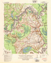
 - 1936 Map of Colfax
 1936 Colfax1936 Print · USGSGrant Parish in the mid-1930s is defined by the sweeping course of the Red River and the expanding reaches of Lake Iatt. Local researchers can trace old family sites and rural institutions like Parsons Cem, Summerfield, and the Oak Grove Sch.2 unique versions available
 - 1937 Map of Chopin NE
 1937 Chopin NE1937 Print · USGSThe borderlands of Natchitoches and Rapides Parishes come into focus in the late 1930s, showing a rural landscape defined by the Cane River and the Texas and Pacific railroad. Researchers can trace the exact locations of family landmarks like Carnahan Cem, Galbraith Sch, and the community of Flatwoods.
 - 1937 Map of Chopin SW
 1937 Chopin SW1937 Print · USGSThe timber-rich borderlands of Natchitoches, Rapides, and Vernon parishes are captured here in the late thirties as logging operations dominated the landscape. Researchers can trace old Logging Railroad routes and find long-established sites like Comrade Cem and Burnstown.
 - 1937 Map of Chopin NW
 1937 Chopin NW1937 Print · USGSNatchitoches and Rapides Parishes are captured here in the late 1930s as the regional timber and farming landscape was maturing. Researchers can trace rural life through the locations of Bolton Cem, Emanuel Sch, and the settlement at Gorum.
 - 1937 Map of Chopin SE
 1937 Chopin SE1937 Print · USGSThe timber country of central Louisiana comes into focus during the late Depression years, showing a landscape carved by industry. Genealogists and historians can trace the paths of the Logging Railroad and locate local landmarks like Jericho and the Clifton Sch.
 - 1940 Map of Marksville, 1943 Print
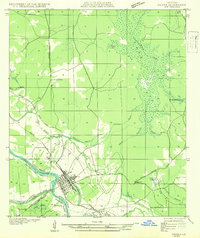
 1940 Marksville1943 Print · USGSAvoyelles Parish life in the early 1940s is centered on the river-and-rail economy of the Red River valley. Genealogists and historians can trace family locations through numerous named churches and schools, such as Hickory Hill Sch, Vick, and the St Paul Ch & Cem.2 unique versions available
 - 1941 Map of Alexandria, 1944 Print
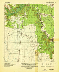
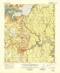
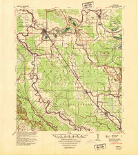
 1941 Alexandria1944 Print · USGSRapides and Grant Parishes are captured here in the early 1940s as massive military training grounds expanded alongside established rail towns. Trace the footprints of Camp Livingston and Camp Beauregard or locate local landmarks like the Philadelphia Ch and Kolin.
 - 1941 Map of Buckeye, 1944 Print
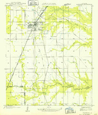
 1941 Buckeye1944 Print · USGSCentral Louisiana’s wetland and prairie interface is captured here in the early 1940s, showing the intricate water systems of the Rapides and La Salle parish lines. Genealogists can locate family landmarks like Barron Chapel, Guillory School, and the settlement of Holloway.2 unique versions available
 - 1941 Map of Boyce, 1945 Print
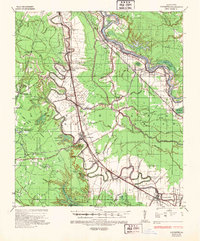
 1941 Boyce1945 Print · USGSRapides Parish was a landscape of river plantations and pine forests in the early 1940s. Genealogists and historians can locate numerous rural landmarks like Hotwells, Fairmount Plantation, and the Israelite Ch Sch & Cem along the Red River.2 unique versions available
 - 1942 Map of Oakdale, 1964 Print
 1942 Oakdale1964 Print · USGSCentral Louisiana's timber and rail country comes to life in the early 1940s as the Calcasieu River winds through Oakdale and Glenmora. Genealogists can trace family roots through landmarks like Hargrove Farm, Cryer Cem, and Cypress Creek Settlement.
 - 1943 Map of Leander
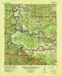
 1943 Leander1943 Print · USGSVernon and Rapides Parishes are shown in the early 1940s as the regional economy shifted from timber production to military training. Researchers can trace the Old Logging Railroad and locate vanished company centers like Fullerton or rural landmarks like Mt Moriah Ch.2 unique versions available
 - 1944 Map of Chopin
 1944 Chopin1944 Print · USGSCentral Louisiana during the early 1940s shows a landscape defined by timber harvesting and the winding Red River. Local historians can trace logging tracks and old community centers like Zimmerman Camp, Mora Ch, and Galbraith Sta.
 - 1945 Map of Boyce SE
 1945 Boyce SE1945 Print · USGSRapides Parish during the mid-forties reveals a landscape defined by its complex waterways and early transportation routes. Researchers can locate vanished landmarks and family sites near Evening Star Ch, Rapides Sch, and along the Texas and Pacific Railroad Grade.
 - 1947 Map of Steep Gully
 1947 Steep Gully1947 Print · USGSLouisiana timber and rail history converge here in the mid-1930s at the junction of Vernon, Rapides, and Allen parishes. Researchers can trace the legacy of logging via the old logging railroad grades or locate family sites at Tenmile Cem and Occupy Sch.
 - 1948 Map of Bunkie, 1950 Print
 1948 Bunkie1950 Print · USGSThe Bunkie area during the late 1940s reveals a landscape defined by Bayou Boeuf and a dense network of early oil infrastructure. Genealogists can trace family roots through numerous rural landmarks like St Lukes Ch & Cem and the Goudeau Sch.
 - 1948 Map of Chopin, 1956 Print
 1948 Chopin1956 Print · USGSLouisiana's timber and rail history comes to life in this mid-century survey of the rural backcountry spanning Natchitoches and Rapides Parishes. Researchers can trace the legacy of small communities and family-named sites like Galbraith Sta, Temple Spur, and the Blackwell Cem.
 - 1949 Map of Boyce NW
 1949 Boyce NW1949 Print · USGSThe Red River valley in the late 1940s reveals a landscape of oxbow lakes and essential rail junctions near the parish borders. Genealogists can locate family landmarks such as Zion Harp Ch, St Matthis Sch, and the small community of Zimmerman.
 - 1949 Map of Glenmora
 1949 Glenmora1949 Print · USGSCentral Louisiana's timber country comes to life in this mid-century survey of the Rapides Parish area. Genealogists and historians can trace the fading tracks of the Old Logging Railroad Grade and explore the early footprints of Glenmora and McNary.
 - 1949 Map of Boyce SE
 1949 Boyce SE1949 Print · USGSRapides Parish at the end of the 1940s is a landscape of winding bayous and rural schools. Researchers can trace the legacy of local communities through landmarks like Evening Star Ch, Rapides Sch, and the Red River floodplain.
Showing maps 1-25 of 285
Top cities of Rapides Parish
- Alexandria historical maps
- Pineville historical maps
- Ball historical maps
- Glenmora historical maps
- Lecompte historical maps
- Boyce historical maps
See more
Frequently asked questions
- What are the different types of historical maps available for Rapides Parish?
- What is the oldest map of Rapides Parish?
- Where can I purchase historical maps of Rapides Parish for my home or office?
- Where can I download high-res historical maps of Rapides Parish?
- Are there historical topographic maps available for Rapides Parish?
- Is there historical aerial imagery available for Rapides Parish?
- Where are historical maps of Rapides Parish sourced from?