1980s Maps of St. Tammany Parish, Louisiana
Explore 14 historic maps of St. Tammany Parish from the 1980s. These maps offer a rare glimpse into what life looked like during the 1980s — showing old roads, neighborhoods, homes, and landmarks that have changed or disappeared over time.
Whether you're researching your family's past, planning a metal detecting trip, or studying how St. Tammany Parish's landscape evolved across the 1980s, these high-resolution maps are a powerful tool for exploring the history of this region.
- Focus on a specific era: All maps on this page are from the 1980s, giving you a focused view of this time period.
- See what’s changed: Compare century-old streets, trails, and buildings to today's modern landscape using overlays and satellite layers.
- Research with precision: Use these maps for genealogy, historical research, land use analysis, or educational projects.
- View, download, or print: Maps are fully viewable online in high resolution, and can be downloaded or printed for your own records.
Start exploring St. Tammany Parish's history through authentic maps from the 1980s. This is your window into the past.
St. Tammany Parish, LA maps
(14)- 1982 Map of Gulfport, 1983 Print
 1982 Gulfport1983 Print · USGSThe Gulf Coast between Louisiana and Mississippi appears in the early eighties as a landscape of marshland and maritime industry. Researchers can trace the path of the Louisville and Nashville RR through towns like Waveland and De Lisle, or locate the sprawling National Space Technology Laboratories.2 unique versions available
 - 1983 Map of Bush
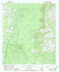
 1983 Bush1983 Print · USGSSt. Tammany Parish in the early eighties shows a landscape of timber-lined creeks and rural rail stops. Genealogists can trace family names at Lavinghouse Cem and Holmes Cem or locate the Bush Ch near the Illinois Central Gulf line.
 - 1983 Map of Amite
 1983 Amite1983 Print · USGSThe Florida Parishes and southern Mississippi are captured here in the early 1980s, centered on the Illinois Central Gulf rail corridor. Genealogists and historians can trace family-named sites like the Camp Moore Confederate Cem, Magnolia Ch, and the Idlewild Plantation (State University).
 - 1983 Map of Waldheim, 1984 Print
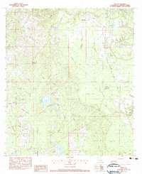
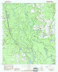
 1983 Waldheim1984 Print · USGSSt. Tammany Parish in the early eighties centers on rural communities and spiritual landmarks along the Bogue Falaya. Genealogists and historians can trace family roots at Fivemile Still Cem, visit St Scholastica Priory, or locate the old Lee Road Sch.
 - 1983 Map of Folsom, 1984 Print
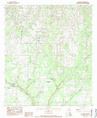
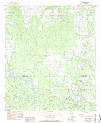
 1983 Folsom1984 Print · USGSThe rural landscape of St. Tammany Parish comes to life in the early 1980s as Folsom and its surrounding homesteads are meticulously documented. Researchers can trace family sites near Stafford Cem or find local landmarks like Lee Hill Ch and New Hope Ch.
 - 1983 Map of Martinville, 1984 Print
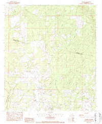
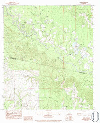
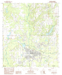
 1983 Martinville1984 Print · USGSSt. Tammany Parish in the early 1980s remains a landscape of quiet communities and numerous winding waterways. Genealogists and local historians can locate many rural landmarks, from the St Johns Cem and Wilke Cem to Camp Covington and Lake Ramsay.3 unique versions available
 - 1983 Map of Henleyfield, 1984 Print
 1983 Henleyfield1984 Print · USGSThe Pearl River and Bogue Chitto bottomlands are captured here in the early 1980s. Genealogists can trace family names at Henleyfield Cem and Sheridan Cem, while outdoor historians can locate Hells Gate and Lock No 3.2 unique versions available
 - 1983 Map of Industrial, 1984 Print
 1983 Industrial1984 Print · USGSThe Pearl River and Bogue Chitto basins in the early 1980s reveal a landscape of dense swamps and shifting river channels along the state line. Genealogists and researchers can trace family landmarks like Copper Cem and Hebron Ch or locate the infrastructure of Lock No 2.2 unique versions available
 - 1983 Map of Ponchatoula, 1984 Print
 1983 Ponchatoula1984 Print · USGSThe Lake Pontchartrain Basin and the River Parishes come into focus during the early 1980s, showcasing the region's complex water-dependent geography. Researchers can trace the rail routes of the Illinois Central Gulf Railroad and explore landmarks from Pass Manchac to Donaldsonville.2 unique versions available
 - 1983 Map of Sun, 1984 Print
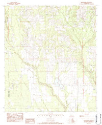
 1983 Sun1984 Print · USGSThe Bogue Chitto River lowlands of St. Tammany Parish are shown here in the early 1980s, revealing a landscape of winding sloughs and rail-side settlements. Genealogists can trace family landmarks like Hillview Memorial Gardens, Jerusalem Ch, and Lock No 3.
 - 1983 Map of Enon, 1984 Print
 1983 Enon1984 Print · USGSSoutheastern Louisiana in the early 1980s reveals a landscape of family-named cemeteries and creek-side settlements. Genealogists can trace rural family roots at Magee Cem and Adams Cem or locate the historic Enon Lookout Tower.
 - 1984 Map of Bogalusa
 1984 Bogalusa1984 Print · USGSThe Pearl River basin on the Louisiana-Mississippi border comes into focus in the mid-1980s, showcasing a landscape of river-bottom swamps and timberlands. Local researchers can trace the growth of Bogalusa and Picayune or find rural landmarks like Macedonia Ch and Wheat Swamp.
 - 1984 Map of Mobile
 1984 Mobile1984 Print · USGSThe Gulf Coast at the height of the mid-eighties shows a landscape of rapid industrial growth and military significance. Researchers can trace the sprawling rail lines of the Illinois Central Gulf RR, locate the NASA Test Facility, or study the barrier island chain from Cat Island to Petit Bois Island.3 unique versions available
 - 1985 Map of Picayune
 1985 Picayune1985 Print · USGSPicayune and the surrounding Pearl River County countryside are captured here in the mid-1980s as the area balanced city growth with its deep-seated timber and river heritage. Genealogists and local historians can trace family locations near Carriere, Ozona, and the residential developments of Hide-A-Way Lake.2 unique versions available
End of results
Showing maps 1-14 of 14
Top cities of St. Tammany Parish
- Slidell historical maps
- Mandeville historical maps
- Covington historical maps
- Abita Springs historical maps
- Madisonville historical maps
- Folsom historical maps
See more
Frequently asked questions
- What are the different types of historical maps available for St. Tammany Parish?
- What is the oldest map of St. Tammany Parish?
- Where can I purchase historical maps of St. Tammany Parish for my home or office?
- Where can I download high-res historical maps of St. Tammany Parish?
- Are there historical topographic maps available for St. Tammany Parish?
- Is there historical aerial imagery available for St. Tammany Parish?
- Where are historical maps of St. Tammany Parish sourced from?