Old Maps of St. Tammany Parish, Louisiana for Genealogy
Trace your family roots with 147 historic maps of St. Tammany Parish. These high-res maps reveal old neighborhoods, homesites, landmarks, and streets — helping you uncover where your ancestors lived and how the area evolved over time.
- Explore historic neighborhoods: Identify where your relatives may have lived in the 1800s or 1900s.
- Compare maps over time: Trace the changes in streets, buildings, and landmarks for multi-generational research.
- Perfect for genealogy & ancestry research: Used by family historians and researchers to map out lineage and migration.
These maps are an incredible resource for exploring your personal connection to St. Tammany Parish's past.
St. Tammany Parish, LA maps
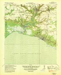
(147)- 1891 Map of Spanish Fort
 1891 Spanish Fort1891 Print · USGSCovers St. Tammany Parish, including New Orleans, Kenner, and other nearby areas4 unique versions available
 - 1892 Map of Chef Menteur
 1892 Chef Menteur1892 Print · USGSCovers St. Tammany Parish, including New Orleans, Slidell, and other nearby areas5 unique versions available
 - 1893 Map of Rigolets
 1893 Rigolets1893 Print · USGSCovers St. Tammany Parish, including New Orleans, Pearlington, and other nearby areas5 unique versions available
 - 1893 Map of Toulme
 1893 Toulme1893 Print · USGSCovers St. Tammany Parish, including Bay Saint Louis, Ansley, and other nearby areas4 unique versions available
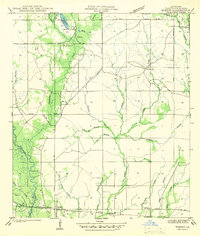
 - 1914 Map of Nicholson, 1957 Print
 1914 Nicholson1957 Print · USGSCovers St. Tammany Parish, including Slidell, Picayune, and other nearby areas2 unique versions available
 - 1921 Map of Nicholson
 1921 Nicholson1921 Print · USGSCovers St. Tammany Parish, including Slidell, Picayune, and other nearby areas
 - 1935 Map of Slidell
 1935 Slidell1935 Print · USGSCovers St. Tammany Parish, including Slidell, Pearl River, and other nearby areas3 unique versions available
 - 1935 Map of English Lookout
 1935 English Lookout1935 Print · USGSCovers St. Tammany Parish, including Pearlington, North Side, and other nearby areas
 - 1935 Map of Covington
 1935 Covington1935 Print · USGSCovers St. Tammany Parish, including Mandeville, Covington, and other nearby areas3 unique versions available
 - 1935 Map of Grand Island Pass
 1935 Grand Island Pass1935 Print · USGSCovers St. Tammany Parish, including Ansley, Lakeshore, and other nearby areas2 unique versions available
 - 1936 Map of North Shore
 1936 North Shore1936 Print · USGSCovers St. Tammany Parish, including New Orleans, Slidell, and other nearby areas
 - 1936 Map of South Point
 1936 South Point1936 Print · USGSCovers St. Tammany Parish, including New Orleans, South Point, and other nearby areas
 - 1936 Map of Chef Menteur, 1938 Print
 1936 Chef Menteur1938 Print · USGSCovers St. Tammany Parish, including New Orleans, Slidell, and other nearby areas2 unique versions available
 - 1936 Map of Spanish Fort, 1938 Print
 1936 Spanish Fort1938 Print · USGSCovers St. Tammany Parish, including New Orleans, Kenner, and other nearby areas
 - 1936 Map of Rigolets, 1949 Print
 1936 Rigolets1949 Print · USGSCovers St. Tammany Parish, including New Orleans, Pearlington, and other nearby areas
 - 1939 Map of Slidell
 1939 Slidell1939 Print · USGSCovers St. Tammany Parish, including Slidell, Pearl River, and other nearby areas
 - 1939 Map of Zona
 1939 Zona1939 Print · USGSCovers St. Tammany Parish, including Enon, Willis, and other nearby areas
 - 1939 Map of Covington
 1939 Covington1939 Print · USGSCovers St. Tammany Parish, including Mandeville, Covington, and other nearby areas
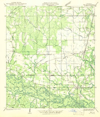
 - 1941 Map of Honey Island
 1941 Honey Island1941 Print · USGSCovers St. Tammany Parish, including Picayune, Pearl River, and other nearby areas
 - 1942 Map of Onville
 1942 Onville1942 Print · USGSCovers St. Tammany Parish, including Covington, Folsom, and other nearby areas
 - 1942 Map of Waldheim
 1942 Waldheim1942 Print · USGSCovers St. Tammany Parish, including Covington, Saint Benedict, and other nearby areas
 - 1942 Map of Husser
 1942 Husser1942 Print · USGSCovers St. Tammany Parish, including Husser, Osceola, and other nearby areas
 - 1942 Map of Robert
 1942 Robert1942 Print · USGSCovers St. Tammany Parish, including Lorraine, Robert, and other nearby areas
 - 1942 Map of Talisheek
 1942 Talisheek1942 Print · USGSCovers St. Tammany Parish, including Talisheek, Bush, and other nearby areas
 - 1942 Map of Rio
 1942 Rio1942 Print · USGSCovers St. Tammany Parish, including Sun, Stein, and other nearby areas
Showing maps 1-25 of 147
Top cities of St. Tammany Parish
- Slidell historical maps
- Mandeville historical maps
- Covington historical maps
- Abita Springs historical maps
- Madisonville historical maps
- Folsom historical maps
See more
Frequently asked questions
- What are the different types of historical maps available for St. Tammany Parish?
- What is the oldest map of St. Tammany Parish?
- Where can I purchase historical maps of St. Tammany Parish for my home or office?
- Where can I download high-res historical maps of St. Tammany Parish?
- Are there historical topographic maps available for St. Tammany Parish?
- Is there historical aerial imagery available for St. Tammany Parish?
- Where are historical maps of St. Tammany Parish sourced from?