Old Maps of Isle au Haut, Maine for Academic Research
Study the evolution of Isle au Haut with 49 high-resolution historic maps. Whether you're teaching, researching, or modeling changes in land use, these maps provide essential visual documentation of urban, environmental, and geographic change.
- Analyze long-term change: Track patterns in development, transportation, and natural features.
- Ideal for environmental or urban studies: Support academic projects with primary historical map data.
- Use in the classroom or lab: Educators and researchers rely on these maps to bring historical context to life.
These maps are a powerful tool for teaching, research, and visualizing how Isle au Haut has changed over the decades.
Isle au Haut, ME maps
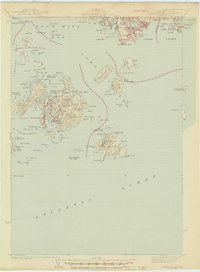
(49)- 1904 Map of Deer Isle
 1904 Deer Isle1904 Print · USGSThe Maine coast in the early nineteen-hundreds is defined by its network of island settlements and steamboat paths. Genealogists and historians can trace family locations from Stonington to Isle au Haut, or locate maritime landmarks like Deer I. Thorofare L.H. and The Haulover.4 unique versions available
 - 1904 Map of Swan Island
 1904 Swan Island1904 Print · USGSThe granite shores of Hancock County appear here at the turn of the century, showing a network of island villages and maritime routes. Trace the old foundations and landing sites at Frenchboro and Minturn, or locate the Bluehill Bay L.H. and early steamboat paths.4 unique versions available
 - 1905 Map of Penobscot Bay
 1905 Penobscot Bay1905 Print · USGSThe Maine coastline at the dawn of the twentieth century was a bustling network of maritime trade and summer retreats. Genealogists and historians can trace the foundations of coastal life through the STEAMBOAT ROUTE, the Northport Camp Ground, and settlements like Sargentville.3 unique versions available
 - 1942 Map of Deer Isle, 1958 Print
 1942 Deer Isle1958 Print · USGSCoastal Maine life in the 1940s centers on the granite industry and maritime trade routes throughout Deer Isle and the Penobscot Bay islands. Genealogists and historians can trace the foundations of local economies through the QUARRIES at Stonington and the many family-named landmarks like Greenlaw Neck or Conary Head.3 unique versions available
 - 1943 Map of Swans Island, 1958 Print
 1943 Swans Island1958 Print · USGSCoastal Hancock County at the height of the Second World War reveals a landscape of isolated island communities and maritime commerce. Genealogists and historians can trace family roots through the settlements of Atlantic, Minturn, and Frenchboro, or locate landmarks like the Blue Hill Bay LH and Little Duck I Bird Sanctuary.3 unique versions available
 - 1944 Map of Deer Isle
 1944 Deer Isle1944 Print · USGSPenobscot Bay and the Eggemoggin Reach appear here in the early 1940s, highlighting the granite and maritime hubs of the Maine coast. Genealogists and historians can locate family homes near Stonington, coastal Quarries, and landmarks like Forest Cem.2 unique versions available
 - 1945 Map of Swans Island
 1945 Swans Island1945 Print · USGSCoastal Maine's island communities thrive amidst the granite shores and deep harbors of Hancock County during the mid-1940s. Trace the isolated settlements of Atlantic, Minturn, and Frenchboro, or locate family sites like the Stockbridge Cem and the Blue Hill Bay LH.2 unique versions available
 - 1948 Map of Bangor
 1948 Bangor1948 Print · USGSThe Maine coast and its industrial river valleys are captured here shortly after the war, showing the vital shipping and rail hubs of the late 1940s. Genealogists and historians can trace the tracks of the Maine Central RR connecting Bangor, Augusta, and Old Town.
 - 1948 Map of Bath
 1948 Bath1948 Print · USGSMid-coast Maine’s intricate shoreline and island outposts are captured here just after the war. Researchers can trace historic maritime settlements from Bath to Friendship and locate remote landmarks like Monhegan Island and Pemaquid Point.2 unique versions available
 - 1956 Map of Bangor, 1966 Print
 1956 Bangor1966 Print · USGSMid-century Maine comes alive in this survey of the rugged coast and river valleys during the 1950s. Genealogists and historians can trace the vital rail corridors of the Maine Central RR connecting timber towns like Old Town to the coast at Bar Harbor.3 unique versions available
 - 1956 Map of Bath, 1974 Print
 1956 Bath1974 Print · USGSCoastal Maine in the mid-fifties reveals a landscape of deep-water harbors and island outposts as the region transitioned from industrial roots to a summer destination. Genealogists can trace maritime families in Boothbay Harbor, Tenants Harbor, and on remote Monhegan Island.
 - 1957 Map of Bath
 1957 Bath1957 Print · USGSThe Maine coast in the mid-fifties is captured here, from the shipbuilding hubs of Bath and Brunswick to the granite reaches of Rockland. Researchers can trace the Maine Central RR line and remote island outposts like Monhegan Island and Matinicus Isle.
 - 1958 Map of Bath
 1958 Bath1958 Print · USGSCoastal Maine in the late fifties reveals a landscape of industrial river towns and remote island outposts. Genealogists and historians can trace the Maine Central RR through Bath, explore the islands of Muscongus Bay, or locate seafaring families at Pemaquid Point.
 - 1960 Map of Bangor
 1960 Bangor1960 Print · USGSCentral Maine in the sixties reveals a landscape of river-powered industry and sprawling coastal island chains. Researchers can trace the rail corridors of the Maine Central or locate mid-century aviation landmarks like Dow Air Force Base.
 - 1961 Map of Bangor
 1961 Bangor1961 Print · USGSMid-century Maine comes alive through its busy river ports and rocky archipelagoes during a period of steady maritime and rail commerce. Researchers can trace the path of the Maine Central railroad and locate coastal landmarks from Acadia National Park to Vinalhaven Island.
 - 1963 Map of Bath
 1963 Bath1963 Print · USGSThe Maine Midcoast in the early sixties remains a world of tidal rivers and jagged peninsulas tied to the sea. Genealogy and local history researchers can trace the rail lines of the Maine Central RR and locate offshore communities like Matinicus Island and Monhegan.2 unique versions available
 - 1965 Map of Bath
 1965 Bath1965 Print · USGSThe Midcoast Maine shoreline and its archipelago come alive in the mid-1960s, showing the region's deep reliance on river and rail. Researchers can trace historic harbor towns like Boothbay Harbor and Damariscotta, and locate coastal landmarks from Pemaquid Point to the Fort Popham Military Res.
 - 1983 Map of Isle Au Haut West
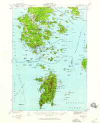
 1983 Isle Au Haut West1983 Print · USGSThe coastal waters of Knox County in the early 1980s reveal a landscape of secluded island life and maritime heritage. Genealogists and historians can locate family landmarks like Turners Cem or trace the coastline past the Robinson Point Lighthouse and Saddleback Ledge Lighthouse.
 - 1983 Map of Johns Island
 1983 Johns Island1983 Print · USGSCoastal Hancock County in the early eighties is mapped here as an intricate network of remote islands and navigational ledges. Maritime researchers can trace the shorelines of Marshall Island, locate Acadia National Park boundaries on Heron I, and find Steamboat Beach in Frenchboro.
 - 1983 Map of Stinson Neck
 1983 Stinson Neck1983 Print · USGSCoastal Hancock County in the early eighties is captured here across the islands and reaches of Stinson Neck. Genealogists and historians can locate family-named points and settlements like Sunshine, Oceanville, and the Beth Eden Ch near Naskeag.
 - 1983 Map of Isle Au Haut East
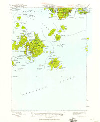
 1983 Isle Au Haut East1983 Print · USGSCoastal Maine's rugged island chains are captured in the early 1980s, featuring the eastern edge of Acadia National Park. Researchers can trace old footpaths like the Sawyer Notch Trail or locate maritime landmarks from Sheep Thief Gulch to York Island.
 - 1985 Map of Matinicus
 1985 Matinicus1985 Print · USGSThe outer islands of Knox County are captured in the mid-1980s, highlighting the isolated settlements of the Gulf of Maine. Genealogists and maritime historians can locate homes and landmarks in Matinicus and Criehaven, or trace the shores of Ragged Island and Seal Island.
 - 1985 Map of Bar Harbor
 1985 Bar Harbor1985 Print · USGSCoastal Hancock County in the mid-eighties shows an intricate landscape of island communities and protected wilderness. Trace the boundaries of Acadia National Park or locate seafaring hubs like Stonington and Bar Harbor.2 unique versions available
 - 1994 Map of Matinicus
 1994 Matinicus1994 Print · USGSThe outer reaches of Penobscot Bay appear in detail during the 1990s, capturing the remote island life of Matinicus and Criehaven. Trace the geography of this maritime frontier through landmarks like Matinicus Rock, Wilson Head, and the Seal Island National Wildlife Refuge.
 - 2011 Map of Matinicus OE NE, 2011 Print
 2011 Matinicus OE NE2011 Print · USGSCovers Isle au Haut, including Vinalhaven, Knox County, and other nearby areas
Showing maps 1-25 of 49
Top cities near Isle au Haut
- Deer Isle historical maps
- Tremont historical maps
- Vinalhaven historical maps
- Stonington historical maps
- Brooklin historical maps
- North Haven historical maps
See more
Top neighborhoods of Isle au Haut
Frequently asked questions
- What are the different types of historical maps available for Isle au Haut?
- What is the oldest map of Isle au Haut?
- Where can I purchase historical maps of Isle au Haut for my home or office?
- Where can I download high-res historical maps of Isle au Haut?
- Are there historical topographic maps available for Isle au Haut?
- Is there historical aerial imagery available for Isle au Haut?
- Where are historical maps of Isle au Haut sourced from?