1950s Maps of Massachusetts
Explore 480 historic maps of Massachusetts from the 1950s. These maps offer a rare glimpse into what life looked like during the 1950s — showing old roads, neighborhoods, homes, and landmarks that have changed or disappeared over time.
Whether you're researching your family's past, planning a metal detecting trip, or studying how Massachusetts's landscape evolved across the 1950s, these high-resolution maps are a powerful tool for exploring the history of this region.
- Focus on a specific era: All maps on this page are from the 1950s, giving you a focused view of this time period.
- See what’s changed: Compare century-old streets, trails, and buildings to today's modern landscape using overlays and satellite layers.
- Research with precision: Use these maps for genealogy, historical research, land use analysis, or educational projects.
- View, download, or print: Maps are fully viewable online in high resolution, and can be downloaded or printed for your own records.
Start exploring Massachusetts's history through authentic maps from the 1950s. This is your window into the past.
Massachusetts maps
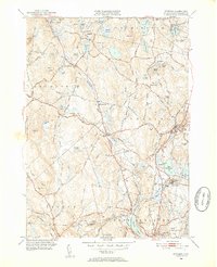
- 1950 Map of Egremont
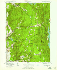
 1950 Egremont1950 Print · USGSThe Berkshires of the mid-twentieth century are captured here along the New York border, showing the rural character of the Egremont hamlets. Researchers can trace historic property lines near Egremont Plain or locate old landmarks like the Great Barrington Airport and Prospect Lake.
 - 1950 Map of North Adams
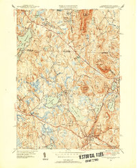
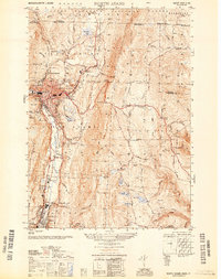 1950 North Adams1950 Print · USGSThe Hoosic River valley hums with industry and transit at the mid-point of the century. Genealogists and industrial historians can trace the Boston and Maine RR line, the famous Mohawk Trail, and the Hoosac Tunnel Central Shaft.
 - 1950 Map of East Lee
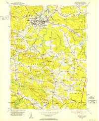
 1950 East Lee1950 Print · USGSThe industrial corridor of the Housatonic Valley meets the high peaks of the Berkshires in the mid-century. Genealogists and historians can trace the rail-side growth of Lenoxdale or locate vanished upland homesteads near October Mountain and Upper Goose Pond.
 - 1950 Map of Townsend, 1952 Print
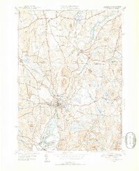
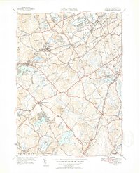
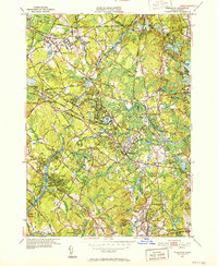
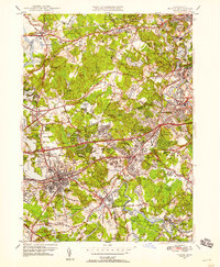
 1950 Townsend1952 Print · USGSMid-century Middlesex County and southern New Hampshire centers on the rail-and-river corridor of Townsend. Genealogists and historians can trace the Boston and Maine Railroad through Townsend Harbor and locate family sites like Hillside Cem and Barker Hill.2 unique versions available
 - 1950 Map of Clinton, 1952 Print
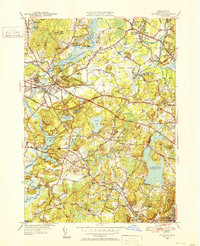
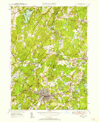
 1950 Clinton1952 Print · USGSMid-century Worcester County comes to life here, showing the busy industrial valley of the Nashua River and the expanding Wachusett Reservoir shoreline. Trace the footprints of South Lancaster institutions and vanished landmarks like the Bolton Airport and Ponakin Mill.4 unique versions available
 - 1950 Map of Ashby, 1952 Print
 1950 Ashby1952 Print · USGSThe Massachusetts-New Hampshire borderlands near Ashby are captured in the mid-twentieth century as the region balanced its rural character with state forest expansion. Genealogists can locate family sites near Glenwood Cem, the Lyman Sch, and the old rail stop at Mason Sta.4 unique versions available
 - 1950 Map of Pepperell, 1952 Print
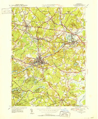
 1950 Pepperell1952 Print · USGSThe borderlands of Massachusetts and New Hampshire are captured here at mid-century, centered on the river junctions and rail lines of the Nashua valley. Genealogists and local historians can trace the Boston and Maine tracks to the Hollis Depot or locate family plots at St Joseph Cem and Woodlawn Cem.4 unique versions available
 - 1950 Map of Concord, 1952 Print
 1950 Concord1952 Print · USGSGreater Concord and Lincoln are seen here just after the war, balancing their deep colonial heritage with new aviation and transit infrastructure. Researchers can trace historic cemeteries and rail stops like the Old Burying Ground, Hastings Sta, and Walden Pond State Reservation.4 unique versions available
 - 1950 Map of Maynard, 1952 Print
 1950 Maynard1952 Print · USGSMiddlesex County's transition from an industrial river-valley hub to a mid-century residential landscape is visible in this mid-century survey. Trace family roots at St Bridgets Cem, follow the rail lines at West Acton, or locate the extensive U S Military Reservation.4 unique versions available
 - 1950 Map of Billerica, 1952 Print
 1950 Billerica1952 Print · USGSMid-century Middlesex County reveals a landscape of growing towns and established institutions along the Concord River. Genealogists and local historians can trace legacy sites like St Patrick Cem, Howe High Sch, and the Marist College and Convent.4 unique versions available
 - 1950 Map of Sterling, 1952 Print
 1950 Sterling1952 Print · USGSThe Sterling area in the early fifties shows a landscape shaped by the Wachusett Reservoir and the Boston and Maine Railroad. Trace family history at Legge Cem, visit the Sterling Camp Grounds, or locate the Butterick Sch.4 unique versions available
 - 1950 Map of Ashburnham, 1952 Print
 1950 Ashburnham1952 Print · USGSMid-century Worcester County comes to life as a landscape of interconnected glacial lakes and upland ridges during the postwar years. Genealogists and local historians can trace the foundations of Ashburnham, Lane Village, and the remote Old North Ashburnham Sta.4 unique versions available
 - 1950 Map of Exeter, 1952 Print
 1950 Exeter1952 Print · USGSCoastal New Hampshire's rural character and established town centers are captured here at mid-century, just as local road networks began to expand. Researchers can trace ancestral roots through family-named landmarks like Gooch Corner, Dows Corner, and the Westview Cem.5 unique versions available
 - 1950 Map of Westford, 1952 Print
 1950 Westford1952 Print · USGSMiddlesex County in the early fifties shows a region defined by its rail heritage and historic village centers. Trace old family lines through Graniteville, Forge Village, and Littleton Common, or locate ancestral burial sites at Russian Cem and Nutting Cem.4 unique versions available
 - 1950 Map of Wilmington, 1952 Print
 1950 Wilmington1952 Print · USGSWilmington and Tewksbury are shown during a period of significant mid-century growth along the Boston and Maine rail lines. Researchers can trace the sprawling grounds of the State Infirmary and locate vanished local landmarks like the Whitefield Sch and Silver Lake.4 unique versions available
 - 1950 Map of Tyngsboro, 1952 Print
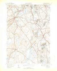
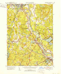 1950 Tyngsboro1952 Print · USGSThe Merrimack River valley at the mid-century mark reveals a landscape of growing towns and academic centers along the New Hampshire border. Researchers can trace old family sites like Frederick Corner, locate the Flat Rock Quarry, or find the Old Dunstable Cem.3 unique versions available
 - 1950 Map of Lowell, 1953 Print
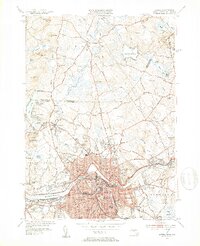 1950 Lowell1953 Print · USGSMid-century Lowell is a bustling center of industry and education at the bend of the Merrimack River. Researchers can trace the era's infrastructure from the Pawtucket Dam to institutions like Keith Academy and the Lowell Textile Institute.4 unique versions available
 - 1950 Map of Plymouth, 1956 Print
 1950 Plymouth1956 Print · USGSCoastal Massachusetts at mid-century reveals a landscape of maritime tradition and growing rail-side industry. Genealogists and historians can trace the neighborhoods of Rocky Nook and Chiltonville or locate landmarks like Russell Mill and Fort Standish.2 unique versions available
 - 1950 Map of Natick, 1956 Print
 1950 Natick1956 Print · USGSPost-war expansion meets established academic life in this study of the western Boston suburbs. Trace family roots and local growth through Wellesley College, the Boston and Albany RR, and old burial sites like Linwood Cem.3 unique versions available
 - 1950 Map of Ipswich, 1956 Print
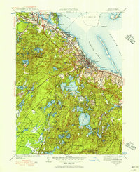
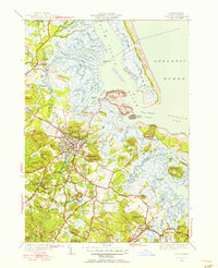 1950 Ipswich1956 Print · USGSCoastal Massachusetts is seen here in the mid-century as a land of expansive salt marshes and historic harbor towns. Genealogists and historians can trace family-named hills and early settlements from Ipswich and Rowley to landmarks like Castle Hill and Nourse Cem.3 unique versions available
 - 1950 Map of Hyannis, 1956 Print
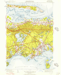 1950 Hyannis1956 Print · USGSHyannis and Barnstable are captured at a mid-century turning point between their maritime roots and modern growth. Researchers can trace family sites at Lothrop Hill Cem, visit the old Yarmouth Sta, or locate the Hyannis State Teachers College.4 unique versions available
 - 1950 Map of Hudson, 1958 Print
 1950 Hudson1958 Print · USGSMid-century Middlesex and Worcester counties come to life as the industrial Assabet River valley meets rural Bolton and Stow. Trace the Boston and Maine Railroad past Gleasondale Sta or find family roots at Old Quaker Cem and Bromfield Academy.3 unique versions available
 - 1950 Map of Shirley, 1958 Print
 1950 Shirley1958 Print · USGSMid-century development spreads through the Worcester and Middlesex county lines during this era of growth. Genealogists and local historians can trace family plots in St Cecelia Cemetery or locate old school sites like the White Sch and the Industrial School.
 - 1950 Map of Shutesbury, 1958 Print
 1950 Shutesbury1958 Print · USGSThe hill towns of Franklin and Hampshire Counties are captured here at mid-century, just as the Quabbin Reservoir reached its full extent. Genealogists and researchers can trace old family roads and locate landmarks like the Rhodes Sch, West Cem, and the small settlement of Cooleyville.2 unique versions available
 - 1950 Map of Ayer, 1958 Print
 1950 Ayer1958 Print · USGSMiddlesex and Worcester counties are shown here at mid-century, highlighting the massive expansion of the Fort Devens military footprint. Researchers can trace the layout of Shaker Village, find the Harvard University Observatory, and locate the Groton School.
Showing maps 1-25
Top cities of Massachusetts
- Boston historical maps
- Worcester historical maps
- Springfield historical maps
- Lowell historical maps
- Cambridge historical maps
- Brockton historical maps
See more
Top counties of Massachusetts
- Middlesex County historical maps
- Worcester County historical maps
- Suffolk County historical maps
- Essex County historical maps
- Norfolk County historical maps
- Bristol County historical maps
See more
Frequently asked questions
- What are the different types of historical maps available for Massachusetts?
- What is the oldest map of Massachusetts?
- Where can I purchase historical maps of Massachusetts for my home or office?
- Where can I download high-res historical maps of Massachusetts?
- Are there historical topographic maps available for Massachusetts?
- Is there historical aerial imagery available for Massachusetts?
- Where are historical maps of Massachusetts sourced from?