1980s Maps of Massachusetts
Explore 138 historic maps of Massachusetts from the 1980s. These maps offer a rare glimpse into what life looked like during the 1980s — showing old roads, neighborhoods, homes, and landmarks that have changed or disappeared over time.
Whether you're researching your family's past, planning a metal detecting trip, or studying how Massachusetts's landscape evolved across the 1980s, these high-resolution maps are a powerful tool for exploring the history of this region.
- Focus on a specific era: All maps on this page are from the 1980s, giving you a focused view of this time period.
- See what’s changed: Compare century-old streets, trails, and buildings to today's modern landscape using overlays and satellite layers.
- Research with precision: Use these maps for genealogy, historical research, land use analysis, or educational projects.
- View, download, or print: Maps are fully viewable online in high resolution, and can be downloaded or printed for your own records.
Start exploring Massachusetts's history through authentic maps from the 1980s. This is your window into the past.
Massachusetts maps
- 1982 Map of Southbridge, 1983 Print
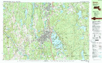
 1982 Southbridge1983 Print · USGSThe industrial Quinebaug River valley and its surrounding highlands are captured here in the early eighties as modernization reached the Massachusetts-Connecticut border. Researchers can trace family sites near St Marys Cem, navigate the ridges of Leadmine Mtn, and locate old village centers like Fiskdale and Sandersdale.2 unique versions available
 - 1982 Map of Uxbridge, 1984 Print
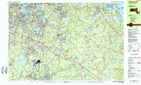
 1982 Uxbridge1984 Print · USGSThe Blackstone Valley at the start of the eighties shows a landscape of historic mill towns and river-driven industry. Researchers can trace family ties and civic growth through sites like the Chestnut Hill Meeting House, Northbridge High Sch, and Evergreen Cem.
 - 1982 Map of North Brookfield, 1984 Print
 1982 North Brookfield1984 Print · USGSWorcester County's rural character is on full display in the early 1980s, before modern suburban expansion altered the hills around North Brookfield. Genealogists and historians can trace family locations through numerous landmarks like St Josephs Abbey, Walnut Grove Cem, and the Eagle Hill Sch.2 unique versions available
 - 1982 Map of Webster, 1984 Print
 1982 Webster1984 Print · USGSCentral Massachusetts and the tri-state borderlands come into focus in the early eighties, centered on the industrial corridors of the French River. Genealogists can trace family sites at St Anthony Cem or locate the campus of Nichols College and the various mills of Webster.2 unique versions available
 - 1982 Map of Milford, 1984 Print
 1982 Milford1984 Print · USGSCentral Massachusetts in the early eighties reveals a landscape of industrial river towns and sprawling state forests. Genealogists and historians can trace the mill villages along the Blackstone River or locate old burial grounds like Indian Cem and Riverdale Cem.
 - 1982 Map of Warren, 1984 Print
 1982 Warren1984 Print · USGSThe Quaboag River valley in the early eighties shows a landscape of industrial river towns and sprawling state parks. Local researchers can trace the rail lines of Conrail, find family plots at Pine Grove Cem, or locate landmarks like Steerage Rock.2 unique versions available
 - 1983 Map of Worcester South, 1984 Print
 1983 Worcester South1984 Print · USGSThe Worcester hills and southern suburbs are captured here in the early 1980s as the regional highway network matured. Researchers can trace historic family burial sites at Hope Cemetery and St Josephs Cem or locate institutional landmarks like Clark University.2 unique versions available
 - 1983 Map of Marlborough, 1984 Print
 1983 Marlborough1984 Print · USGSThe boroughs of Central Massachusetts are shown during a period of significant suburban growth in the early eighties. Genealogists and local historians can locate family plots in Mountain View Cemetery or trace the development around Marlborough Junction and the Westborough State Hospital.3 unique versions available
 - 1983 Map of Worcester North, 1984 Print
 1983 Worcester North1984 Print · USGSNorth Worcester and its neighboring hill towns are shown in the early eighties as the region's academic and medical campuses expanded. Genealogists and local historians can trace the grounds of Assumption College, the Rural Cemetery, and the Rutland Heights Hospital.2 unique versions available
 - 1984 Map of Block Island
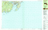
 1984 Block Island1984 Print · USGSThe coastal borderlands of Rhode Island, Connecticut, and New York are captured here in the mid-eighties, from the rail hubs of Westerly to the shores of Block Island. Genealogists and historians can trace the shoreline's evolution through landmarks like the Pequot Indian Res, New Shoreham, and Narragansett Pier.
 - 1984 Map of Lowell
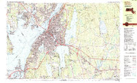
 1984 Lowell1984 Print · USGSThe Merrimack Valley industrial corridor is captured here in the mid-eighties, showing the interconnected growth of Lowell, Nashua, and Lawrence. Genealogists and historians can trace the paths of the Boston and Maine railroad or locate institutional landmarks like Merrimack College and the Fort Devens Military Reservation.
 - 1984 Map of Gloucester
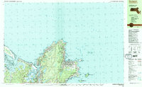
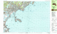
 1984 Gloucester1984 Print · USGSCoastal Massachusetts and the New Hampshire borderlands are shown here in the mid-eighties, from the granite shores of Cape Ann to the Merrimack River. Researchers can trace the legacy of maritime trade and higher education at Salem State College or follow the Boston and Maine rail lines through Ipswich and Beverly.
 - 1984 Map of Scituate
 1984 Scituate1984 Print · USGSCoastal Plymouth County in the mid-eighties shows a landscape of storied sea cliffs and winding tidal marshes. Genealogists and local historians can trace family roots through Meeting House Lane Cem, locate the Scituate Station, or explore the heritage of Scituate Harbor.2 unique versions available
 - 1984 Map of Gloucester
 1984 Gloucester1984 Print · USGSGloucester and the rocky Cape Ann shoreline are shown in the mid-eighties as the region’s maritime and residential character was firmly established. Researchers can trace historic family burial sites at West Parish Cem, locate the Hammond Museum, and follow the Boston and Maine rail line into the heart of the city.
 - 1984 Map of Weymouth
 1984 Weymouth1984 Print · USGSCoastal Plymouth and Norfolk Counties are captured here in the mid-eighties, showing the region's transition from a naval hub to a modern suburban corridor. Researchers can trace family sites at Village Cem or explore the massive layout of the South Weymouth Naval Air Station and Wompatuck State Park.2 unique versions available
 - 1984 Map of Rockport
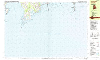
 1984 Rockport1984 Print · USGSCape Ann's rugged Atlantic coastline and granite quarrying history are on full display in this mid-eighties record. Genealogists and historians can trace the Boston and Maine railroad line through Rockport and locate family plots at Beech Grove Cem or Locust Grove Cem.2 unique versions available
 - 1984 Map of Sakonnet Point
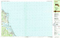
 1984 Sakonnet Point1984 Print · USGSThe coastal border of Rhode Island and Massachusetts in the 1980s reveals a shoreline of wildlife refuges and rocky navigational hazards. Trace local landmarks like the Lighthouse (Abandoned) at Sakonnet Point, St Andrews by the Sea Ch, and the grounds of Woods Castle.
 - 1984 Map of Hull
 1984 Hull1984 Print · USGSThe South Shore and Boston Harbor islands are captured in detail during the mid-eighties, showing a landscape defined by maritime navigation and coastal defense. Researchers can trace historic fortifications like Fort Warren and Fort Standish or locate family sites in Nantasket Beach and Allerton.
 - 1984 Map of Providence, 1985 Print
 1984 Providence1985 Print · USGSThe Rhode Island coast and its industrial heartlands are captured here in the mid-eighties, showing the density of the Providence metro area. Researchers can trace historic rail lines like the Providence & Worcester RR and explore the maritime layout of Narragansett Bay and Newport.
 - 1984 Map of Provincetown, 1986 Print
 1984 Provincetown1986 Print · USGSThe Massachusetts coastline and the tip of Cape Cod appear here during the mid-eighties, highlighting the region's dense coastal settlements and maritime defenses. You can locate family landmarks in Marshfield, trace the grounds of the North Truro Air Force Station, and explore the islands of Boston Harbor like Peddocks Island.2 unique versions available
 - 1985 Map of Lynn
 1985 Lynn1985 Print · USGSThe Massachusetts North Shore comes into focus during the mid-eighties, detailing the dense urban fabric and rocky coastlines from Lynn to Marblehead. Researchers can trace neighborhood development near Pine Grove Cem, locate the old Coast Guard Station at Nahant, and follow the B & M rail corridor.2 unique versions available
 - 1985 Map of Exeter
 1985 Exeter1985 Print · USGSThe New Hampshire seacoast in the mid-eighties shows a landscape of colonial roots meeting modern energy infrastructure. Genealogists and historians can trace long-standing family corners and sites like Phillips Exeter Academy or Coffins Mill alongside the emerging Seabrook nuclear facility.
 - 1985 Map of Westport
 1985 Westport1985 Print · USGSThe coastal border of Massachusetts and Rhode Island is meticulously detailed in the mid-1980s, showcasing a landscape of tidal inlets and colonial-era crossroads. Local researchers can trace old family footprints at Adamsville or find local landmarks like St Catherine Ch and the Westport Yacht Club.
 - 1985 Map of Somerset
 1985 Somerset1985 Print · USGSCoastal Bristol County in the mid-1980s shows the bustling Taunton River corridor as it evolved into a modern suburban and industrial hub. Genealogists can locate family landmarks like Simmons Cem and Eddy Cem or trace the early waterfront at Old Town Landing.2 unique versions available
 - 1985 Map of Fall River
 1985 Fall River1985 Print · USGSFall River and the surrounding Bristol County shorelines are captured here in the mid-1980s, showcasing the region's dense urban core and rural fringes. Researchers can locate specific community landmarks like Westport Factory, the Polish National Cem, and the Borden Flats Lighthouse.2 unique versions available
Showing maps 1-25
Top cities of Massachusetts
- Boston historical maps
- Worcester historical maps
- Springfield historical maps
- Lowell historical maps
- Cambridge historical maps
- Brockton historical maps
See more
Top counties of Massachusetts
- Middlesex County historical maps
- Worcester County historical maps
- Suffolk County historical maps
- Essex County historical maps
- Norfolk County historical maps
- Bristol County historical maps
See more
Frequently asked questions
- What are the different types of historical maps available for Massachusetts?
- What is the oldest map of Massachusetts?
- Where can I purchase historical maps of Massachusetts for my home or office?
- Where can I download high-res historical maps of Massachusetts?
- Are there historical topographic maps available for Massachusetts?
- Is there historical aerial imagery available for Massachusetts?
- Where are historical maps of Massachusetts sourced from?