1960s Maps of Massachusetts
Explore 308 historic maps of Massachusetts from the 1960s. These maps offer a rare glimpse into what life looked like during the 1960s — showing old roads, neighborhoods, homes, and landmarks that have changed or disappeared over time.
Whether you're researching your family's past, planning a metal detecting trip, or studying how Massachusetts's landscape evolved across the 1960s, these high-resolution maps are a powerful tool for exploring the history of this region.
- Focus on a specific era: All maps on this page are from the 1960s, giving you a focused view of this time period.
- See what’s changed: Compare century-old streets, trails, and buildings to today's modern landscape using overlays and satellite layers.
- Research with precision: Use these maps for genealogy, historical research, land use analysis, or educational projects.
- View, download, or print: Maps are fully viewable online in high resolution, and can be downloaded or printed for your own records.
Start exploring Massachusetts's history through authentic maps from the 1960s. This is your window into the past.
Massachusetts maps
- 1960 Map of Williamstown, 1961 Print
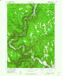
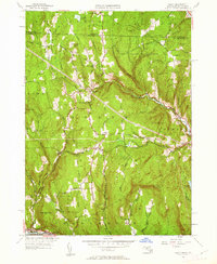
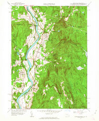
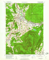 1960 Williamstown1961 Print · USGSThe Berkshires of western Massachusetts are shown in detail during the early sixties, centered on the college town and the state's highest peak. Researchers can trace the Appalachian Trail over Mt Greylock or locate ancestral sites at Westlawn Cem and Southlawn Cem.2 unique versions available
 - 1960 Map of Windsor, 1961 Print
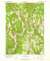
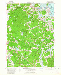
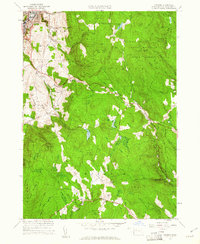 1960 Windsor1961 Print · USGSBerkshire County at the start of the 1960s reveals a landscape of high-elevation forests and small hill-town outposts. Genealogists and hikers can trace the Appalachian Trail through the timber of Savoy Mountain State Forest and locate the St Stanislaus Kostka Cem or the Crane Sch.2 unique versions available
 - 1960 Map of North Adams, 1961 Print
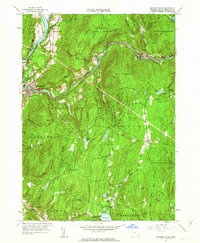
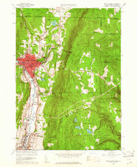 1960 North Adams1961 Print · USGSThe Northern Berkshires in the early 1960s reveal a landscape where industrial river towns like NORTH ADAMS and Adams meet high mountain forests. Genealogists and historians can trace local roots through Southview Cem, visit the Natural Bridge, or follow the BOSTON AND MAINE RAILROAD through Zylonite.2 unique versions available
 - 1960 Map of Berlin, 1961 Print
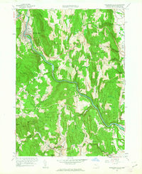
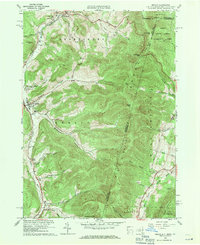 1960 Berlin1961 Print · USGSRensselaer County at the start of the sixties reveals a valley life shaped by the Taconic Range and the winding Little Hoosic River. Genealogists can trace family heritage through numerous hillside burial grounds like Brimmer Cem and Weaver Cem, or locate landmarks like the Carmelite Novitiate.2 unique versions available
 - 1960 Map of Rowe, 1961 Print
 1960 Rowe1961 Print · USGSThe Berkshires at the start of the 1960s show a landscape shaped by the Deerfield River and the industrial infrastructure of the Boston and Maine RR. Genealogists and historians can trace family plots at Sherman Cem or locate the famed Hoosac Tunnel and the mills at Monroe Bridge.2 unique versions available
 - 1960 Map of Rockport, 1962 Print
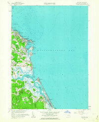
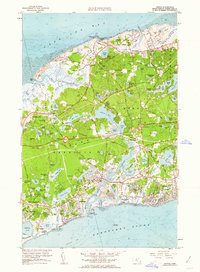
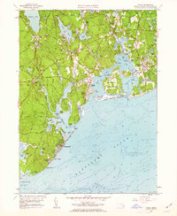
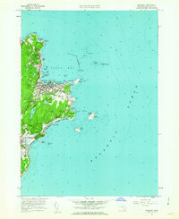 1960 Rockport1962 Print · USGSCape Ann's eastern tip is revealed here in the early sixties, showing a maritime landscape shaped by granite quarrying and coastal navigation. Researchers can locate family plots at Beech Grove Cem, trace the rail line of the Boston and Maine, and see the iconic Cape Ann Lighthouse on Thacher Island.2 unique versions available
 - 1960 Map of Worcester South, 1962 Print
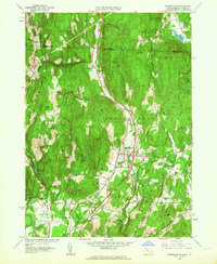
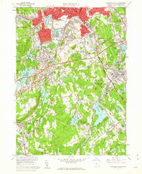 1960 Worcester South1962 Print · USGSWorcester and its southern townships are captured here at the start of the sixties, showing a landscape of dense industry and classic New England town centers. Researchers can trace historic family plots at Hope Cemetery or locate old industrial sites like the Millbury Woolen Pd and Drury Square.2 unique versions available
 - 1960 Map of Worcester North, 1962 Print
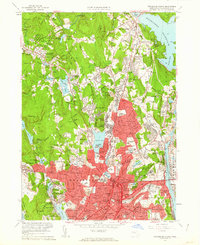 1960 Worcester North1962 Print · USGSMid-century Worcester and Holden appear here as a landscape of dense neighborhoods, academic institutions, and growing infrastructure. Genealogists and historians can trace family locations near the Rural Cemetery or locate old industrial nodes like Canada Mills and Chaffinville.2 unique versions available
 - 1960 Map of Hancock, 1966 Print
 1960 Hancock1966 Print · USGSThe Massachusetts-New York borderlands are surveyed here in the early sixties, showing the mountain hollows and rural cross-border communities of the Taconics. Genealogists can locate several family cemeteries and historical landmarks like the Whitman Burial Vault, Hancock Central Sch, and St Josephs Cem.
 - 1961 Map of Hartford
 1961 Hartford1961 Print · USGSSouthern New England and the Hudson Valley are shown here in the mid-fifties, capturing a landscape of booming coastal cities and interior hill towns. Researchers can trace the legacy of the New York New Haven and Hartford rail corridor and find strategic sites like Camp Shanks and Fort Michie.
 - 1961 Map of Boston
 1961 Boston1961 Print · USGSThe Massachusetts coastline and its industrial interior are detailed here in the mid-twentieth century, from the Monadnock highlands to Cape Cod. Researchers can trace the rail routes of the Boston and Maine or locate landmarks like Fort Devens and the Wachusett Reservoir.2 unique versions available
 - 1961 Map of Heath, 1962 Print
 1961 Heath1962 Print · USGSThe Berkshire foothills of the early 1960s are revealed here, showing the rural landscape of Heath and Colrain along the Vermont border. Genealogists and researchers can locate several remote burial grounds like Center Cem and Panel Hill Cem, or trace the historical Mohawk Trail along the Deerfield River.2 unique versions available
 - 1961 Map of Millers Falls, 1963 Print
 1961 Millers Falls1963 Print · USGSFranklin County's river-driven industrial hubs and forested uplands are documented here in the early sixties. Researchers can trace the rail junction at Millers Falls, find remote burial sites like Dry Hill Cem, and explore the shoreline of Lake Wyola.2 unique versions available
 - 1961 Map of Orange, 1963 Print
 1961 Orange1963 Print · USGSOrange and the Millers River valley are captured here in the early sixties as industrial rail hubs transitioned into a landscape of sprawling state forests. Trace historic village sites like Morse Village and Wendell Depot, or locate family landmarks near Lake Mattawa.2 unique versions available
 - 1961 Map of Duxbury, 1963 Print
 1961 Duxbury1963 Print · USGSThe Plymouth County coast in the early sixties reveals a landscape rich in Pilgrim history and maritime tradition. Trace early colonial roots at the John Alden House, the Standish Monument, and the iconic Plymouth Lighthouse on Gurnet Point.
 - 1961 Map of Scituate, 1963 Print
 1961 Scituate1963 Print · USGSThe Plymouth County coast in the early sixties reveals a transition from traditional maritime villages to expanding shoreline communities. Trace local history through the Coast Guard Station, the Meeting House Lane Cemetery and Church, and the Scituate Station rail stop.2 unique versions available
 - 1961 Map of Mt Grace, 1963 Print
 1961 Mt Grace1963 Print · USGSUpper Franklin County and the New Hampshire borderlands are captured here in the early 1960s as a region of forestry and small rural hamlets. Genealogists can locate family sites at South Cem or Newton Cem, while hikers can trace the terrain around Mt Grace and Tully Mtn.
 - 1961 Map of Bernardston, 1963 Print
 1961 Bernardston1963 Print · USGSThe Massachusetts and Vermont borderlands come into focus in the early sixties as the modern interstate era begins to reshape the river valleys. Researchers can locate family burial sites at Beaver Meadow Cem or trace the old Boston and Maine Railroad through Bernardston and Hales Crossing.2 unique versions available
 - 1961 Map of Colrain, 1963 Print
 1961 Colrain1963 Print · USGSNorthwestern Massachusetts in the early sixties remains a landscape of river-valley industry and colonial frontier sites. Researchers can trace the heritage of Colrain and Leyden through numerous family-named landmarks like Franklin Hill and historic locations such as Fort Morrison (Site).2 unique versions available
 - 1961 Map of Dennis, 1963 Print
 1961 Dennis1963 Print · USGSCape Cod's mid-century expansion is visible in this survey of the shoreline between Cape Cod Bay and Nantucket Sound. Trace family history and land use through numerous burial sites like Hall Cem and distinctive landmarks such as Hokum Rock and Scargo Lake.2 unique versions available
 - 1961 Map of Shelburne Falls, 1963 Print
 1961 Shelburne Falls1963 Print · USGSThe Deerfield River valley in the early 1960s reveals a landscape of steep ridges and tight-knit villages connected by the Boston and Maine railroad. Genealogists can trace family names through numerous burial grounds like Hawks Cem or locate former schoolhouses such as Roberts Sch near East Hill.2 unique versions available
 - 1961 Map of Hyannis, 1963 Print
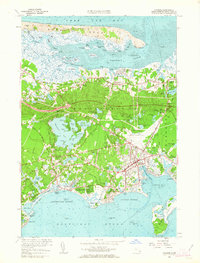 1961 Hyannis1963 Print · USGSMid-century Barnstable and Hyannis appear here as traditional maritime villages undergoing modern growth. Researchers can trace family sites at Beechwood Cem, locate the old Hyannis Port Schoolhouse, and see the working Cranberry Bogs that once defined the local economy.2 unique versions available
 - 1961 Map of Northfield, 1963 Print
 1961 Northfield1963 Print · USGSThe Connecticut River valley at the tri-state border was a hub of academic and rail life in the early sixties. Genealogists can trace family plots at West Northfield Cem and Coller Cem or locate the sprawling grounds of the Northfield School for Boys.2 unique versions available
 - 1961 Map of Cohasset, 1963 Print
 1961 Cohasset1963 Print · USGSThe South Shore at the start of the sixties reveals a blend of coastal heritage and postwar growth. Local historians can trace family roots through the Old First Parish Cem or locate historic sites like Kings Landing and the Old Oaken Bucket Homestead.2 unique versions available
 - 1961 Map of Cotuit, 1963 Print
 1961 Cotuit1963 Print · USGSCape Cod's southern shore appears here in the early sixties, showing the well-established villages of Cotuit, Osterville, and Marstons Mills. Genealogists and local historians can locate several burying grounds including Hillside Cem and the Old Indian Ch set amongst the many Cranberry Bogs that then dotted the landscape.2 unique versions available
Showing maps 1-25
Top cities of Massachusetts
- Boston historical maps
- Worcester historical maps
- Springfield historical maps
- Lowell historical maps
- Cambridge historical maps
- Brockton historical maps
See more
Top counties of Massachusetts
- Middlesex County historical maps
- Worcester County historical maps
- Suffolk County historical maps
- Essex County historical maps
- Norfolk County historical maps
- Bristol County historical maps
See more
Frequently asked questions
- What are the different types of historical maps available for Massachusetts?
- What is the oldest map of Massachusetts?
- Where can I purchase historical maps of Massachusetts for my home or office?
- Where can I download high-res historical maps of Massachusetts?
- Are there historical topographic maps available for Massachusetts?
- Is there historical aerial imagery available for Massachusetts?
- Where are historical maps of Massachusetts sourced from?