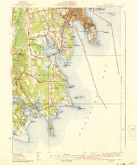
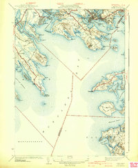
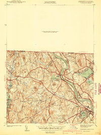
1940s Maps of Massachusetts
Explore 340 historic maps of Massachusetts from the 1940s. These maps offer a rare glimpse into what life looked like during the 1940s — showing old roads, neighborhoods, homes, and landmarks that have changed or disappeared over time.
Whether you're researching your family's past, planning a metal detecting trip, or studying how Massachusetts's landscape evolved across the 1940s, these high-resolution maps are a powerful tool for exploring the history of this region.
- Focus on a specific era: All maps on this page are from the 1940s, giving you a focused view of this time period.
- See what’s changed: Compare century-old streets, trails, and buildings to today's modern landscape using overlays and satellite layers.
- Research with precision: Use these maps for genealogy, historical research, land use analysis, or educational projects.
- View, download, or print: Maps are fully viewable online in high resolution, and can be downloaded or printed for your own records.
Start exploring Massachusetts's history through authentic maps from the 1940s. This is your window into the past.
Massachusetts maps
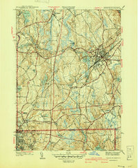
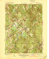
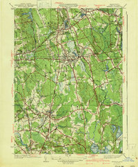
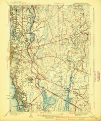
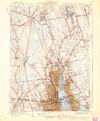
(340)- 1940 Map of Wachusett Mtn
 1940 Wachusett Mtn1940 Print · USGSCentral Massachusetts hill country and valley settlements are captured here just before the 1940s. Genealogists and historians can trace the Boston and Maine Railroad lines and locate the State Sanatorium or Rural Glen Cem.2 unique versions available
 - 1940 Map of Franklin
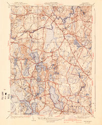
 1940 Franklin1940 Print · USGSFranklin and the surrounding border towns of Norfolk County are shown here just before the mid-century. Genealogists can locate specific sites like Dean Academy, St Johns Cem, and the old rail corridors of the New York New Haven and Hartford.2 unique versions available
 - 1940 Map of Hampden
 1940 Hampden1940 Print · USGSMassachusetts and Connecticut borderlands meet at the edge of the Berkshires in the late thirties. Local historians can trace old homesteads and community hubs near Baptist Village, Woodland Dell Cem, and the high peak of Minnechoag Mountain.2 unique versions available
 - 1940 Map of Sterling
 1940 Sterling1940 Print · USGSWorcester County communities like Oakdale and Sterling appear just before the mid-century, defined by the expansion of the regional water supply. Researchers can trace the path of the Quabbin Aqueduct or locate family landmarks like the Sterling Camp Grounds and Legge Cem.2 unique versions available
 - 1940 Map of Sagamore
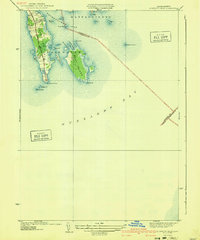
 1940 Sagamore1940 Print · USGSThe Cape Cod Canal area in the 1940s reveals a maritime landscape transitioning toward modern infrastructure. Trace family roots and local history through Sagamore village, the Indian Cem, and the rail lines of the New York New Haven and Hartford.4 unique versions available
 - 1940 Map of Sandwich
 1940 Sandwich1940 Print · USGSCape Cod’s oldest town and the surrounding marshes are captured just before the war as a landscape of rural villages and glacial ponds. Genealogy researchers can trace family landmarks like the Tobey Cem, the Old Quaker Meetinghouse, and the Cape Cod Airport.
 - 1940 Map of Wrentham
 1940 Wrentham1940 Print · USGSNorfolk County in the late 1930s shows a landscape of busy mill villages and expanding state institutions. Genealogists can trace family roots through the Bacon Cem, Quaker Cem, and local schools like Vogel Sch and Everett Sch.2 unique versions available
 - 1940 Map of Westford
 1940 Westford1940 Print · USGSWestford and Littleton appear at the outbreak of World War II as a network of rail-side mill villages and family-held hills. Genealogists can trace old cemeteries like Westlawn Cem, rural depots at Westford Sta, and the layout of Littleton Common.
 - 1940 Map of Bridgewater
 1940 Bridgewater1940 Print · USGSSoutheastern Massachusetts at the dawn of the 1940s reveals a landscape shaped by state institutions and the cranberry industry. Researchers can trace family sites near The Green, find the Fair Grounds, or locate old schoolhouses like the Pleasant Street School.3 unique versions available
 - 1940 Map of Sconticut Neck
 1940 Sconticut Neck1940 Print · USGSCoastal Fairhaven and its surrounding islands appear here in the mid-1930s, showing the early layout of the peninsula and its maritime borders. Trace the path of Sconticut Neck Road to the tip at Sconticut Point or explore the shores of West Island.3 unique versions available
 - 1940 Map of Tyngsoboro
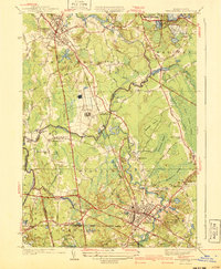
 1940 Tyngsoboro1940 Print · USGSMiddlesex County emerges in the era before the post-war suburban boom, centered on the Merrimack River and the Boston and Maine RR. Genealogists can trace family locations at Whidden Corner and Fletcher Cem, or find recreational landmarks like Camp Massapoag.
 - 1940 Map of Scituate
 1940 Scituate1940 Print · USGSThe Plymouth County coast is captured in the late 1930s, documenting a landscape of seaside villages and tidal rivers. Researchers can trace the path of the New York New Haven and Hartford RR and find local landmarks like Union Cem and Fourth Cliff.4 unique versions available
 - 1940 Map of Medfield
 1940 Medfield1940 Print · USGSMedfield and the surrounding Charles River valley appear here just before the Second World War, showing a landscape of small villages and large institutional grounds. Researchers can trace the old rail beds of the New York New Haven and Hartford and find local landmarks like Schoolhouse No 14 and the Medfield State Hospital.2 unique versions available
 - 1940 Map of Hanover
 1940 Hanover1940 Print · USGSThe pond-strewn landscape of Plymouth County is captured here in the years before mid-century suburbanization. You can trace early schoolhouse locations like the Smith Sch, find ancestral plots in the Pine Grove Cem, and follow the old line of the New York New Haven and Hartford RR.3 unique versions available
 - 1941 Map of Whitman
 1941 Whitman1941 Print · USGSThe Plymouth County interior is shown in the early 1940s, as traditional rail corridors and cranberry agriculture defined the local economy. Genealogists can locate family landmarks like St James Cem, Beaver Sch, and the Fireworks works near West Hanover.3 unique versions available
 - 1941 Map of Woods Hole
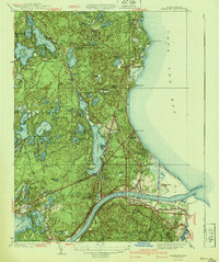
 1941 Woods Hole1941 Print · USGSThe Buzzards Bay shoreline and the Elizabeth Islands appear here just before the mid-century, featuring a landscape of maritime industry and coastal estates. Researchers can trace the New York New Haven and Hartford rail line, locate family plots at Crowell Cem, or explore the marshes of Great Sippowisset Swamp.3 unique versions available
 - 1941 Map of Shelburne Falls
 1941 Shelburne Falls1941 Print · USGSFranklin County's hill towns and river valleys are captured here during the early 1940s, showing the intersection of industry and rural life. Trace the path of the Mohawk Trail and find local landmarks such as Arms Cem, Union Ch, and the settlement of Burkville.3 unique versions available
 - 1941 Map of Marion
 1941 Marion1941 Print · USGSThe Buzzards Bay coastline flourished in the late 1930s with a blend of maritime education, rail commerce, and seaside recreation. Genealogists and historians can trace family burial sites at Barlow Cem, locate the landmark Tabor Academy, and follow the New York New Haven and Hartford railroad.3 unique versions available
 - 1941 Map of East Providence
 1941 East Providence1941 Print · USGSThe Rhode Island and Massachusetts borderlands show a unique mix of urban growth and coastal tradition in the late 1930s. Researchers can trace family roots through numerous local landmarks like Newman Ave Sch, Hurst Cemetery, and the Narragansett Race Track.3 unique versions available
 - 1941 Map of Holliston
 1941 Holliston1941 Print · USGSThe town of Holliston and the surrounding river valleys are captured here just before the mid-century suburban expansion. Genealogists and historians can trace rail-era landmarks like Braggville Sta, local institutions like the Wilder Sch, and old burial grounds including Lake Grove Cem.
 - 1941 Map of Mt Grace
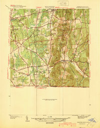
 1941 Mt Grace1941 Print · USGSThe upland villages of northern Massachusetts are captured here in the early 1940s, showing a landscape defined by high ridges and small mill ponds. Local historians can trace family-named sites from the Fire Tower on Mt Grace to Baptist Corners and Blissville.2 unique versions available
 - 1941 Map of New Bedford South
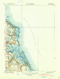
 1941 New Bedford South1941 Print · USGSCoastal Massachusetts at the start of the 1940s reveals a landscape of harbor defenses, seaside villages, and rural schools. Researchers can trace historic family-named landmarks and institutions like Fort Phoenix, St Johns Ch, and the Padanaram Breakwater.3 unique versions available
 - 1941 Map of Onset
 1941 Onset1941 Print · USGSCoastal Massachusetts at the start of the 1940s reveals a landscape of maritime recreation and local industry. Genealogists and historians can trace the development of Onset and East Marion, or locate landmarks like the Wings Neck Lighthouse and Agawam Cem.4 unique versions available
 - 1941 Map of Tyngsboro
 1941 Tyngsboro1941 Print · USGSMiddlesex County communities along the Merrimack River are caught at a point of transition just before the mid-century. Genealogists and local historians can trace family-named crossroads like Frederick Corner and locate the historic Fletcher Quarry or the Central Cem.2 unique versions available
 - 1941 Map of New Bedford North
 1941 New Bedford North1941 Print · USGSIn the early 1940s, the New Bedford waterfront was a complex network of rail and industry. Trace the historic neighborhoods of Fairhaven and Acushnet, locating family landmarks like St Marys Cem or the Evergreen Racetrack.3 unique versions available
Showing maps 1-25 of 340
Top cities of Massachusetts
- Boston historical maps
- Worcester historical maps
- Springfield historical maps
- Lowell historical maps
- Cambridge historical maps
- Brockton historical maps
See more
Top counties of Massachusetts
- Middlesex County historical maps
- Worcester County historical maps
- Suffolk County historical maps
- Essex County historical maps
- Norfolk County historical maps
- Bristol County historical maps
See more
Frequently asked questions
- What are the different types of historical maps available for Massachusetts?
- What is the oldest map of Massachusetts?
- Where can I purchase historical maps of Massachusetts for my home or office?
- Where can I download high-res historical maps of Massachusetts?
- Are there historical topographic maps available for Massachusetts?
- Is there historical aerial imagery available for Massachusetts?
- Where are historical maps of Massachusetts sourced from?