1970s Maps of Granite County, Montana
Explore 29 historic maps of Granite County from the 1970s. These maps offer a rare glimpse into what life looked like during the 1970s — showing old roads, neighborhoods, homes, and landmarks that have changed or disappeared over time.
Whether you're researching your family's past, planning a metal detecting trip, or studying how Granite County's landscape evolved across the 1970s, these high-resolution maps are a powerful tool for exploring the history of this region.
- Focus on a specific era: All maps on this page are from the 1970s, giving you a focused view of this time period.
- See what’s changed: Compare century-old streets, trails, and buildings to today's modern landscape using overlays and satellite layers.
- Research with precision: Use these maps for genealogy, historical research, land use analysis, or educational projects.
- View, download, or print: Maps are fully viewable online in high resolution, and can be downloaded or printed for your own records.
Start exploring Granite County's history through authentic maps from the 1970s. This is your window into the past.
Granite County, MT maps
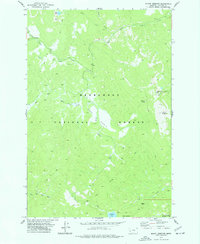
(29)- 1971 Map of Henderson Mountain, 1973 Print
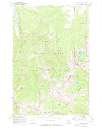
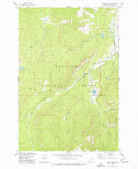
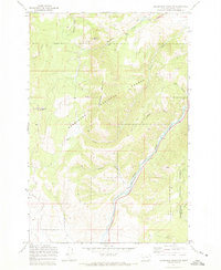 1971 Henderson Mountain1973 Print · USGSMining activity in Granite County was still clearly etched into the Deerlodge National Forest in the early seventies. Geologists and local historians can trace the legacy of mineral extraction through the Black Pine Mine, extensive Dredge Tailings, and the Burlington Northern rail corridor.2 unique versions available
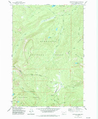
 - 1971 Map of Georgetown Lake, 1973 Print
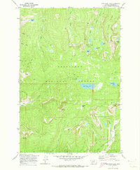
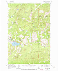
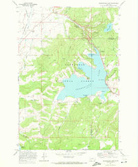 1971 Georgetown Lake1973 Print · USGSGeorgetown Lake sits at the heart of the Deerlodge National Forest in the early 1970s, showcasing a landscape defined by water power and recreation. Trace industrial history along the Old Railroad Grade and Stuart Mill Spring, or locate secluded spots like Echo Lake.2 unique versions available
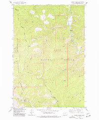
 - 1971 Map of Pikes Peak, 1973 Print
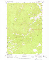
 1971 Pikes Peak1973 Print · USGSThe high country of the Deerlodge National Forest is captured here in the early 1970s during a period of active exploration. You can locate remote sites like the Master Mining Camp and trace old routes to the Thursday Friday Mine and Port Royal Mines.2 unique versions available
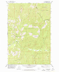
 - 1971 Map of Maxville, 1973 Print
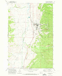
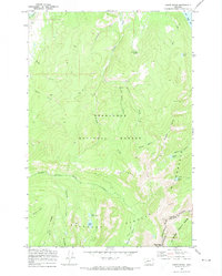
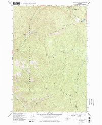
 1971 Maxville1973 Print · USGSThe mining and timber country of Granite County is captured here in the early 1970s. Trace old operations at Gold Hill Mine and Moonlight Mine or follow the Burlington Northern rail line through Maxville.2 unique versions available
 - 1971 Map of West Valley, 1973 Print
 1971 West Valley1973 Print · USGSDuring the early 1970s, the industrial valley near Deer Lodge was defined by the Butte Anaconda and Pacific railroad and active Mines. Trace the rail-side life of West Valley, find Stump Town, or locate the Garrity Cave and Meyers Dam.2 unique versions available
 - 1971 Map of Antelope Creek, 1973 Print
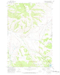
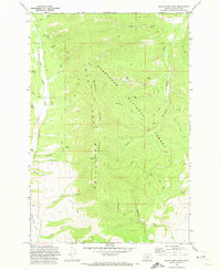
 1971 Antelope Creek1973 Print · USGSThe John Long Mountains in the early 1970s reveal a high-country landscape dominated by forest management and small-scale mining. Researchers can trace remote Jeep Trails to several Mines and follow the headwaters of Antelope Creek and Upper Willow Creek.2 unique versions available
 - 1971 Map of Potato Lakes, 1973 Print
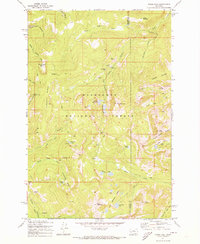
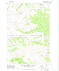
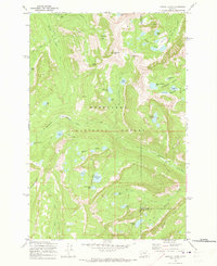
 1971 Potato Lakes1973 Print · USGSGranite County in the early seventies was a land of high-elevation water engineering and remote forest peaks. You can trace the complex irrigation network from the Flint Creek Canal to the East Fork Reservoir and locate high-altitude Mines near Wildcat Gulch.
 - 1971 Map of Philipsburg, 1973 Print
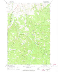
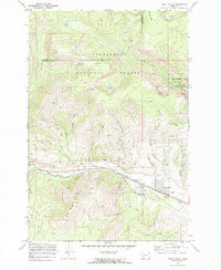
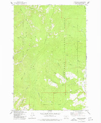
 1971 Philipsburg1973 Print · USGSPhilipsburg and the high valley floor are documented here during the early seventies, capturing the town's industrial footprint and forest boundaries. Researchers can locate specific mines, the Burlington Northern rail line, and the local Cemetery.
 - 1971 Map of Fred Burr Lake, 1973 Print
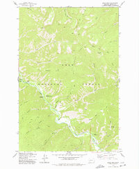
 1971 Fred Burr Lake1973 Print · USGSThe high Flint Creek Range in the early seventies shows a landscape shaped by remote mining and alpine waters. Trace historical mining sites at Granite and Red Lion Mine, or follow primitive routes over Fred Burr Pass to reach Racetrack Lake.2 unique versions available
 - 1971 Map of Carpp Ridge, 1973 Print
 1971 Carpp Ridge1973 Print · USGSGranite and Deer Lodge Counties are captured here in the early seventies, spanning the high ridgelines of the Pintlar Range and the Continental Divide. Researchers can trace the remote Carpp Mine, follow the Hi Line Trail, and locate high-mountain waters like Blue Grotto Spring.2 unique versions available
 - 1971 Map of Black Pine Ridge, 1973 Print
 1971 Black Pine Ridge1973 Print · USGSGranite County’s high timber and mining country is captured here in the early seventies, detailing the steep drainages of the John Mountains. You can trace early forest access routes like Maloney Trail No 5 and locate industrial activity at the Black Pine Lookout Tower or various scattered Mines.2 unique versions available
 - 1971 Map of Pozega Lakes, 1973 Print
 1971 Pozega Lakes1973 Print · USGSThe high Flint Creek Range comes into focus in the early 1970s, showing a landscape of alpine lakes and rugged mining prospects. You can trace early routes like the Racetrack Trail to the Powell Mines or the small settlement at Danielsville.2 unique versions available
 - 1971 Map of Stony Creek, 1974 Print
 1971 Stony Creek1974 Print · USGSThe Anaconda-Pintlar Wilderness and the high Continental Divide are captured here in the early 1970s. Researchers can trace historic access routes via Pack Trails to remote sites like the Sunshine Mine, Storm Lake, and One Hundred Acre Meadow.
 - 1971 Map of Silver Lake, 1974 Print
 1971 Silver Lake1974 Print · USGSDeer Lodge County's high-country mining and recreation landscape is captured here in the early 1970s. Researchers can trace old industrial remains like the Gold Coin Mine and an Old Railroad Grade or locate historic sites such as Southern Cross.2 unique versions available
 - 1974 Map of Stony Creek, 1977 Print
 1974 Stony Creek1977 Print · USGSHigh-elevation Montana forests and the Granite County line are documented in the mid-1970s. Trace old backcountry access routes along Stony Creek or locate remote landmarks like Stony Lake and the Windlass Bridge over Rock Creek.
 - 1974 Map of Skalkaho Pass, 1977 Print
 1974 Skalkaho Pass1977 Print · USGSHigh in the Sapphire Mountains during the mid-seventies, this survey captures the meeting point of two national forests and two counties. Trace the historic Pack Trail past Signal Rock, Mud Lake, and local Prospects along the continental divide.2 unique versions available
 - 1974 Map of Burnt Fork Lake, 1977 Print
 1974 Burnt Fork Lake1977 Print · USGSHigh in the Bitterroot Mountains during the mid-seventies, this survey shows the remote convergence of three national forests. Researchers can trace historic Pack Trails leading to Skalkaho Falls, Burnt Lake, and Kneaves Lake.2 unique versions available
 - 1974 Map of Mount Emerine, 1977 Print
 1974 Mount Emerine1977 Print · USGSThe Granite County backcountry in the mid-1970s is shown here as a landscape of remote peaks and pack trails. Genealogists and historians can trace the paths to the Congdon Mine or locate the historic Lookout Tower and Emerine Spring near the high summits.
 - 1974 Map of Whetstone Ridge, 1977 Print
 1974 Whetstone Ridge1977 Print · USGSHigh in the Bitterroot and Deerlodge national forests during the 1970s, this area was a hub of prospecting and high-altitude pack trails. Trace the locations of historic claims like Montana Prince Mine and Millers Mine near the heights of Whetstone Ridge.
 - 1974 Map of Kent Peak, 1977 Print
 1974 Kent Peak1977 Print · USGSHigh in the Sapphire Mountains during the mid-seventies, this survey maps the boundary between Ravalli and Granite counties. Trace old routes past Lost Tooth Cabin and high-altitude water like Kent Lake and Lake Abundance.
 - 1974 Map of Sawmill Saddle, 1977 Print
 1974 Sawmill Saddle1977 Print · USGSGranite and Ravalli counties were still primarily wilderness in the mid-1970s, defined by the intersection of national forests. You can trace the remote network of pack trails connecting Sawmill Saddle, Bitterroot Flat Campground, and Eagle Point.
 - 1974 Map of Lick Creek, 1977 Print
 1974 Lick Creek1977 Print · USGSHigh in the Bitterroot range during the mid-seventies, this area shows the convergence of national forest lands and wilderness. Trace the remote Pack Trails used by foresters and hunters, and locate early landmarks like the East Fork Forest Service Station and Lookout Tower.2 unique versions available
 - 1974 Map of Moose Lake, 1977 Print
 1974 Moose Lake1977 Print · USGSGranite County’s high-country mining and wilderness boundaries are captured here during the mid-seventies. Researchers can locate remote operations like the Banner Mine and Prospect Mine or trace trails through the Anaconda Pintlar Wilderness.
 - 1975 Map of Alder Gulch, 1977 Print
 1975 Alder Gulch1977 Print · USGSHigh-country drainages and forest boundaries define this Granite County terrain in the 1970s. Researchers can trace the network of Pack trails and named drainages like Alder Gulch, Sawpit Gulch, and Upper Willow Creek.
 - 1975 Map of Quigg Peak, 1978 Print
 1975 Quigg Peak1978 Print · USGSThe Granite County mountains in the mid-seventies were a landscape of remote forestry and river access. Researchers can trace historic access points like the Rock Creek Forest Service Station and the Butte Cabin Trail.
Showing maps 1-25 of 29
Top cities of Granite County
Frequently asked questions
- What are the different types of historical maps available for Granite County?
- What is the oldest map of Granite County?
- Where can I purchase historical maps of Granite County for my home or office?
- Where can I download high-res historical maps of Granite County?
- Are there historical topographic maps available for Granite County?
- Is there historical aerial imagery available for Granite County?
- Where are historical maps of Granite County sourced from?