Old Maps of Granite County, Montana for Metal Detecting
Plan your next treasure hunt with 352 historic maps of Granite County. Find old homesites, ghost towns, trails, and gathering spots that may be lost to time — perfect for identifying promising metal detecting locations.
- Locate forgotten sites: Uncover places like long-lost settlements, abandoned rail lines, or gathering spots.
- Plan better hunts: Use map overlays combined with LiDAR or satellite views to narrow in on historically rich areas.
- Made for detectorists: Thousands of hobbyists use these maps to discover relics, coins, and hidden history.
Use these historic maps to boost your research and find new opportunities beneath the surface of Granite County.
Granite County, MT maps
(352)- 1903 Map of Bonner
 1903 Bonner1903 Print · USGSMissoula and the surrounding river canyons come to life in this turn-of-the-century survey during the height of early rail expansion. Trace the original path of the Northern Pacific through mountain passes and locate early settlements like Bonner, Potomac, and Clinton.4 unique versions available
 - 1908 Map of Philipsburg
 1908 Philipsburg1908 Print · USGSGranite County at the height of its mining era features a landscape shaped by mineral wealth and the high peaks of the Divide. Genealogists and historians can trace industrial roots at Philipsburg, Southern Cross, and the Stamp Mill near Combination.3 unique versions available
 - 1909 Map of Sapphire
 1909 Sapphire1909 Print · USGSThe high Montana wilderness of the Sapphire and Bitterroot ranges is captured in the early 1900s, showing the border between Granite and Ravalli counties. Genealogists and researchers can trace family-named landmarks like Dominic Butte or explore remote basins like Frogpond Basin and Moose Meadows.3 unique versions available
 - 1919 Map of Drummond, 1958 Print
 1919 Drummond1958 Print · USGSGranite and Powell counties were at the height of their rail-and-ranching era in the years following the Great War. Researchers can trace the dual paths of the Northern Pacific railroad through Drummond or locate long-standing landmarks like New Chicago and the Sugarloaf School.2 unique versions available
 - 1921 Map of Drummond
 1921 Drummond1921 Print · USGSGranite and Missoula counties are seen here in the years following the Great War, as mining camps and valley ranches defined the local economy. Genealogists can trace family homesteads like Williams Ranch or locate rural landmarks including Sunset School and Garnet.3 unique versions available
 - 1947 Map of Butte, 1949 Print
 1947 Butte1949 Print · USGSWestern Montana at the peak of its rail-and-river era shows the vital connections between the mining and industrial centers of Butte and Helena. Researchers can trace the three major railroad lines serving mountain settlements like Garrison, Philipsburg, and Warm Springs.2 unique versions available
 - 1955 Map of Dillon, 1978 Print
 1955 Dillon1978 Print · USGSSouthwest Montana at the dawn of the interstate era reveals a landscape of high-mountain ranching and historic mining camps. Trace the routes of the Union Pacific through Dillon and Armstead, or locate early settlements like Bannack and Wisdom.2 unique versions available
 - 1957 Map of Dillon
 1957 Dillon1957 Print · USGSSouthwest Montana and Idaho in the mid-fifties reveal a high-country landscape of mountain ranges and ranching valleys. Genealogists can trace family holdings and rail stops along the Union Pacific Railroad, from Dillon to historic Virginia City and Twin Bridges.
 - 1958 Map of Butte
 1958 Butte1958 Print · USGSWestern Montana's mining and rail corridors are captured in the late fifties, from the urban bustle of the Copper King cities to high mountain passes. Researchers can trace the path of the Milwaukee St Paul and Pacific through Deer Lodge and locate remote outposts like Potomac Post Office.5 unique versions available
 - 1958 Map of Dillon
 1958 Dillon1958 Print · USGSSouthwestern Montana during the late fifties reveals a high-country landscape defined by the Continental Divide and a legacy of mountain mining. Genealogists and historians can trace rail lines like the Union Pacific or locate early industrial sites including the Hecla Mine and Ermont Mine.
 - 1958 Map of Drummond, 1960 Print
 1958 Drummond1960 Print · USGSDrummond and the surrounding Clark Fork valley are captured here in the late fifties, showcasing a critical Montana rail and river corridor. Genealogists and rail historians can trace the paths of the Northern Pacific through settlements like New Chicago and Hall.3 unique versions available
 - 1959 Map of Cleveland Mountain, 1961 Print
 1959 Cleveland Mountain1961 Print · USGSRavalli and Missoula counties meet along the high ridges of the Sapphire Mountains during the late fifties. Genealogists and historians can locate the Ambrose settlement, trace early timber and mining routes like Woodchuck, or find the Lone Rock Sch near the river.2 unique versions available
 - 1959 Map of Bearmouth, 1961 Print
 1959 Bearmouth1961 Print · USGSGranite County in the late fifties shows a landscape defined by the deep canyons of the Clark Fork and high mountain ridges. Researchers can trace historic transportation routes like the Mullan Road and find remote sites such as Griffith Cabin and the Conn Ranch.3 unique versions available
 - 1959 Map of Ravenna, 1961 Print
 1959 Ravenna1961 Print · USGSIn the late 1950s, this mountainous border between Missoula and Granite Counties was a hub of river-and-rail transport. Researchers can trace the dual tracks of the Northern Pacific and Milwaukee Road, locating vanished stops like Nimrod and the old settlement at Quigley.2 unique versions available
 - 1960 Map of Butte
 1960 Butte1960 Print · USGSWestern Montana at the dawn of the sixties is defined by its industrial mining hubs and the railroads that connect them. Genealogists and historians can trace the routes of the Milwaukee Road through Butte or locate smaller settlements like Southern Cross and Bearmouth.
 - 1962 Map of Butte
 1962 Butte1962 Print · USGSWestern Montana in the early sixties remains a landscape of industrial muscle and high-mountain passes. Trace the rail lines of the Northern Pacific through Deer Lodge and the mining history around Anaconda and Philipsburg.
 - 1962 Map of Dillon
 1962 Dillon1962 Print · USGSSouthwest Montana in the early sixties is defined by its high mountain ranges and the winding rivers that carved its settlement patterns. Trace the rail routes of the Union Pacific through Dillon or locate mining activity near Butte and Argenta.
 - 1962 Map of Warren Peak, 1964 Print
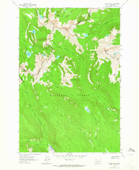 1962 Warren Peak1964 Print · USGSThe Anaconda Range in the early sixties is captured here at the crest of the Continental Divide. Trace early high-country routes like the Hi Line Trail and locate remote alpine landmarks including Warren Peak and the Pintlar Meadows.4 unique versions available
 - 1965 Map of Dillon
 1965 Dillon1965 Print · USGSSouthwest Montana in the mid-1960s is defined by its rugged river valleys and high mountain passes along the Continental Divide. Researchers can trace the path of the Union Pacific through Dillon and Armstead, or locate early mining activity near Melrose and Wise River.
 - 1965 Map of Union Peak, 1967 Print
 1965 Union Peak1967 Print · USGSThe mining districts along the Missoula and Granite county border are captured here in the mid-1960s. Researchers can locate the Coloma Cem and trace old workings like the Copper Cliff Mine and Clemantha Mine.
 - 1965 Map of Wild Horse Parks, 1967 Print
 1965 Wild Horse Parks1967 Print · USGSThe high Montana backcountry along the Granite and Powell county line is captured here during the mid-sixties. Researchers and collectors can trace the remote network of Wild Horse Parks and Jeep Trails connecting landmarks like Nelson Spring and a solitary mountain prospect.
 - 1965 Map of Elevation Mountain, 1967 Print
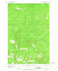 1965 Elevation Mountain1967 Print · USGSGranite County at the height of the mid-1960s reveals the layout of historic mining camps deep in the mountains. Genealogists and historians can trace the footprint of early settlements like Garnet, Beartown, and Reynolds City in their original geographical context.4 unique versions available
 - 1971 Map of Henderson Mountain, 1973 Print
 1971 Henderson Mountain1973 Print · USGSMining activity in Granite County was still clearly etched into the Deerlodge National Forest in the early seventies. Geologists and local historians can trace the legacy of mineral extraction through the Black Pine Mine, extensive Dredge Tailings, and the Burlington Northern rail corridor.2 unique versions available
 - 1971 Map of Georgetown Lake, 1973 Print
 1971 Georgetown Lake1973 Print · USGSGeorgetown Lake sits at the heart of the Deerlodge National Forest in the early 1970s, showcasing a landscape defined by water power and recreation. Trace industrial history along the Old Railroad Grade and Stuart Mill Spring, or locate secluded spots like Echo Lake.2 unique versions available
 - 1971 Map of Pikes Peak, 1973 Print
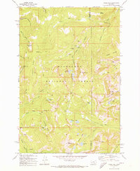 1971 Pikes Peak1973 Print · USGSThe high country of the Deerlodge National Forest is captured here in the early 1970s during a period of active exploration. You can locate remote sites like the Master Mining Camp and trace old routes to the Thursday Friday Mine and Port Royal Mines.2 unique versions available
Showing maps 1-25 of 352
Top cities of Granite County
Frequently asked questions
- What are the different types of historical maps available for Granite County?
- What is the oldest map of Granite County?
- Where can I purchase historical maps of Granite County for my home or office?
- Where can I download high-res historical maps of Granite County?
- Are there historical topographic maps available for Granite County?
- Is there historical aerial imagery available for Granite County?
- Where are historical maps of Granite County sourced from?