1990s Maps of Granite County, Montana
Explore 44 historic maps of Granite County from the 1990s. These maps offer a rare glimpse into what life looked like during the 1990s — showing old roads, neighborhoods, homes, and landmarks that have changed or disappeared over time.
Whether you're researching your family's past, planning a metal detecting trip, or studying how Granite County's landscape evolved across the 1990s, these high-resolution maps are a powerful tool for exploring the history of this region.
- Focus on a specific era: All maps on this page are from the 1990s, giving you a focused view of this time period.
- See what’s changed: Compare century-old streets, trails, and buildings to today's modern landscape using overlays and satellite layers.
- Research with precision: Use these maps for genealogy, historical research, land use analysis, or educational projects.
- View, download, or print: Maps are fully viewable online in high resolution, and can be downloaded or printed for your own records.
Start exploring Granite County's history through authentic maps from the 1990s. This is your window into the past.
Granite County, MT maps
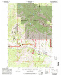
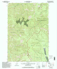
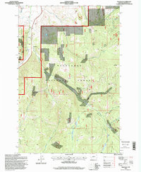
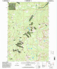
(44)- 1993 Map of Philipsburg, 1994 Print
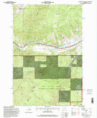
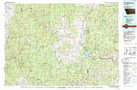 1993 Philipsburg1994 Print · USGSThe mining and mountain country of Granite County is captured in the early nineties, showing a landscape defined by timber and mineral wealth. You can trace historical mining operations at the Black Pine Mine and Cable Mine or locate early settlements like Maxville and Southern Cross.
 - 1994 Map of Wisdom
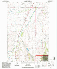
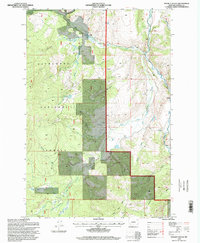
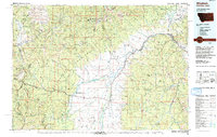 1994 Wisdom1994 Print · USGSThe high mountain valleys of Southwest Montana and East Idaho come alive in the mid-1990s as the Big Hole River meanders toward the Continental Divide. Trace the grounds of the Big Hole National Battlefield or locate remote settlements like Wisdom and Gibbonsville.2 unique versions available
 - 1996 Map of Fred Burr Lake
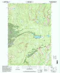 1996 Fred Burr Lake1996 Print · USGSGranite County's high country is captured here in the mid-1990s as a landscape of historic mining and modern skiing. Researchers can trace the proximity of the Red Lion Mine and Rumsey to the slopes of the Discovery Basin Ski Area and alpine waters like Fred Burr Lake.2 unique versions available
 - 1996 Map of Potato Lakes, 1998 Print
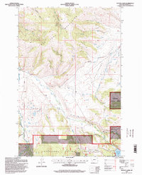 1996 Potato Lakes1998 Print · USGSThe John Long Mountains and Philipsburg Valley meet in this mid-nineties survey of the Deerlodge National Forest. Researchers can trace complex water systems like the Flint Creek Canal and find old extraction sites including Mines and Prospects.
 - 1996 Map of West Valley, 1998 Print
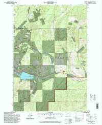
 1996 West Valley1998 Print · USGSDeer Lodge County in the mid-1990s reveals a complex landscape where deep mountain prospecting meets the developing valley floor. Researchers can trace the layout of Stump Town, find the Drive-in Theater, and locate numerous mine workings along Blue Eyed Nellie Gulch.
 - 1996 Map of Henderson Mountain, 1998 Print
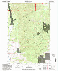
 1996 Henderson Mountain1998 Print · USGSGranite County's high country is captured in the mid-1990s as a landscape defined by mineral exploration and wilderness. Researchers can trace the footprint of the Black Pine Mine and find numerous prospects along Henderson Creek and Smart Creek.
 - 1996 Map of Alder Gulch, 1998 Print
 1996 Alder Gulch1998 Print · USGSThe Granite County highlands at the close of the twentieth century are defined here by the intersection of the Deerlodge National Forest and Lolo National Forest. Researchers can trace the rugged drainage systems of Alder Gulch and Sawpit Gulch or locate the historic Ranch Creek Trail.
 - 1996 Map of Cornish Gulch, 1998 Print
 1996 Cornish Gulch1998 Print · USGSGranite County's high country is documented here in the mid-nineties, showing the intersection of mineral history and public lands. Trace early mining efforts at the Silver King Mine and locate the Squaw Fork Rental Cabin along the banks of Stony Creek.
 - 1996 Map of Spink Point, 1998 Print
 1996 Spink Point1998 Print · USGSIn the mid-1990s, the high country of Granite County remained a landscape defined by mineral exploration and forestry. Researchers can trace the legacy of local mining at the Brewster Mine and Argo Mine, or locate the Side Rock Lookout atop Sliderock Mountain.
 - 1996 Map of Silver Lake, 1998 Print
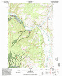
 1996 Silver Lake1998 Print · USGSDeer Lodge County's mining heritage is frozen in time here during the mid-nineties, showing the intersection of heavy industry and national forest land. Researchers can trace the layout of the Cable Mine, the settlement at Southern Cross, and the Anaconda Civilian Conservation Center.
 - 1996 Map of Hall, 1998 Print
 1996 Hall1998 Print · USGSThe Granite County ranchlands near Hall are shown in the late twentieth century, showing a landscape of water engineering and mining. Genealogists and researchers can trace the Allendale Ditch and find local landmarks like Stone and the Chicago mine.
 - 1996 Map of Bearmouth, 1998 Print
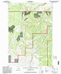
 1996 Bearmouth1998 Print · USGSThis mid-nineties survey of the Granite County mountains captures a landscape shaped by mining and the Clark Fork river. Researchers can trace historical mining footprints at the Bearmouth Prospect, locate old Tailings, and explore the gulches near Harvey Ridge.
 - 1996 Map of Medicine Tree Hill, 1998 Print
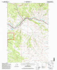
 1996 Medicine Tree Hill1998 Print · USGSThe Clark Fork river corridor in the mid-1990s reveals a landscape of high mountain ridges and essential valley transit points. Genealogists and historians can trace family-named landmarks like Harvey Ridge and remote settlements such as Nimrod and Bearmouth.
 - 1996 Map of Black Pine Ridge, 1998 Print
 1996 Black Pine Ridge1998 Print · USGSGranite County, Montana, is shown here during the mid-1990s as a landscape of resource extraction and mountain trails. You can trace the legacy of local mining through several Prospects, Mines, and a Drill Hole scattered across Black Pine Ridge.
 - 1996 Map of Philipsburg, 1998 Print
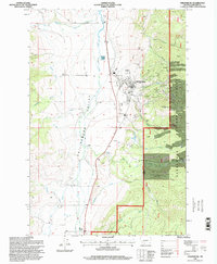 1996 Philipsburg1998 Print · USGSPhilipsburg and the high mountain valleys of Granite County are captured here in the mid-1990s as the regional mining industry left its mark on the land. Genealogists and historians can trace local landmarks like the Cemetery, County Airport, and the City Park.
 - 1996 Map of Storm Lake, 1998 Print
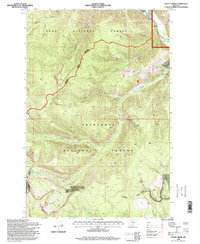
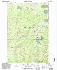
 1996 Storm Lake1998 Print · USGSThe high Montana backcountry of the 1990s is captured here, centered on the Continental Divide and the Anaconda Pintler Wilderness. Historians can trace the region's mining legacy at the Sunshine Mine or locate secluded alpine landmarks like Goat Flat and Storm Lake.
 - 1996 Map of Maxville, 1998 Print
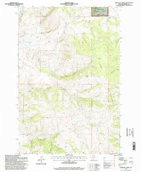
 1996 Maxville1998 Print · USGSGranite County extraction and timber roads are well-documented in the 1990s as the high-country landscape supported local industry. Researchers can trace historic mining operations like the Royal Basin Mine, Nonpareil Mine, and the settlement at Princeton.
 - 1996 Map of Stony Creek, 1998 Print
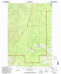
 1996 Stony Creek1998 Print · USGSGranite County’s mountain summits and forest boundaries are captured here in the mid-1990s. Researchers can trace the protected grounds of the Skalkaho Game Preserve and the drainage patterns of Stony Creek and Badger Gulch.
 - 1996 Map of Maukey Gulch, 1998 Print
 1996 Maukey Gulch1998 Print · USGSGranite County in the mid-1990s was a landscape of forest management and mountain mining. Genealogists and historians can trace local landmarks like the McDonald Mine, the West Fork Work Center, and the broad wetlands of Moose Meadows.
 - 1996 Map of Pozega Lakes, 1998 Print
 1996 Pozega Lakes1998 Print · USGSHigh in the Deerlodge National Forest during the late nineties, this landscape shows the intersection of alpine wilderness and industrial history. Researchers can trace the layout of the Danielsville (Site) or locate mountain operations like Powell Mines and the Tungsten Mine.
 - 1996 Map of Georgetown Lake, 1998 Print
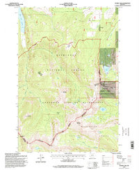
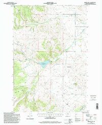
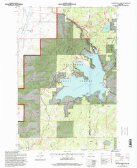 1996 Georgetown Lake1998 Print · USGSGeorgetown Lake was a hub of recreation and utility in the mid-nineties, set against the backdrop of the High Rockies. Researchers can trace the water systems of the Penstock or locate local landmarks like the Haggin Dude Ranch and Camp Lahepia.
 - 1996 Map of Pikes Peak, 1998 Print
 1996 Pikes Peak1998 Print · USGSThe Flint Creek Range of western Montana is shown here in the mid-1990s, revealing a landscape defined by high-altitude mining and national forest lands. Researchers can trace historic extraction sites like the Master Mining Camp, Port Royal Mines, and Thursday-Friday Mine.
 - 1996 Map of Nirling Hill, 1998 Print
 1996 Nirling Hill1998 Print · USGSHigh-altitude Granite County ranching and water management are preserved here in the late nineties. Researchers can trace the extensive irrigation systems of the Allendale Ditch and find local landmarks like the Conn Ranch and Sugarloaf Sugar Loaf.
 - 1996 Map of Antelope Creek, 1998 Print
 1996 Antelope Creek1998 Print · USGSGranite County’s high timber country in the mid-nineties is documented here as it appeared under federal forest management. Researchers can trace the drainage of Antelope Creek or locate historic mining activity at Mines Prospect and the southern Corral.
 - 1996 Map of Moose Lake, 1998 Print
 1996 Moose Lake1998 Print · USGSGranite County, Montana, was a quiet enclave of alpine lakes and old mining claims in the 1990s. Trace the remote trails of the Deerlodge National Forest to find the Banner Mine, Suste Lake, and the Moose Lake Rental Cabin.
Showing maps 1-25 of 44
Top cities of Granite County
Frequently asked questions
- What are the different types of historical maps available for Granite County?
- What is the oldest map of Granite County?
- Where can I purchase historical maps of Granite County for my home or office?
- Where can I download high-res historical maps of Granite County?
- Are there historical topographic maps available for Granite County?
- Is there historical aerial imagery available for Granite County?
- Where are historical maps of Granite County sourced from?