1950s Maps of Cibola County, New Mexico
Explore 33 historic maps of Cibola County from the 1950s. These maps offer a rare glimpse into what life looked like during the 1950s — showing old roads, neighborhoods, homes, and landmarks that have changed or disappeared over time.
Whether you're researching your family's past, planning a metal detecting trip, or studying how Cibola County's landscape evolved across the 1950s, these high-resolution maps are a powerful tool for exploring the history of this region.
- Focus on a specific era: All maps on this page are from the 1950s, giving you a focused view of this time period.
- See what’s changed: Compare century-old streets, trails, and buildings to today's modern landscape using overlays and satellite layers.
- Research with precision: Use these maps for genealogy, historical research, land use analysis, or educational projects.
- View, download, or print: Maps are fully viewable online in high resolution, and can be downloaded or printed for your own records.
Start exploring Cibola County's history through authentic maps from the 1950s. This is your window into the past.
Cibola County, NM maps
(33)- 1951 Map of Mt Sedgwick, 1953 Print
 1951 Mt Sedgwick1953 Print · USGSValencia County, New Mexico, is depicted here in the early 1950s, centered on the high peaks and deep drainages of the Cibola National Forest. Topographers and local historians can trace the canyon networks of Prop Canyon and find isolated cattle-range features like Ojo Redondo.2 unique versions available
 - 1952 Map of Valle Largo, 1953 Print
 1952 Valle Largo1953 Print · USGSThe high timberlands and volcanic ridges of Cibola County are captured here in the early fifties, following the 1945 aerial surveys. Researchers can trace the path of the Continental Divide past the Aragon Ranch and remote watering points like Aragon Spring.3 unique versions available
 - 1952 Map of Post Office Flat, 1953 Print
 1952 Post Office Flat1953 Print · USGSIn the Zuni Mountains during the early fifties, this area shows the rugged transition of the Continental Divide. Genealogists and historians can trace family locations at the Serna Homestead or follow industrial sites like the Sawmill (Aban'd) and Mirabal Mine.3 unique versions available
 - 1952 Map of Paxton Springs, 1954 Print
 1952 Paxton Springs1954 Print · USGSThe Zuni Mountains high country comes into focus in the early fifties, capturing the remote landscapes of the Cibola National Forest. Trace the path of the Continental Divide past Paxton Springs and the Oso Ridge Lookout Tower.8 unique versions available
 - 1954 Map of South Garcia, 1955 Print
 1954 South Garcia1955 Print · USGSThe high desert of Valencia County in the mid-1950s is defined here by tribal lands and cattle ranching. Trace early landmarks like the Antonio Sedillo Grant Headquarters and the Atchison Topeka and Santa Fe railroad.2 unique versions available
 - 1954 Map of Canoncito School, 1955 Print
 1954 Canoncito School1955 Print · USGSBernalillo and Valencia counties meet in the high desert during the mid-1950s, a landscape defined by Indigenous lands and mineral exploration. Researchers can trace historic locations such as the Canoncito Navajo Day School, Pueblo Ruins, and the Fern Mine.3 unique versions available
 - 1954 Map of Saint Johns, 1968 Print
 1954 Saint Johns1968 Print · USGSThe high plateau of the Arizona-New Mexico border is captured here in the mid-1950s, showing the intersection of tribal lands and national forests. Researchers can trace the cattle country and mountain outposts from Saint Johns to Pie Town and McNary.3 unique versions available
 - 1954 Map of Socorro, 1972 Print
 1954 Socorro1972 Print · USGSMid-century New Mexico comes into focus as the Rio Grande valley and the surrounding high desert undergo post-war growth. Genealogists and historians can trace old mountain settlements like Tajique and Punta de Agua or locate remote sites like the Torrance Mine.2 unique versions available
 - 1954 Map of Gallup, 1973 Print
 1954 Gallup1973 Print · USGSNative American tribal lands and the railroad corridor of the Southwest appear here at the midpoint of the century. Trace historic sites and remote settlements from Window Rock to the Fort Wingate Army Depot and Bibo.2 unique versions available
 - 1956 Map of South Garcia, 1958 Print
 1956 South Garcia1958 Print · USGSThe high desert landscape west of Albuquerque is captured here in the mid-fifties as ranching and rail infrastructure defined the region. Researchers can trace historic ranch boundaries and water sources like the Antonio Sedillo Grant Hdqrs, T X Ranch, and Marys Windmill.3 unique versions available
 - 1956 Map of Mesa Aparejo, 1958 Print
 1956 Mesa Aparejo1958 Print · USGSRanching life in the New Mexico desert is captured here in the mid-fifties, spanning the Valencia and Socorro county line. Genealogists and historians can trace family-named sites like Romero Ranch, Yriart Ranch, and the outpost at Kings Rest.2 unique versions available
 - 1957 Map of Saint Johns
 1957 Saint Johns1957 Print · USGSThe Arizona-New Mexico borderlands are captured here in the mid-fifties, showing the high-country settlements and federal lands before modern development. Genealogists and historians can trace old homesteads and landmarks like the Red Hill Post Office, Lyman Reservoir, and the mountain communities of Eagar and Springerville.
 - 1957 Map of San Rafael, 1959 Print
 1957 San Rafael1959 Print · USGSIn the high desert of Valencia County during the late fifties, the village of San Rafael serves as a gateway to the volcanic uplands. Genealogists and hikers can trace the Agua Fria Trail and locate family sites like the Porter Cemetery or the historic Ojo del Gallo.2 unique versions available
 - 1957 Map of Lobo Springs, 1959 Print
 1957 Lobo Springs1959 Print · USGSCibola National Forest and the Acoma Pueblo Indian Land met in this high-desert landscape during the late fifties. Researchers can trace remote life through landmarks like Tietjen Ranch, find a lone Grave, and locate numerous named water sources like De Armand Spring.3 unique versions available
 - 1957 Map of Mount Taylor, 1959 Print
 1957 Mount Taylor1959 Print · USGSThe high peaks of the San Mateo Mountains define this late 1950s New Mexico survey. Local historians and researchers can trace the complex boundaries between the Laguna Indian Reservation and Cibola National Forest or locate early water sources like Gooseberry Spring.3 unique versions available
 - 1957 Map of Laguna, 1959 Print
 1957 Laguna1959 Print · USGSLaguna Pueblo and the surrounding mesas were transitioning into the mid-twentieth century when this survey was conducted. Local historians can trace family locations and land use across the Laguna Indian Reservation, finding markers like the San Jose Mission, Encinal, and Eckerman Cemetery.2 unique versions available
 - 1957 Map of Mesa Gigante, 1959 Print
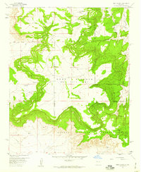 1957 Mesa Gigante1959 Print · USGSCibola County lands in the late 1950s reveal a detailed intersection of tribal territories and historic land grants. Researchers can trace the boundaries of the Laguna Indian Reservation and locate landmarks like the Harrington Windmill and Alamos Spring.3 unique versions available
 - 1957 Map of Moquino, 1959 Print
 1957 Moquino1959 Print · USGSTraditional Pueblo lands and massive Spanish land grants meet the emerging uranium mining industry of the late fifties. Genealogists and researchers can locate old Ruins and trace the development of the Jackpile Mine near Paguate and Moquino.2 unique versions available
 - 1957 Map of Dos Lomas, 1959 Print
 1957 Dos Lomas1959 Print · USGSThe high mesas of northwestern New Mexico come to life in the late fifties as a hub for mining and ranching. Trace the locations of early uranium workings like the Poison Canyon Mine or identify remote family outposts like Roundy Ranch.3 unique versions available
 - 1957 Map of Grants SE, 1959 Print
 1957 Grants SE1959 Print · USGSThe high desert south of Grants in the late fifties is defined by the intersection of ancient lava flows and vital transport corridors. Trace the route of the Atchison Topeka and Santa Fe past Rancho del Padre and into the Acoma Pueblo Grant.3 unique versions available
 - 1957 Map of Bluewater, 1959 Print
 1957 Bluewater1959 Print · USGSThe high-desert landscape of McKinley County is shown here in the late fifties as uranium milling and the railroad shaped local life. Researchers can trace the industrial footprint of the Anaconda Bluewater Mill or locate the old Trailer Court and Bluewater Siding.3 unique versions available
 - 1957 Map of Mc Cartys, 1959 Print
 1957 Mc Cartys1959 Print · USGSThe Acoma Pueblo lands and the Rio San Jose valley come to life in the late fifties, showing the region's deep rail and mission history. Trace family roots at McCartys and Chief Rancho or locate landmarks like the Santa Maria Mission.2 unique versions available
 - 1957 Map of Cubero, 1959 Print
 1957 Cubero1959 Print · USGSWest of Albuquerque in the late fifties, this survey captures the convergence of tribal lands and transport corridors. Genealogists can trace family roots through the St Anne Mission, Seama Sch, and settlements like Villa de Cubero and San Fidel.2 unique versions available
 - 1957 Map of Seboyeta, 1959 Print
 1957 Seboyeta1959 Print · USGSNew Mexico's high-mesa country in the late fifties reveals a land of ancient settlements and complex land grants. Researchers can trace the winding Rio Paguate through the Laguna Indian Reservation to the communities of Seboyeta, Bibo, and Paguate.3 unique versions available
 - 1957 Map of Mesita, 1959 Print
 1957 Mesita1959 Print · USGSThe Laguna Indian Reservation and its surrounding land grants are captured here during the late fifties, showing a landscape of mesas and vital river valleys. Researchers can trace the rail corridor of the Atchison Topeka and Santa Fe and locate local landmarks like Mesita, Marmon, and the Mesita Sch.2 unique versions available
Showing maps 1-25 of 33
Top cities of Cibola County
Frequently asked questions
- What are the different types of historical maps available for Cibola County?
- What is the oldest map of Cibola County?
- Where can I purchase historical maps of Cibola County for my home or office?
- Where can I download high-res historical maps of Cibola County?
- Are there historical topographic maps available for Cibola County?
- Is there historical aerial imagery available for Cibola County?
- Where are historical maps of Cibola County sourced from?