1960s Maps of Cibola County, New Mexico
Explore 60 historic maps of Cibola County from the 1960s. These maps offer a rare glimpse into what life looked like during the 1960s — showing old roads, neighborhoods, homes, and landmarks that have changed or disappeared over time.
Whether you're researching your family's past, planning a metal detecting trip, or studying how Cibola County's landscape evolved across the 1960s, these high-resolution maps are a powerful tool for exploring the history of this region.
- Focus on a specific era: All maps on this page are from the 1960s, giving you a focused view of this time period.
- See what’s changed: Compare century-old streets, trails, and buildings to today's modern landscape using overlays and satellite layers.
- Research with precision: Use these maps for genealogy, historical research, land use analysis, or educational projects.
- View, download, or print: Maps are fully viewable online in high resolution, and can be downloaded or printed for your own records.
Start exploring Cibola County's history through authentic maps from the 1960s. This is your window into the past.
Cibola County, NM maps
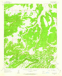
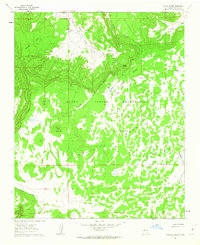
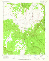
(60)- 1960 Map of South Butte, 1963 Print
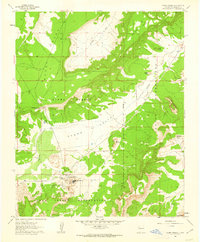
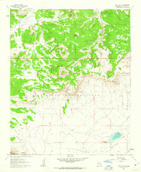 1960 South Butte1963 Print · USGSLaguna Pueblo lands in the early 1960s reveal a high-desert landscape shaped by traditional landmarks and vital water sources. Researchers can trace the cattle and water infrastructure of the era, from the Katama settlement to the Casp-Druma Dam and Kemp Santiago Spring.2 unique versions available
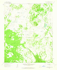
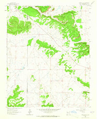
 - 1960 Map of Dough Mountain, 1963 Print
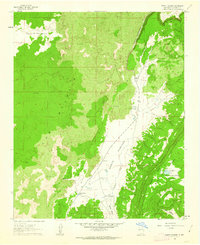
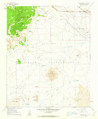 1960 Dough Mountain1963 Print · USGSThe high desert of the Laguna Indian Reservation is captured here during the transition to the interstate era. Researchers can trace the path of the Atchison Topeka and Santa Fe past Mesitá Blanca and the South Laguna Mines.2 unique versions available
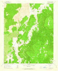
 - 1960 Map of Cerro Verde, 1963 Print
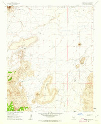
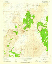 1960 Cerro Verde1963 Print · USGSThe northern Laguna Indian Reservation meets a stark volcanic landscape in the early sixties. Researchers can trace the ranching infrastructure of this arid terrain, from the Homestead Windmill and Rock Tank Windmill to the peaks of Cerro Verde and Black Mesa.2 unique versions available
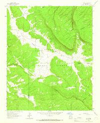
 - 1961 Map of Marquez, 1963 Print
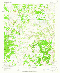
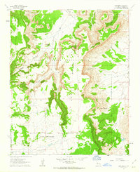
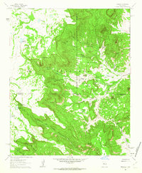 1961 Marquez1963 Print · USGSCibola County’s high mesas and deep canyons are documented here in the early sixties, centered on the settlement of Marquez. Genealogists and historians can trace family-named landmarks like Gallegos Bridge, the Cem, and the intricate Las Cuevas de Marquez.2 unique versions available
 - 1961 Map of Acoma Pueblo, 1963 Print
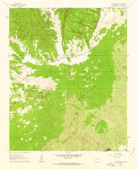
 1961 Acoma Pueblo1963 Print · USGSThe ancient community of Acoma Pueblo is documented in the early 1960s, showing the settlement and its surrounding mesa landscape. Researchers can trace the proximity of Acoma Village to landmarks like Mesa Encantada and Dinosaur Rock.2 unique versions available
 - 1961 Map of North Pasture, 1963 Print
 1961 North Pasture1963 Print · USGSCibola County ranching and volcanic geology are documented in the early sixties as the lava flows of The Malpais meet the high bluffs of Cebolleta Mesa. Researchers can trace remote landmarks like Hole-In-The-Wall, the Natural Arch, and family-named water sites like the Henson No 2 Windmill.2 unique versions available
 - 1961 Map of Marmon Ranch, 1963 Print
 1961 Marmon Ranch1963 Print · USGSThe high-desert ranchlands of the Laguna Indian Reservation come into focus in the early sixties. Researchers can trace the legacy of remote outposts and water management at Marmon Ranch, Alberta Homestead, and the Badger Dam.2 unique versions available
 - 1961 Map of La Gotera, 1963 Print
 1961 La Gotera1963 Print · USGSSandoval and Valencia counties are documented here in the early sixties, showing a landscape of historical land grants and high-country ranching. Genealogists and historians can locate family landmarks like Evans Ranch, the Dorey Mine, and the site of Rancho Agua Blanca.2 unique versions available
 - 1961 Map of Crow Point, 1963 Print
 1961 Crow Point1963 Print · USGSThe Acoma Pueblo lands in the early sixties were a landscape of high plateaus and vital water sources reached only by trail. Trace the boundary between the Acoma Pueblo Indian Reservation and Acoma Purchase, and locate remote points like Negra Mesa Spring and Sky Spring.2 unique versions available
 - 1961 Map of Arrosa Ranch, 1963 Print
 1961 Arrosa Ranch1963 Print · USGSValencia County ranching and volcanic geology are frozen in time during the early sixties. Researchers can trace the layout of family lands like Arrosa Ranch and Porter Ranch against the dramatic backdrop of The Malpais and Bonita Canyon.
 - 1961 Map of East Mesa, 1963 Print
 1961 East Mesa1963 Print · USGSCibola County ranching and reservation lands are captured here in the early sixties, showing the complex boundary of the Acoma and Laguna peoples. Genealogists and historians can locate family-named landmarks like Sarracino Ranch and the Frank Paisano Spring.2 unique versions available
 - 1961 Map of Blue Mesa, 1963 Print
 1961 Blue Mesa1963 Print · USGSHigh-desert mesa country and tribal lands are documented here in the early 1960s, showing a landscape defined by vital water sources. Researchers can trace land boundaries and water rights at Indian Lake, Spider Spring, and the prominent Piñon Mountain.2 unique versions available
 - 1961 Map of Laguna Honda, 1963 Print
 1961 Laguna Honda1963 Print · USGSCibola County, New Mexico, is shown in the early sixties as a high-mesa landscape of ancestral sites and cattle tanks. Researchers can trace the geography of the Acoma Indian Reservation and locate features like the Kowina Ruins and Laguna Honda.2 unique versions available
 - 1961 Map of Laguna Canoneros, 1963 Print
 1961 Laguna Canoneros1963 Print · USGSHigh mesa territory and seasonal water sources define this region of New Mexico in the early sixties. Researchers can locate remote seasonal sites like Casa Fria and Cuate Camp or trace the drainages of Seboyeta Creek and Laguna Cañoneros.2 unique versions available
 - 1961 Map of Los Pilares, 1963 Print
 1961 Los Pilares1963 Print · USGSThe high desert of western New Mexico comes into focus during the early sixties, showing a landscape defined by volcanic flows and remote ranching. Trace ancestral sites and local landmarks from Los Pilares and Bibo Ranch to the Natural Arch.
 - 1961 Map of Cottonwood Canyon, 1981 Print
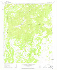
 1961 Cottonwood Canyon1981 Print · USGSCibola National Forest and the Continental Divide define this high-country landscape during the mid-twentieth century. Local researchers can trace family ranching history at Irvin Ranch and Coddington Ranch or locate the remote Graves near Cottonwood Canyon.
 - 1962 Map of Albuquerque
 1962 Albuquerque1962 Print · USGSAlbuquerque and the surrounding high desert are captured here in the early 1960s during a period of intense mineral and military growth. Genealogists and historians can locate early schools like the Pueblo Pintado School, major industrial sites like the Jackpile Mine, and the sprawling Kirtland Air Force Base.
 - 1962 Map of Socorro
 1962 Socorro1962 Print · USGSCentral New Mexico comes alive in the early sixties as the rail-and-river corridor of the Rio Grande connects historic pueblos and ranching towns. Local historians can trace the route of the Atchison Topeka and Santa Fe through Belen or locate the Torrance Mine near Mountainair.
 - 1962 Map of Gallup
 1962 Gallup1962 Print · USGSThe high plateau and mountains surrounding Gallup in the early sixties reveal a landscape defined by tribal lands, coal mining, and the rail corridor. Researchers can locate remote trading posts, the Gibson Coal Mine, and the historic Window Rock capital.
 - 1962 Map of Saint Johns
 1962 Saint Johns1962 Print · USGSEastern Arizona and the New Mexico borderlands come alive in the early sixties, showing a landscape of high-plateau ranching and early national monuments. Trace the path of the Atchison Topeka and Santa Fe or locate old water sources like Salado Springs and Lyman Reservoir.
 - 1962 Map of Cottonwood Canyon, 1966 Print
 1962 Cottonwood Canyon1966 Print · USGSThe high country of the Cibola National Forest is captured in the early sixties as it straddles the Continental Divide. Family historians and researchers can trace local ranching footprints at Irvin Ranch, Bass Ranch, and Poddington Ranch.
 - 1962 Map of Page, 1966 Print
 1962 Page1966 Print · USGSMcKinley and Valencia counties are captured here in the early sixties, showing a landscape of high ridges and isolated family homesteads. Genealogists and historians can locate specific sites like Radosevich Ranch, Navarre Place, and Bloomfield Flat along the Continental Divide.3 unique versions available
 - 1963 Map of San Mateo, 1965 Print
 1963 San Mateo1965 Print · USGSSan Mateo and its surrounding ranchlands are captured here in the early 1960s, showing a landscape defined by traditional land grants and desert water sources. Genealogists and historians can locate the San Mateo Mine, Marcus Ranch, and a CCC Camp near the foot of La Jara Mesa.4 unique versions available
 - 1963 Map of Togeye Lake, 1965 Print
 1963 Togeye Lake1965 Print · USGSThe McKinley and Valencia county borderlands come into focus in the 1960s, showing a high desert landscape shaped by ancient history and rugged geology. Researchers can locate Pueblo Ruins, the Mormon Ch, and natural landmarks like Los Gigantes.3 unique versions available
 - 1963 Map of Albuquerque, 1965 Print
 1963 Albuquerque1965 Print · USGSMid-century New Mexico unfolds across this map, showcasing the intersection of ancient pueblos, modern military bases, and historic mining districts. Trace family roots and local history through the Ortiz Mine, Seven Lakes Trading Post, and Alameda.3 unique versions available
Showing maps 1-25 of 60
Top cities of Cibola County
Frequently asked questions
- What are the different types of historical maps available for Cibola County?
- What is the oldest map of Cibola County?
- Where can I purchase historical maps of Cibola County for my home or office?
- Where can I download high-res historical maps of Cibola County?
- Are there historical topographic maps available for Cibola County?
- Is there historical aerial imagery available for Cibola County?
- Where are historical maps of Cibola County sourced from?