1970s Maps of Cibola County, New Mexico
Explore 23 historic maps of Cibola County from the 1970s. These maps offer a rare glimpse into what life looked like during the 1970s — showing old roads, neighborhoods, homes, and landmarks that have changed or disappeared over time.
Whether you're researching your family's past, planning a metal detecting trip, or studying how Cibola County's landscape evolved across the 1970s, these high-resolution maps are a powerful tool for exploring the history of this region.
- Focus on a specific era: All maps on this page are from the 1970s, giving you a focused view of this time period.
- See what’s changed: Compare century-old streets, trails, and buildings to today's modern landscape using overlays and satellite layers.
- Research with precision: Use these maps for genealogy, historical research, land use analysis, or educational projects.
- View, download, or print: Maps are fully viewable online in high resolution, and can be downloaded or printed for your own records.
Start exploring Cibola County's history through authentic maps from the 1970s. This is your window into the past.
Cibola County, NM maps
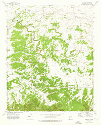
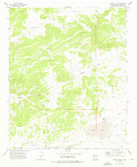
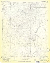
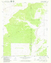
(23)- 1972 Map of Twentytwo Spring, 1976 Print
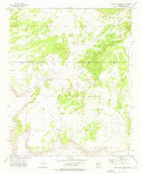 1972 Twentytwo Spring1976 Print · USGSWestern New Mexico rangeland is captured here in the early 1970s, showcasing the intricate system of water management in a high-desert environment. Researchers can trace remote ranching infrastructure such as the Roundtree Windmills, Twentytwo Spring, and Indian Tank.
 - 1972 Map of Upper Galestina Canyon, 1976 Print
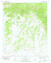
 1972 Upper Galestina Canyon1976 Print · USGSThe Zuni plateau in the early seventies shows a landscape defined by deep drainages and reservation boundaries. Researchers can trace historic water management features like the Upper Galestina No 7 Reservoir and the ECW No 7 Windmill.
 - 1972 Map of Plumasano Basin, 1976 Print
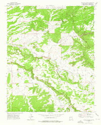
 1972 Plumasano Basin1976 Print · USGSThe Zuni high-desert country is captured here during the early seventies, detailing tribal lands and county divisions. Trace historical markers like the Old Indian Reservation Boundary alongside landforms like Pie Mesa and the Plumasano Basin.
 - 1972 Map of Fence Lake, 1976 Print
 1972 Fence Lake1976 Print · USGSFence Lake and the surrounding high desert of Valencia County are captured here during the early seventies. Trace local ranching history through water sources and landmarks like Atarque, East Malpais Windmill, and the dramatic Red Cliffs.
 - 1972 Map of Cerro Prieto, 1976 Print
 1972 Cerro Prieto1976 Print · USGSCatron County ranching country is captured here in the early seventies, showing a land of isolated homesteads and essential desert water sources. Researchers can trace family landmarks and cattle-country history at the Hubbell Ranch, Montaño Ranch, and the Apodaca Windmill.
 - 1972 Map of Fence Lake SW, 1976 Print
 1972 Fence Lake SW1976 Print · USGSWestern New Mexico ranching and water rights come into focus in the early 1970s along the border of Valencia and Catron counties. Researchers can trace historic water sources and property markers from Old Santa Rita Springs to the Cox Ranch and the small Cem near Nicolas Spring.
 - 1972 Map of The Dyke, 1976 Print
 1972 The Dyke1976 Print · USGSValencia County ranching and water infrastructure are documented in the early seventies, centered on the high desert plains. Researchers can trace historic family holdings and water sources like White Ranch, Gonzales Windmill, and the settlement at Lorenzo.
 - 1972 Map of Mesita De Yeso, 1976 Print
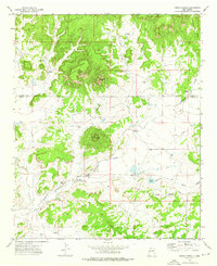
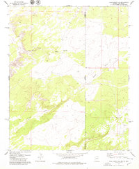
 1972 Mesita De Yeso1976 Print · USGSCibola County ranchlands are documented here in the early seventies, showing a vast network of water infrastructure across the arid range. Researchers can locate specific family-named landmarks like the Trujillo Windmill, High Lonesome Windmill, and East Joe Windmill.
 - 1972 Map of Cantaralo Spring, 1976 Print
 1972 Cantaralo Spring1976 Print · USGSHigh-desert ranching country in Valencia County is captured here in the early 1970s, showcasing the isolated outposts of the New Mexico interior. Researchers can trace the terrain around Mazón Camp and the winding paths of Jaralosa Draw and Aguaje Draw.
 - 1972 Map of Ojo Caliente Reservoir, 1976 Print
 1972 Ojo Caliente Reservoir1976 Print · USGSThe Zuni high desert is captured in the early 1970s, showcasing a landscape where water and boundary lines define the community. Researchers can trace the importance of springs and washes to the area around Ojo Caliente, from the Sacred Spring to the Ojo Caliente Reservoir.
 - 1972 Map of Atarque Lake, 1976 Print
 1972 Atarque Lake1976 Print · USGSWestern New Mexico ranching lands are captured here in the early 1970s, focused on the drainage of Atarque Lake. Researchers and genealogists can trace the rural infrastructure of Atarque Ranch and local water sources like Franciscan Windmill and Solomon Windmill.
 - 1972 Map of Shoemaker Canyon SE, 1976 Print
 1972 Shoemaker Canyon SE1976 Print · USGSValencia County’s high-desert landscape in the early seventies reveals a remote world of small outposts and ancestral markers. Genealogists and historians can locate the Mares Cemetery, the Las Norias Store, and the site of Los Pinitos (Ruins).
 - 1972 Map of Moreno Hill, 1976 Print
 1972 Moreno Hill1976 Print · USGSHigh desert ranching and resource extraction define this area of western New Mexico in the early seventies. Researchers can trace land use through features like Morelos Cem, the Pueblo Windmill, and numerous cattle tanks including Heffner Tank.
 - 1972 Map of Venadito Camp, 1976 Print
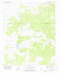
 1972 Venadito Camp1976 Print · USGSCibola County, New Mexico, is captured here in the early seventies, showing a ranching landscape bordering the Zuni Indian Reservation. Researchers can locate isolated landmarks like Venadito Camp, Venado Wells, and a lonely Grave south of the draw.
 - 1972 Map of Rincon Hondo, 1976 Print
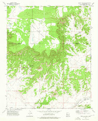
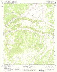
 1972 Rincon Hondo1976 Print · USGSThe high mesa country of western New Mexico is documented here in the early seventies, centered on the dramatic rifts of the Santa Rita Mesa. Researchers can locate the historic Fort Atarque Ruins, seasonal sites like Rincon Camp, and numerous named water sources like Jaralosa Spring.
 - 1972 Map of Shoemaker Canyon, 1976 Print
 1972 Shoemaker Canyon1976 Print · USGSThe Zuni and Ramah lands are captured here in the early 1970s, showing a high-desert landscape shaped by deep canyons and tribal boundaries. Researchers can locate archaeological sites like Ojo Pueblo (Ruins) and remote water features such as Miller Well.
 - 1978 Map of Barth Well
 1978 Barth Well1978 Print · USGSThe high desert borderlands of Arizona and New Mexico are captured in the late seventies, showing the sparse infrastructure of the Zuni Indian Reservation. Genealogists and researchers can trace isolated water sources like Barth Well and the Hellsappoppin Well along the Zuni River.
 - 1978 Map of Grants
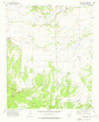
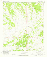
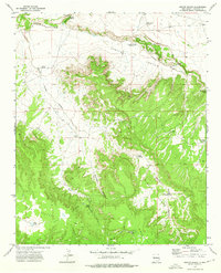
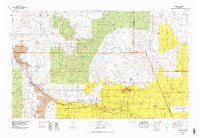 1978 Grants1978 Print · USGSWest-Central New Mexico is captured here in the late seventies as uranium mining and the railroad shaped the high desert landscape. Genealogists and historians can trace settlements from Grants to Laguna, including the Jackpile Mine and Acomita West Village.2 unique versions available
 - 1978 Map of Carrisito Spring
 1978 Carrisito Spring1978 Print · USGSThe Arizona-New Mexico state line runs through this remote high-desert region during the late 1970s. Local researchers can trace the drainage patterns of Little Blanco Canyon and locate isolated ranching landmarks like Carrisito Spring and various corrals.2 unique versions available
 - 1978 Map of Acoma Pueblo, 1979 Print
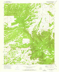
 1978 Acoma Pueblo1979 Print · USGSCibola and Valencia counties are captured here in the late seventies, showing a landscape of ancient pueblos and modern transit corridors. Genealogists and historians can trace the paths of U.S. 66 and the Atchison Topeka and Santa Fe RR past Acoma Pueblo and Suwanee.
 - 1978 Map of Valle Bonito NE, 1979 Print
 1978 Valle Bonito NE1979 Print · USGSThe Arizona and New Mexico state line bisects this high-desert landscape as it appeared in the late seventies. Researchers can locate remote ranching landmarks like Lynch Ranch and the water source at Pine Springs Well along Pine Springs Wash.2 unique versions available
 - 1979 Map of Barth Well
 1979 Barth Well1979 Print · USGSThe Arizona and New Mexico borderlands come alive in this late-seventies survey of the high desert and river canyons. Researchers can trace the winding Zuni River and locate isolated watering points like Hellsapoppin Well and Barth Lake.
 - 1979 Map of Ceadro Spring SE
 1979 Ceadro Spring SE1979 Print · USGSThe Arizona-New Mexico border country comes alive in the late 1970s, showcasing the high-desert terrain where the Zuni River meanders near the Zuni Indian Reservation. Local researchers can trace the intricate drainage of Venadito Draw and Jaralosa Draw across the Apache County line.2 unique versions available
End of results
Showing maps 1-23 of 23
Top cities of Cibola County
Frequently asked questions
- What are the different types of historical maps available for Cibola County?
- What is the oldest map of Cibola County?
- Where can I purchase historical maps of Cibola County for my home or office?
- Where can I download high-res historical maps of Cibola County?
- Are there historical topographic maps available for Cibola County?
- Is there historical aerial imagery available for Cibola County?
- Where are historical maps of Cibola County sourced from?