1950s Maps of Eddy County, New Mexico
Explore 27 historic maps of Eddy County from the 1950s. These maps offer a rare glimpse into what life looked like during the 1950s — showing old roads, neighborhoods, homes, and landmarks that have changed or disappeared over time.
Whether you're researching your family's past, planning a metal detecting trip, or studying how Eddy County's landscape evolved across the 1950s, these high-resolution maps are a powerful tool for exploring the history of this region.
- Focus on a specific era: All maps on this page are from the 1950s, giving you a focused view of this time period.
- See what’s changed: Compare century-old streets, trails, and buildings to today's modern landscape using overlays and satellite layers.
- Research with precision: Use these maps for genealogy, historical research, land use analysis, or educational projects.
- View, download, or print: Maps are fully viewable online in high resolution, and can be downloaded or printed for your own records.
Start exploring Eddy County's history through authentic maps from the 1950s. This is your window into the past.
Eddy County, NM maps
(27)- 1951 Map of Diamond Mound, 1953 Print
 1951 Diamond Mound1953 Print · USGSEddy and Chaves Counties are captured here in the early fifties, showing a landscape of high-desert ranching and alkaline basins. Researchers can locate remote outposts like Merritt Ranch and trace the drainage patterns of Derrick Draw and Flat Lake.
 - 1953 Map of Espuela, 1954 Print
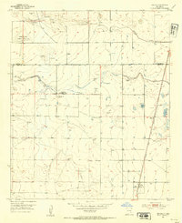 1953 Espuela1954 Print · USGSSoutheast New Mexico in the early fifties shows a landscape of artesian wells and shifting industry along the railroad. Researchers can locate the Cottonwood School, the Cottonwood Community Church, and the now-abandoned Walker Air Base Emergency Landing Field.2 unique versions available
 - 1953 Map of Basin Well, 1954 Print
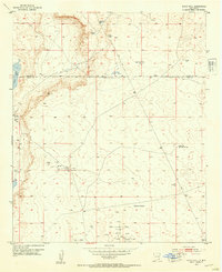 1953 Basin Well1954 Print · USGSSoutheast New Mexico ranching and oil exploration are documented here during the mid-fifties along the Chaves and Eddy County line. Researchers can locate remote desert water sources like Double Wells Tank and industrial markers ranging from a solitary Landing Strip to the High Lonesome Windmill.2 unique versions available
 - 1954 Map of Seven Rivers, 1956 Print
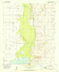
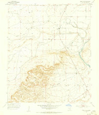 1954 Seven Rivers1956 Print · USGSEddy County ranching country is captured here in the mid-1950s, showing the critical junction where multiple river forks meet. Genealogists and historians can trace the original Seven Rivers area, including the Seven Rivers Cemetery and Major Johnson Springs.2 unique versions available
 - 1954 Map of Carlsbad, 1963 Print
 1954 Carlsbad1963 Print · USGSSoutheastern New Mexico's desert peaks and river valleys appear in this mid-century study of the borderlands. Researchers can locate vanished sites like Sacramento City, trace the Pecos River reservoirs, and explore Carlsbad Caverns.3 unique versions available
 - 1954 Map of Hobbs, 1963 Print
 1954 Hobbs1963 Print · USGSThe High Plains and Permian Basin transition is captured here at the height of the mid-century energy boom. Genealogists and industrial historians can trace the foundations of Humble City, locate the Potash Mine and Plant, and follow the Texas-New Mexico RR.2 unique versions available
 - 1954 Map of Van Horn, 1964 Print
 1954 Van Horn1964 Print · USGSThe Trans-Pecos region of West Texas comes into focus in the mid-1950s as a vital corridor of rail and desert commerce. Researchers can trace the path of the Texas and Pacific through Van Horn or locate remote rail sidings like Borracho and Laska Siding.2 unique versions available
 - 1955 Map of Artesia
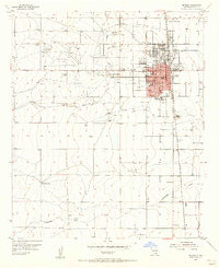 1955 Artesia1955 Print · USGSArtesia during the mid-fifties is a bustling railroad and refinery town where the city grid meets the vast Eddy County ranch lands. Genealogists and local historians can trace the foundations of the community through the Prisoner of War Camp, McKinstry Ranch, and neighborhood schools like Hermosa Sch.2 unique versions available
 - 1955 Map of Artesia NE, 1956 Print
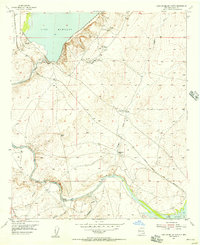
 1955 Artesia NE1956 Print · USGSThe high plains of Eddy and Chaves County come alive in the mid-1950s as the river valley meets early oil exploration. Trace the rail-and-river network from Lake Arthur down the Pecos River or locate the remote Oil Well and Oil Tank in the eastern flats.3 unique versions available
 - 1955 Map of Hope NW, 1956 Print
 1955 Hope NW1956 Print · USGSEddy and Chaves Counties in the mid-fifties show a landscape shaped by ranching and seasonal water. Genealogists and historians can trace isolated homesteads like the Kincaid Ranch and Runyan Place among the drainage of North Cottonwood Creek.
 - 1955 Map of Spring Lake, 1956 Print
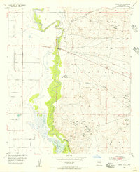 1955 Spring Lake1956 Print · USGSEddy County, New Mexico, is captured in the mid-fifties as the petroleum industry reshaped the Pecos River valley. Researchers can trace the extensive network of the Empire Oil Field and find specific landmarks like Spring Lake and the Gaging Station.3 unique versions available
 - 1955 Map of Red Lake SE, 1956 Print
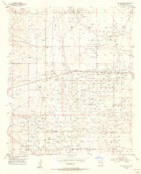 1955 Red Lake SE1956 Print · USGSMid-century Eddy County is defined here by the booming petroleum industry of the Permian Basin. Trace the extensive network of oil wells and pipelines serving the Loco Hills Gasoline Plant and the Maljamar Oil Field.2 unique versions available
 - 1955 Map of Dayton, 1956 Print
 1955 Dayton1956 Print · USGSEddy County ranching and rail life are captured here in the mid-fifties along the Rio Peñasco. Researchers can trace the Atchison Topeka and Santa Fe line through the settlement of Dayton and locate landmarks like the 100 Ranch.3 unique versions available
 - 1955 Map of Lake Mc Millan North, 1956 Print
 1955 Lake Mc Millan North1956 Print · USGSEddy County ranching and rail infrastructure are captured here in the mid-1950s as the Pecos River feeds into the reservoir. Researchers can trace the A T & S F railroad near Lakewood, find the Lewis Ranch, or locate water sources like Chalk Bluff Spring.2 unique versions available
 - 1955 Map of Lake Mc Millan South, 1956 Print
 1955 Lake Mc Millan South1956 Print · USGSEddy County in the mid-fifties is captured here as a landscape of essential river water and emerging industrial activity. Researchers can trace the legacy of the Pecos River through Adams Bend and locate active petroleum sites near Fanning Ranch.2 unique versions available
 - 1955 Map of Hope NE, 1956 Print
 1955 Hope NE1956 Print · USGSThe high plains along the Eddy and Chaves County line come into focus during the mid-1950s, revealing a landscape of ranching and water management. Researchers can locate the Nelson Landing Field, trace the winding Cottonwood Creek, and identify local industry at the Gravel Pit.2 unique versions available
 - 1955 Map of Hope, 1956 Print
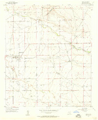
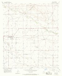 1955 Hope1956 Print · USGSIn the mid-1950s, the community of Hope was a hub for Eddy County ranching and irrigation in a landscape carved by Eagle Draw. Family history researchers can locate prominent holdings like Mc Ashan Ranch and the Hope South Cem.
 - 1955 Map of Red Lake, 1986 Print
 1955 Red Lake1986 Print · USGSEddy County petroleum production and ranching are captured here in the mid-1950s during a period of significant industrial expansion. Researchers can trace the footprint of the Red Lake Oil Field and Empire Oil Field or locate the Diamond A Ranch.
 - 1956 Map of Hope, 1957 Print
 1956 Hope1957 Print · USGSHope and its surrounding ranchlands are captured here in the mid-fifties, showing the vital irrigation systems that sustained this Eddy County community. Researchers can trace family sites like the Mc Ashan Ranch and Cole Place, or locate the Hope South Cem.2 unique versions available
 - 1956 Map of Parish Ranch, 1957 Print
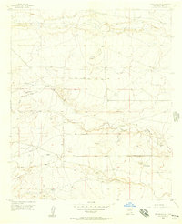 1956 Parish Ranch1957 Print · USGSEddy County ranching life in the mid-1950s was centered on the vital water sources and isolated homesteads of the New Mexico desert. Researchers can trace historic property boundaries and water infrastructure at Parish Ranch, Gardner, and along the banks of Rio Peñasco.2 unique versions available
 - 1956 Map of Antelope Sink, 1957 Print
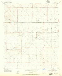
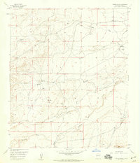
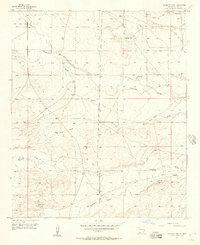 1956 Antelope Sink1957 Print · USGSEddy County ranching life in the mid-fifties is frozen in time on this detailed topographic study of the New Mexico high desert. Researchers can locate remote family landmarks like Runyan Ranch, trace the path of an ABANDONED CANAL, and find scattered water sources from Hilt Well to Antelope Sink.2 unique versions available
 - 1956 Map of Hope SE, 1957 Print
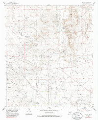
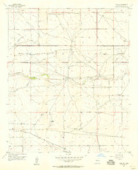 1956 Hope SE1957 Print · USGSEddy County ranching life in the mid-1950s is defined here by its water-security network and evolving transit infrastructure. You can trace early family holdings like Eaton Ranch or locate the Emergency Landing Field and Old Railroad Grade.2 unique versions available
 - 1957 Map of Foster Ranch, 1959 Print
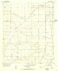
 1957 Foster Ranch1959 Print · USGSEddy County ranchlands and early oil exploration sites come into focus during the late fifties. Researchers can trace family-named landmarks like Foster Ranch and Knowles Place or locate the McDonald Cemetery and the Black Muley Mill amid the draws.2 unique versions available
 - 1957 Map of Box Canyon Ranch, 1959 Print
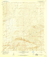 1957 Box Canyon Ranch1959 Print · USGSEddy County ranching life is frozen in time in the late fifties, showing a landscape defined by deep draws and isolated homesteads. Researchers can locate remote outposts like Box Canyon Ranch and Cass Ranch alongside desert landmarks such as Strychnine Draw.2 unique versions available
 - 1958 Map of Van Horn
 1958 Van Horn1958 Print · USGSWest Texas ranching and rail history come alive in this 1950s survey of the Trans-Pecos desert during the era of major steam-to-diesel transition. Genealogists and historians can trace family-named outposts like Mayfield Ranch or locate the ruins of Presidio Viejo along the Rio Grande.
Showing maps 1-25 of 27
Top cities of Eddy County
- Carlsbad historical maps
- Artesia historical maps
- Loving historical maps
- Hope historical maps
- Whites City historical maps
Frequently asked questions
- What are the different types of historical maps available for Eddy County?
- What is the oldest map of Eddy County?
- Where can I purchase historical maps of Eddy County for my home or office?
- Where can I download high-res historical maps of Eddy County?
- Are there historical topographic maps available for Eddy County?
- Is there historical aerial imagery available for Eddy County?
- Where are historical maps of Eddy County sourced from?