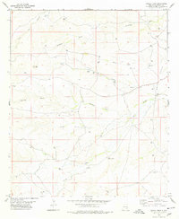
1970s Maps of Eddy County, New Mexico
Explore 19 historic maps of Eddy County from the 1970s. These maps offer a rare glimpse into what life looked like during the 1970s — showing old roads, neighborhoods, homes, and landmarks that have changed or disappeared over time.
Whether you're researching your family's past, planning a metal detecting trip, or studying how Eddy County's landscape evolved across the 1970s, these high-resolution maps are a powerful tool for exploring the history of this region.
- Focus on a specific era: All maps on this page are from the 1970s, giving you a focused view of this time period.
- See what’s changed: Compare century-old streets, trails, and buildings to today's modern landscape using overlays and satellite layers.
- Research with precision: Use these maps for genealogy, historical research, land use analysis, or educational projects.
- View, download, or print: Maps are fully viewable online in high resolution, and can be downloaded or printed for your own records.
Start exploring Eddy County's history through authentic maps from the 1970s. This is your window into the past.
Eddy County, NM maps
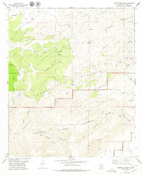
(19)- 1973 Map of Paduca Breaks NW, 1975 Print
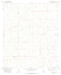
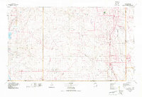
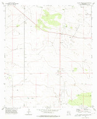 1973 Paduca Breaks NW1975 Print · USGSThe high desert along the New Mexico county line comes alive in the early 1970s as a hub for energy exploration. Researchers can trace the industrial footprint of the Double X Oil Field and locate isolated landmarks like Cotton Place and Jack Tank.
 - 1973 Map of Owl Hills, 1976 Print
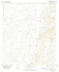
 1973 Owl Hills1976 Print · USGSThe Texas-New Mexico borderland comes into focus in the early 1970s, showing a landscape shaped by the Delaware River and high-desert ranching. Genealogists and historians can trace local landmarks like Prewit Ranch, Owl Spring, and early energy exploration at various Drill Hole sites.
 - 1973 Map of Paduca Breaks West, 1976 Print
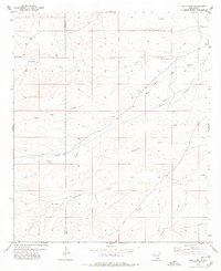
 1973 Paduca Breaks West1976 Print · USGSThe high-desert borderlands of New Mexico and Texas are captured in the early seventies during a period of active energy development. Genealogists and historians can trace the Battle-axe Ranch, early Paduca Oil Field wells, and isolated landmarks like Ross Place.
 - 1978 Map of Bandanna Point
 1978 Bandanna Point1978 Print · USGSSoutheast New Mexico in the late 1970s shows a landscape defined by ranching water and energy exploration. Researchers can trace the drainage networks of Last Chance Canyon and locate isolated water points like Pipkin Well, Wagontire, and Lower John Well.
 - 1978 Map of Grapevine Draw
 1978 Grapevine Draw1978 Print · USGSThe high desert canyons along the New Mexico and Texas border come into focus in the late 1970s. Explorers and researchers can locate specific cave entrances like Ogle Cave and New Cave, or trace water sources such as Grapevine Spring.
 - 1978 Map of Strychnine Draw
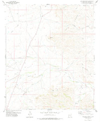
 1978 Strychnine Draw1978 Print · USGSEddy and Chaves counties are mapped in the late seventies, showing a landscape defined by ranching life and deep desert draws. Researchers can locate remote outposts like Strychnine Camp and trace the paths of Buzzard Canyon and Strychnine Draw.
 - 1978 Map of Artesia, 1979 Print
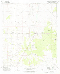
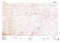 1978 Artesia1979 Print · USGSThe Pecos River valley in southeastern New Mexico comes alive in the late seventies, showing the intersection of rail-line agriculture and oil-field growth. Trace the path of the Atchison Topeka and Santa Fe through settlements like Dayton, Espuela, and Lakewood near Lake McMillan.
 - 1978 Map of Martha Creek, 1979 Print
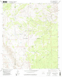
 1978 Martha Creek1979 Print · USGSEddy County’s high desert landscape comes into focus in the late 1970s, showing a terrain defined by energy extraction and ranching. Genealogists and local historians can trace the network of gas wells surrounding the Gas Plant and find landmarks like The Tepee, Weld Tank, and Cone Butte.
 - 1978 Map of Holt Tank, 1979 Print
 1978 Holt Tank1979 Print · USGSEddy and Chaves counties in the late 1970s reveal a landscape defined by ranching life and desert water management. Trace the historic infrastructure of Holt and Bullis alongside numerous water catchments like Holt Tank and Catclaw Draw.
 - 1978 Map of Jal, 1979 Print
 1978 Jal1979 Print · USGSSoutheast New Mexico in the late seventies is a landscape shaped by energy production and the rugged Llano Estacado. Genealogists and industrial historians can trace the growth of Jal and Eunice along the Texas-New Mexico RR and across the Jal Oil Field.
 - 1978 Map of Cawley Draw, 1979 Print
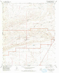
 1978 Cawley Draw1979 Print · USGSEddy County in the late 1970s reveals a high-desert landscape transition from traditional ranching to modern energy exploration. Researchers can trace land use through family-named landmarks like Fanning Draw and water sources such as CCC Tank and Raider Well.
 - 1979 Map of Queen
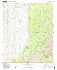
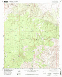 1979 Queen1979 Print · USGSThe settlement of Queen and the surrounding national forest are captured here in the late seventies. Researchers can trace land use through isolated sites like Putman Cabin, the Queen Cem, and the prominent Sitting Bull Falls.2 unique versions available
 - 1979 Map of Black River Village
 1979 Black River Village1979 Print · USGSSoutheast New Mexico in the late seventies is captured here as the gateway to the caverns meets a landscape of ranching and resource extraction. Researchers can locate the Smith Cem and trace water sources from Blue Spring to Black River Village.
 - 1979 Map of El Paso Gap
 1979 El Paso Gap1979 Print · USGSThe high desert and rugged escarpments of the New Mexico-Texas borderlands are captured here in the late seventies. Genealogists and historians can locate remote outposts like Hughes Ranch, the El Paso Gap Ch, and the high-elevation Guadalupe Mine.
 - 1979 Map of Pickett Hill
 1979 Pickett Hill1979 Print · USGSEddy and Otero counties meet in this 1970s survey of the high desert and canyon lands within the Lincoln National Forest. Genealogists and historians can trace the network of ranching infrastructure through features like Shattuck Well, Pickett Hill, and the dramatic escarpment of The Rim.
 - 1979 Map of Carlsbad
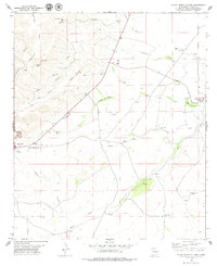
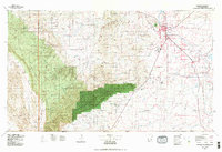 1979 Carlsbad1979 Print · USGSSoutheast New Mexico is captured here in the late seventies, showing the gateway to the caverns and the fertile Pecos Valley. Genealogists can trace family names near Black River Village or Otis, while collectors will find the Atchison Topeka and Santa Fe rail corridor and Avalon Lake clearly detailed.2 unique versions available
 - 1979 Map of Carlsbad Caverns
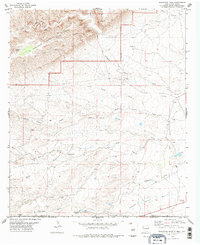
 1979 Carlsbad Caverns1979 Print · USGSEddy County in the 1970s is centered on the iconic gateway of Whites City and the surrounding high desert plateau. Researchers can trace the early tourism footprint at the Visitor Center and Cavern Entrance, or locate remote landmarks like Baldridge Well and Chimney Cave.2 unique versions available
 - 1979 Map of Serpentine Bends
 1979 Serpentine Bends1979 Print · USGSEddy County’s subterranean and high-desert landscapes are documented here in the late seventies. Researchers can trace land use at the X Bar Ranch and identify remote landmarks like Lechuguilla Cave, Goat Cave, and a lonely Cem.
 - 1979 Map of Gunsight Canyon, 1986 Print
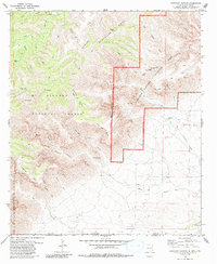 1979 Gunsight Canyon1986 Print · USGSThe high desert of Eddy County was documented in the late seventies as the backcountry of the Guadalupe Mountains was being managed for conservation and ranching. Genealogists and hikers can trace remote landmarks like Franks Spring, the Lookout Tower, and geologic features like the Upper Painted Grotto.
End of results
Showing maps 1-19 of 19
Top cities of Eddy County
- Carlsbad historical maps
- Artesia historical maps
- Loving historical maps
- Hope historical maps
- Whites City historical maps
Frequently asked questions
- What are the different types of historical maps available for Eddy County?
- What is the oldest map of Eddy County?
- Where can I purchase historical maps of Eddy County for my home or office?
- Where can I download high-res historical maps of Eddy County?
- Are there historical topographic maps available for Eddy County?
- Is there historical aerial imagery available for Eddy County?
- Where are historical maps of Eddy County sourced from?