1980s Maps of Eddy County, New Mexico
Explore 34 historic maps of Eddy County from the 1980s. These maps offer a rare glimpse into what life looked like during the 1980s — showing old roads, neighborhoods, homes, and landmarks that have changed or disappeared over time.
Whether you're researching your family's past, planning a metal detecting trip, or studying how Eddy County's landscape evolved across the 1980s, these high-resolution maps are a powerful tool for exploring the history of this region.
- Focus on a specific era: All maps on this page are from the 1980s, giving you a focused view of this time period.
- See what’s changed: Compare century-old streets, trails, and buildings to today's modern landscape using overlays and satellite layers.
- Research with precision: Use these maps for genealogy, historical research, land use analysis, or educational projects.
- View, download, or print: Maps are fully viewable online in high resolution, and can be downloaded or printed for your own records.
Start exploring Eddy County's history through authentic maps from the 1980s. This is your window into the past.
Eddy County, NM maps
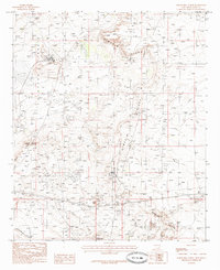
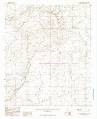
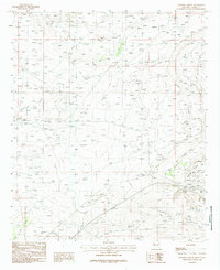
(34)- 1984 Map of Bootleg Ridge
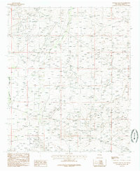
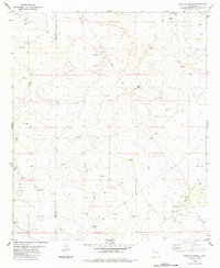 1984 Bootleg Ridge1984 Print · USGSSoutheastern New Mexico's high desert was a hub of energy production in the early eighties. Genealogists and historians can trace the industrial footprint of the Oil Field and Pipeline networks alongside natural landmarks like Bootleg Ridge and Hayfield Tank.
 - 1984 Map of Laguna Gatuna
 1984 Laguna Gatuna1984 Print · USGSThe high desert of the New Mexico state line is shown in the mid-1980s as a hub of energy production and salt basins. Researchers can trace the industrial footprint of the OIL FIELD and GAS FIELD alongside isolated landmarks like Salt Lake Ranch and Three Wells Windmill.
 - 1984 Map of The Divide
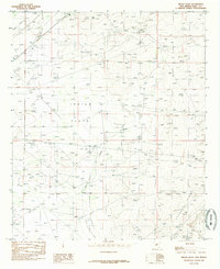
 1984 The Divide1984 Print · USGSThe high plains of the New Mexico borderlands are captured here in the mid-1980s, showcasing a landscape defined by energy and water. Researchers can trace the development of the Gas Field or locate historic watering spots like Rockbottom Tank and School Section Tanks.
 - 1985 Map of Kitchen Cove
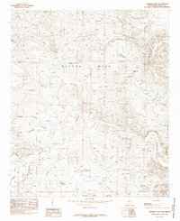
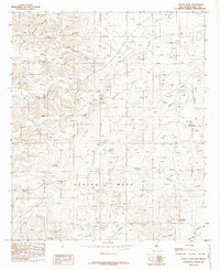
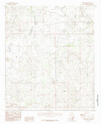
 1985 Kitchen Cove1985 Print · USGSEddy County ranchlands and energy fields are captured here during the mid-eighties as the region balanced aviation and resource extraction. Researchers can trace land use through features like the Sheep Draw Aqueduct, Yellow Jacket Spring, and the Carlsbad Cavern City Air Terminal.
 - 1985 Map of Tower Hill North
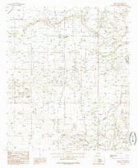
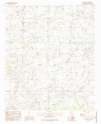
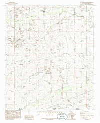
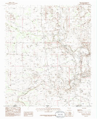
 1985 Tower Hill North1985 Print · USGSEddy County, New Mexico, was a landscape of high desert industry and ridgelines in the mid-eighties. Researchers can trace the development of the regional energy economy through the Gas Field, an Old Railroad Grade, and the small settlement of Stovall.
 - 1985 Map of Malaga
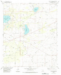
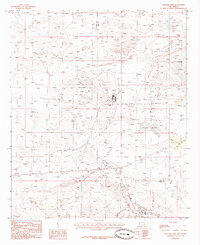
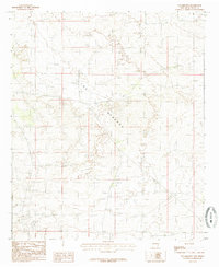
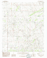
 1985 Malaga1985 Print · USGSEddy County in the mid-eighties shows a landscape shaped by the Pecos River and an intricate network of desert irrigation. Researchers can trace the layout of Malaga, locate the local Cem, and follow the paths of the Livingston Canal and Willow Lake.
 - 1985 Map of Otis
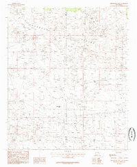
 1985 Otis1985 Print · USGSThe outskirts of Carlsbad and the rural community of Otis are captured in the mid-1980s as a landscape shaped by water and industry. Researchers can trace the engineering of the Southern Canal and locate specific sites like the local Radio Facility or regional Gravel Pits.
 - 1985 Map of Williams Sink
 1985 Williams Sink1985 Print · USGSSoutheastern New Mexico's industrial landscape is captured in the mid-eighties as the potash and oil fields shaped the terrain. Researchers can locate infrastructure like Mine Shafts, Tailings, and the expansive Laguna Plata.
 - 1985 Map of Greenwood Lake
 1985 Greenwood Lake1985 Print · USGSThe Querecho Plains of New Mexico are captured in the mid-1980s, showcasing a desert landscape heavily shaped by energy extraction. Researchers can trace the sprawling infrastructure of the Oil and Gas Field and locate landmarks like Greenwood Lake.
 - 1985 Map of Livingston Ridge
 1985 Livingston Ridge1985 Print · USGSEddy County’s high desert landscape is recorded here in the mid-1980s, centered on the prominent rise of Livingston Ridge. Researchers can trace the area's resource history through features like Mine Tailings, Nash Draw, and the isolated Nova Tank.
 - 1985 Map of Carnero Peak
 1985 Carnero Peak1985 Print · USGSEddy County ranching lands and high desert terrain come into focus in the mid-1980s. Researchers can trace the named water tanks and topographic landmarks of the area, from the heights of Carnero Peak to the deep cuts of Dark Canyon and Kuykendall Draw.
 - 1985 Map of Angel Draw
 1985 Angel Draw1985 Print · USGSEddy County, New Mexico, is captured in the late seventies and early eighties when desert drainage patterns defined the land. Trace the paths of Angel Draw and Palmilla Draw or locate landmarks like Indian Hill and the northern reach of Lake Avalon.
 - 1985 Map of Carlsbad East
 1985 Carlsbad East1985 Print · USGSMid-century development in Eddy County shows the desert transformed by the oil industry and river irrigation. Genealogists and historians can trace the growth of Carlsbad and La Huerta alongside the Carlsbad Oil Field and the Pecos River.
 - 1985 Map of Los Medanos
 1985 Los Medanos1985 Print · USGSEddy County, New Mexico, was a vast expanse of shifting dunes and desert solitude in the mid-eighties. Researchers can trace the path of the major Powerline and locate early resource extraction sites like the Gravel Pit among the sands of Los Medaños.
 - 1985 Map of Illinois Camp NE
 1985 Illinois Camp NE1985 Print · USGSEddy County, New Mexico, is captured here in the late seventies and early eighties during a period of energy infrastructure development. Local historians and land researchers can trace the routes of numerous pipelines and identify topographic landmarks like Bear Grass Draw and Palmilla Draw.
 - 1985 Map of Guadalupe Peak
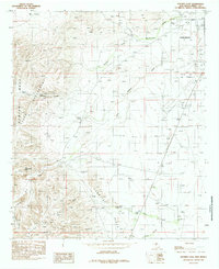
 1985 Guadalupe Peak1985 Print · USGSCulberson County and the rugged Trans-Pecos region are shown in the mid-1980s as a landscape of massive peaks and desert draws. Researchers can trace the historic Butterfield Trail, locate the Old Michigan Mine, and explore the high country of Guadalupe Peak.
 - 1985 Map of Indian Flats
 1985 Indian Flats1985 Print · USGSEddy County’s desert landscape is captured here in the mid-1980s, showing a mix of natural ridges and industrial utility. You can trace the path of an Abandoned Canal and find local landmarks such as Sand Point, Quahada Ridge, and the Pumping Sta.
 - 1985 Map of Azotea Peak
 1985 Azotea Peak1985 Print · USGSEddy County in the mid-1980s reveals a high-desert landscape of prominent mesas and deep canyon systems. Researchers can trace the importance of desert water sources at Boyds Waterhole and Walt Spring while locating high-elevation landmarks like Azotea Peak.
 - 1985 Map of Cottonwood Hills
 1985 Cottonwood Hills1985 Print · USGSThe high desert borderlands of the mid-eighties come alive on this map of the Cottonwood Hills and the state line. Researchers can trace the ranching life of the era through isolated landmarks like Ward Waterhole and Mc Bride Tank.
 - 1985 Map of Illinois Camp SE
 1985 Illinois Camp SE1985 Print · USGSEddy County during the mid-1980s shows the industrial character of the New Mexico oil patch. Researchers can trace extraction history through the Oil Field and mine shafts located near Quahada Ridge and Burton Flat.
 - 1985 Map of Remuda Basin
 1985 Remuda Basin1985 Print · USGSEddy County, New Mexico, is shown in the mid-1980s as a landscape of resource extraction and desert basins. Local historians can trace early industrial activity at the Gravel Pit and explore natural landmarks like Forty-niner Ridge and Salt Lake.
 - 1985 Map of Carlsbad West
 1985 Carlsbad West1985 Print · USGSThe western reaches of the Pecos River valley are documented here in the mid-eighties as urban growth begins to climb into the nearby hills. Local researchers can trace residential developments like Happy Valley or locate old water sources like Mc Kitric Spring and Mc Gruder Spring.2 unique versions available
 - 1985 Map of Red Bluff
 1985 Red Bluff1985 Print · USGSThe Pecos River valley at the New Mexico-Texas border is captured here during the mid-eighties, showing a landscape defined by water engineering and ranching infrastructure. Researchers can trace land use through features like Rock House Crossing, East Apple Tank, and the northern reaches of the Red Bluff Reservoir.
 - 1985 Map of Henshaw Tank
 1985 Henshaw Tank1985 Print · USGSThe high desert border of Chaves and Eddy counties is captured here in the late seventies, showing a landscape shaped by water engineering and industry. Researchers can trace the path of the Underground Aqueduct and locate landmarks like Henshaw Tank and several Gravel Pits.
 - 1985 Map of Hackberry Lake
 1985 Hackberry Lake1985 Print · USGSEddy County’s energy and mineral landscape is captured here in the mid-eighties as petroleum and potash production shaped the terrain. Researchers can trace infrastructure from the Hackberry Oil Field to specific sites like a Mine Shaft and the Aqueduct.
Showing maps 1-25 of 34
Top cities of Eddy County
- Carlsbad historical maps
- Artesia historical maps
- Loving historical maps
- Hope historical maps
- Whites City historical maps
Frequently asked questions
- What are the different types of historical maps available for Eddy County?
- What is the oldest map of Eddy County?
- Where can I purchase historical maps of Eddy County for my home or office?
- Where can I download high-res historical maps of Eddy County?
- Are there historical topographic maps available for Eddy County?
- Is there historical aerial imagery available for Eddy County?
- Where are historical maps of Eddy County sourced from?