1970s Maps of Quay County, New Mexico
Explore 25 historic maps of Quay County from the 1970s. These maps offer a rare glimpse into what life looked like during the 1970s — showing old roads, neighborhoods, homes, and landmarks that have changed or disappeared over time.
Whether you're researching your family's past, planning a metal detecting trip, or studying how Quay County's landscape evolved across the 1970s, these high-resolution maps are a powerful tool for exploring the history of this region.
- Focus on a specific era: All maps on this page are from the 1970s, giving you a focused view of this time period.
- See what’s changed: Compare century-old streets, trails, and buildings to today's modern landscape using overlays and satellite layers.
- Research with precision: Use these maps for genealogy, historical research, land use analysis, or educational projects.
- View, download, or print: Maps are fully viewable online in high resolution, and can be downloaded or printed for your own records.
Start exploring Quay County's history through authentic maps from the 1970s. This is your window into the past.
Quay County, NM maps
(25)- 1970 Map of Jordan, 1973 Print
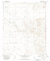
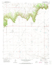
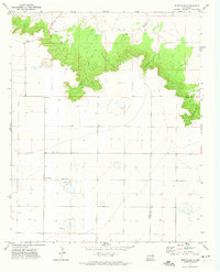
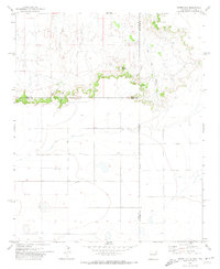
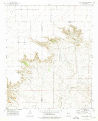
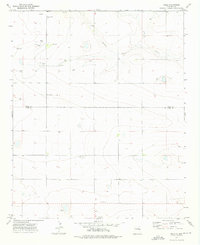
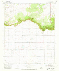 1970 Jordan1973 Print · USGSQuay County ranching country is documented here at the start of the 1970s, where the high plains break into deep canyons. Researchers can trace the family lands around Browning, locate the Browning Cem, and find ranching outposts like Bar B Ranch.
 - 1970 Map of Quay, 1973 Print
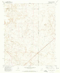
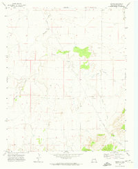
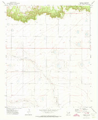
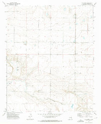
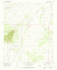 1970 Quay1973 Print · USGSQuay County ranching life is preserved here during the early seventies, showing a landscape shaped by mesas and creek beds. Researchers can locate the Quay post office and Brown Cem, or trace landmarks like Saddleback Mesa and the Orbeson Windmill.
 - 1970 Map of Circles S Mesa, 1973 Print
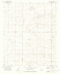
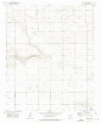
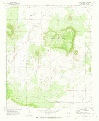 1970 Circles S Mesa1973 Print · USGSQuay County ranching country is captured here in the early seventies, showing a landscape of high mesas and broad flats. Genealogists and local historians can locate the West Cem, isolated family outposts like Fish Ranch, and the namesake Circle S Mesa.
 - 1970 Map of Cunavea Basin, 1973 Print
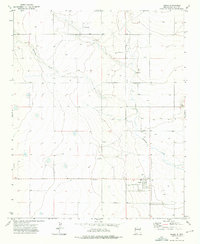
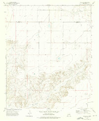
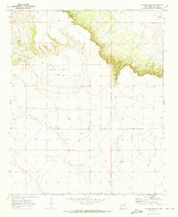 1970 Cunavea Basin1973 Print · USGSQuay County ranching land is documented here in the early 1970s, revealing a landscape defined by mesa breaks and sparse water. Researchers can trace land use through identified Wells and Tanks or locate natural features like Alamo Spring and Hart Springs.2 unique versions available
 - 1971 Map of Kerlin Hill, 1972 Print
 1971 Kerlin Hill1972 Print · USGSEastern New Mexico ranching country is documented here in the early seventies, spanning the border between Union and Quay counties. Researchers can trace family-named water sources like North Gregg Well and Laycock Well near the Egerton Ranch.2 unique versions available
 - 1971 Map of Doyle Hill, 1973 Print
 1971 Doyle Hill1973 Print · USGSThe high plains of the New Mexico-Texas border come into focus in the early seventies, showing a ranching landscape tied to the railroad. Genealogists and historians can trace family-named water sources like Patterson Well or Millican Well and locate isolated landmarks such as the Grave near the SAND HILLS.
 - 1971 Map of Obar, 1973 Print
 1971 Obar1973 Print · USGSEastern New Mexico's high plains are captured here in the early 1970s, focused on the rail-side community of Obar. Researchers can trace family-named water sources like Burkhart Well and Nelson Well or locate the Obar Cem along the Chicago Rock Island and Pacific tracks.
 - 1971 Map of Nara Visa, 1973 Print
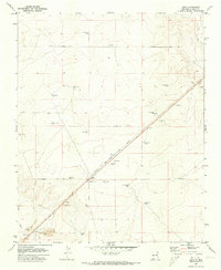
 1971 Nara Visa1973 Print · USGSThe ranching landscape of Quay County is documented here in the early 1970s, as the railroad still shaped the high plains. Genealogists and historians can trace family-named water sources like Jones Well and McAlister Well near Nara Visa.
 - 1971 Map of Ragland, 1974 Print
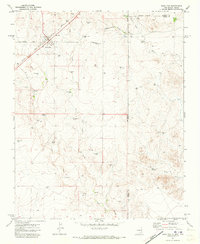
 1971 Ragland1974 Print · USGSQuay County in the early seventies shows a quiet ranching landscape defined by the sharp escarpment of Ragland Hill. Genealogists and local historians can locate the Prater Cem and trace the winding course of Blanco Creek and Frio Draw.2 unique versions available
 - 1971 Map of Mesa Redonda, 1974 Print
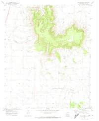 1971 Mesa Redonda1974 Print · USGSQuay County ranching lands in the early 1970s are defined here by the massive plateau of Mesa Redonda. Genealogists and historians can trace high-desert access routes like the Pack Trail and locate remote landmarks such as Barranca Creek and a hilltop Corral.
 - 1971 Map of Day Canyon, 1974 Print
 1971 Day Canyon1974 Print · USGSThe high plains of the New Mexico borderlands come to life in this early 1970s survey. Researchers can trace the rugged drainages of Day Canyon and Rusk Canyon or locate land features like Buffalo Lake and Round Mountain.
 - 1971 Map of Apache Canyon, 1974 Print
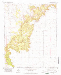 1971 Apache Canyon1974 Print · USGSQuay County ranchlands and breaks come into focus during the early seventies, centered on the dramatic erosion of Apache Canyon. Researchers can pinpoint the Brown Cem and trace the drainage paths of Saladito Creek and Dog Creek.
 - 1971 Map of Wheatland, 1974 Print
 1971 Wheatland1974 Print · USGSThe high plains of the New Mexico borderlands meet the break of the caprock in the early seventies. Genealogists and local historians can locate the Wheatland Cem and trace the winding paths of Horseshoe Cave Canyon and Tipton Canyon.
 - 1971 Map of Norton, 1974 Print
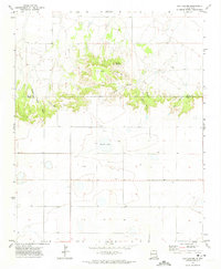
 1971 Norton1974 Print · USGSQuay County ranch land and high plains topography are captured here in the early 1970s. Local researchers can locate the settlement of Norton, find the Puerto Cem, and trace the rugged course of Barranca Creek and Dog Canyon.
 - 1971 Map of Grady, 1974 Print
 1971 Grady1974 Print · USGSEastern New Mexico's high plains are documented here in the early seventies, centered on the village of Grady. Researchers can trace the local footprint of the town, from its central Park and Storage Bins to the nearby Cem and Substa.
 - 1971 Map of Grady SW, 1974 Print
 1971 Grady SW1974 Print · USGSThe High Plains of Eastern New Mexico are captured in the early 1970s as a landscape of ranching and utility infrastructure. Genealogists and researchers can locate the settlement of Watts, a lone Cemetery, and remote features like Landing Strips.2 unique versions available
 - 1971 Map of Endee Hill, 1974 Print
 1971 Endee Hill1974 Print · USGSThe New Mexico and Texas state line meets at this high plains escarpment during the early seventies. Genealogists and local historians can locate Mitchel Cem and trace livestock water sources from Arroyo Trujillo to Salt Well Canyon.
 - 1971 Map of Forrest, 1974 Print
 1971 Forrest1974 Print · USGSQuay County ranching country is documented here in the early 1970s, showing the intersection of high plains agriculture and deep desert draws. Genealogists and local historians can trace family ties at Plain Cem and Beevers Cem or locate the small settlement of Forrest.2 unique versions available
 - 1973 Map of Weber City, 1975 Print
 1973 Weber City1975 Print · USGSThe High Plains of eastern New Mexico were a network of family-named water sources and ranching outposts in the 1970s. Trace local roots and land use near Weber City through features like Yeakley Cemetery, Capps Lake, and several historic wells.2 unique versions available
 - 1973 Map of House, 1975 Print
 1973 House1975 Print · USGSHouse and the surrounding High Plains of Quay County are captured in the early seventies as a hub of rural ranching and aviation. Researchers can trace the town's footprint, locate the House Cem, and find industrial markers like Gravel Pit and scattered Landing Strips.
 - 1973 Map of Peach Canyon, 1975 Print
 1973 Peach Canyon1975 Print · USGSEastern New Mexico ranching country is documented here in the early 1970s at the intersection of Quay, De Baca, and Roosevelt counties. Researchers can locate remote landmarks like Peach Canyon Spring, a solitary Grave, and the winding path of Sand Creek.
 - 1973 Map of Mc Alister, 1975 Print
 1973 Mc Alister1975 Print · USGSQuay County ranching and small-town life are preserved in this early 1970s survey of the New Mexico plains. Researchers can locate the McAlister Cem and trace the drainage of Alamosa Creek near Caballo Lake and the settlement of McAlister.2 unique versions available
 - 1973 Map of Field SW, 1976 Print
 1973 Field SW1976 Print · USGSThe high plains of eastern New Mexico meet in the early seventies at the junction of three counties. Genealogists and land researchers can trace property boundaries and livestock infrastructure like a Silo, remote Well sites, and the course of Alamosa Creek.2 unique versions available
 - 1973 Map of House SE, 1976 Print
 1973 House SE1976 Print · USGSThe eastern New Mexico plains and the deep canyons of Alamosa Creek are captured here in the early 1970s. Researchers can trace the high-country boundary of Quay and Roosevelt counties and locate specific ranching Wells used during this era.2 unique versions available
 - 1973 Map of Field, 1976 Print
 1973 Field1976 Print · USGSThe high plains of the Quay and Curry county line come into focus during the early seventies. Genealogists and local historians can trace family-named sites like Grandmother Well or Cornet Well and locate the isolated Field Cem near Field.
End of results
Showing maps 1-25 of 25
Top cities of Quay County
Frequently asked questions
- What are the different types of historical maps available for Quay County?
- What is the oldest map of Quay County?
- Where can I purchase historical maps of Quay County for my home or office?
- Where can I download high-res historical maps of Quay County?
- Are there historical topographic maps available for Quay County?
- Is there historical aerial imagery available for Quay County?
- Where are historical maps of Quay County sourced from?