Old Maps of Quay County, New Mexico for Genealogy
Trace your family roots with 444 historic maps of Quay County. These high-res maps reveal old neighborhoods, homesites, landmarks, and streets — helping you uncover where your ancestors lived and how the area evolved over time.
- Explore historic neighborhoods: Identify where your relatives may have lived in the 1800s or 1900s.
- Compare maps over time: Trace the changes in streets, buildings, and landmarks for multi-generational research.
- Perfect for genealogy & ancestry research: Used by family historians and researchers to map out lineage and migration.
These maps are an incredible resource for exploring your personal connection to Quay County's past.
Quay County, NM maps
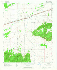
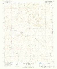
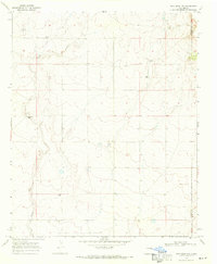
(444)- 1930 Map of Tucumcari
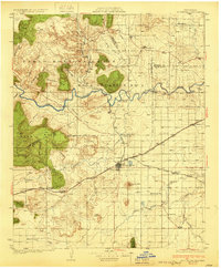 1930 Tucumcari1930 Print · USGSTucumcari and the surrounding ranch lands of eastern New Mexico are captured here during the peak of the steam rail era. Genealogists and historians can trace family-named sites like the Elliott Ranch, remote schools such as Bryantine Sch, and the winding Canadian River corridor.2 unique versions available
 - 1954 Map of Santa Fe, 1963 Print
 1954 Santa Fe1963 Print · USGSNew Mexico's high mountains and eastern plains meet in the mid-fifties, showing a landscape defined by the Sangre de Cristo Mountains and the Pecos River. Trace family roots and local history through San Christobal Church, Sena School, and the historic Las Vegas rail corridor.4 unique versions available
 - 1954 Map of Fort Sumner, 1964 Print
 1954 Fort Sumner1964 Print · USGSEast-central New Mexico's ranching and rail heartland is captured here in the mid-1950s, centered on the strategic junctions of the high plains. Researchers can trace the development of early highway networks and rail towns like Vaughn, Fort Sumner, and the copper operations at Guadalupe Mine.3 unique versions available
 - 1954 Map of Tucumcari, 1965 Print
 1954 Tucumcari1965 Print · USGSThe high plains along the New Mexico and Texas border come alive in this mid-century survey, just as the regional highway network was maturing. Trace the historic route of U.S. 66 through Glenrio and San Jon or locate remote rail sidings like Rehm Station and Obar.2 unique versions available
 - 1954 Map of Clovis, 1966 Print
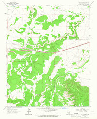
 1954 Clovis1966 Print · USGSThe High Plains of the Texas-New Mexico borderland come alive in this mid-century survey as the region's agricultural and rail networks reached their peak. Trace family roots and local history through features like Cannon AFB, the massive Sand Hills, and busy rail towns such as Friona and Littlefield.4 unique versions available
 - 1957 Map of Hammond Ranch, 1958 Print
 1957 Hammond Ranch1958 Print · USGSCurry County ranching country comes into focus in the mid-1950s, highlighting a landscape of isolated homesteads and ephemeral draws. Genealogists and researchers can locate family sites like Hammond Ranch and the uniquely named Denton Ranch (The Buzzard Roost).
 - 1958 Map of Fort Sumner
 1958 Fort Sumner1958 Print · USGSEast-central New Mexico in the mid-fifties is captured here as a sprawling landscape of high mesas and cattle ranching. Researchers can trace the convergence of the Southern Pacific railroad at Vaughn and locate family landmarks like Borica School or Marquez Ranch.
 - 1958 Map of Santa Fe
 1958 Santa Fe1958 Print · USGSThe Sangre De Cristo Mountains meet the high plains in the late 1950s, showing a landscape defined by rail corridors and ranching. Genealogists can trace family-named sites like Upton Ranch or visit the Fort Union (Ruins) and Tuloso School.
 - 1958 Map of Clovis
 1958 Clovis1958 Print · USGSThe High Plains of the New Mexico-Texas borderlands are captured here in the late fifties, during a period of significant military and agricultural expansion. Genealogists and historians can trace the rail-side growth of Clovis, the operations at Clovis Air Force Base, and the rural layout of communities like Muleshoe and Hereford.
 - 1958 Map of Tucumcari
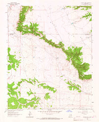
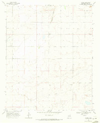
 1958 Tucumcari1958 Print · USGSEastern New Mexico and the Texas Panhandle meet in this mid-century survey of the high plains ranching and rail corridor. Researchers can trace the path of Mother Road travelers through Tucumcari and Glenrio or locate remote rail stops like Nara Visa Station and Hartley Station.
 - 1962 Map of Logan, 1966 Print
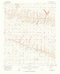
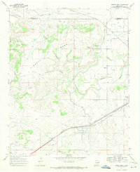
 1962 Logan1966 Print · USGSQuay County ranching and rail life are documented here in the early sixties, centered on the Logan river crossing. Researchers can trace historic family holdings like Pyle Ranch and Martinez Springs or locate the Anniston Cem near the southern plains.
 - 1964 Map of Muniz Canyon, 1966 Print
 1964 Muniz Canyon1966 Print · USGSSan Miguel County ranchlands are captured here in the mid-1960s, showing a landscape defined by mesa edges and water infrastructure. Researchers can locate named family landmarks and stock tanks including Smith Windmill, Muniz Tank, and the Mesa Rica Camp.
 - 1964 Map of Gate Canyon, 1967 Print
 1964 Gate Canyon1967 Print · USGSGuadalupe County ranching and rail transport are captured here in the mid-1960s as the high desert landscape undergoes modernization. Researchers can locate remote family landmarks like Knowles Windmill, the Roman Camp settlement, and the old Chicago Rock Island and Pacific rail line.
 - 1964 Map of Montoya, 1967 Print
 1964 Montoya1967 Print · USGSEastern New Mexico ranching and railroading are captured here in the mid-1960s as the modern interstate began to parallel old Route 66. Genealogists can trace family landmarks like Juana de Darca Ch or cattle operations centered at Headquarters Windmill and Registered Windmill.
 - 1964 Map of Ortega Tank, 1967 Print
 1964 Ortega Tank1967 Print · USGSGuadalupe and San Miguel counties appear here in the mid-1960s, showing a landscape of high mesas and cattle ranching infrastructure. Trace family names and historic land use through sites like Mitchell Windmill, Padilla Tank, and the Benavidez Windmills.
 - 1966 Map of Cherokee Valley, 1969 Print
 1966 Cherokee Valley1969 Print · USGSQuay County ranching and water management are frozen in time on this mid-century survey of the New Mexico high plains. Family researchers can locate early homesteads like Kaufman Ranch or trace the Cherokee Valley Cemetery and numerous family-named landmarks.
 - 1966 Map of Lockney, 1969 Print
 1966 Lockney1969 Print · USGSQuay County ranching country is captured here in the mid-1960s, showing a landscape defined by isolated wells and desert draws. Genealogists and local historians can locate specific family-named landmarks like Willis Well, Keyes Well, and the Lockney (Site).
 - 1966 Map of Mc Carty Ranch, 1969 Print
 1966 Mc Carty Ranch1969 Print · USGSThe high plains of the Harding and Quay county border are captured here in the mid-1960s, showing a landscape defined by ranching and water. Genealogists and local historians can trace family-named landmarks like Tom Young Well, Casados Well, and the McCarty Ranch.
 - 1966 Map of Mc Cloy Ranch, 1969 Print
 1966 Mc Cloy Ranch1969 Print · USGSHarding and Quay counties are depicted in the mid-1960s as a specialized landscape of cattle ranching and water management. Researchers can trace historic water sources and property boundaries through labels like the Old Church Well, McCloy Ranch, and Whorial Blanca Well.2 unique versions available
 - 1967 Map of Trinchera Creek, 1971 Print
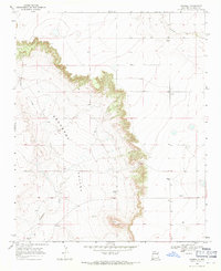
 1967 Trinchera Creek1971 Print · USGSSan Miguel County ranch lands and the winding Canadian River are documented here in the late sixties. Researchers can trace land grant boundaries and vital water sources like the Chappell-Spade Ranch, the Old Railroad Grade, and Trinchera Well.
 - 1967 Map of Liberty Mesa, 1971 Print
 1967 Liberty Mesa1971 Print · USGSQuay County ranching and rail infrastructure are on full display during the late sixties, showing the vital irrigation networks north of Tucumcari. Genealogists and historians can trace family landmarks like the Leslie Windmill or local sites such as the Drive-in Theater and Liberty.
 - 1967 Map of Tucumcari, 1971 Print
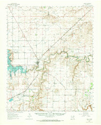
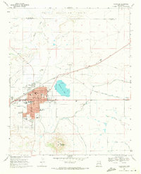 1967 Tucumcari1971 Print · USGSTucumcari was a vital rail and ranching center in the late sixties, where the high plains meet essential irrigation networks. Researchers can trace the development of the city's schools and neighborhoods near landmarks like Tucumcari Mountain and Tucumcari Lake.
 - 1968 Map of Hassell, 1971 Print
 1968 Hassell1971 Print · USGSQuay County ranching country is captured here in the late sixties, showing the isolated homesteads and burial grounds of the High Plains. Researchers can locate family landmarks like Urton Ranch and the small Lone Mesa Cem or Gerhardt Cem.
 - 1968 Map of Twin Mesa NW, 1971 Print
 1968 Twin Mesa NW1971 Print · USGSDe Baca and Quay counties are captured here in the late sixties, showcasing a landscape shaped by high-desert ranching. Researchers can locate family landmarks like Locust Grove Cem, Weaver Ranch, and the Drum and Bley Ranch.
 - 1968 Map of Porter, 1971 Print
 1968 Porter1971 Print · USGSThe rural plains of Quay County are captured in the late sixties, showing the small settlement of Porter and the winding Tuscocillo Canyon. Researchers can trace old utility lines like the local PIPELINE and identify specific family ranching resources including numerous wells.
Showing maps 1-25 of 444
Top cities of Quay County
Frequently asked questions
- What are the different types of historical maps available for Quay County?
- What is the oldest map of Quay County?
- Where can I purchase historical maps of Quay County for my home or office?
- Where can I download high-res historical maps of Quay County?
- Are there historical topographic maps available for Quay County?
- Is there historical aerial imagery available for Quay County?
- Where are historical maps of Quay County sourced from?