2000s (21st Century) Maps of San Miguel County, New Mexico
Explore 534 historic maps of San Miguel County from the 2000s (21st Century). These maps offer a rare glimpse into what life looked like during the 2000s — showing old roads, neighborhoods, homes, and landmarks that have changed or disappeared over time.
Whether you're researching your family's past, planning a metal detecting trip, or studying how San Miguel County's landscape evolved across the 2000s, these high-resolution maps are a powerful tool for exploring the history of this region.
- Focus on a specific era: All maps on this page are from the 2000s, giving you a focused view of this time period.
- See what’s changed: Compare century-old streets, trails, and buildings to today's modern landscape using overlays and satellite layers.
- Research with precision: Use these maps for genealogy, historical research, land use analysis, or educational projects.
- View, download, or print: Maps are fully viewable online in high resolution, and can be downloaded or printed for your own records.
Start exploring San Miguel County's history through authentic maps from the 2000s. This is your window into the past.
San Miguel County, NM maps
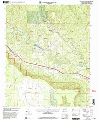
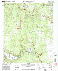
(534)- 2002 Map of Elk Mountain, 2003 Print
 2002 Elk Mountain2003 Print · USGSSan Miguel County's high country is captured here during the early 2000s, showcasing the transition from protected wilderness to forest lands. Researchers can locate remote features like the Electronic Site on Elk Mountain, a Mine near Hollinger Canyon, and the Rio Mora Flats.
 - 2002 Map of San Geronimo, 2003 Print
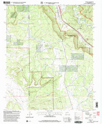
 2002 San Geronimo2003 Print · USGSSan Miguel County settlements and high forest terrain are captured here at the turn of the millennium. Genealogists and hikers can trace the rural layout of San Geronimo and San Pablo, or locate landmarks like Mineral Hill and the Lookout Tower near Bartilas Peak.
 - 2002 Map of Montezuma, 2003 Print
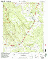
 2002 Montezuma2003 Print · USGSSan Miguel County at the turn of the millennium remains a landscape of deep canyons and historic land grants. Local historians can trace the foundations of Montezuma, locate the Sagrado Corazon Ch, and explore the legacy of the Las Vegas Grant.
 - 2002 Map of Lower Colonias, 2003 Print
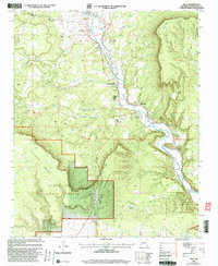
 2002 Lower Colonias2003 Print · USGSSan Miguel County ranching and forest lands are captured here as they appeared at the start of the millennium. Genealogists and local historians can locate Lower Colonias, the Santo Niño Cem, and the high-elevation Brazel Park.
 - 2002 Map of Pecos, 2003 Print
 2002 Pecos2003 Print · USGSUpper New Mexico at the dawn of the millennium shows a landscape defined by monastic peace and ancient ruins. Genealogists and historians can trace family locations from La Cueva to East Pecos, or locate the Terrero Mill (Site) and Cem.2 unique versions available
 - 2002 Map of North San Ysidro, 2003 Print
 2002 North San Ysidro2003 Print · USGSSan Miguel County at the turn of the millennium shows a landscape defined by the Pecos River and deep-rooted land grants. Researchers can trace the Santa Fe National Historic Trail through the settlements of Ilfeld, Gise, and North San Ysidro.
 - 2002 Map of Honey Boy Ranch, 2003 Print
 2002 Honey Boy Ranch2003 Print · USGSSan Miguel County ranch lands and high valleys are preserved here during the early 2000s, showing the intersection of private holdings and public forest. Researchers can trace the drainages of Cow Creek to find Honey Boy Ranch, Emerson Ranch, and various mineral Prospects.
 - 2002 Map of Leyba, 2003 Print
 2002 Leyba2003 Print · USGSSan Miguel County ranching and forest lands are revealed in this early 2000s survey of the high mesa country. Genealogists and historians can locate the San Francisco Church in Leyba, or trace remote sites like Vigil and the Shelly Hayes Camp.
 - 2002 Map of Laguna Ortiz, 2003 Print
 2002 Laguna Ortiz2003 Print · USGSSan Miguel County ranch lands are shown at the start of the new millennium as they intersect with the Santa Fe National Forest. Researchers can trace remote homesteads and water infrastructure including Clark Ranch, White Ranch, and Laguna Ortiz.
 - 2002 Map of Rosilla Peak, 2003 Print
 2002 Rosilla Peak2003 Print · USGSThe Pecos River valley north of Pecos reveals its secluded ranching and forest history at the dawn of the millennium. Researchers can trace family-named landmarks like Martin Ranch and Brush Ranch, or locate the historic El Macho (Site) and Terrero settlement.
 - 2002 Map of Ojitos Frios, 2003 Print
 2002 Ojitos Frios2003 Print · USGSSan Miguel County ranching culture and high-desert terrain are mapped here at the turn of the millennium. Researchers can locate the Ojitos Frios post office, the Santo Niño Church at La Manga, and the historic Box Ranch.
 - 2002 Map of Sapello, 2003 Print
 2002 Sapello2003 Print · USGSUpper San Miguel County comes into focus as a network of historic land grants and canyon-side villages at the turn of the millennium. Genealogists can trace family connections through sites like San Ignacio Cem, the Brother of Jesus Mission, and settlements at Las Tusas and Tierra Monte.
 - 2002 Map of Apache Springs, 2003 Print
 2002 Apache Springs2003 Print · USGSUpper San Miguel County in the early 2000s shows a landscape still defined by historic land grants and high desert mesa topography. Trace the ancestral sites of Lagunita and Aurupa, or locate family landmarks near Apache Springs and Anton Chico Creek.
 - 2002 Map of Rowe, 2003 Print
 2002 Rowe2003 Print · USGSSan Miguel County at the start of the millennium retains its deep western roots, anchored by the river and the rail. Researchers can trace the path of the Historic Santa Fe Trail or locate family sites like Rowe Cem and Archuleta Ranch.
 - 2002 Map of El Porvenir, 2003 Print
 2002 El Porvenir2003 Print · USGSSan Miguel County at the turn of the millennium shows a landscape defined by mountain ranching and wilderness retreats. Genealogists and local historians can trace family-named sites like Trujillo Ranch and Beisman Ranch or locate the San Antonio Ch near El Porvenir.
 - 2002 Map of Tecolote, 2003 Print
 2002 Tecolote2003 Print · USGSUpper San Miguel County comes into focus in this modern era revision, showcasing the deep-rooted settlements and old land grants of northern New Mexico. Researchers can trace the Santa Fe National Historic Trail as it passes Serafina and Bernal near the prominent Starvation Peak.
 - 2002 Map of San Jose, 2003 Print
 2002 San Jose2003 Print · USGSThis San Miguel County landscape near the turn of the millennium shows a deep intersection of Spanish land grant history and early American transport. Genealogists and historians can trace the traditional settlements of San Jose and Ribera alongside the Santa Fe National Historic Trail and the Atchison Topeka and Santa Fe RR.
 - 2002 Map of Cowles, 2003 Print
 2002 Cowles2003 Print · USGSHigh in the mountains of San Miguel County just after the millennium, this area shows a unique mix of remote wilderness and seasonal mountain retreats. You can trace the path of the Pecos River, locate the historic Tererro Mine, and find secluded spots like the Winsor Creek Summer Home Area.
 - 2002 Map of San Juan, 2003 Print
 2002 San Juan2003 Print · USGSSan Miguel County ranching country and the Pecos River valley appear here in a detailed late twentieth-century update. Researchers can locate family outposts like T Gallegos Ranch and Romero Ranch alongside the high plateaus of Mesa Segura.
 - 2002 Map of Rencona, 2003 Print
 2002 Rencona2003 Print · USGSRanching life and forest management define this corner of San Miguel County at the start of the twenty-first century. Genealogists and local historians can trace legacy holdings like Witte Ranch, Padilla Ranch, and the Douthit Place among the draws and canyons.
 - 2002 Map of Sena, 2003 Print
 2002 Sena2003 Print · USGSSan Miguel County's river-valley life is on display in this early 2000s survey of the Pecos corridor. Researchers can trace traditional water rights through the Ribera Ditch and locate historic village centers like San Miguel and Upper Pueblo.
 - 2002 Map of Aurora, 2003 Print
 2002 Aurora2003 Print · USGSHigh mesas and deep canyons define this portion of San Miguel County at the turn of the twenty-first century. Genealogists and local historians can locate early family holdings like Gonzales Ranch and Pablo Sena Ranch alongside landmarks like Bustos Well.
 - 2002 Map of Villanueva, 2003 Print
 2002 Villanueva2003 Print · USGSVillanueva and the surrounding San Miguel County landscape are shown here as they appeared at the turn of the millennium. Researchers can trace historic land grants and riverfront settlements like El Cerrito or locate the Villanueva Cem and Laguñita Springs.
 - 2002 Map of Rociada, 2003 Print
 2002 Rociada2003 Print · USGSUpper Rociada and the surrounding mountain valleys are captured here at the turn of the millennium as traditional ranching landscapes met modern forest management. Genealogists and researchers can locate family sites at Villa San Pio X, Harvey Ranch, and the San Jose Cem.
 - 2010 Map of Onava, 2010 Print
 2010 Onava2010 Print · USGSCovers San Miguel County, including Kroenigs, Onava, and other nearby areas
Showing maps 1-25 of 534
Top cities of San Miguel County
Frequently asked questions
- What are the different types of historical maps available for San Miguel County?
- What is the oldest map of San Miguel County?
- Where can I purchase historical maps of San Miguel County for my home or office?
- Where can I download high-res historical maps of San Miguel County?
- Are there historical topographic maps available for San Miguel County?
- Is there historical aerial imagery available for San Miguel County?
- Where are historical maps of San Miguel County sourced from?