1900s (20th Century) Maps of San Miguel County, New Mexico
Explore 111 historic maps of San Miguel County from the 1900s (20th Century). These maps offer a rare glimpse into what life looked like during the 1900s — showing old roads, neighborhoods, homes, and landmarks that have changed or disappeared over time.
Whether you're researching your family's past, planning a metal detecting trip, or studying how San Miguel County's landscape evolved across the 1900s, these high-resolution maps are a powerful tool for exploring the history of this region.
- Focus on a specific era: All maps on this page are from the 1900s, giving you a focused view of this time period.
- See what’s changed: Compare century-old streets, trails, and buildings to today's modern landscape using overlays and satellite layers.
- Research with precision: Use these maps for genealogy, historical research, land use analysis, or educational projects.
- View, download, or print: Maps are fully viewable online in high resolution, and can be downloaded or printed for your own records.
Start exploring San Miguel County's history through authentic maps from the 1900s. This is your window into the past.
San Miguel County, NM maps
(111)- 1930 Map of Tucumcari
 1930 Tucumcari1930 Print · USGSTucumcari and the surrounding ranch lands of eastern New Mexico are captured here during the peak of the steam rail era. Genealogists and historians can trace family-named sites like the Elliott Ranch, remote schools such as Bryantine Sch, and the winding Canadian River corridor.2 unique versions available
 - 1954 Map of Santa Fe, 1963 Print
 1954 Santa Fe1963 Print · USGSNew Mexico's high mountains and eastern plains meet in the mid-fifties, showing a landscape defined by the Sangre de Cristo Mountains and the Pecos River. Trace family roots and local history through San Christobal Church, Sena School, and the historic Las Vegas rail corridor.4 unique versions available
 - 1954 Map of Tucumcari, 1965 Print
 1954 Tucumcari1965 Print · USGSThe high plains along the New Mexico and Texas border come alive in this mid-century survey, just as the regional highway network was maturing. Trace the historic route of U.S. 66 through Glenrio and San Jon or locate remote rail sidings like Rehm Station and Obar.2 unique versions available
 - 1958 Map of Santa Fe
 1958 Santa Fe1958 Print · USGSThe Sangre De Cristo Mountains meet the high plains in the late 1950s, showing a landscape defined by rail corridors and ranching. Genealogists can trace family-named sites like Upton Ranch or visit the Fort Union (Ruins) and Tuloso School.
 - 1958 Map of Tucumcari
 1958 Tucumcari1958 Print · USGSEastern New Mexico and the Texas Panhandle meet in this mid-century survey of the high plains ranching and rail corridor. Researchers can trace the path of Mother Road travelers through Tucumcari and Glenrio or locate remote rail stops like Nara Visa Station and Hartley Station.
 - 1960 Map of Villanueva, 1962 Print
 1960 Villanueva1962 Print · USGSThe Pecos River valley in the early sixties maintains its traditional network of villages and acequia irrigation ditches. Genealogists and historians can trace family locations across the San Miguel Del Bado Tract and find settlements like Sena, El Cerrito, and San Miguel.
 - 1960 Map of Apache Springs, 1962 Print
 1960 Apache Springs1962 Print · USGSSan Miguel County ranching and mesa country are captured here in the early sixties, showing a landscape shaped by canyons and cattle. Trace old family sites and rural infrastructure at San Augustin, Los Montoyas, and the Armstrong Ranch Hdqrs.
 - 1961 Map of San Geronimo, 1965 Print
 1961 San Geronimo1965 Print · USGSSan Miguel County ranching and forest lands are captured here in the early 1960s. Genealogists and researchers can locate the San Geronimo settlement, the local Cem, and family landmarks such as Shearer Ranch and Fisher Hill.2 unique versions available
 - 1961 Map of El Porvenir, 1965 Print
 1961 El Porvenir1965 Print · USGSSan Miguel County's mountain canyon country is mapped here in the early sixties, showing a landscape of high retreats and early ranching. Researchers can locate family outposts like Trujillo Ranch, the San Antonio Ch, and the Western Life Camp.
 - 1961 Map of Montezuma, 1965 Print
 1961 Montezuma1965 Print · USGSSan Miguel County in the early 1960s reveals a landscape defined by the rugged interface of the La Sierrita canyons and the waters of Gallinas Creek. Genealogists and historians can trace traditional settlements like Los Vigiles, El Llano, and the landmarks of Montezuma.2 unique versions available
 - 1961 Map of Honey Boy Ranch, 1966 Print
 1961 Honey Boy Ranch1966 Print · USGSSan Miguel County ranch lands and forest depths are captured here in the early sixties before modern development reached these high valleys. Genealogists and historians can trace old homesteads like Honey Boy Ranch and Emerson Ranch along the winding Rito Manzanares.3 unique versions available
 - 1961 Map of Rosilla Peak, 1966 Print
 1961 Rosilla Peak1966 Print · USGSSan Miguel County high country is documented here in the early sixties as the mountain economy balanced ranching and mining. Researchers can locate the Jones Mine, the site at El Macho, and old riverside settlements like Terrero and Tres Lagunas.3 unique versions available
 - 1961 Map of Ojitos Frios, 1966 Print
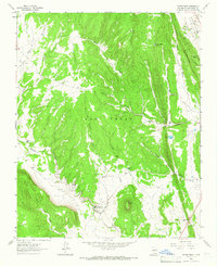 1961 Ojitos Frios1966 Print · USGSSan Miguel County is captured here in the early sixties, showing the rural ranching life and early settlements southwest of Las Vegas. Researchers can trace the grounds of Ojitos Frios, locate the Santo Niño Ch, and follow the ridge of The Creston.
 - 1961 Map of Pecos, 1966 Print
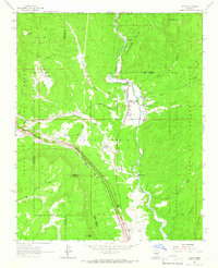 1961 Pecos1966 Print · USGSNorthern New Mexico's cultural and natural geography is meticulously documented here in the early sixties. Genealogists and historians can trace family locations in Pecos or East Pecos while identifying landmarks like the Benedictine Monastery and Pecos State Monument Ruins.2 unique versions available
 - 1961 Map of Lower Colonias, 1966 Print
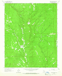 1961 Lower Colonias1966 Print · USGSSan Miguel County ranching and rural life are preserved here as they were in the early sixties, centered on the drainage of Cow Creek. Researchers can locate Lower Colonias (Pine PO), the Santo Niño Cem, and remote outposts like Kay Bar Ranch.2 unique versions available
 - 1961 Map of Cowles, 1966 Print
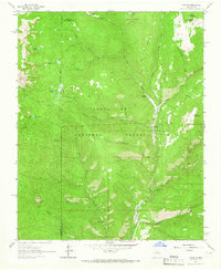 1961 Cowles1966 Print · USGSThe Sangre de Cristo foothills near the San Miguel and Santa Fe county lines appear here in the early sixties, centered on the Pecos River. You can trace alpine trails to Spirit Lake or locate the historic Panchuela Ranger Station and Cowles settlement.4 unique versions available
 - 1963 Map of Lake Isabel, 1964 Print
 1963 Lake Isabel1964 Print · USGSThe Mora and San Miguel county line in the early 1960s reveals a quiet landscape of ranch land and river valleys. Genealogists and researchers can locate Our Lady of Guadalupe Ch, Sapello Cem, and the old Las Vegas Grant Boundary.
 - 1963 Map of Las Vegas SE, 1964 Print
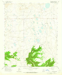 1963 Las Vegas SE1964 Print · USGSSan Miguel County ranch lands are captured here in the early sixties, showing a landscape defined by family estates and high-desert drainage. Genealogists and historians can trace holdings like Leatherwood Ranch and Lewis Ranch or locate Ruins near the springs.2 unique versions available
 - 1963 Map of Las Vegas, 1965 Print
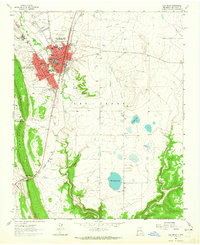 1963 Las Vegas1965 Print · USGSLas Vegas, New Mexico, serves as a bustling rail and trail hub in the early sixties. Genealogists and historians can trace family sites from Romeroville to the campus of Highlands University and along the historic Santa Fe Trail.
 - 1963 Map of Jacinto Mesa, 1965 Print
 1963 Jacinto Mesa1965 Print · USGSSan Miguel and Torrance counties meet in this early 1960s survey of high-plains ranching country. Researchers can trace the water-rights and land-use history of the era through family landmarks like Trujillo Ranch, Maes Ranch, and Nicholas Tank.
 - 1963 Map of Pedro Miguel Peak, 1965 Print
 1963 Pedro Miguel Peak1965 Print · USGSGuadalupe and San Miguel counties are captured in the early 1960s as the high desert landscape was defined by large land grants and cattle ranching. Trace the intersections of the Anton Chico Grant and remote outposts like Sowell Ranch and North Camp.
 - 1963 Map of Las Vegas NW, 1965 Print
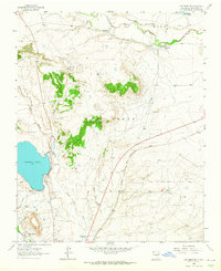 1963 Las Vegas NW1965 Print · USGSNorth of the city in the early sixties, this area shows the historic intersection of the Old Santa Fe Trail and the high-altitude irrigation of the Storrie Lake project. Researchers can locate St Anthonys Cemetery, the Santo Nino Ch, and early aviation at the Las Vegas Municipal Airport.
 - 1963 Map of Cactus Tank, 1965 Print
 1963 Cactus Tank1965 Print · USGSSan Miguel County ranching country is captured here in the early sixties, showing the land use across the Mesa Antonio Ortiz Montoya. Researchers can trace old livestock infrastructure and remote outposts like Alamito Camp, the Big Red Windmill, and a secluded Cem.
 - 1963 Map of Mesa Cherisco, 1965 Print
 1963 Mesa Cherisco1965 Print · USGSThe ranchlands along the San Miguel and Guadalupe county line are captured here in the early sixties. Researchers can trace the water-dependent settlement of this high plateau through family landmarks like Boylan Ranch, Pino Spring, and the prominent Mesa Cherisco.2 unique versions available
 - 1963 Map of Horse Pasture Tank, 1965 Print
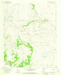 1963 Horse Pasture Tank1965 Print · USGSGuadalupe and San Miguel Counties are seen here as a network of mid-century ranching outposts and remote stock tanks. Genealogists and local historians can trace the landscape of the Anton Chico Grant, identifying sites like Alamito Camp, Payne Ranch, and the Pecos River.2 unique versions available
Showing maps 1-25 of 111
Top cities of San Miguel County
Frequently asked questions
- What are the different types of historical maps available for San Miguel County?
- What is the oldest map of San Miguel County?
- Where can I purchase historical maps of San Miguel County for my home or office?
- Where can I download high-res historical maps of San Miguel County?
- Are there historical topographic maps available for San Miguel County?
- Is there historical aerial imagery available for San Miguel County?
- Where are historical maps of San Miguel County sourced from?