Old Maps of Sandoval County, New Mexico for Metal Detecting
Plan your next treasure hunt with 651 historic maps of Sandoval County. Find old homesites, ghost towns, trails, and gathering spots that may be lost to time — perfect for identifying promising metal detecting locations.
- Locate forgotten sites: Uncover places like long-lost settlements, abandoned rail lines, or gathering spots.
- Plan better hunts: Use map overlays combined with LiDAR or satellite views to narrow in on historically rich areas.
- Made for detectorists: Thousands of hobbyists use these maps to discover relics, coins, and hidden history.
Use these historic maps to boost your research and find new opportunities beneath the surface of Sandoval County.
Sandoval County, NM maps
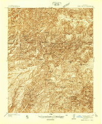
(651)- 1883 Map of Mt. Taylor
 1883 Mt. Taylor1883 Print · USGSThe high-desert frontier of New Mexico comes to life in the 1880s, centered on the towering Mt Taylor. Researchers can trace the early path of the Atlantic and Pacific Railroad and locate settlements like Old Fort Wingate and Laguna.
 - 1886 Map of Mt. Taylor
 1886 Mt. Taylor1886 Print · USGSNorthwestern New Mexico in the mid-1880s reveals a high-desert territory where early rail commerce meets long-standing mountain settlements. Researchers can trace the path of the Atlantic and Pacific Railroad past Old Fort Wingate and the historic villages of Laguna and Cebolletta.
 - 1888 Map of Bernalillo, 1951 Print
 1888 Bernalillo1951 Print · USGSThe Middle Rio Grande valley appears here in the late nineteenth century, just as the railroad began to reshape the high desert. Genealogists and historians can trace the early footprints of Albuquerque, Bernalillo, and traditional communities like Atrisco and Santa Ana.
 - 1889 Map of Albuquerque
 1889 Albuquerque1889 Print · USGSAlbuquerque and the Rio Grande Valley appear here during the expansion of the territorial railroad system. Local historians can trace the early rail corridor of the Atchison Topeka and Santa Fe Railroad and find early river settlements like Bernalillo, Alameda, and Artisco.
 - 1889 Map of Largo
 1889 Largo1889 Print · USGSNorthwestern New Mexico in the late nineteenth century shows a vast network of desert canyons and river valleys before modern development. Genealogists and researchers can trace early settlements like Bloomfield and Largo or locate landmarks such as Angels Peak and the remote Stinking Lakes Sinks.
 - 1890 Map of Jemes
 1890 Jemes1890 Print · USGSUpper New Mexico in the late nineteenth century was a land of high mesas and ancient pueblo sites along the Jemes Creek drainage. Researchers can trace the early layout of Jemes Pueblo, the location of the San Miguel Mine, and traditional springs like Ojo del Oso.2 unique versions available
 - 1892 Map of San Pedro
 1892 San Pedro1892 Print · USGSNew Mexico's high desert and mountain mining districts come alive in the late nineteenth century as the rail lines reached the interior. Genealogists and historians can trace old wagon routes and rail stops near Dolores, the mining activity at Golden, and early adobe settlements like Algodones and San Pedro.5 unique versions available
 - 1892 Map of Jemes
 1892 Jemes1892 Print · USGSThe high canyons and pueblos of northern New Mexico are documented here in the late 1880s, shortly after the region's territorial reorganization. Researchers can trace the early footprint of Jemes Pueblo, locate the San Miguel Mine, and identify remote springs like Ojo del Espiritu Santo.4 unique versions available
 - 1892 Map of Santa Clara
 1892 Santa Clara1892 Print · USGSUpper New Mexico at the end of the nineteenth century reveals a landscape shaped by the Rio Grande and the arrival of the rails. Genealogists and historians can trace traditional settlements like San Ildefonso and Peña Blanca alongside the burgeoning Santa Fé Southern Railway.4 unique versions available
 - 1892 Map of Mt. Taylor, 1896 Print
 1892 Mt. Taylor1896 Print · USGSNorthwestern New Mexico in the late nineteenth century was a territory of rail expansion and ancient volcanic landmarks. Researchers can trace the path of the Atlantic and Pacific Railroad past Old Fort Wingate and the pueblo at Laguna.
 - 1893 Map of Albuquerque
 1893 Albuquerque1893 Print · USGSThe Rio Grande valley in the late nineteenth century is a study in river-fronting settlements and the emerging rail economy. Genealogists can trace the early footprints of Albuquerque, Bernalillo, and the traditional community at Artisco.5 unique versions available
 - 1895 Map of Largo, 1897 Print
 1895 Largo1897 Print · USGSNorthwestern New Mexico appears as a rugged frontier of canyons and high peaks in the years before statehood. Researchers can trace early settlements at Bloomfield and Largo or locate iconic landmarks such as El Huerfano and the headwaters of Canon Largo.3 unique versions available
 - 1899 Map of Mt. Taylor
 1899 Mt. Taylor1899 Print · USGSNorthwestern New Mexico in the late nineteenth century is a landscape of vast mesas and early rail stops before modern highways arrived. Genealogists and historians can trace the foundations of Grant, San Mateo, and Old Fort Wingate along the Santa Fe Pacific Railroad.5 unique versions available
 - 1909 Map of Gallina
 1909 Gallina1909 Print · USGSUpper New Mexico at the end of the territorial era is captured here, showing the remote ranching and mining country along the Continental Divide. Genealogists and historians can locate early homesteads like Hart Ranch, the mining-era Copper City, and ancient Cliff Dwellings.2 unique versions available
 - 1918 Map of Abiquiu
 1918 Abiquiu1918 Print · USGSUpper Rio Arriba County comes alive in the years following the Great War, showing a network of historic land grants and riverside villages. Researchers can trace the path of the D. and R. G. R. R. or locate ancestral roots in Abiquiu, Vallecitos, and San Juan.
 - 1934 Map of Alameda
 1934 Alameda1934 Print · USGSThe Rio Grande valley in the mid-1930s reveals a landscape of deep-rooted land grants and modernizing infrastructure. Genealogists and historians can trace the irrigation ditches around Alameda and find landmarks like the Nazareth Sanatorium and KOB Radio Transmitter.
 - 1934 Map of Griegos
 1934 Griegos1934 Print · USGSThe Rio Grande valley north of Albuquerque is shown here in the mid-thirties as a landscape of historic land grants and complex irrigation. Genealogists and historians can trace the early rail-and-road network near Hahn Station and the Alameda Bridge.
 - 1937 Map of Jemez Springs
 1937 Jemez Springs1937 Print · USGSThe Jemez Mountains in the late thirties were a landscape of geothermal activity and sprawling land grants. Researchers can trace historic family outposts like Boyd Ranch and Ruiz Ranch or locate New Deal-era sites such as the CCC Camp.
 - 1938 Map of Albuquerque
 1938 Albuquerque1938 Print · USGSAlbuquerque and the Rio Grande Valley are shown in the late 1930s, when irrigation ditches still defined the rural landscape between the river and the mountains. Researchers can trace ancestral lands through the Town of Atrisco Grant or locate landmarks like the U S Indian School and Old Albuquerque.
 - 1939 Map of La Ventana, 1957 Print
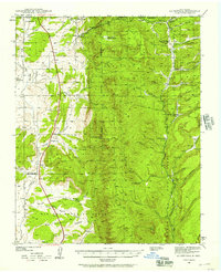 1939 La Ventana1957 Print · USGSSandoval County at the end of the Depression era shows a landscape where high-desert ranching meets mountain timber and mining. Genealogists and historians can trace old homesteads and work sites like Señorita, the Luciani Mines, and the Ojitos Logging Camp.2 unique versions available
 - 1939 Map of San Ysidro, 1958 Print
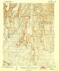
 1939 San Ysidro1958 Print · USGSCentral New Mexico in the late 1930s is revealed here as a land of sprawling Indian Reservations and high-desert ranching. Genealogists and historians can trace family locations at Rincon Ranch, locate the CCC Camp No 8 N, or follow the Santa Fe Northwestern rail line.
 - 1940 Map of Cuba, 1962 Print
 1940 Cuba1962 Print · USGSNorthwestern New Mexico’s high country is captured here just before the mid-century, where the Santa Fe National Forest meets early ranching outposts. Researchers can trace ancestral locations at the Gallina Cem, Capulin Sch, and remote sites like Old Mestas Ranch.2 unique versions available
 - 1943 Map of San Ysidro
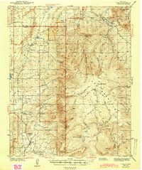
 1943 San Ysidro1943 Print · USGSSandoval County in the late 1930s is a landscape of high-altitude ranching and rugged mountain passes just as the local rail industry began to fade. Researchers can trace the Santa Fe Northwestern rail grade or locate remote outposts like CCC Camp No 8 N and Marquez Ranch.
 - 1943 Map of Jemez
 1943 Jemez1943 Print · USGSSandoval County at the end of the 1930s shows a landscape of expansive pueblo grants and former rail corridors. You can trace the Santa Fe Northwestern (RR Abandoned) line and locate the Paliza C C C Camp and Spanish Queen Mine.4 unique versions available
 - 1943 Map of Cuba
 1943 Cuba1943 Print · USGSIn the Sandoval County high country during the early 1940s, ranching outposts and small mountain settlements were the heart of the community. You can trace the locations of historic rural education sites like La Jara Sch and find family landmarks such as Old Meatas Ranch and Vallecito Damian.2 unique versions available
Showing maps 1-25 of 651
Top cities of Sandoval County
- Rio Rancho historical maps
- Bernalillo historical maps
- Corrales historical maps
- Cuba historical maps
- Peña Blanca historical maps
- Jemez Springs historical maps
See more
Frequently asked questions
- What are the different types of historical maps available for Sandoval County?
- What is the oldest map of Sandoval County?
- Where can I purchase historical maps of Sandoval County for my home or office?
- Where can I download high-res historical maps of Sandoval County?
- Are there historical topographic maps available for Sandoval County?
- Is there historical aerial imagery available for Sandoval County?
- Where are historical maps of Sandoval County sourced from?