1970s Maps of Sandoval County, New Mexico
Explore 18 historic maps of Sandoval County from the 1970s. These maps offer a rare glimpse into what life looked like during the 1970s — showing old roads, neighborhoods, homes, and landmarks that have changed or disappeared over time.
Whether you're researching your family's past, planning a metal detecting trip, or studying how Sandoval County's landscape evolved across the 1970s, these high-resolution maps are a powerful tool for exploring the history of this region.
- Focus on a specific era: All maps on this page are from the 1970s, giving you a focused view of this time period.
- See what’s changed: Compare century-old streets, trails, and buildings to today's modern landscape using overlays and satellite layers.
- Research with precision: Use these maps for genealogy, historical research, land use analysis, or educational projects.
- View, download, or print: Maps are fully viewable online in high resolution, and can be downloaded or printed for your own records.
Start exploring Sandoval County's history through authentic maps from the 1970s. This is your window into the past.
Sandoval County, NM maps
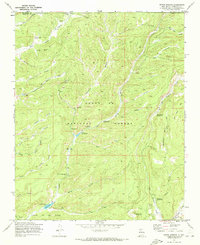
(18)- 1970 Map of Redondo Peak, 1973 Print
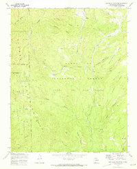
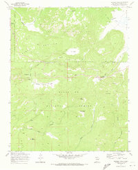 1970 Redondo Peak1973 Print · USGSHigh in the Jemez Mountains during the 1970s, this area shows the intersection of private land grants and national forest lands. Researchers can trace historic ranch boundaries like Baca Location No 1 alongside landmarks like Headquarters Ranch and the Cerro Pelado Lookout.4 unique versions available
 - 1970 Map of Bear Springs Peak, 1973 Print
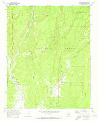
 1970 Bear Springs Peak1973 Print · USGSSandoval County in the early seventies reveals a high-altitude landscape of timber and tribal lands. Genealogists and historians can trace the remote Eliza Seligman Camp and the Bear Springs Guard Station among the peaks of the Santa Fe National Forest.2 unique versions available
 - 1970 Map of Loma Creston, 1973 Print
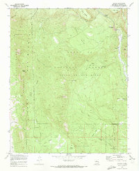
 1970 Loma Creston1973 Print · USGSThe high desert of Sandoval County in the early seventies reveals a complex landscape of tribal land grants and federal forests. Trace historic boundaries and terrain features like Santa Ana Mesa, Bodega Butte, and the waters of Bear Springs.2 unique versions available
 - 1970 Map of Valle San Antonio, 1973 Print
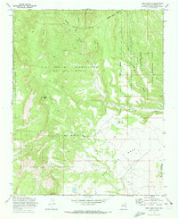
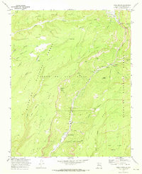
 1970 Valle San Antonio1973 Print · USGSThe Valles Caldera highlands in the early seventies reveal a fascinating landscape of geothermal activity and vast land grants. Researchers can trace the development of Sulphur Springs, locate numerous Steam Wells, and explore the meadows of Valle Seco.3 unique versions available
 - 1970 Map of La Ventana, 1973 Print
 1970 La Ventana1973 Print · USGSSandoval County's high-desert landscape comes into focus during the early 1970s, showing a mix of tribal lands and industrial remnants. Genealogists and historians can trace the Old Railroad Grade near La Ventana or locate the San Miguel Mines and the settlement of Catron.
 - 1970 Map of Seven Springs, 1973 Print
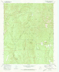
 1970 Seven Springs1973 Print · USGSThe high canyons of Sandoval County are captured here in the early 1970s, showing a landscape defined by forest management and natural springs. You can trace the path to the San Antonio Hot Spring, locate the State Fish Hatchery, or find the Peñas Negras Cabin.4 unique versions available
 - 1970 Map of Ponderosa, 1973 Print
 1970 Ponderosa1973 Print · USGSThe high mesas of Sandoval County come alive in this early 1970s survey, showing a landscape shaped by canyon-floor villages and ancient heights. Researchers can trace the cultural history of Ponderosa and Cañon through landmarks like Santo Toribio Ch and the Spanish Queen Mine.2 unique versions available
 - 1970 Map of Rancho Del Chaparral, 1973 Print
 1970 Rancho Del Chaparral1973 Print · USGSThe Jemez Mountains in the early seventies are characterized here by high-elevation mesas and the deep canyons of the Santa Fe National Forest. Genealogists and hikers can trace remote landmarks like Rancho del Chaparral, the Red Top Lookout, and Deer Lake.
 - 1970 Map of San Pablo, 1973 Print
 1970 San Pablo1973 Print · USGSThe Sandoval County backcountry comes into focus in the early seventies, where mining and ranching meet the national forest. Researchers can trace historic industrial sites like the Nacimiento Mine or locate old ranch outposts at Blue Bird Ranch and Campo El Deseo.
 - 1970 Map of Gilman, 1973 Print
 1970 Gilman1973 Print · USGSThe high mesas and canyons of New Mexico are documented here in the early 1970s, showing the intersection of tribal and forest lands. Researchers can locate remote outposts like Deer Creek Landing and natural features such as Guadalupe Box and Navajo Springs.2 unique versions available
 - 1970 Map of Jemez Springs, 1973 Print
 1970 Jemez Springs1973 Print · USGSIn the 1970s, Jemez Springs was already a gateway to the high mesas and deep canyons of the Jemez Mountains. Researchers can trace historic sites like the Via Coeli Monastery, old Ruins, and landmarks like Soda Dam.3 unique versions available
 - 1970 Map of San Miguel Mountain, 1973 Print
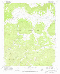
 1970 San Miguel Mountain1973 Print · USGSHigh in the Jemez Mountains during the early seventies, this area reveals a landscape of massive mesas and ancestral sites. Researchers can find archaeological markers like Giant Footprint Ruins alongside early outposts at Porter and O'Neil Landing.2 unique versions available
 - 1975 Map of Hagan, 1986 Print
 1975 Hagan1986 Print · USGSSandoval County in the mid-1970s reveals a landscape defined by old land grants and the remnants of early mining and rail. Researchers can trace the Old Railroad Grade, locate the Tejon Cemetery, and find Tonque Pueblo (Ruins).
 - 1976 Map of Chaco Canyon, 1978 Print
 1976 Chaco Canyon1978 Print · USGSNorthwestern New Mexico in the mid-seventies is a landscape of ancient ruins, high desert mesas, and remote outposts. Researchers can trace the legacy of the regional economy through sites like the Huerfano Trading Post and Nageezi, or locate early industrial infrastructure within the Escrito Oil Field.
 - 1977 Map of Chaco Mesa, 1978 Print
 1977 Chaco Mesa1978 Print · USGSNorthwestern New Mexico in the late seventies remained a landscape of remote trading outposts and high-altitude mesas. Researchers can trace the location of historic commerce hubs like Star Lake Trading Post and Pueblo Pintado alongside the Continental Divide.2 unique versions available
 - 1978 Map of Los Alamos
 1978 Los Alamos1978 Print · USGSThe Jemez Mountains and Rio Grande valley come together in the late seventies, showing a land defined by volcanic peaks and ancient pueblos. Trace the footprints of Bandelier National Monument, find the rail line of the Atchison Topeka and Santa Fe, and locate historic settlements like Jemez Pueblo.
 - 1978 Map of Grants
 1978 Grants1978 Print · USGSWest-Central New Mexico is captured here in the late seventies as uranium mining and the railroad shaped the high desert landscape. Genealogists and historians can trace settlements from Grants to Laguna, including the Jackpile Mine and Acomita West Village.2 unique versions available
 - 1978 Map of Albuquerque, 1986 Print
 1978 Albuquerque1986 Print · USGSGreater Albuquerque and the Rio Grande valley are captured here during a period of significant suburban expansion in the late seventies. Researchers can trace the early Subdivision Road Pattern near Rio Rancho and the historic footprints of Santa Ana Pueblo and Bernalillo.
End of results
Showing maps 1-18 of 18
Top cities of Sandoval County
- Rio Rancho historical maps
- Bernalillo historical maps
- Corrales historical maps
- Cuba historical maps
- Peña Blanca historical maps
- Jemez Springs historical maps
See more
Frequently asked questions
- What are the different types of historical maps available for Sandoval County?
- What is the oldest map of Sandoval County?
- Where can I purchase historical maps of Sandoval County for my home or office?
- Where can I download high-res historical maps of Sandoval County?
- Are there historical topographic maps available for Sandoval County?
- Is there historical aerial imagery available for Sandoval County?
- Where are historical maps of Sandoval County sourced from?