2000s (21st Century) Maps of Sandoval County, New Mexico
Explore 481 historic maps of Sandoval County from the 2000s (21st Century). These maps offer a rare glimpse into what life looked like during the 2000s — showing old roads, neighborhoods, homes, and landmarks that have changed or disappeared over time.
Whether you're researching your family's past, planning a metal detecting trip, or studying how Sandoval County's landscape evolved across the 2000s, these high-resolution maps are a powerful tool for exploring the history of this region.
- Focus on a specific era: All maps on this page are from the 2000s, giving you a focused view of this time period.
- See what’s changed: Compare century-old streets, trails, and buildings to today's modern landscape using overlays and satellite layers.
- Research with precision: Use these maps for genealogy, historical research, land use analysis, or educational projects.
- View, download, or print: Maps are fully viewable online in high resolution, and can be downloaded or printed for your own records.
Start exploring Sandoval County's history through authentic maps from the 2000s. This is your window into the past.
Sandoval County, NM maps
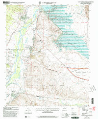
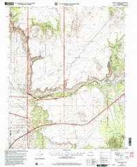
(481)- 2002 Map of Guaje Mountain, 2003 Print
 2002 Guaje Mountain2003 Print · USGSLos Alamos and its surrounding mesas are documented here at the turn of the millennium, showing the unique intersection of a world-class laboratory and the New Mexico landscape. Researchers can trace the layout of North Mesa, find the Guaje Pines Cemetery, and locate the Los Alamos National Laboratory.
 - 2002 Map of Mesa Portales, 2003 Print
 2002 Mesa Portales2003 Print · USGSSandoval County at the turn of the millennium shows a landscape of expansive mesas and critical water sources within the Santa Fe National Forest. Researchers can trace the ranching and industrial history of the area through sites like Ojo de Gutierrez, a local Cem, and numerous Drill Holes.
 - 2002 Map of Loma Creston, 2003 Print
 2002 Loma Creston2003 Print · USGSTribal lands and historic land grants converge in this Sandoval County landscape at the start of the twenty-first century. Researchers can trace the complex boundaries of the Ojo Del Borrego Grant and the Santa Ana Indian Reservation across Santa Ana Mesa.
 - 2002 Map of Gilman, 2003 Print
 2002 Gilman2003 Print · USGSSandoval County at the turn of the millennium shows a land of deep canyons and historic grants bordering the Jemez Pueblo. Genealogists and researchers can locate the settlement of Gilman and trace seasonal water sources like Navajo Springs or Log Springs across the high mesas.
 - 2002 Map of Redondo Peak, 2003 Print
 2002 Redondo Peak2003 Print · USGSThe Valles Caldera region of Sandoval County is mapped here during a period of significant land management transition. Researchers can trace the volcanic geography of Redondo Peak, the legacy of the Baca Location No 1 Grant, and landmarks like the Cerro Palado Lookout.
 - 2002 Map of Bear Springs Peak, 2003 Print
 2002 Bear Springs Peak2003 Print · USGSIn the early 2000s, this high-country landscape near the Jemez Indian Reservation showed a rugged intersection of ranching and mining history. Researchers can find old resource sites like Strip Mines and trace the paths through Paliza Canyon to Bear Springs Peak.
 - 2002 Map of Canada NW, 2003 Print
 2002 Canada NW2003 Print · USGSThe high mesas and ancestral canyonlands of Sandoval County are captured here at the turn of the millennium. Researchers can trace the boundaries of the Pueblo De Conchiti, locate the Pumice Mine, and explore the formations of Kasha-Katuwe Tent Rocks National Monument.3 unique versions available
 - 2002 Map of Cerro Del Grant, 2003 Print
 2002 Cerro Del Grant2003 Print · USGSHigh-country ranching and timber history are preserved in this Rio Arriba County landscape at the start of the new millennium. Researchers can trace the legacy of land grants and early industry at the Upper Coyote Creek Sawmill and La Grulla Ranch.
 - 2002 Map of Jemez Pueblo, 2003 Print
 2002 Jemez Pueblo2003 Print · USGSTraditional Pueblo lands and high desert arroyos define this New Mexico landscape at the start of the twenty-first century. Researchers can trace tribal boundaries and geographic features like Jemez Pueblo, Zia Pueblo, and the Jemez River.
 - 2002 Map of San Miguel Mountain, 2003 Print
 2002 San Miguel Mountain2003 Print · USGSSandoval County at the start of the twenty-first century reveals a landscape of high mesas and complex land grants. Researchers can trace historic boundaries like the Jemez Reservation and locate isolated landmarks such as Porter and O'Neil Landing.
 - 2002 Map of Santo Domingo Pueblo, 2003 Print
 2002 Santo Domingo Pueblo2003 Print · USGSThe Rio Grande valley comes into sharp focus at the turn of the millennium, showing the vital intersection of ancestral lands and modern water management. Genealogists and local historians can locate Santo Domingo Pueblo, trace the Santa Fe River, and find local landmarks like Peña Blanca and Cochiti Pueblo.
 - 2002 Map of Cuba, 2003 Print
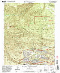
 2002 Cuba2003 Print · USGSThe high mountain valley around Cuba is captured here during the early 2000s, showing the settlement's relationship to the forest and tribal lands. Researchers can trace local genealogy and civic history through the Santos Niños Ch, several Cems, and the High Sch.
 - 2002 Map of Chili, 2003 Print
 2002 Chili2003 Print · USGSThe Rio Chama valley in northern New Mexico is shown at the start of the 21st century, revealing traditional land grant boundaries and river-fed agriculture. Researchers can trace local landmarks like Chili, the Immaculate Conception Ch, and the nearby Pumice Pits.
 - 2002 Map of Bland, 2003 Print
 2002 Bland2003 Print · USGSSandoval County’s mountain landscape is captured here at the turn of the millennium, showing a rugged transition from high caldera rims to deep canyon floors. Genealogists and historians can trace defunct mountain communities and mining sites like Bland, Pines, and the Bruce Place.
 - 2002 Map of Polvadera Peak, 2003 Print
 2002 Polvadera Peak2003 Print · USGSThe high country of Rio Arriba County is shown here at the start of the millennium, where massive land grants and national forest lands converge. Trace the boundaries of the Polvadera Grant and the paths of the Highline Trail near Polvadera Peak.
 - 2002 Map of San Pablo, 2003 Print
 2002 San Pablo2003 Print · USGSThe Sandoval County landscape near the Rio Arriba border was shaped by resource extraction and high-desert ranching at the start of the millennium. Local researchers can trace the industrial footprint of the Nacimiento Mine, find the location of the Sawmill Incinerator, and locate rural settlements like San Pablo and San Miguel.
 - 2002 Map of Tetilla Peak, 2003 Print
 2002 Tetilla Peak2003 Print · USGSThe high basaltic mesas and canyon descents south of Santa Fe come into focus at the start of the millennium. Local historians and geologists can trace the steep paths at La Bajada, historic land boundaries like the La Majada Grant, and volcanic landmarks including Tetilla Peak.
 - 2002 Map of Arroyo Chijuillita, 2003 Print
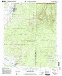
 2002 Arroyo Chijuillita2003 Print · USGSHigh desert mesas and tribal lands meet along the Continental Divide in Sandoval County at the start of the new millennium. Researchers can trace a complex network of water control structures like Retention Dam No 7 and remote landmarks including Pine Spring.
 - 2002 Map of White Rock, 2003 Print
 2002 White Rock2003 Print · USGSNorthern New Mexico at the start of the millennium reveals a fascinating intersection of laboratory science, tribal lands, and suburban expansion. Trace the boundaries of the Los Alamos National Laboratory as it neighbors White Rock and the San Ildefonso Indian Reservation.
 - 2002 Map of Puye, 2003 Print
 2002 Puye2003 Print · USGSNew Mexico's high plateaus and ancestral lands are shown in great detail during the early 2000s as the modern lab facilities expanded. Researchers can trace the proximity of Los Alamos National Laboratory to sacred sites like the Puya Cliff Dwellings and the San Ildefonso Pueblo Grant.
 - 2002 Map of Rancho Del Chaparral, 2003 Print
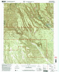
 2002 Rancho Del Chaparral2003 Print · USGSThe high peaks of the Nacimiento Mountains meet the historical Cañon de San Diego Grant in this late twentieth-century forest survey. Local historians can trace the remote Rancho del Chaparral and landmarks like Red Top Lookout.
 - 2002 Map of Cochiti Dam, 2003 Print
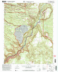
 2002 Cochiti Dam2003 Print · USGSThe Rio Grande corridor south of Bandalier is captured here at the start of the millennium, showing the massive engineering of Cochiti Dam. Researchers can trace old mining claims near Bland or locate local landmarks like the Painted Cave and Tetilla Peak.2 unique versions available
 - 2002 Map of Regina, 2003 Print
 2002 Regina2003 Print · USGSRegina and the high country of the Sandoval County line are captured here just after the turn of the millennium. Genealogists and local historians can trace the community around the Regina Cem, the site of the Drive-in Theater, and the border of the Jicarilla Apache Indian Reservation.
 - 2002 Map of La Ventana, 2003 Print
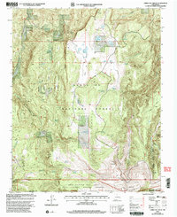
 2002 La Ventana2003 Print · USGSThe high desert landscape of Sandoval County is captured here at the start of the millennium, showing a transition from national forest to tribal lands. Genealogists and historians can trace the boundaries of the Ojo Del Espiritu Santo Grant and locate sites like the Luciani Mines or Thompson Spring.
 - 2002 Map of Frijoles, 2003 Print
 2002 Frijoles2003 Print · USGSModern scientific infrastructure meets ancient landscapes in the mesas around Los Alamos during the early 2000s. Trace the boundaries of the Los Alamos National Laboratory and the historic Ramon Vigil Grant, or locate the Ceremonial Cave within Bandelier National Monument.
Showing maps 1-25 of 481
Top cities of Sandoval County
- Rio Rancho historical maps
- Bernalillo historical maps
- Corrales historical maps
- Cuba historical maps
- Peña Blanca historical maps
- Jemez Springs historical maps
See more
Frequently asked questions
- What are the different types of historical maps available for Sandoval County?
- What is the oldest map of Sandoval County?
- Where can I purchase historical maps of Sandoval County for my home or office?
- Where can I download high-res historical maps of Sandoval County?
- Are there historical topographic maps available for Sandoval County?
- Is there historical aerial imagery available for Sandoval County?
- Where are historical maps of Sandoval County sourced from?