1950s Maps of Sandoval County, New Mexico
Explore 50 historic maps of Sandoval County from the 1950s. These maps offer a rare glimpse into what life looked like during the 1950s — showing old roads, neighborhoods, homes, and landmarks that have changed or disappeared over time.
Whether you're researching your family's past, planning a metal detecting trip, or studying how Sandoval County's landscape evolved across the 1950s, these high-resolution maps are a powerful tool for exploring the history of this region.
- Focus on a specific era: All maps on this page are from the 1950s, giving you a focused view of this time period.
- See what’s changed: Compare century-old streets, trails, and buildings to today's modern landscape using overlays and satellite layers.
- Research with precision: Use these maps for genealogy, historical research, land use analysis, or educational projects.
- View, download, or print: Maps are fully viewable online in high resolution, and can be downloaded or printed for your own records.
Start exploring Sandoval County's history through authentic maps from the 1950s. This is your window into the past.
Sandoval County, NM maps
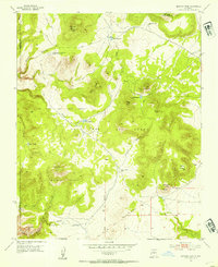
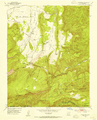
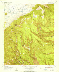
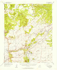
(50)- 1952 Map of White Rock, 1954 Print
 1952 White Rock1954 Print · USGSThe high mesas of Los Alamos and Santa Fe counties are captured here in the early fifties, documenting the remote canyon systems and early utility networks. Genealogists and historians can trace land grant boundaries and find markers of early industry like the Old Railroad Grade and Totavi.3 unique versions available
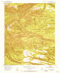
 - 1952 Map of Valle Toledo, 1954 Print
 1952 Valle Toledo1954 Print · USGSHigh in the Jemez Mountains during the early fifties, this area centers on the private Baca Location No 1 land grant. Genealogists and historians can trace early trails and landmarks like Camp May, the Santa Clara Indian Reservation border, and Cerro Rubio.5 unique versions available
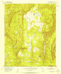
 - 1952 Map of Jemez Springs, 1954 Print
 1952 Jemez Springs1954 Print · USGSThe Jemez Mountains in the early fifties reveal a landscape of thermal springs and high-altitude ranching within the national forest. Trace the development of local landmarks like Jemez Springs, the Soda Dam, and the early layout of Camp Shaver.3 unique versions available
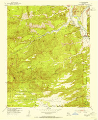
 - 1952 Map of Frijoles, 1954 Print
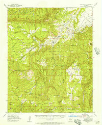
 1952 Frijoles1954 Print · USGSThe Pajarito Plateau's high mesas and deep canyons are shown in the early fifties, a time when these archaeological landscapes were under federal stewardship. Trace the ancient paths of the Stone Lions Trail to reach the Pueblo of the Stone Lions and the Ceremonial Cave.3 unique versions available
 - 1952 Map of Puye, 1954 Print
 1952 Puye1954 Print · USGSThe Pajarito Plateau in the early fifties reveals a landscape of deep canyons and ancient heritage. Researchers can locate archaeological sites like the Cliff Dwellings at Puye or trace the early industrial footprint of the General Pumice Mine.4 unique versions available
 - 1952 Map of Montoso Peak, 1954 Print
 1952 Montoso Peak1954 Print · USGSSanta Fe County’s high plateau is captured here in the early fifties, dominated by the historic Caja Del Rio Grant and its network of arroyos. Researchers can trace early water management and land use through Rito Reservoir, Eleven Hundred Well, and the Department of Agriculture Experimental Area.4 unique versions available
 - 1952 Map of Guaje Mountain, 1954 Print
 1952 Guaje Mountain1954 Print · USGSLos Alamos and the surrounding high desert mesas are captured here in the early fifties, documenting a landscape of deep canyons and tribal lands. Researchers can trace the Quemazon Trail, locate ancient Pueblo Ruins, and study the boundaries of the Santa Clara Pueblo Grant.3 unique versions available
 - 1952 Map of Jemez, 1962 Print
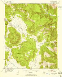
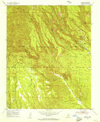
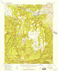
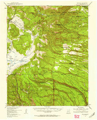
 1952 Jemez1962 Print · USGSSandoval County's canyon lands and pueblo grants are captured here during the early fifties, showing a transition from traditional land use to modern forestry and mining. Genealogists and historians can trace the foundations of Jemez Pueblo, the Spanish Queen Mine, and the route of the Bland Bear Springs Trail.
 - 1953 Map of Cerro Del Grant, 1954 Print
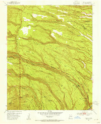
 1953 Cerro Del Grant1954 Print · USGSRio Arriba County in the early fifties shows a high-altitude landscape of timber camps and alpine meadows within the Santa Fe National Forest. Genealogists and historians can trace old logging sites like Mascareñas Sawmill and the La Grulla Ranch.3 unique versions available
 - 1953 Map of Chili, 1954 Print
 1953 Chili1954 Print · USGSNorthern New Mexico's Rio Chama valley is shown here in the mid-fifties, dominated by the huge Juan Jose Lobato Grant and tribal lands. Genealogists and historians can trace local life at Chili, locate the Immaculate Conception Ch, or find industrial sites like the Pumice Pit.3 unique versions available
 - 1953 Map of Vallecitos, 1954 Print
 1953 Vallecitos1954 Print · USGSNorthern New Mexico in the early fifties shows the intersection of historical Spanish land grants and federal forest management. Researchers can trace the boundaries of the Town of Abiquiu Grant, visit the settlement at Vallecitos, or locate the Rio del Oso Ranger Sta.3 unique versions available
 - 1953 Map of Cochiti Dam, 1954 Print
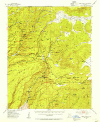
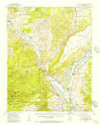
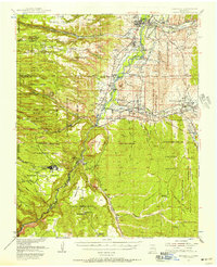
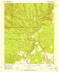 1953 Cochiti Dam1954 Print · USGSHigh mesas and deep river canyons define this Sandoval County landscape during the early fifties, where the Rio Grande meets historic Spanish land grants. Genealogists and historians can trace the sites of Pueblo Ruins, the settlement at Bland, and landmarks like Painted Cave.6 unique versions available
 - 1953 Map of Santo Domingo Pueblo, 1954 Print
 1953 Santo Domingo Pueblo1954 Print · USGSThe Rio Grande valley in the early fifties shows a landscape of traditional pueblo lands and vital irrigation networks. Genealogists and historians can trace family-named sites in Peña Blanca, the rail stop at Domingo, and the rural School near Sile.5 unique versions available
 - 1953 Map of Polvadera Peak, 1954 Print
 1953 Polvadera Peak1954 Print · USGSHigh country timber and grazing lands define this northern New Mexico terrain during the early fifties. Researchers can trace the Polvadera Sawmill Camp and historical land grant boundaries like the Polvadera Grant and Juan Jose Lobato Grant.3 unique versions available
 - 1953 Map of Bland, 1954 Print
 1953 Bland1954 Print · USGSSandoval County during the early 1950s reveals a landscape of high-country mining and retreating settlements. Researchers can trace the remnants of the Cochiti Mining District and locate sites like Bland and Tent Rock Ranch.6 unique versions available
 - 1953 Map of Tetilla Peak, 1954 Print
 1953 Tetilla Peak1954 Print · USGSSanta Fe County in the early fifties shows a rugged landscape defined by historic Spanish land grants and the steep drop of La Bajada Mesa. Researchers can trace the path of El Camino Real, locate the Tsinat Ruins, and find the remote Turquoise Trading Post.5 unique versions available
 - 1953 Map of Santo Domingo Pueblo SW, 1954 Print
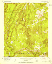
 1953 Santo Domingo Pueblo SW1954 Print · USGSThe Pueblo lands of Sandoval County are captured here in the early fifties, showing the vital irrigation networks of the Rio Grande valley. Researchers can trace the paths of the Santo Domingo East Side Ditch, various Check Dams, and the boundaries of the San Felipe Pueblo Grant.3 unique versions available
 - 1953 Map of Bernalillo NW, 1955 Print
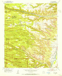
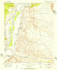
 1953 Bernalillo NW1955 Print · USGSNative American lands in Sandoval County are captured here in the early fifties, showcasing the vast Zia Indian Reservation. Researchers can trace the path of an Old Railroad Grade and find remote landmarks like the Jemez Windmill and Ojito.2 unique versions available
 - 1953 Map of Canada, 1955 Print
 1953 Canada1955 Print · USGSThe Jemez Mountains and surrounding land grants are seen here in the mid-1950s, highlighting the intersection of tribal lands and forest service management. Researchers can trace the footprints of industry and habitation at the Albemarle (Site), Pumice Mines, and Rancho Canada.6 unique versions available
 - 1953 Map of Agua Fria, 1956 Print
 1953 Agua Fria1956 Print · USGSSanta Fe and the surrounding mesas in the mid-1950s reveal a mix of ancient Puebloan history and mid-century modern growth. Trace the path of El Camino Real, locate family roots near La Bajada, or find mining history at the Marshal Bonanza Mine.
 - 1953 Map of San Juan Pueblo, 1956 Print
 1953 San Juan Pueblo1956 Print · USGSRio Arriba County life in the mid-fifties is centered on the fertile confluence of the Rio Chama and Rio Grande. Local history researchers can trace ancestral roots through the numerous land grants, old irrigation Ditch lines, and early sites like San Juan Pueblo, Hernandez, and Los Luceros.2 unique versions available
 - 1953 Map of Youngsville, 1956 Print
 1953 Youngsville1956 Print · USGSNorthern New Mexico in the early fifties was a land of high mesas and remote timber operations near the edge of the forest grants. Genealogists and historians can trace family locations at the C Serrano Cabin, Mesa Poleo School, and Santa Teresa Church.2 unique versions available
 - 1953 Map of Abiquiu, 1957 Print
 1953 Abiquiu1957 Print · USGSNorthern New Mexico in the early fifties shows a landscape of historic land grants and canyon communities. Genealogists and historians can trace traditional life through landmarks like Abiquiu, the Capilla de San Miguel, and the old Cañones Grade School.2 unique versions available
 - 1953 Map of Frijoles, 1958 Print
 1953 Frijoles1958 Print · USGSThe Pajarito Plateau was a landscape of deep canyons and volcanic mesas in the years following the war. Genealogists and historians can trace the mining remnants at Bland, ancestral Pueblo Ruins, and early homesteads like the Evans Griffin Place.3 unique versions available
 - 1953 Map of Espanola, 1958 Print
 1953 Espanola1958 Print · USGSNorthern New Mexico in the early fifties shows a landscape of deep canyons and ancestral Pueblo lands along the RIO GRANDE. Genealogists and historians can trace family-named sites like Evans Ranch or locate ancient Cliff Dwellings and the Old Railroad Grade.3 unique versions available
Showing maps 1-25 of 50
Top cities of Sandoval County
- Rio Rancho historical maps
- Bernalillo historical maps
- Corrales historical maps
- Cuba historical maps
- Peña Blanca historical maps
- Jemez Springs historical maps
See more
Frequently asked questions
- What are the different types of historical maps available for Sandoval County?
- What is the oldest map of Sandoval County?
- Where can I purchase historical maps of Sandoval County for my home or office?
- Where can I download high-res historical maps of Sandoval County?
- Are there historical topographic maps available for Sandoval County?
- Is there historical aerial imagery available for Sandoval County?
- Where are historical maps of Sandoval County sourced from?