1960s Maps of Sandoval County, New Mexico
Explore 48 historic maps of Sandoval County from the 1960s. These maps offer a rare glimpse into what life looked like during the 1960s — showing old roads, neighborhoods, homes, and landmarks that have changed or disappeared over time.
Whether you're researching your family's past, planning a metal detecting trip, or studying how Sandoval County's landscape evolved across the 1960s, these high-resolution maps are a powerful tool for exploring the history of this region.
- Focus on a specific era: All maps on this page are from the 1960s, giving you a focused view of this time period.
- See what’s changed: Compare century-old streets, trails, and buildings to today's modern landscape using overlays and satellite layers.
- Research with precision: Use these maps for genealogy, historical research, land use analysis, or educational projects.
- View, download, or print: Maps are fully viewable online in high resolution, and can be downloaded or printed for your own records.
Start exploring Sandoval County's history through authentic maps from the 1960s. This is your window into the past.
Sandoval County, NM maps
(48)- 1960 Map of Los Griegos
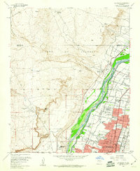 1960 Los Griegos1960 Print · USGSThe Rio Grande valley north of Albuquerque is captured here during a period of suburban growth into traditional grant lands. Researchers can trace the extensive irrigation network and find sites like St Joseph College, Los Poblanos Ranch, and the A T & S F RR.3 unique versions available
 - 1960 Map of Alameda
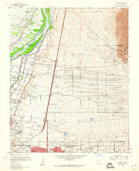 1960 Alameda1960 Print · USGSThe Rio Grande valley north of Albuquerque shows a landscape of intensive irrigation and early suburban growth during the 1960s. Researchers can trace the historic Camino Real, locate family landmarks like San Ysidro Ch, or study the grounds of the Sandia View Academy.3 unique versions available
 - 1960 Map of Sky Village NW, 1963 Print
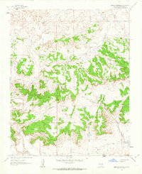
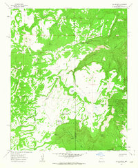
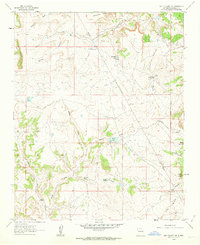 1960 Sky Village NW1963 Print · USGSSandoval County ranching and water management are documented in detail in this early 1960s survey of the high desert terrain. Researchers can locate remote family-named landmarks and essential livestock infrastructure like Armijo Lake, Griego Tanks, and the Red Gate Dam.2 unique versions available
 - 1960 Map of Pueblo Alto Trading Post, 1963 Print
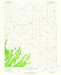 1960 Pueblo Alto Trading Post1963 Print · USGSMcKinley and Sandoval counties appear here in the early sixties as a high-desert landscape of trading posts and remote airfields. Researchers can trace the proximity of the Pueblo Alto Trading Post to ancient Ruins and the Tanner Landing Strip.2 unique versions available
 - 1960 Map of Sky Village NE, 1963 Print
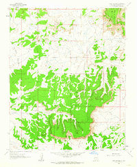
 1960 Sky Village NE1963 Print · USGSHigh desert ranching and tribal lands in New Mexico come to life in this early 1960s survey. Researchers can trace the drainage of Arroyo Ojito and locate historic points like Tenorio Ranch and the waters of Laguna de Baca.2 unique versions available
 - 1961 Map of Sandia Crest, 1962 Print
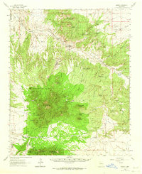
 1961 Sandia Crest1962 Print · USGSThe Sandia Mountains stand at a crossroads of recreational expansion and historic land grants in the early sixties. Researchers can find old backcountry outposts like Juan Tabo Cabin, the Cañoncito Cemetery, and the high-altitude La Luz Mine.5 unique versions available
 - 1961 Map of Marquez, 1963 Print
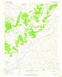
 1961 Marquez1963 Print · USGSCibola County’s high mesas and deep canyons are documented here in the early sixties, centered on the settlement of Marquez. Genealogists and historians can trace family-named landmarks like Gallegos Bridge, the Cem, and the intricate Las Cuevas de Marquez.2 unique versions available
 - 1961 Map of Ojo Encino Mesa, 1963 Print
 1961 Ojo Encino Mesa1963 Print · USGSHigh-desert mesas and washes dominate the McKinley County landscape in the early sixties. Researchers can trace local development at Ojo Encino, including the Ojo Encino Trailer Sch and isolated landmarks like Eagle Spring.2 unique versions available
 - 1961 Map of Johnson Trading Post, 1963 Print
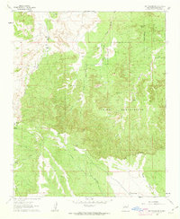
 1961 Johnson Trading Post1963 Print · USGSSandoval County in the early sixties reveals a landscape of high mesas and remote desert outposts. Local researchers can trace the ranching and energy history of the area through landmarks like Johnson Trading Post, a small Cem, and the remote Landing Strip.
 - 1961 Map of Headcut Reservoir, 1963 Print
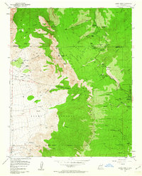
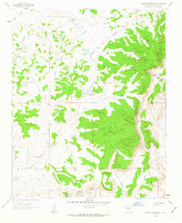 1961 Headcut Reservoir1963 Print · USGSSandoval County ranch lands and high mesas are captured here in the early sixties before modern development. Genealogists and historians can trace livestock water sources and landmarks like Montoya Well, Deadman Peaks, and the La Ventana Mesa.2 unique versions available
 - 1961 Map of Star Lake, 1963 Print
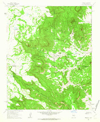
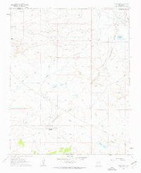 1961 Star Lake1963 Print · USGSNorthwest New Mexico at the start of the sixties reveals a transition between traditional trading hubs and modern energy infrastructure. Genealogists and researchers can trace the vicinity of the Star Lake Trading Post, find the local Mission, and locate the Star Lake Pumping Station along the Continental Divide.2 unique versions available
 - 1961 Map of Cerro Parido, 1963 Print
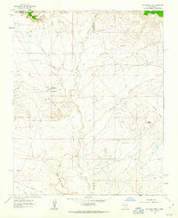
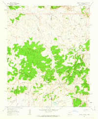
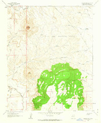
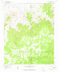 1961 Cerro Parido1963 Print · USGSMcKinley and Sandoval counties appear here in the early 1960s as a high-altitude ranching landscape defined by land grants and national forest boundaries. Genealogists and historians can trace family landholdings at Sandoval Ranch and Joe Montoya Ranch or locate isolated water sources like Toruno Spring.2 unique versions available
 - 1961 Map of Cerro Tinaja, 1963 Print
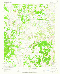
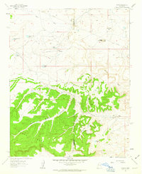
 1961 Cerro Tinaja1963 Print · USGSSandoval County ranching and land grant boundaries are captured here in the early sixties, showing a landscape defined by high mesas and seasonal water. Genealogists can locate family holdings like Juan Jose Ranch, Sanchez Ranch, and Gonzales Ranch near the Cibola National Forest.
 - 1961 Map of La Gotera, 1963 Print
 1961 La Gotera1963 Print · USGSSandoval and Valencia counties are documented here in the early sixties, showing a landscape of historical land grants and high-country ranching. Genealogists and historians can locate family landmarks like Evans Ranch, the Dorey Mine, and the site of Rancho Agua Blanca.2 unique versions available
 - 1961 Map of Arroyo Empedrado, 1963 Print
 1961 Arroyo Empedrado1963 Print · USGSSandoval County in the early sixties reveals a landscape of high mesas and deep arroyos shaped by seasonal water. Researchers can trace the path of Torreon Wash or locate local landmarks like Laguna de la Leña and the Cabezon Community Reservoir.2 unique versions available
 - 1961 Map of Mesa Portales, 1963 Print
 1961 Mesa Portales1963 Print · USGSHigh-desert mesas and vital spring-fed watering points define this Sandoval County landscape in the early sixties. Researchers can trace historic water sources and rugged canyons like Ojo de Gutierrez, Arroyo Chijuilla, and the edge of the Santa Fe National Forest.2 unique versions available
 - 1961 Map of Puerco Dam, 1963 Print
 1961 Puerco Dam1963 Print · USGSArid ranchlands and tribal territories north of Albuquerque come into focus during the early sixties. Researchers can trace the path of the Rio Puerco, locate the Puerco Dam (Ruin), and identify early ranching footprints at Las Lagunitas Ranch.2 unique versions available
 - 1961 Map of Canada Calladita, 1963 Print
 1961 Canada Calladita1963 Print · USGSThe McKinley and Sandoval county line area in the early sixties reveals a landscape shaped by water and ranching. Genealogists and historians can trace the locations of the Rancho De Stephan and Tucker Ranch among the canyons of Cañada Calladita.2 unique versions available
 - 1961 Map of Tinian, 1963 Print
 1961 Tinian1963 Print · USGSHigh-desert life in early 1960s McKinley County centered around remote outposts and livestock tanks. Genealogists and historians can trace the foundations of Tinian Mission and locate features like the Torreon Trading Post and Chaco Mesa.3 unique versions available
 - 1961 Map of Laguna Seca, 1963 Print
 1961 Laguna Seca1963 Print · USGSHigh canyons and mesas mark the McKinley and Sandoval county border in the early sixties. Genealogists and historians can trace old land divisions and remote locales like Eagle Nest, La Jolla Alfalfa, and the Guadalupe Ranger Station.2 unique versions available
 - 1961 Map of Cabezon Peak, 1963 Print
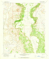
 1961 Cabezon Peak1963 Print · USGSThe high desert of Sandoval County comes to life in the early 1960s, centered on the dramatic volcanic plug of Cabezon Peak. Researchers can trace the riverbank settlement at Casa Salazar and locate old landmarks like the Casa Salazar Sch or the Canada Bonita Tank.2 unique versions available
 - 1961 Map of Casa Salazar, 1963 Print
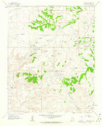
 1961 Casa Salazar1963 Print · USGSNew Mexico's high-desert ranching country is documented here in the early sixties, centered on the Rio Puerco drainage. Genealogists and historians can trace the remote settlement of Casa Salazar or locate specific ranching landmarks like the Miguel Urrea Tank and Sam Hill Tank.2 unique versions available
 - 1961 Map of Wolf Stand, 1963 Print
 1961 Wolf Stand1963 Print · USGSThe high desert of Sandoval County comes into focus in the early sixties, centered on the mission and water tanks of the San Juan Basin. Researchers can trace rural life through the Torreon Navajo Mission, the Cem at Torreon, and family-named landmarks like Geronimo Tank.2 unique versions available
 - 1961 Map of Madrid, 1964 Print
 1961 Madrid1964 Print · USGSThe high-desert mining country of New Mexico is captured here in the early sixties, showing the intersection of large land grants and mineral extraction. Trace the rail lines of the Atchison Topeka and Santa Fe or locate landmarks like the Ortiz Mine and San Francisco Ch.4 unique versions available
 - 1961 Map of San Luis, 1964 Print
 1961 San Luis1964 Print · USGSThe high desert valley of the Rio Puerco is documented here in the early sixties, showing the intersection of historic land grants and ranching life. Researchers can locate the San Luis Cem, Cuevitas Camp, and the distant Cabezon Cem.3 unique versions available
Showing maps 1-25 of 48
Top cities of Sandoval County
- Rio Rancho historical maps
- Bernalillo historical maps
- Corrales historical maps
- Cuba historical maps
- Peña Blanca historical maps
- Jemez Springs historical maps
See more
Frequently asked questions
- What are the different types of historical maps available for Sandoval County?
- What is the oldest map of Sandoval County?
- Where can I purchase historical maps of Sandoval County for my home or office?
- Where can I download high-res historical maps of Sandoval County?
- Are there historical topographic maps available for Sandoval County?
- Is there historical aerial imagery available for Sandoval County?
- Where are historical maps of Sandoval County sourced from?