Old Maps of Socorro County, New Mexico for Academic Research
Study the evolution of Socorro County with 890 high-resolution historic maps. Whether you're teaching, researching, or modeling changes in land use, these maps provide essential visual documentation of urban, environmental, and geographic change.
- Analyze long-term change: Track patterns in development, transportation, and natural features.
- Ideal for environmental or urban studies: Support academic projects with primary historical map data.
- Use in the classroom or lab: Educators and researchers rely on these maps to bring historical context to life.
These maps are a powerful tool for teaching, research, and visualizing how Socorro County has changed over the decades.
Socorro County, NM maps
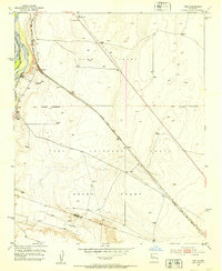
(890)- 1906 Map of Socorro
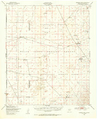
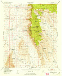
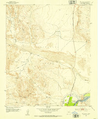
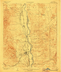 1906 Socorro1906 Print · USGSSocorro and the Rio Grande valley are captured here at the dawn of the twentieth century, as the railroad and mining industries reshaped the region. Genealogists and researchers can locate old sites like the School of Mines, the Dewey Mine, and the river crossing at Ford and Ferry.3 unique versions available
 - 1916 Map of La Joya
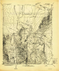 1916 La Joya1916 Print · USGSThe Rio Grande valley at the time of the Belen Cut Off's construction reveals a landscape of massive Spanish land grants and new rail towns. Trace early settlements like La Joya and Becker or geological landmarks like Pyramid Crater.
 - 1916 Map of Salinas Peak
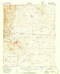
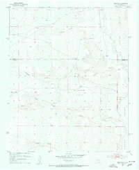
 1916 Salinas Peak1916 Print · USGSSouthern New Mexico was a land of expansive ranches and rail stops in the years before the Great War. You can trace early twentieth-century desert survival through water landmarks like Anaya Spring and rail-side settlements including Engle and Cutter.
 - 1916 Map of Tularosa
 1916 Tularosa1916 Print · USGSNew Mexico ranching and railroading define this pre-war survey of the valley during its early years of statehood. Genealogists and historians can trace family landholdings at Jackson Ranch and Chosa Ranch or follow the path of the El Paso and Southwestern railroad.2 unique versions available
 - 1917 Map of Cerro Verde
 1917 Cerro Verde1917 Print · USGSNorthwestern New Mexico’s high desert landscape is captured here during the First World War era, showing a mix of ancient land grants and rail-side outposts. Genealogists and historians can trace family-named sites like Vigil, Baca, and the Correo Post Office along the Atchison Topeka and Santa Fe line.
 - 1917 Map of Broom Mountain
 1917 Broom Mountain1917 Print · USGSValencia County at the close of the First World War shows a landscape of high mesas and scattered homesteads. Genealogists and historians can trace early ranching outposts like Bodenheimer and Th Garcia or locate the former Miller Post Office.
 - 1918 Map of Oscura Peak
 1918 Oscura Peak1918 Print · USGSSocorro and Lincoln counties appear here in the early twentieth century as a landscape of isolated ranches and rugged mining prospects. Genealogists and historians can locate early family-named sites like Bursum, Estey, and Chihuahua Ranch near the Oscura Range.
 - 1947 Map of Capitol Peak, 1955 Print
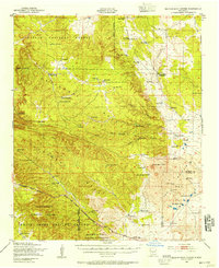
 1947 Capitol Peak1955 Print · USGSThe northern reaches of the San Andres Mountains appear at the dawn of the atomic age, as the White Sands Proving Ground was being established. Researchers can trace remote water sources like Malpais Spring and the complex terrain of the Lava Bed and Mockingbird Gap.
 - 1948 Map of Carthage, 1954 Print
 1948 Carthage1954 Print · USGSCarthage and Tokay were at the center of Socorro County's coal and ranching country in the late 1940s. Genealogists and historians can trace family ranch sites like Muncy Ranch or locate the historic Hart Coal Mine and Gilmore Coal Mine.
 - 1948 Map of Broken Back Crater, 1954 Print
 1948 Broken Back Crater1954 Print · USGSThe Socorro County desert meets mid-century military history in the late 1940s. Genealogists and historians can trace ranching life at Harvey Ranch Headquarters or find early military markers within the White Sands Proving Ground.2 unique versions available
 - 1948 Map of Granjean Well, 1954 Print
 1948 Granjean Well1954 Print · USGSSocorro County during the late 1940s reflects a landscape at the crossroads of traditional ranching and the atomic age. Genealogists and historians can locate established holdings like McDonald Ranch Headquarters and Story Ranch as they were being absorbed into the White Sands Proving Ground.
 - 1948 Map of Bingham, 1954 Print
 1948 Bingham1954 Print · USGSRanching life and mining ventures met the dawn of the atomic age in central New Mexico during the late 1940s. Genealogists can trace family holdings like the Coker Headquarters or B Lucero Ranch alongside local landmarks like the White Store and Royal Flush Mine.
 - 1948 Map of Chihuahua Ranch, 1954 Print
 1948 Chihuahua Ranch1954 Print · USGSLincoln County was a center for military testing and cattle ranching in the late 1940s. Genealogists and researchers can trace family-named sites like Barnes Ranch and Withers Ranch alongside the Oscura Coal Mine (Abandoned).
 - 1948 Map of San Antonio, 1954 Print
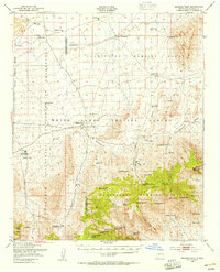
 1948 San Antonio1954 Print · USGSThe Rio Grande valley in the years following the war reveals a landscape of railroad towns and vast migratory bird habitats. Genealogists and historians can trace family landholdings from Jacobo Sedillo Ranch to San Antonio, alongside the Atchison Topeka and Santa Fe rail line.2 unique versions available
 - 1948 Map of Val Verde, 1954 Print
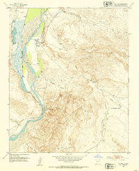
 1948 Val Verde1954 Print · USGSThe Rio Grande valley south of Socorro is captured here shortly after the war, showing the vital rail corridor through the Pedro Armendaris Grant. Genealogists and historians can trace the remote ranching life at Bruton Ranch and the lost structures near San Marcial.2 unique versions available
 - 1948 Map of Malpais Well, 1954 Print
 1948 Malpais Well1954 Print · USGSThe high-desert ranching country of Socorro and Sierra counties is captured here just after the war. Researchers can trace the legacy of the Pedro Armendaris Grant No 33 and locate historic outposts like Casa Grande Ranch and Malpais Well.
 - 1948 Map of Mockingbird Gap, 1955 Print
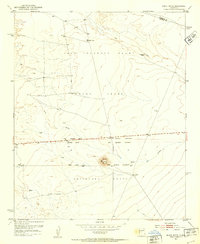
 1948 Mockingbird Gap1955 Print · USGSHigh-desert ranching meets Cold War military testing in this late 1940s survey of the Oscura Mountains. Researchers can trace remote outposts like A D Helm Ranch and Estes City alongside early installations for the White Sands Proving Ground.2 unique versions available
 - 1948 Map of Salinas Peak, 1955 Print
 1948 Salinas Peak1955 Print · USGSThe high desert of Socorro and Sierra Counties is shown here in the late forties, just as military testing grounds began to redefine the landscape. Genealogists and researchers can trace ranching footprints like Cain Ranch Headquarters and Martin Headquarters or locate the Bear Den Sch.2 unique versions available
 - 1950 Map of Little Black Peak, 1954 Print
 1950 Little Black Peak1954 Print · USGSLincoln County and Socorro County meet at the edge of the high desert in this mid-century survey. Trace the route of the Southern Pacific railroad past Little Black Peak and through the volcanic expanse of The Malpais.3 unique versions available
 - 1952 Map of La Joya NW, 1953 Print
 1952 La Joya NW1953 Print · USGSIn the early 1950s, this desert corridor in Socorro County served as a vital transportation artery. Trace the historical path of El Camino Real and locate essential ranching water sources like Mariano Draw and several named Windmills.3 unique versions available
 - 1952 Map of San Anacia, 1953 Print
 1952 San Anacia1953 Print · USGSThe Rio Grande valley north of Socorro comes to life in the early fifties, showing the precarious balance of desert agriculture and river management. Researchers can trace the El Camino Highway and locate local landmarks like the cemetery near Alamillo.2 unique versions available
 - 1952 Map of Belen SW, 1953 Print
 1952 Belen SW1953 Print · USGSThe high desert west of the Rio Grande is captured here in the early 1950s, showing a landscape defined by ranching and traditional land grants. Trace the boundaries of the Belen Grant and locate water sources like Pedro Draw and Coyote Draw.
 - 1952 Map of Black Butte, 1953 Print
 1952 Black Butte1953 Print · USGSCentral New Mexico is captured here in the early fifties, focusing on the vast desert land grants south of Belen. Researchers can trace the massive boundaries of the Casa Colorado Grant and Sevilleta Grant near Black Butte.2 unique versions available
 - 1952 Map of La Joya, 1953 Print
 1952 La Joya1953 Print · USGSThe Rio Grande valley in the early fifties shows a landscape defined by the river and rail, including the tracks of the Atchison Topeka and Santa Fe. Genealogists and local historians can locate the La Joya Cemetery, the rural Diamond T Ranch, and the boundaries of the Sevilleta Grant.3 unique versions available
 - 1952 Map of Turn, 1953 Print
 1952 Turn1953 Print · USGSValencia County in the early 1950s is shown as a corridor of river-fed agriculture and rail transit. Genealogists and local historians can trace the community around Turn, the Casa Colorada School, and the Cem near the banks of the Rio Grande.3 unique versions available
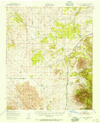
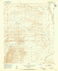
Showing maps 1-25 of 890
Top cities of Socorro County
Frequently asked questions
- What are the different types of historical maps available for Socorro County?
- What is the oldest map of Socorro County?
- Where can I purchase historical maps of Socorro County for my home or office?
- Where can I download high-res historical maps of Socorro County?
- Are there historical topographic maps available for Socorro County?
- Is there historical aerial imagery available for Socorro County?
- Where are historical maps of Socorro County sourced from?