1990s Maps of Socorro County, New Mexico
Explore 47 historic maps of Socorro County from the 1990s. These maps offer a rare glimpse into what life looked like during the 1990s — showing old roads, neighborhoods, homes, and landmarks that have changed or disappeared over time.
Whether you're researching your family's past, planning a metal detecting trip, or studying how Socorro County's landscape evolved across the 1990s, these high-resolution maps are a powerful tool for exploring the history of this region.
- Focus on a specific era: All maps on this page are from the 1990s, giving you a focused view of this time period.
- See what’s changed: Compare century-old streets, trails, and buildings to today's modern landscape using overlays and satellite layers.
- Research with precision: Use these maps for genealogy, historical research, land use analysis, or educational projects.
- View, download, or print: Maps are fully viewable online in high resolution, and can be downloaded or printed for your own records.
Start exploring Socorro County's history through authentic maps from the 1990s. This is your window into the past.
Socorro County, NM maps
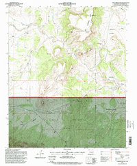
(47)- 1991 Map of Veguita, 1996 Print
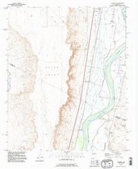 1991 Veguita1996 Print · USGSThe Rio Grande valley in central New Mexico appears here as a complex patchwork of historic land grants and irrigation networks in the mid-twentieth century. Researchers can trace the water systems of the Old Jarales Ditch and locate family-named settlements like Jarales, Bosque, and Sabinal.
 - 1991 Map of Turn, 1996 Print
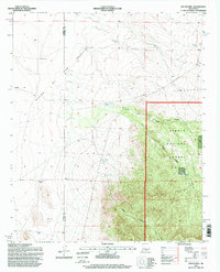
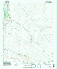 1991 Turn1996 Print · USGSValencia County at the end of the twentieth century shows a landscape shaped by ancient land grants and early aviation. Genealogists can trace the rural communities of Turn and Madrone while locating the small Cem near the Sabinal Ditch.
 - 1991 Map of Belen SW, 1996 Print
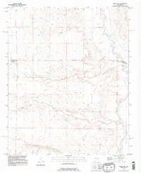 1991 Belen SW1996 Print · USGSSocorro County's arid drainages and land grants are documented here in the early 1990s. Researchers can trace the path of the Rio Puerco and locate survey markers along the New Mexico Principal Meridian and Belen Grant.
 - 1995 Map of Montoya Butte, 1998 Print
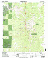
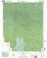
 1995 Montoya Butte1998 Print · USGSSocorro County's high-desert landscape is recorded here in the mid-1990s, where the Cibola National Forest meets the Cuchillo Mountains. Researchers can trace the Old Indian Treaty Boundary and locate historic water sites like Ojo Caliente Springs and the Monticello Box.
 - 1995 Map of San Juan Peak, 1998 Print
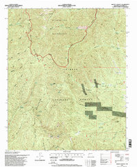
 1995 San Juan Peak1998 Print · USGSSocorro County ranching and wilderness lands are captured here in the mid-1990s as the high-elevation terrain of the San Mateo Mountains remained largely roadless. Local historians can trace cattle-country landmarks like the Hickman Ranch and San Juan Corral alongside remote water sources like Junction Spring.
 - 1995 Map of Vicks Peak, 1998 Print
 1995 Vicks Peak1998 Print · USGSThe high San Mateo Mountains of New Mexico appear here in the mid-1990s, showing a landscape of remote wilderness and mining claims. Researchers can trace historic backcountry life through landmarks like Cooks Cabin Corral, the Priest Mine, and Shipman Spring.
 - 1995 Map of Dusty, 1998 Print
 1995 Dusty1998 Print · USGSSocorro and Catron counties appear here in the mid-1990s, revealing a landscape of high-country ranching and forest land. Genealogists and historians can locate family landmarks such as McCracken Ranch, Henderson Ranch, and the Pigeon Windmill.
 - 1995 Map of Water Canyon, 1998 Print
 1995 Water Canyon1998 Print · USGSSocorro County's mountain landscape was carefully documented during the mid-1990s, revealing a network of remote outposts and high peaks. Researchers can locate family-named landmarks like A Strozzi, the Water Canyon Lodge, and the waters of Sedillo Reservoir.
 - 1995 Map of Carbon Springs, 1998 Print
 1995 Carbon Springs1998 Print · USGSThe settlement of Riley and the braided Rio Salado define this high-desert landscape in the mid-1990s. Genealogists and historians can trace old ranching footprints at the Gray and Ligon Ranch and industrial sites like East Mill and East New Mill.
 - 1995 Map of Table Mountain, 1998 Print
 1995 Table Mountain1998 Print · USGSSocorro County in the mid-1990s showcases the intersection of the Alamo Band Indian Reservation and national forest lands. Researchers can trace rural infrastructure and desert landmarks like the Alamo Mission, Red Lake Ranch, and the peaks of Table Mountain.
 - 1995 Map of Mesa Cencerro, 1998 Print
 1995 Mesa Cencerro1998 Print · USGSSocorro County's high mesas and ranching outposts are meticulously recorded in this mid-nineties survey of the Bear Mountains. Researchers can locate isolated landmarks like Chavez Ranch, Lumber House Spring No 1, and early mining Prospects.
 - 1995 Map of Lion Mountain, 1998 Print
 1995 Lion Mountain1998 Print · USGSHigh-desert ranching and the eastern Gallinas Mountains dominate this Socorro County landscape in the mid-1990s. Genealogists and local historians can trace water rights and livestock history through landmarks like Double H Ranch, East Chavez Tank, and High Lonesome Well.
 - 1995 Map of Sierra Fijardo, 1998 Print
 1995 Sierra Fijardo1998 Print · USGSSouthern New Mexico’s high-desert terrain is meticulously documented in the 1990s as it transitions between ranch lands and national forest. Researchers can locate remote landmarks like the Flying X Ranch, the solitary Grave near the forest boundary, and Peñasco Peak.
 - 1995 Map of Kellog Well, 1998 Print
 1995 Kellog Well1998 Print · USGSThe high desert of Socorro County comes into focus in the mid-1990s as the western plains meet the mountain canyons. Researchers can trace land use at the forest edge, locating ranching landmarks like Satahite Place and essential water sources such as Kellog Well.
 - 1995 Map of Puertecito, 1998 Print
 1995 Puertecito1998 Print · USGSCentrally located in Socorro County during the 1990s, this area showcases the intersection of the Alamo Band Indian Reservation and high-desert ranching life. Genealogists can trace family footprints at the John Padilla Settlement and locate community landmarks like the Navajo Community Hall.
 - 1995 Map of Blue Mountain, 1998 Print
 1995 Blue Mountain1998 Print · USGSThe San Mateo Mountains were surveyed in the mid-nineties, capturing a remote landscape of the Cibola National Forest. Local history enthusiasts can trace the Apache Kid Wilderness to the Apache Kid Grave Site and Holdup Mountain.
 - 1995 Map of Tres Montosas, 1998 Print
 1995 Tres Montosas1998 Print · USGSThe Socorro County rangeland and the heights of the Cibola National Forest are shown here in the mid-nineties. Researchers can trace the layout of regional cattle operations at Evans Ranch, Cat Mountain Ranch, and Montosa Camp.
 - 1995 Map of Progresso SW, 1998 Print
 1995 Progresso SW1998 Print · USGSHigh desert ranching in Torrance County during the mid-nineties is defined by isolated outposts and vital water improvements. Researchers can locate remote family landmarks like the Atkinson Ranch and trace a network of named wells including Axtell Well and Middle Well.
 - 1995 Map of Tenmile Hill, 1998 Print
 1995 Tenmile Hill1998 Print · USGSSocorro County’s high-desert ranching country is documented here during the mid-nineties within the Cibola National Forest. Local historians can trace the remote operations of the Tigner Ranch and Wilson Ranch alongside landmarks like Tenmile Hill.
 - 1995 Map of Indian Mesa, 1998 Print
 1995 Indian Mesa1998 Print · USGSSocorro County's high-desert peaks and reservation borders are frozen in time during the mid-nineties. Genealogists and historians can trace old land use through the Baca Homestead or locate remote water sources like High Lonesome Windmill and Indian Spring.
 - 1995 Map of Grassy Lookout, 1998 Print
 1995 Grassy Lookout1998 Print · USGSThe San Mateo Mountains in the mid-1990s reveal a high-desert landscape shaped by both wilderness protection and historic mining. Researchers can trace the industrial legacy of the Rosedale Mine and Bell Mine or locate landmarks like Grassy Lookout.
 - 1995 Map of Squaw Peak, 1998 Print
 1995 Squaw Peak1998 Print · USGSSocorro County ranchlands and forest plateaus are captured here in the mid-1990s during a period of transition in the New Mexico interior. Researchers can trace historic homestead locations like the Old Garcia Ranch and essential water features such as Choate Windmill and Alameda Spring.
 - 1995 Map of Indian Spring Canyon, 1998 Print
 1995 Indian Spring Canyon1998 Print · USGSSocorro County during the mid-1990s showcases a high-desert landscape of tribal lands and forest reserves. Genealogists and historians can locate remote family sites like Thomas Canada Ranch, the Hot Spot Mines, and water landmarks including Abbe Spring and Indian Tank.
 - 1995 Map of Magdalena, 1998 Print
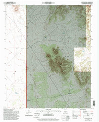
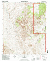
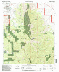 1995 Magdalena1998 Print · USGSMagdalena and the mining settlement of Kelly are shown here in the 1990s as the high desert meets the Magdalena Mountains. Researchers can trace the legacy of resource extraction through numerous mines and prospects scattered near Kelly Gulch and Elephant Mountain.2 unique versions available
 - 1995 Map of Mount Withington, 1998 Print
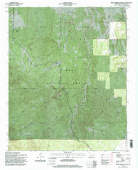
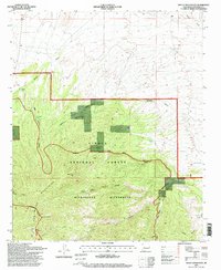 1995 Mount Withington1998 Print · USGSThe San Mateo Mountains of Socorro County are shown in the 1990s as a high-altitude wilderness of deep canyons and lookout peaks. Local historians can trace remote landmarks like Monica Cabin, Lookout 10115, and numerous water sources including Cooney Spring and New Well.
Showing maps 1-25 of 47
Top cities of Socorro County
Frequently asked questions
- What are the different types of historical maps available for Socorro County?
- What is the oldest map of Socorro County?
- Where can I purchase historical maps of Socorro County for my home or office?
- Where can I download high-res historical maps of Socorro County?
- Are there historical topographic maps available for Socorro County?
- Is there historical aerial imagery available for Socorro County?
- Where are historical maps of Socorro County sourced from?