1950s Maps of Socorro County, New Mexico
Explore 28 historic maps of Socorro County from the 1950s. These maps offer a rare glimpse into what life looked like during the 1950s — showing old roads, neighborhoods, homes, and landmarks that have changed or disappeared over time.
Whether you're researching your family's past, planning a metal detecting trip, or studying how Socorro County's landscape evolved across the 1950s, these high-resolution maps are a powerful tool for exploring the history of this region.
- Focus on a specific era: All maps on this page are from the 1950s, giving you a focused view of this time period.
- See what’s changed: Compare century-old streets, trails, and buildings to today's modern landscape using overlays and satellite layers.
- Research with precision: Use these maps for genealogy, historical research, land use analysis, or educational projects.
- View, download, or print: Maps are fully viewable online in high resolution, and can be downloaded or printed for your own records.
Start exploring Socorro County's history through authentic maps from the 1950s. This is your window into the past.
Socorro County, NM maps
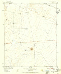
(28)- 1950 Map of Little Black Peak, 1954 Print
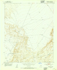
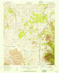 1950 Little Black Peak1954 Print · USGSLincoln County and Socorro County meet at the edge of the high desert in this mid-century survey. Trace the route of the Southern Pacific railroad past Little Black Peak and through the volcanic expanse of The Malpais.3 unique versions available
 - 1952 Map of La Joya NW, 1953 Print
 1952 La Joya NW1953 Print · USGSIn the early 1950s, this desert corridor in Socorro County served as a vital transportation artery. Trace the historical path of El Camino Real and locate essential ranching water sources like Mariano Draw and several named Windmills.3 unique versions available
 - 1952 Map of San Anacia, 1953 Print
 1952 San Anacia1953 Print · USGSThe Rio Grande valley north of Socorro comes to life in the early fifties, showing the precarious balance of desert agriculture and river management. Researchers can trace the El Camino Highway and locate local landmarks like the cemetery near Alamillo.2 unique versions available
 - 1952 Map of Belen SW, 1953 Print
 1952 Belen SW1953 Print · USGSThe high desert west of the Rio Grande is captured here in the early 1950s, showing a landscape defined by ranching and traditional land grants. Trace the boundaries of the Belen Grant and locate water sources like Pedro Draw and Coyote Draw.
 - 1952 Map of Black Butte, 1953 Print
 1952 Black Butte1953 Print · USGSCentral New Mexico is captured here in the early fifties, focusing on the vast desert land grants south of Belen. Researchers can trace the massive boundaries of the Casa Colorado Grant and Sevilleta Grant near Black Butte.2 unique versions available
 - 1952 Map of La Joya, 1953 Print
 1952 La Joya1953 Print · USGSThe Rio Grande valley in the early fifties shows a landscape defined by the river and rail, including the tracks of the Atchison Topeka and Santa Fe. Genealogists and local historians can locate the La Joya Cemetery, the rural Diamond T Ranch, and the boundaries of the Sevilleta Grant.3 unique versions available
 - 1952 Map of Turn, 1953 Print
 1952 Turn1953 Print · USGSValencia County in the early 1950s is shown as a corridor of river-fed agriculture and rail transit. Genealogists and local historians can trace the community around Turn, the Casa Colorada School, and the Cem near the banks of the Rio Grande.3 unique versions available
 - 1952 Map of Veguita, 1953 Print
 1952 Veguita1953 Print · USGSThe Rio Grande valley in the early fifties shows a vibrant agricultural corridor shaped by centuries of land grants. Genealogists and historians can trace family-named landmarks and rural life in Sabinal, Bosque, and Jarales along the historic El Camino Real.3 unique versions available
 - 1952 Map of Becker SW, 1953 Print
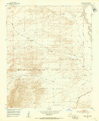
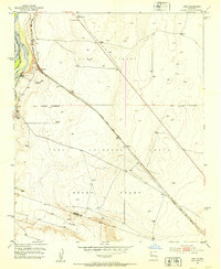
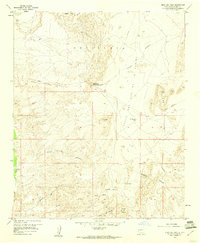
 1952 Becker SW1953 Print · USGSSocorro County in the early 1950s reveals a high-desert landscape of land grants and scattered milling operations. Local historians can trace early industry and ranching via Mine Shaft Mill, Gibbs Place, and the network of water sources like Cottonwood Tank.
 - 1952 Map of Becker, 1953 Print
 1952 Becker1953 Print · USGSThe high desert of Socorro County in the early fifties shows the intersection of the Atchison Topeka and Santa Fe rail line and massive Spanish land grants. Researchers can trace the ranching history of West and Pyle Ranch and industrial sites like the Santa Fe Quarry.2 unique versions available
 - 1952 Map of Abeytas, 1953 Print
 1952 Abeytas1953 Print · USGSThe Rio Grande valley in the early fifties shows a landscape of historic land grants and intricate irrigation systems. Genealogists and historians can trace the foundations of Abeytas, Bernardo, and Las Nutrias, or locate local landmarks like San Isidro Church.4 unique versions available
 - 1952 Map of Cerro Montoso, 1959 Print
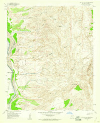
 1952 Cerro Montoso1959 Print · USGSSocorro County ranchlands and mountains are captured here in the early fifties, showing the vast Sevilleta Grant before modern development. Genealogists and historians can locate isolated outposts like Burris and Nunn Ranch and the Tom Wright Mill.3 unique versions available
 - 1954 Map of Tularosa, 1963 Print
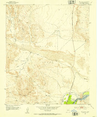
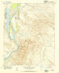
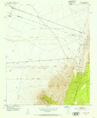
 1954 Tularosa1963 Print · USGSSouth-central New Mexico in the early fifties shows a landscape of desert basins and high peaks under heavy military and water-reclamation use. Trace the path of the Atchison Topeka and Santa Fe Railway past San Marcial and into the massive White Sands Proving Ground.4 unique versions available
 - 1954 Map of Fort Sumner, 1964 Print
 1954 Fort Sumner1964 Print · USGSEast-central New Mexico's ranching and rail heartland is captured here in the mid-1950s, centered on the strategic junctions of the high plains. Researchers can trace the development of early highway networks and rail towns like Vaughn, Fort Sumner, and the copper operations at Guadalupe Mine.3 unique versions available
 - 1954 Map of Socorro, 1972 Print
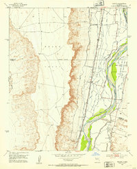
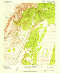
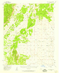
 1954 Socorro1972 Print · USGSMid-century New Mexico comes into focus as the Rio Grande valley and the surrounding high desert undergo post-war growth. Genealogists and historians can trace old mountain settlements like Tajique and Punta de Agua or locate remote sites like the Torrance Mine.2 unique versions available
 - 1955 Map of Roswell, 1974 Print
 1955 Roswell1974 Print · USGSSoutheastern New Mexico is shown in transition during the mid-fifties, from the Pecos Valley ranching hubs to the high timber of the Sacramento Mountains. Researchers can trace the Atchison Topeka and Santa Fe RR through Roswell and Hagerman or locate the old barracks at Ft Stanton.3 unique versions available
 - 1956 Map of Mesa Aparejo, 1958 Print
 1956 Mesa Aparejo1958 Print · USGSRanching life in the New Mexico desert is captured here in the mid-fifties, spanning the Valencia and Socorro county line. Genealogists and historians can trace family-named sites like Romero Ranch, Yriart Ranch, and the outpost at Kings Rest.2 unique versions available
 - 1958 Map of Socorro
 1958 Socorro1958 Print · USGSNew Mexico's high desert during the late fifties reveals a landscape of massive land grants and remote mining outposts. Researchers can trace the path of the Atchison Topeka and Santa Fe railroad as it connects Socorro and Belen to industrial sites like the Manganese Mill.
 - 1958 Map of Fort Sumner
 1958 Fort Sumner1958 Print · USGSEast-central New Mexico in the mid-fifties is captured here as a sprawling landscape of high mesas and cattle ranching. Researchers can trace the convergence of the Southern Pacific railroad at Vaughn and locate family landmarks like Borica School or Marquez Ranch.
 - 1958 Map of Roswell
 1958 Roswell1958 Print · USGSThe High Plains and mountain peaks of New Mexico are captured here during the mid-fifties, showing the region before the closure of Walker Air Force Base. Researchers can trace the ranching and rail landscape from Lincoln to the Pecos River valley through Hagerman and Lake Arthur.
 - 1958 Map of Tularosa
 1958 Tularosa1958 Print · USGSSouthern New Mexico in the late fifties shows a landscape of military expansion and deep-rooted river settlements. Trace family history in Truth or Consequences or locate the ruins of San Marcial and the remote Dusty Post Office.2 unique versions available
 - 1959 Map of Loma De Las Canas, 1960 Print
 1959 Loma De Las Canas1960 Print · USGSThe Rio Grande valley in the late fifties showcases a sophisticated irrigation system essential to local life. Genealogists can trace family-named landmarks and water sources like Ojo del Rancho de Lopez, Minas de Chupadero, and the Socorro Ditch.4 unique versions available
 - 1959 Map of Socorro, 1960 Print
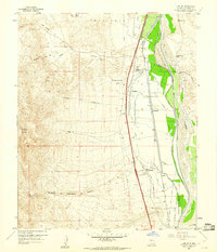
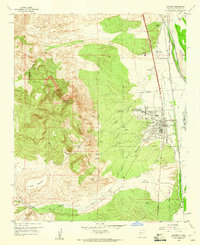 1959 Socorro1960 Print · USGSSocorro and the Rio Grande valley are shown in detail during the late fifties as the town grew around the mining institute. Researchers can locate the San Miguel Ch, trace the Atchison Topeka and Santa Fe Railway, and find the Zimmerly Sch.2 unique versions available
 - 1959 Map of Mesa Del Yeso, 1960 Print
 1959 Mesa Del Yeso1960 Print · USGSSocorro County's high desert and the banks of the Rio Grande are captured here during the late fifties. You can locate isolated landmarks of the ranching era, such as the Old Stapleton Ranch, Sabino Ranch, and Ruins Ojo de la Parida.3 unique versions available
 - 1959 Map of Lemitar, 1960 Print
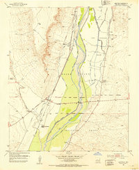
 1959 Lemitar1960 Print · USGSThe Rio Grande valley near Lemitar is shown in the late fifties as a hub of complex irrigation and historic transport routes. Genealogists and historians can trace family-named locations like McNierney and Limitar alongside the Atchison Topeka and Santa Fe RR.2 unique versions available
Showing maps 1-25 of 28
Top cities of Socorro County
Frequently asked questions
- What are the different types of historical maps available for Socorro County?
- What is the oldest map of Socorro County?
- Where can I purchase historical maps of Socorro County for my home or office?
- Where can I download high-res historical maps of Socorro County?
- Are there historical topographic maps available for Socorro County?
- Is there historical aerial imagery available for Socorro County?
- Where are historical maps of Socorro County sourced from?