1970s Maps of Socorro County, New Mexico
Explore 24 historic maps of Socorro County from the 1970s. These maps offer a rare glimpse into what life looked like during the 1970s — showing old roads, neighborhoods, homes, and landmarks that have changed or disappeared over time.
Whether you're researching your family's past, planning a metal detecting trip, or studying how Socorro County's landscape evolved across the 1970s, these high-resolution maps are a powerful tool for exploring the history of this region.
- Focus on a specific era: All maps on this page are from the 1970s, giving you a focused view of this time period.
- See what’s changed: Compare century-old streets, trails, and buildings to today's modern landscape using overlays and satellite layers.
- Research with precision: Use these maps for genealogy, historical research, land use analysis, or educational projects.
- View, download, or print: Maps are fully viewable online in high resolution, and can be downloaded or printed for your own records.
Start exploring Socorro County's history through authentic maps from the 1970s. This is your window into the past.
Socorro County, NM maps
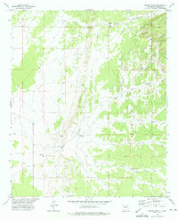
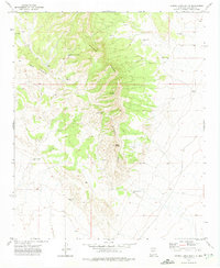
(24)- 1972 Map of Turkey Ridge, 1975 Print
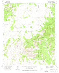
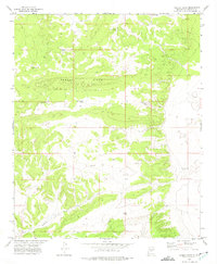 1972 Turkey Ridge1975 Print · USGSSocorro County in the early seventies was a landscape defined by water rights and ranching boundaries. Genealogists and local historians can trace family-named landmarks like Jerrett Well, Axtell Well, and the prominent Turkey Ridge.
 - 1972 Map of Turkey Ridge SW, 1975 Print
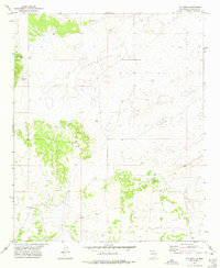
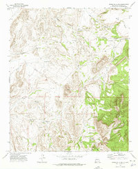
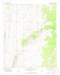
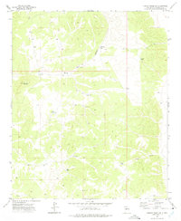 1972 Turkey Ridge SW1975 Print · USGSSocorro County, New Mexico, is documented here in the early 1970s, showcasing a landscape defined by livestock water and high-desert terrain. Local historians can trace ranching infrastructure through named sites like Mesa Well, Brushy Mountain, and Cuate Canyon.
 - 1972 Map of Gran Quivira, 1975 Print
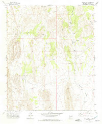
 1972 Gran Quivira1975 Print · USGSCentral New Mexico in the early seventies is defined here by the desert mesa and high plains near the county line. Researchers can trace the layout of the Gran Quivira National Monument and locate the Center Point School or Espinosa Lake.
 - 1972 Map of Sierra Larga North, 1975 Print
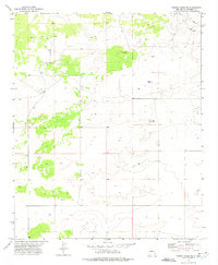
 1972 Sierra Larga North1975 Print · USGSArid ranchlands and high mesas define this Socorro County landscape in the early seventies. Genealogists and historians can trace essential water sources and landmarks like Ponciano Well, Booster Windmill, and Upper Marr Tank across the high desert.
 - 1972 Map of Chupadera Spring, 1975 Print
 1972 Chupadera Spring1975 Print · USGSSocorro County in the early 1970s remains a land of isolated ranching outposts and vital desert water sources. Researchers can trace the essential network of high-desert life through Chupadera Spring, Indian Well, and the remote Forest Well.
 - 1972 Map of Chupadera, 1975 Print
 1972 Chupadera1975 Print · USGSThe high desert border of Torrance and Socorro counties is captured here in the early seventies, revealing a landscape of remote ranching and resource utility. Genealogists and historians can locate Chupadera Cem, the Fite Mine, and vital water sources like San Antonio Spring.
 - 1972 Map of Bigbee Draw, 1975 Print
 1972 Bigbee Draw1975 Print · USGSHigh-desert ranching territory in Torrance and Socorro counties is captured here during the early seventies. Researchers can trace land use through a network of remote sites like the Cain Ranch, Kerr Well, and the seasonal Brown Lake.
 - 1972 Map of Wilson Ranch, 1975 Print
 1972 Wilson Ranch1975 Print · USGSSocorro County ranching lands are captured here in the early 1970s, showing the remote lifestyle of the New Mexico high desert. Researchers can trace the essential water infrastructure of the era through sites like Wilson Ranch, Lee Well, and O'Neal Tank.
 - 1972 Map of Cat Mesa, 1975 Print
 1972 Cat Mesa1975 Print · USGSSocorro County's high desert rangeland is captured here in the early 1970s, showing the vital infrastructure of remote ranching life. Genealogists and historians can locate the Monte Prieto Ranch and trace the network of water sources like Rish Well and New Flat Well.
 - 1972 Map of Bustos Well, 1975 Print
 1972 Bustos Well1975 Print · USGSSocorro County ranching country is documented here in the early 1970s, showing a landscape defined by desert water management and mineral exploration. Genealogists and historians can locate the Arroyo de las Cañas Ranch, isolated outposts like Bustos Well, and numerous mining Prospects.
 - 1972 Map of Turkey Ridge NE, 1975 Print
 1972 Turkey Ridge NE1975 Print · USGSHigh desert ranching and water management define this portion of Socorro County as it appeared in the early seventies. Researchers can locate remote sites like White Lake Cem and essential water sources including North Sloan Well and White Lake.
 - 1972 Map of Sierra Larga South, 1975 Print
 1972 Sierra Larga South1975 Print · USGSThe Socorro County high country comes into focus in the early 1970s, showing a landscape defined by ranching and mineral exploration. Genealogists and researchers can trace family-named water sources like Savedra Wells, Tafoya Well, and the remote Long Ranch.
 - 1972 Map of Sierra De La Cruz, 1975 Print
 1972 Sierra De La Cruz1975 Print · USGSSocorro County ranching lands in the early 1970s center on the Sevilleta region and the surrounding high desert. Genealogists and historians can locate remote family-named water sources like Tomas Baca Well and Stapleton Well, or trace trails near Milagro.
 - 1972 Map of Scholle, 1975 Print
 1972 Scholle1975 Print · USGSThe Manzano foothills and the critical transit corridor of Abo Canyon are captured here in the early seventies. Genealogists and historians can trace the rail-and-road economy through Scholle, the Abo Mine, and the Atchison Topeka and Santa Fe railroad.
 - 1972 Map of Orndorff Ranch, 1975 Print
 1972 Orndorff Ranch1975 Print · USGSSocorro County ranchlands are documented here in the early seventies, capturing the isolated operations of the high desert. Researchers can trace family-named holdings like Orndorff Ranch and Fernandez Ranch alongside essential water sites and an old Landing Strip.
 - 1972 Map of Rayo Hills, 1975 Print
 1972 Rayo Hills1975 Print · USGSCentral New Mexico in the early seventies remained a landscape of isolated ranching outposts and rugged desert terrain. Researchers can locate early water infrastructure like Brazil Windmill or track landmarks like U-Butte and Chupadera Gap.
 - 1972 Map of Bishop Ranch, 1975 Print
 1972 Bishop Ranch1975 Print · USGSSocorro County ranching life is preserved here during the early 1970s, showing a landscape shaped by water scarcity and isolated homesteads. Researchers can trace historic stock tanks and rugged tracks like the Chupadera Jeep Trail, Bishop Ranch, and Indian Well.
 - 1978 Map of Acoma Pueblo, 1979 Print
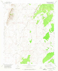
 1978 Acoma Pueblo1979 Print · USGSCibola and Valencia counties are captured here in the late seventies, showing a landscape of ancient pueblos and modern transit corridors. Genealogists and historians can trace the paths of U.S. 66 and the Atchison Topeka and Santa Fe RR past Acoma Pueblo and Suwanee.
 - 1979 Map of Belen
 1979 Belen1979 Print · USGSThe Rio Grande Valley south of Albuquerque in the late seventies reveals a landscape of historic land grants and modern subdivisions. Trace the rail-and-river corridor through Belen and Isleta Pueblo, or find high-elevation landmarks in Cibola National Forest.2 unique versions available
 - 1979 Map of Magdalena
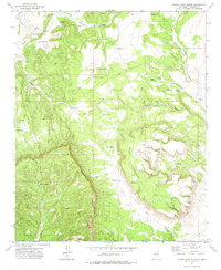
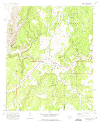
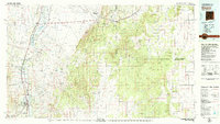
 1979 Magdalena1979 Print · USGSSocorro County in the late seventies is shown here as a high-desert landscape of mountain ranges and remote settlements. Genealogists and historians can trace the reach of the Atchison Topeka and Santa Fe Railway and locate sites like Kelly and Guthrieville.
 - 1979 Map of Socorro
 1979 Socorro1979 Print · USGSThe Rio Grande corridor south of Belen comes into focus during the late seventies, showing the vital link between river-valley agriculture and high-desert ranching. Genealogists and historians can trace riverside settlements like Polvadera and La Joya or locate the Abo Mine and Dewey Lode Mine.2 unique versions available
 - 1979 Map of Socorro
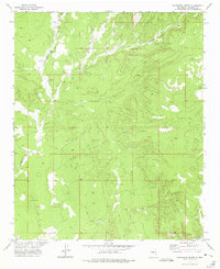
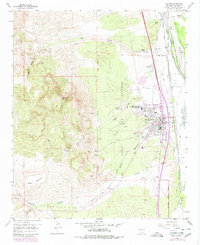 1979 Socorro1979 Print · USGSSocorro and the Rio Grande valley are seen here in the late seventies, revealing a landscape shaped by mountain peaks and complex river irrigation. Trace local history through the New Mexico Tech campus, San Miguel Cem, and the Dewey Lode Mine.
 - 1979 Map of Truth or Consequences
 1979 Truth or Consequences1979 Print · USGSSierra County in the late seventies is a landscape of massive reservoirs and remote mining districts. Researchers can trace the Rio Grande corridor from Truth or Consequences past historic outposts like Winston, Chloride, and the Republic Mine.2 unique versions available
 - 1979 Map of San Mateo Mountains
 1979 San Mateo Mountains1979 Print · USGSCentral New Mexico’s high desert and mountain ranges are captured here in the late seventies, showing the remote ranching and mining country of Socorro County. Researchers can locate historic sites like Fort Craig (Ruins), the Continental Divide, and isolated settlements like Dusty and Monticello.2 unique versions available
End of results
Showing maps 1-24 of 24
Top cities of Socorro County
Frequently asked questions
- What are the different types of historical maps available for Socorro County?
- What is the oldest map of Socorro County?
- Where can I purchase historical maps of Socorro County for my home or office?
- Where can I download high-res historical maps of Socorro County?
- Are there historical topographic maps available for Socorro County?
- Is there historical aerial imagery available for Socorro County?
- Where are historical maps of Socorro County sourced from?