1960s Maps of Socorro County, New Mexico
Explore 50 historic maps of Socorro County from the 1960s. These maps offer a rare glimpse into what life looked like during the 1960s — showing old roads, neighborhoods, homes, and landmarks that have changed or disappeared over time.
Whether you're researching your family's past, planning a metal detecting trip, or studying how Socorro County's landscape evolved across the 1960s, these high-resolution maps are a powerful tool for exploring the history of this region.
- Focus on a specific era: All maps on this page are from the 1960s, giving you a focused view of this time period.
- See what’s changed: Compare century-old streets, trails, and buildings to today's modern landscape using overlays and satellite layers.
- Research with precision: Use these maps for genealogy, historical research, land use analysis, or educational projects.
- View, download, or print: Maps are fully viewable online in high resolution, and can be downloaded or printed for your own records.
Start exploring Socorro County's history through authentic maps from the 1960s. This is your window into the past.
Socorro County, NM maps
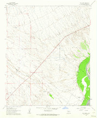
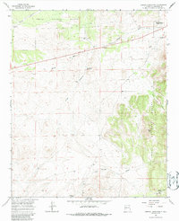
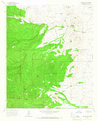
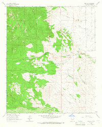
(50)- 1961 Map of Sierra Fijardo, 1963 Print
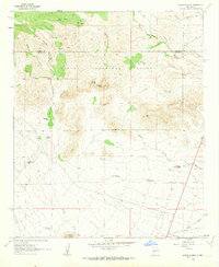 1961 Sierra Fijardo1963 Print · USGSCentral New Mexico's high desert landscape comes into focus in the early sixties, showing the ranching and livestock culture of the era. Genealogists and historians can locate a Grave near Peñasco Canyon or trace the boundaries of the Flying X Ranch.2 unique versions available
 - 1961 Map of Hickman Ranch, 1963 Print
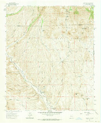
 1961 Hickman Ranch1963 Print · USGSSocorro County ranching lands are captured in the early sixties as they existed before modern development. Genealogists and historians can trace the remote Hickman Ranch and survey landmarks like VABM Donna across the drainages of Milligan Gulch.2 unique versions available
 - 1961 Map of Paraje Well, 1963 Print
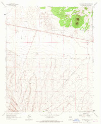
 1961 Paraje Well1963 Print · USGSThe Rio Grande valley in the early sixties is shown here as a landscape of managed water and volcanic desert. Genealogists and historians can trace the Pedro Armendaris No 34 Grant and the rail line of the Atchison Topeka and Santa Fe near Paraje Well.2 unique versions available
 - 1961 Map of Black Hill, 1963 Print
 1961 Black Hill1963 Print · USGSSocorro County ranchlands are captured here in the early sixties, showing a landscape defined by water management and high-desert terrain. Researchers can trace land use through local landmarks like W Coupland Ranch, C C C Tank, and Bottle Hill.2 unique versions available
 - 1961 Map of Fort Craig, 1964 Print
 1961 Fort Craig1964 Print · USGSSocorro County's desert frontier and the Rio Grande's edge are captured in the early sixties, showing the transition from military history to modern ranching. Researchers can locate the Fort Craig (Ruins), Fort Craig Cem, and the George Birner Ranch.2 unique versions available
 - 1961 Map of Monticello, 1964 Print
 1961 Monticello1964 Print · USGSSierra County ranching and river life are captured here in the early 1960s, centered on the Alamosa River valley. Genealogists and local historians can trace family ties at the Monticello Cem, St Ignatius Ch, and the outlying settlement of Placitas.2 unique versions available
 - 1961 Map of Lava, 1964 Print
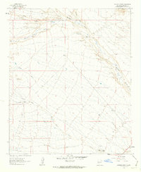
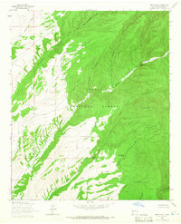
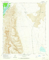 1961 Lava1964 Print · USGSSierra County's high desert is captured here in the early sixties, as the high peaks of the Fra Cristobal Range overlook the Rio Grande. Researchers can trace the Atchison Topeka and Santa Fe railroad through the Jornada del Muerto to the Lava Well Ranch.3 unique versions available
 - 1961 Map of Romero Canyon, 1964 Print
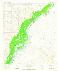
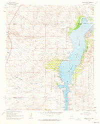 1961 Romero Canyon1964 Print · USGSThe Sierra County desert meets the rising waters of the Elephant Butte Reservoir in the early sixties. Genealogists and researchers can trace local ranching landmarks like Old Pankey Ranch and remote infrastructure such as Pete Well Road.3 unique versions available
 - 1962 Map of Roswell
 1962 Roswell1962 Print · USGSSoutheastern New Mexico in the early sixties shows a landscape defined by high mountain peaks and a growing military presence at Roswell. Genealogists and historians can trace the roads connecting Fort Stanton, Capitan, and the Mescalero Apache Indian Reservation.
 - 1962 Map of Socorro
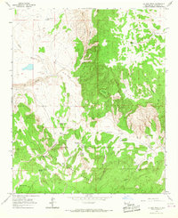
 1962 Socorro1962 Print · USGSCentral New Mexico comes alive in the early sixties as the rail-and-river corridor of the Rio Grande connects historic pueblos and ranching towns. Local historians can trace the route of the Atchison Topeka and Santa Fe through Belen or locate the Torrance Mine near Mountainair.
 - 1963 Map of Arroyo Landavaso, 1967 Print
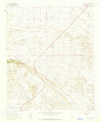
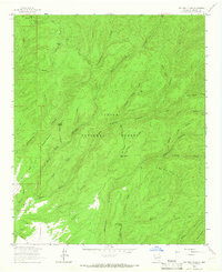
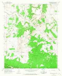
 1963 Arroyo Landavaso1967 Print · USGSMagdalena sat at the edge of the desert wilderness in the early sixties, where ranching life relied on a network of remote wells and reservoirs. Researchers can trace historic water sources like Boxcar Well and Landavaso Reservoir near the slopes of Cerro Pelon.2 unique versions available
 - 1964 Map of Arrowhead Well
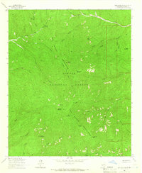
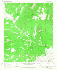
 1964 Arrowhead Well1964 Print · USGSSocorro County ranching country is captured here in the mid-sixties, showing a landscape defined by water rights and national forest boundaries. Researchers can trace the development of high-desert water sources like Arrowhead Well, the CCC Well, and the Fair Corral.
 - 1964 Map of Welty Hill, 1966 Print
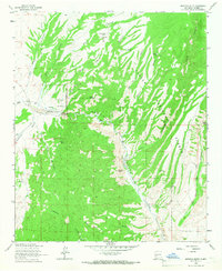
 1964 Welty Hill1966 Print · USGSSocorro County in the mid-1960s is shown here as a landscape of deep canyons and high ridges within the Cibola National Forest. Researchers can trace the network of vital water sources including Rock Spring Tank, Antelope Tank, and the winding Sim Yaten Canyon.2 unique versions available
 - 1964 Map of Vicks Peak, 1966 Print
 1964 Vicks Peak1966 Print · USGSThe high San Mateo Mountains come into sharp focus in the mid-1960s as a landscape of remote canyons and forest management. Researchers can trace historic mountain infrastructure from the Lookout Tower and COWBOY TRAIL to local landmarks like Myers Cabin and the Fluorite Mine.2 unique versions available
 - 1964 Map of San Juan Peak, 1966 Print
 1964 San Juan Peak1966 Print · USGSSocorro County’s high country remains largely untouched in the mid-1960s, centered on the elevations of the Cibola National Forest. Researchers can locate remote water sources and cattle infrastructure like San Juan Spring, Wasp Tank, and Eaton Tank.2 unique versions available
 - 1964 Map of Bay Buck Peaks, 1966 Print
 1964 Bay Buck Peaks1966 Print · USGSSocorro County's high-country wilderness is captured here in the mid-1960s, showing the complex ridges and drainages of the Cibola National Forest. Trace the names of remote landmarks like Alexander Mountain, Bay Buck Peaks, and the deep Whitewater Canyon.2 unique versions available
 - 1964 Map of Blue Mountain, 1966 Print
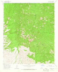
 1964 Blue Mountain1966 Print · USGSThe high backcountry of Socorro County during the mid-1960s is preserved here, centered on the rugged summits of the San Mateo Mountains. Researchers can trace old routes like the pack trail past Apache Kid Peak, Holdup Mountain, and Hardscrabble Spring.4 unique versions available
 - 1964 Map of Montoya Butte, 1966 Print
 1964 Montoya Butte1966 Print · USGSSocorro County during the mid-sixties reveals a rugged landscape of deep canyons and historic territorial lines. Genealogists and historians can trace the Old Indian Treaty Boundary near Alamosa and locate isolated water sources like Ojo Caliente Springs and Alum Spring.2 unique versions available
 - 1964 Map of Steel Hill, 1966 Print
 1964 Steel Hill1966 Print · USGSSocorro County ranching and mining lands appear here in the mid-1960s, showing the transition from forest to high plains. Researchers can trace historic site locations such as Picky Mine, the remote Nogal Canyon Ranch, and isolated landmarks like Rabbit Spring.2 unique versions available
 - 1964 Map of Grassy Lookout, 1966 Print
 1964 Grassy Lookout1966 Print · USGSSocorro County, New Mexico, is shown here in the mid-1960s as a landscape of remote mountain peaks and legacy mining operations. Researchers can trace the history of the local extraction economy at the Rosedale Mine and Bell Mine or locate water sources like Oak Spring.
 - 1964 Map of Monica Saddle, 1966 Print
 1964 Monica Saddle1966 Print · USGSThe high-elevation backcountry of Socorro County was primarily managed as part of the Cibola National Forest in the mid-1960s. Researchers can trace the layout of the Durfee Ranch and locate remote landmarks like Monica Saddle and Morley Tank.
 - 1964 Map of Indian Mesa, 1967 Print
 1964 Indian Mesa1967 Print · USGSSocorro County's high-desert grazing lands are documented here in the mid-1960s, showing the high peaks of the Gallinas Mountains. Researchers can locate family landmarks like the Baca Homestead and trace ranching infrastructure through the High Lonesome Windmill and Pinto Tank.
 - 1964 Map of La Jara Peak, 1967 Print
 1964 La Jara Peak1967 Print · USGSSocorro County ranchlands are captured here in the mid-1960s, showing a landscape defined by remote outposts and seasonal springs. You can trace the homesteading footprint at Benjamin Ranch and Rancho de los Chaves or locate water sources like Riley Spring.
 - 1964 Map of Table Mountain, 1967 Print
 1964 Table Mountain1967 Print · USGSThe Socorro County high country comes into focus in the mid-1960s, showing the intersection of ranching and mission life. Trace family-named landmarks like Benevites Tank, the remote Alamo Day Sch, and the rugged peaks of Table Mountain.2 unique versions available
 - 1964 Map of Silver Hill, 1967 Print
 1964 Silver Hill1967 Print · USGSSocorro County ranching life in the mid-sixties is centered here among the high desert canyons and mountains. Genealogists and local historians can trace legacy landholdings like Bear Springs Ranch and Pueblito Ranch alongside ancient Indian Ruins.2 unique versions available
Showing maps 1-25 of 50
Top cities of Socorro County
Frequently asked questions
- What are the different types of historical maps available for Socorro County?
- What is the oldest map of Socorro County?
- Where can I purchase historical maps of Socorro County for my home or office?
- Where can I download high-res historical maps of Socorro County?
- Are there historical topographic maps available for Socorro County?
- Is there historical aerial imagery available for Socorro County?
- Where are historical maps of Socorro County sourced from?