1990s Maps of Taos County, New Mexico
Explore 39 historic maps of Taos County from the 1990s. These maps offer a rare glimpse into what life looked like during the 1990s — showing old roads, neighborhoods, homes, and landmarks that have changed or disappeared over time.
Whether you're researching your family's past, planning a metal detecting trip, or studying how Taos County's landscape evolved across the 1990s, these high-resolution maps are a powerful tool for exploring the history of this region.
- Focus on a specific era: All maps on this page are from the 1990s, giving you a focused view of this time period.
- See what’s changed: Compare century-old streets, trails, and buildings to today's modern landscape using overlays and satellite layers.
- Research with precision: Use these maps for genealogy, historical research, land use analysis, or educational projects.
- View, download, or print: Maps are fully viewable online in high resolution, and can be downloaded or printed for your own records.
Start exploring Taos County's history through authentic maps from the 1990s. This is your window into the past.
Taos County, NM maps
(39)- 1995 Map of Arroyo Seco, 1997 Print
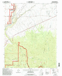
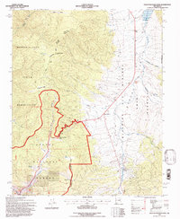
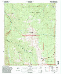
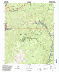
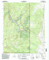
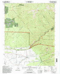 1995 Arroyo Seco1997 Print · USGSTaos County in the mid-nineties shows a unique intersection of ancestral land grants and high-altitude wilderness. Researchers can trace historic boundaries like the Arroyo Hondo Grant or locate specific landmarks like Kiowa Village and the Lawrence Ranch.
 - 1995 Map of Cerro Vista, 1997 Print
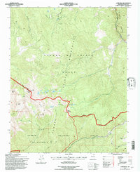
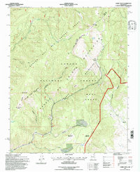 1995 Cerro Vista1997 Print · USGSThe Sangre de Cristo Mountains during the mid-nineties reveal a landscape shaped by historic land grants and forestry. Local historians can trace the boundaries of the Rancho del Rio Grande Grant and locate places like Little Korea and Chacon.
 - 1995 Map of Red River Pass, 1997 Print
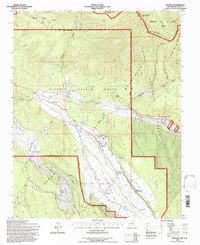
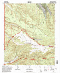
 1995 Red River Pass1997 Print · USGSThe Sangre de Cristo Mountains in the mid-1990s showcase a high-alpine landscape of historic land grants and wilderness. Researchers can trace early settlements at Memphis, locate high-country crossings like Bobcat Pass, and find old ranching sites including Moreno Ranch.
 - 1995 Map of Penasco, 1997 Print
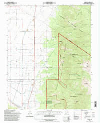
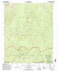
 1995 Penasco1997 Print · USGSIn the Sangre de Cristo foothills during the mid-nineties, traditional acequia irrigation systems remained vital to village life. Genealogists and historians can trace the ancient Camino Real through Peñasco or locate the historic Picuris Pueblo and San Acacio chapel.
 - 1995 Map of El Valle, 1997 Print
 1995 El Valle1997 Print · USGSNorthern New Mexico's traditional mountain villages and communal land grants are preserved here in the late twentieth century. Genealogists can trace family holdings like Tafoya Ranch or the historical village of El Valle alongside the high ridges of Jicarilla Peak.
 - 1995 Map of Cerro, 1997 Print
 1995 Cerro1997 Print · USGSSunshine Valley and the high Sangre de Cristo peaks met in the mid-nineties, showing a landscape defined by ranching and high-altitude wilderness. Researchers can trace the irrigation systems of Sunshine Ditch and Llano Ditch or locate the historic Latir Cem.
 - 1995 Map of Taos SW, 1997 Print
 1995 Taos SW1997 Print · USGSThe high plateau of northern New Mexico in the mid-1990s showcases a landscape shaped by deep canyons and historic Spanish land grants. Researchers can trace the boundaries of the Gijosa Grant and locate features like Pueblo Lower, Rio Vista, and Warm Springs.
 - 1995 Map of Shady Brook, 1997 Print
 1995 Shady Brook1997 Print · USGSThe high Sangre de Cristo Mountains of the mid-nineties are mapped here across the Rancho del Rio Grande Grant. Trace local development in Shady Brook and Valle Escondido, or locate water sources like Bernardin Lake and Porky Spring.
 - 1995 Map of Tres Ritos, 1997 Print
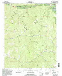
 1995 Tres Ritos1997 Print · USGSThe high alpine valleys of Taos County are captured here in the mid-1990s, showcasing a landscape of historic Spanish land grants and Forest Service outposts. Researchers can trace the winding Rio Pueblo to find Las Mochas, the Sipapu Ski Area, and Tres Ritos.
 - 1995 Map of Eagle Nest, 1997 Print
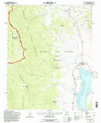 1995 Eagle Nest1997 Print · USGSThe Moreno Valley comes into focus during the mid-nineties, showing the intersection of historic land grants and high-country wilderness. Trace the remnants of the gold-mining era at Elizabethtown or the Klondike Mine while exploring the shores of Eagle Nest Lake.
 - 1995 Map of Osha Mountain, 1997 Print
 1995 Osha Mountain1997 Print · USGSThe high peaks and land grants of northern New Mexico are captured here in the mid-1990s as the borders of three counties meet. Genealogists and local historians can trace legacy sites like the San Antonio Ch Cem or navigate the high reaches of Osha Mountain and Valle Largo.
 - 1995 Map of Palo Flechado Pass, 1997 Print
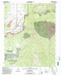
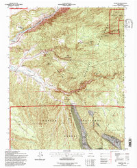
 1995 Palo Flechado Pass1997 Print · USGSHigh-altitude mountain passes and historical land grants define this corner of the Sangre de Cristo range in the mid-1990s. Researchers can trace the borders of the Pueblo de Taos Indian Reservation or locate the Angel Fire Ski Area and Agua Fria.2 unique versions available
 - 1995 Map of Latir Peak, 1997 Print
 1995 Latir Peak1997 Print · USGSThe Sangre de Cristo Mountains of Taos County are shown in the mid-1990s as a haven for wilderness and winter sports. High-country explorers and genealogists can trace the remote Baldy Cabin, the Rio Costilla Ski Area, and landmarks like the Latir Rock Cairn.
 - 1995 Map of Ranchos De Taos, 1997 Print
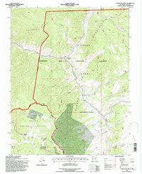
 1995 Ranchos De Taos1997 Print · USGSTraditional Spanish land grants and irrigation acequias define this high-altitude landscape near the end of the century. Genealogists and historians can trace family sites near Ranchos De Taos, St Francis Cem, and the Talpa Reservoir.
 - 1995 Map of Cerro De Los Taoses, 1997 Print
 1995 Cerro De Los Taoses1997 Print · USGSTaos County in the mid-nineties shows a high-desert landscape shaped by volcanic terrain and national forest boundaries. Researchers can trace the sparse settlement at One-Eleven and locate essential water sources like Tooses Tank and Aguaje Tank.
 - 1995 Map of The Wall, 1997 Print
 1995 The Wall1997 Print · USGSNorthern New Mexico and the Colorado borderland are shown in the mid-nineties, featuring the intersection of historic land grants and national forest. Researchers can trace remote mountain outposts like Bernal Cabin, the Van Diest Mine, and landmarks like Vermejo Peak.
 - 1995 Map of Jicarita Peak, 1997 Print
 1995 Jicarita Peak1997 Print · USGSThe high Sangre de Cristo Mountains of the mid-1990s are mapped here as they straddle three New Mexico counties. Trace high-altitude landmarks and alpine water sources including Jicarita Peak, Serpent Lake, and the historic trails of the Santa Barbara Grant.
 - 1995 Map of Truchas, 1997 Print
 1995 Truchas1997 Print · USGSHigh in the Sangre de Cristo Mountains during the mid-nineties, these traditional Hispanic villages remain centered around centuries-old land grant boundaries. Genealogists and historians can trace family locations in Truchas and Cordova or find the Trampas Cemetery near the county line.
 - 1995 Map of Pueblo Peak, 1997 Print
 1995 Pueblo Peak1997 Print · USGSNorthern New Mexico's high mountain landscape comes alive in the mid-nineties, showing the sharp transition from desert canyons to alpine peaks. Genealogists and historians can trace the Antoine Leroux Grant Boundary or locate landmarks like Pueblo Peak and the Rio Pueblo de Taos.
 - 1995 Map of Questa, 1997 Print
 1995 Questa1997 Print · USGSNorthern New Mexico's mining and mountain landscapes are captured here during the mid-nineties. Genealogists can trace family sites at the Questa Cemetery and Lama, while industrial historians can locate the Questa Molybdenum Mine.
 - 1995 Map of Red River, 1997 Print
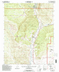
 1995 Red River1997 Print · USGSThe high mountain town of Red River is shown in the mid-1990s during a period of transition between its mining roots and its growth as a ski destination. Researchers can trace the industrial footprint of the Moly Mine and Open Pit Mine or find recreational landmarks like St Edwin Chapel and the Red River Ski Area.
 - 1995 Map of Comanche Point, 1997 Print
 1995 Comanche Point1997 Print · USGSHigh in the Sangre De Cristo Mountains during the mid-nineties, this area shows a landscape of forest management and early mining. Genealogists and historians can trace routes to the Midnight Mine or locate seasonal sites like La Belle Lodge and La Cueva Camp.
 - 1995 Map of Trampas, 1997 Print
 1995 Trampas1997 Print · USGSTraditional New Mexican land grants and mountain villages define this area during the mid-nineties. Genealogists and historians can locate family landmarks in Trampas and Dixon, including the Iglesia de Santo Tomas and the Harding Mine.
 - 1995 Map of Ojo Caliente, 1998 Print
 1995 Ojo Caliente1998 Print · USGSThe high desert of northern New Mexico is captured here in the mid-nineties, where the river valley supports a string of traditional settlements and mountain mines. Researchers can trace land grants and local genealogy through Ojo Caliente Cem, the Joseph Mine, and landmarks like Mesa Vista School.
 - 1995 Map of Holman, 1998 Print
 1995 Holman1998 Print · USGSNorthern New Mexico's high mountain valleys are documented here in the mid-nineties, showing the intersection of Spanish land grants and national forests. Genealogists and historians can locate the Agua Negra Cemetery near Holman or trace old water rights along the Sierra Ditch and La Sierra Ditch.
Showing maps 1-25 of 39
Top cities of Taos County
- Taos historical maps
- Questa historical maps
- Red River historical maps
- Costilla historical maps
- Taos Ski Valley historical maps
Frequently asked questions
- What are the different types of historical maps available for Taos County?
- What is the oldest map of Taos County?
- Where can I purchase historical maps of Taos County for my home or office?
- Where can I download high-res historical maps of Taos County?
- Are there historical topographic maps available for Taos County?
- Is there historical aerial imagery available for Taos County?
- Where are historical maps of Taos County sourced from?