Old Maps of Taos County, New Mexico for Hiking & Exploration
Hike through history with 352 historic maps of Taos County. Explore old trails, ghost towns, and forgotten backroads — perfect for outdoor adventurers and local explorers.
- Rediscover forgotten places: Map out old mining camps, roads, and footpaths that no longer exist on modern maps.
- Layer with modern tools: Combine with LiDAR or satellite views to plan hikes through historical terrain.
- Made for exploration: Popular among hikers, overlanders, and local history lovers.
Use these maps to find adventure and explore the hidden past of Taos County.
Taos County, NM maps
(352)- 1918 Map of Abiquiu
 1918 Abiquiu1918 Print · USGSUpper Rio Arriba County comes alive in the years following the Great War, showing a network of historic land grants and riverside villages. Researchers can trace the path of the D. and R. G. R. R. or locate ancestral roots in Abiquiu, Vallecitos, and San Juan.
 - 1918 Map of Tusas
 1918 Tusas1918 Print · USGSThe high country of Northern New Mexico and the Colorado border is captured here during the First World War. Researchers can trace the Denver and Rio Grande RR through remote stations like Toltec or locate early settlements in the Tierra Amarilla Grant.
 - 1953 Map of Truchas, 1955 Print
 1953 Truchas1955 Print · USGSNorthern New Mexico's high-altitude villages and traditional land grants are meticulously documented during the mid-century. Researchers can trace historic acequias and property lines within the Las Trampas Grant or locate ancestral sites in Truchas, Cordova, and Ojo Sarco.4 unique versions available
 - 1953 Map of Velarde, 1955 Print
 1953 Velarde1955 Print · USGSThe Rio Grande valley in the early fifties shows a landscape of traditional irrigation and canyon settlements. Genealogists and historians can trace the Low Ditch system through Velarde, find the Embudo Presbyterian Hospital, and locate family plots in the Dixon Cemeteries.2 unique versions available
 - 1953 Map of Trampas, 1955 Print
 1953 Trampas1955 Print · USGSNorthern New Mexico in the early fifties shows a landscape defined by deep canyons and ancient land grants. Researchers can trace the village layout of Trampas near the Iglesia de Santo Tomas and locate old mining operations like the Harding Mine.3 unique versions available
 - 1953 Map of Ojo Caliente, 1955 Print
 1953 Ojo Caliente1955 Print · USGSThe high desert of Taos and Rio Arriba Counties comes into focus during the early fifties, centering on the historic Ojo Caliente grant. Genealogists and historians can trace the foundations of local life at the Ojo Caliente Cemetery, the San Texas Mine, and the post office at Gallegos.3 unique versions available
 - 1954 Map of Raton, 1963 Print
 1954 Raton1963 Print · USGSNorthern New Mexico's high-country and plains are documented here in the early sixties, showing the region's ranching and mining infrastructure. Trace the legacy of the Maxwell Land Grant, locate remote rural sites like Tafoya School, and follow the Atchison Topeka and Santa Fe Railway through the heart of Raton.3 unique versions available
 - 1954 Map of Aztec, 1975 Print
 1954 Aztec1975 Print · USGSNorthern New Mexico and southern Colorado come alive in the mid-1950s, showing the high-country settlements and tribal lands of the San Juan Basin. Genealogists and historians can trace the path of the Denver & Rio Grande Western RR and locate communities like Abiquiu, Park View, and Lumberton.4 unique versions available
 - 1955 Map of Ute Park, 1957 Print
 1955 Ute Park1957 Print · USGSColfax County in the mid-1950s shows a landscape of storied land grants and high-country mining. You can trace the legacy of the Maxwell Grant and locate old workings at the Aztec Mine or the historic Virginia City site.5 unique versions available
 - 1958 Map of Raton
 1958 Raton1958 Print · USGSNorthern New Mexico and the Colorado borderlands are mapped here in the late fifties, showcasing a landscape of high peaks and historic land grants. Genealogists and historians can trace families across Picuris Pueblo, find old schoolhouses like Piedra Lumbre School, or follow the Atchison Topeka and Santa Fe rail line.3 unique versions available
 - 1958 Map of Aztec
 1958 Aztec1958 Print · USGSNorthern New Mexico and the southern Colorado border are captured here during the mid-fifties, showing the rugged intersection of national forests and tribal lands. Researchers can trace the Denver and Rio Grande Western rail line and locate remote outposts like Blanco Trading Post or Sargent Ranch.
 - 1960 Map of Taos Junction, 1963 Print
 1960 Taos Junction1963 Print · USGSHigh-altitude New Mexico terrain at the dawn of the sixties shows a landscape defined by ranching life and mountain transit. Researchers can trace the Old Railroad Grade and locate long-standing landmarks like Taos Junction and Cerro Azul.3 unique versions available
 - 1961 Map of Carson, 1963 Print
 1961 Carson1963 Print · USGSTaos County in the early sixties reveals a landscape of high-altitude forest and deep river canyons. Genealogists and historians can trace the homesteads around Carson PO or locate landmarks like Mondragon Tank and the riverside village of Pilar.3 unique versions available
 - 1961 Map of Tres Orejas, 1963 Print
 1961 Tres Orejas1963 Print · USGSNorthern New Mexico in the early 1960s features a landscape of high-desert peaks and arroyos. Researchers can trace the drainage of the Arroyo Aguaje de la Petaca and identify the summits of Tres Orejas within the Carson National Forest.2 unique versions available
 - 1961 Map of Servilleta Plaza, 1963 Print
 1961 Servilleta Plaza1963 Print · USGSNorthern New Mexico's high-country terrain is captured here in the early sixties, centered on the settlement of Servilleta Plaza. Genealogists and historians can trace the Old Railroad Grade near Route 285 and locate landmarks like Cerro Mojino.2 unique versions available
 - 1962 Map of Aztec
 1962 Aztec1962 Print · USGSNorthwestern New Mexico in the early sixties showcases a landscape defined by the arrival of the Navajo Reservoir and the high-altitude timber of the Carson National Forest. Trace the path of the Denver & Rio Grande Western RR or locate historic settlements like Tierra Amarilla and Gobernador.
 - 1962 Map of Ash Mountain, 1964 Print
 1962 Ash Mountain1964 Print · USGSThe Sangre de Cristo Mountains and the historic Maxwell Land Grant are captured here in the early sixties. Researchers can trace high-altitude ranching and mining history through sites like the Van Lint Mine, Penatlor Ruins, and family-named landmarks like Banning Place.3 unique versions available
 - 1963 Map of Los Pinos, 1967 Print
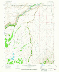 1963 Los Pinos1967 Print · USGSThe high borderlands of New Mexico and Colorado are captured here in the early sixties as the railroad still wound through the mountain passes. Researchers can trace the narrow-gauge path of the Denver and Rio Grande Western near Lava and Los Pinos.2 unique versions available
 - 1963 Map of Wheeler Peak, 1967 Print
 1963 Wheeler Peak1967 Print · USGSThe Sangre de Cristo Mountains rise to their highest New Mexico point in the early 1960s, revealing a landscape of high-altitude mining and wilderness. Trace the old mining operations at Twining and the Bull of the Woods Pasture Mines or locate remote outposts like Ditch Cabin.2 unique versions available
 - 1963 Map of Pinabetoso Peaks, 1967 Print
 1963 Pinabetoso Peaks1967 Print · USGSThe high borderlands between New Mexico and Colorado are captured here in the early 1960s, showing a landscape defined by industrial history and rugged terrain. Local historians can trace the clear path of the Old Railroad Grade as it bypasses the Pinabetoso Peaks.2 unique versions available
 - 1963 Map of Eagle Nest, 1967 Print
 1963 Eagle Nest1967 Print · USGSThe Moreno Valley and the Sangre de Cristo high country come into focus during the early sixties, centered on the waters of Eagle Nest Lake. Local historians can trace the Maxwell Grant boundaries and find remote sites like the Klondike Mine and Idlewild.3 unique versions available
 - 1963 Map of Costilla, 1967 Print
 1963 Costilla1967 Print · USGSThe Colorado-New Mexico borderlands in the early 1960s reveal a landscape defined by traditional irrigation and ranching. Genealogists and historians can trace family-named water systems like Acequia Madre and Cordillera Ditch near the village of Costilla.3 unique versions available
 - 1963 Map of Arroyo Seco, 1967 Print
 1963 Arroyo Seco1967 Print · USGSIn the high country north of Taos during the early sixties, the valley settlements meet the Sangre de Cristo foothills. Genealogists and historians can trace traditional land grants and local landmarks like Arroyo Seco, Valdez, and the Lawrence Ranch.2 unique versions available
 - 1963 Map of Amalia, 1967 Print
 1963 Amalia1967 Print · USGSTaos County’s high mountain valleys are captured in the early sixties as they transition into the modern era. Genealogists and local historians can trace the community life of the region through landmarks like Santo Niño Ch, Amalia Sch, and the isolated Mine sites near Ballejos Creek.2 unique versions available
 - 1963 Map of Arroyo Hondo, 1967 Print
 1963 Arroyo Hondo1967 Print · USGSTaos County in the early sixties reveals a landscape of traditional acequias and historic Spanish land grants along the river canyons. Genealogists can trace family sites like the Lady of Sorrows Ch and Rael Cem or locate the Manby Hot Springs.
Showing maps 1-25 of 352
Top cities of Taos County
- Taos historical maps
- Questa historical maps
- Red River historical maps
- Costilla historical maps
- Taos Ski Valley historical maps
Frequently asked questions
- What are the different types of historical maps available for Taos County?
- What is the oldest map of Taos County?
- Where can I purchase historical maps of Taos County for my home or office?
- Where can I download high-res historical maps of Taos County?
- Are there historical topographic maps available for Taos County?
- Is there historical aerial imagery available for Taos County?
- Where are historical maps of Taos County sourced from?