Old Maps of Crow Hill District, North Dakota for Academic Research
Study the evolution of Crow Hill District with 54 high-resolution historic maps. Whether you're teaching, researching, or modeling changes in land use, these maps provide essential visual documentation of urban, environmental, and geographic change.
- Analyze long-term change: Track patterns in development, transportation, and natural features.
- Ideal for environmental or urban studies: Support academic projects with primary historical map data.
- Use in the classroom or lab: Educators and researchers rely on these maps to bring historical context to life.
These maps are a powerful tool for teaching, research, and visualizing how Crow Hill District has changed over the decades.
Crow Hill District, ND maps
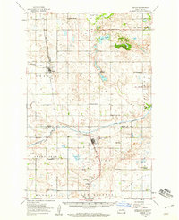
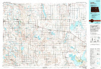
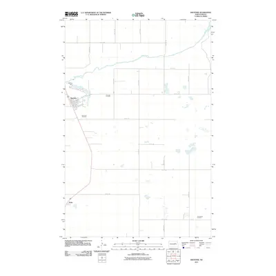
(54)- 1931 Map of Oberon
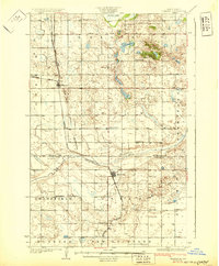 1931 Oberon1931 Print · USGSThe North Dakota prairie unfolds in the late twenties as a network of rail-side towns and rural townships north of the Sheyenne River. Genealogists and historians can trace the exact locations of Grandfield Ch, St Gertrudes Ch, and several numbered country schools.2 unique versions available
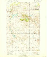
 - 1932 Map of Grahams Island
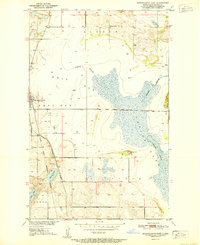
 1932 Grahams Island1932 Print · USGSDevils Lake and Grahams Island are seen here in the early 1930s as a complex network of prairie schools and railroads. Genealogists can locate family landmarks like St Paul Cem, Antiochia Ch, and the many numbered schools scattered across Normania and Coulee.
 - 1950 Map of Oberon SW
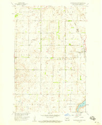
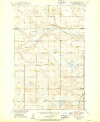 1950 Oberon SW1950 Print · USGSMid-century Eddy County remains a landscape of traditional township borders and scattered prairie schoolhouses. Genealogists can locate Grandfield Ch and Town Hall, or trace the Northern Pacific tracks as they cross the Sheyenne River.2 unique versions available
 - 1950 Map of Sheyenne
 1950 Sheyenne1950 Print · USGSMid-century Eddy County comes into focus as a network of rural schools and rail-side settlements in the years following the war. Genealogists and historians can trace the foundations of Sheyenne and Divide, along with local landmarks like Holy Cross Cem and Rose Hill Sch.3 unique versions available
 - 1950 Map of Grahams Island, 1959 Print
 1950 Grahams Island1959 Print · USGSDevils Lake and its rugged shoreline dominate this mid-century survey of Benson and Ramsey counties. Local historians can trace the legacy of rural education and faith at School No 5, St Paul Cem, and the Old Military Reservation.2 unique versions available
 - 1950 Map of Oberon, 1960 Print
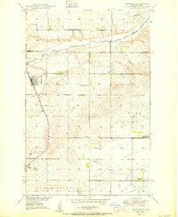
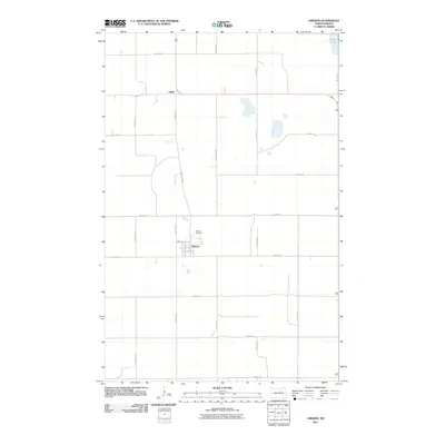
 1950 Oberon1960 Print · USGSBenson and Eddy Counties are captured here at mid-century, defined by a landscape of prairie schoolhouses and the winding Sheyenne River. Genealogists can trace the locations of family landmarks like Holy Cross Cem, St Jerome Ch, and the town of Oberon along the Northern Pacific rail line.
 - 1951 Map of Crow Hill
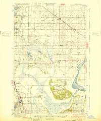
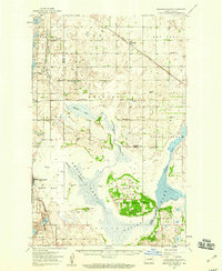
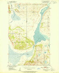
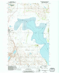
 1951 Crow Hill1951 Print · USGSBenson County was a landscape of small school districts and rural parishes in the early fifties. Genealogists and historians can trace the foundations of this community through landmarks like St Jerome Ch, Plainview Sch No 2, and the shores of Twin Lakes.2 unique versions available
 - 1951 Map of Oberon
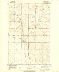 1951 Oberon1951 Print · USGSBenson County prairie life is centered on the railroad in the early fifties, where the tracks connect small rural hubs. Researchers can trace the Old Indian Reservation Boundary and locate family landmarks like Hillside Cem and Oberon.2 unique versions available
 - 1951 Map of Grahams Island
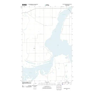
 1951 Grahams Island1951 Print · USGSGrahams Island and the intricate bays of Devils Lake are captured here in the early fifties, showing the region's rural character. Trace the Old Military Reservation Boundary or locate local landmarks like School No 1 and School No 2.2 unique versions available
 - 1951 Map of Minnewaukan East
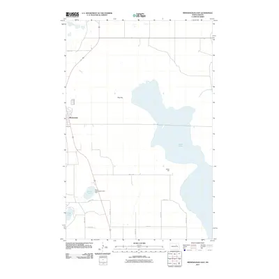
 1951 Minnewaukan East1951 Print · USGSThe Benson County shoreline in the early 1950s shows the complex water levels of Devils Lake and the rural reaches of Minnewaukan. Genealogists and local historians can locate early landmarks like School No 1, the Northern Pacific rail line, and family landmarks like Sams Hill.
 - 1952 Map of New Rockford, 1968 Print
 1952 New Rockford1968 Print · USGSThe North Dakota prairie during the mid-1950s was a landscape of rail-dependent farm towns and vast wildlife refuges. Genealogists and historians can trace the foundations of local communities at Fort Totten Indian Agenc, Concordia Lutheran Church, and the Bowdon Country Church and Cemetery.3 unique versions available
 - 1953 Map of Devils Lake, 1968 Print
 1953 Devils Lake1968 Print · USGSNorth Dakota's northern plains are captured here in the mid-fifties, showing a landscape of rail-fed grain elevators and prairie wetlands. Genealogists can locate family landmarks like Rose Hill School, Hurricane Lake Church, and the Turtle Mountain Indian Reservation.3 unique versions available
 - 1956 Map of New Rockford
 1956 New Rockford1956 Print · USGSMid-century central North Dakota is captured here as a landscape of prairie rail towns and vast wildlife refuges. Trace family roots at the Bowdon Country Church and Cemetery or locate the old St Michael Mission School and Fort Totten.
 - 1956 Map of Devils Lake
 1956 Devils Lake1956 Print · USGSNorthern North Dakota is shown at a mid-century peak of rail-driven agriculture, where the Soo Line and Great Northern railroads cross the prairie. Trace the borders of the Turtle Mountain Indian Reservation and locate local landmarks like Rose Hill School or Camp Grafton.
 - 1958 Map of Minnewaukan West, 1959 Print
 1958 Minnewaukan West1959 Print · USGSBenson County's prairie landscape is captured here in the late fifties as the town of Minnewaukan sits at a rail and water crossroads. Researchers can trace the Northern Pacific line or locate family sites at St Peter Cem and Free Church Cem.2 unique versions available
 - 1971 Map of New Rockford, 1974 Print
 1971 New Rockford1974 Print · USGSCentral North Dakota was a landscape of wildlife refuges and rail-linked agricultural towns in the early seventies. Genealogists and local historians can trace the development of the Fort Totten Indian Reservation and locate old railway points like Maddock, Hamal, and Kloten.
 - 1981 Map of New Rockford
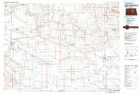 1981 New Rockford1981 Print · USGSCentral North Dakota's prairie heartland is captured here in the early eighties, showing a landscape defined by the Burlington Northern rail lines and sprawling waterfowl refuges. Genealogists and local historians can trace the foundations of New Rockford, Maddock, and Fessenden, alongside landmarks like Tomlinson Field and the Fort Totten Indian Reservation.
 - 1985 Map of Leeds, 1994 Print
 1985 Leeds1994 Print · USGSBenson and Ramsey counties are shown during the mid-eighties as a patchwork of prairie agriculture and vital wetland habitats. Researchers can locate family roots at Knox Cem, trace the Soo Line rail corridors, or explore the fringes of Devils Lake.
 - 1994 Map of Minnewaukan East, 1995 Print
 1994 Minnewaukan East1995 Print · USGSBenson County's lakeside landscape comes into focus in the mid-1990s as it transitions from the town of Minnewaukan into tribal lands. Genealogists and historians can trace the boundaries of the Sioux Indian Reservation and locate local landmarks like Humphrey Memorial Park or Sams Hill.
 - 2011 Map of Oberon SW, 2011 Print
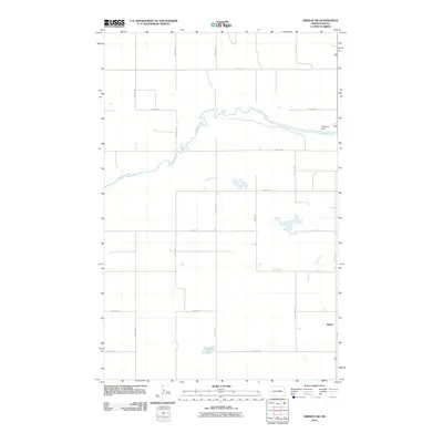 2011 Oberon SW2011 Print · USGSCovers Crow Hill District, including Eddy County, Benson County, and other nearby areas
 - 2011 Map of Crow Hill, 2011 Print
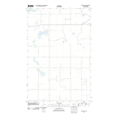 2011 Crow Hill2011 Print · USGSCovers Crow Hill District, including Fort Totten District, Fort Totten, and other nearby areas
 - 2011 Map of Sheyenne, 2011 Print
 2011 Sheyenne2011 Print · USGSCovers Crow Hill District, including Sheyenne, Divide, and other nearby areas
 - 2011 Map of Oberon, 2011 Print
 2011 Oberon2011 Print · USGSCovers Crow Hill District, including Lallie, Oberon, and other nearby areas
 - 2011 Map of Grahams Island, 2011 Print
 2011 Grahams Island2011 Print · USGSCovers Crow Hill District, including Fort Totten District, Benson County, and other nearby areas
 - 2011 Map of Minnewaukan East, 2011 Print
 2011 Minnewaukan East2011 Print · USGSCovers Crow Hill District, including Minnewaukan, Benson County, and other nearby areas
Showing maps 1-25 of 54
Top cities near Crow Hill District
- Devils Lake historical maps
- Lallie historical maps
- Minnewaukan historical maps
- Sheyenne historical maps
- Grand Harbor historical maps
- Oberon historical maps
See more
Top neighborhoods of Crow Hill District
Frequently asked questions
- What are the different types of historical maps available for Crow Hill District?
- What is the oldest map of Crow Hill District?
- Where can I purchase historical maps of Crow Hill District for my home or office?
- Where can I download high-res historical maps of Crow Hill District?
- Are there historical topographic maps available for Crow Hill District?
- Is there historical aerial imagery available for Crow Hill District?
- Where are historical maps of Crow Hill District sourced from?