1980s Maps of Emmons County, North Dakota
Explore 9 historic maps of Emmons County from the 1980s. These maps offer a rare glimpse into what life looked like during the 1980s — showing old roads, neighborhoods, homes, and landmarks that have changed or disappeared over time.
Whether you're researching your family's past, planning a metal detecting trip, or studying how Emmons County's landscape evolved across the 1980s, these high-resolution maps are a powerful tool for exploring the history of this region.
- Focus on a specific era: All maps on this page are from the 1980s, giving you a focused view of this time period.
- See what’s changed: Compare century-old streets, trails, and buildings to today's modern landscape using overlays and satellite layers.
- Research with precision: Use these maps for genealogy, historical research, land use analysis, or educational projects.
- View, download, or print: Maps are fully viewable online in high resolution, and can be downloaded or printed for your own records.
Start exploring Emmons County's history through authentic maps from the 1980s. This is your window into the past.
Emmons County, ND maps
(9)- 1980 Map of Linton
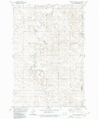
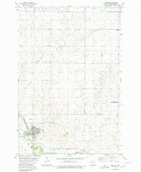 1980 Linton1980 Print · USGSLinton is shown in the early eighties as a thriving rail and agricultural center in Emmons County. Researchers can trace the legacy of local families at St Anthonys Cem or investigate the unique industrial site of the Volcanic Ash Pit.
 - 1980 Map of Rohrich Dam
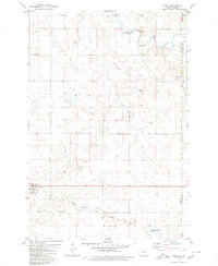
 1980 Rohrich Dam1980 Print · USGSEmmons County in the late 1970s is captured here as a landscape of prairie drainage and quiet family histories. Researchers can locate remote burial grounds like Bethlehem Cem and Omio Cem or trace the path of Clear Creek.
 - 1980 Map of Linton
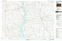 1980 Linton1980 Print · USGSThe Missouri River corridor in the early eighties serves as a backdrop for the sprawling Standing Rock Indian Reservation and Missouri plateau farm towns. Researchers can trace historic railroad routes like the Burlington Northern and find local landmarks such as Fort Yates, Solen, and Winona Flats.
 - 1980 Map of Hague
 1980 Hague1980 Print · USGSThe prairie town of Hague is captured during the early eighties, situated along the county line. Genealogists and historians can trace the local rail corridor of the Chicago Milwaukee St Paul and Pacific and locate landmarks like St Marys Cem and the Vetter site.
 - 1980 Map of Weisser Dam West
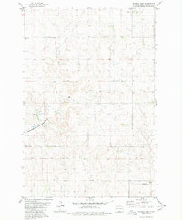
 1980 Weisser Dam West1980 Print · USGSThe prairie landscape of south-central North Dakota is captured here during the late 1970s, showing a traditional agrarian layout. Local historians can trace the foundations of the community at St Aloysius Ch and Odessa Sch or locate the Weisser Dam along the drainage of Beaver Creek.
 - 1985 Map of Mobridge
 1985 Mobridge1985 Print · USGSCrossing the Missouri River in the mid-1980s, this landscape reveals the intersection of the Standing Rock Indian Reservation and the rising waters of Lake Oahe. Researchers can locate significant historical markers such as Sitting Bulls Grave, St Elizabeth Mission Home, and the Leavenworth Monument.2 unique versions available
 - 1985 Map of Eureka, 1986 Print
 1985 Eureka1986 Print · USGSThe northern plains of the mid-eighties come alive in this survey of the border country between South Dakota and North Dakota. Researchers can trace the rail-side growth of Eureka and Hosmer or locate local landmarks like the Plainview Colony and Lake Hiddenwood State Park.3 unique versions available
 - 1985 Map of Steele, 1994 Print
 1985 Steele1994 Print · USGSCentral North Dakota’s prairie pothole region is showcased here in the mid-1980s, revealing a landscape of vital wetlands and rail-dependent towns. Researchers can trace family ties and land use near Steele, Napoleon, and the many waterfowl production areas like Slade National Wildlife Refuge.
 - 1986 Map of Wishek
 1986 Wishek1986 Print · USGSMcIntosh and Logan counties are depicted here in the mid-1980s, a period defined by small-town rail commerce and extensive prairie conservation. Genealogists and researchers can trace the rail corridors of the Soo Line and Burlington Northern through centers like Wishek, Ashley, and Fredonia.2 unique versions available
End of results
Showing maps 1-9 of 9
Top cities of Emmons County
- Linton historical maps
- Strasburg historical maps
- Hazelton historical maps
- Hague historical maps
- Braddock historical maps
Frequently asked questions
- What are the different types of historical maps available for Emmons County?
- What is the oldest map of Emmons County?
- Where can I purchase historical maps of Emmons County for my home or office?
- Where can I download high-res historical maps of Emmons County?
- Are there historical topographic maps available for Emmons County?
- Is there historical aerial imagery available for Emmons County?
- Where are historical maps of Emmons County sourced from?