Old Maps of Emmons County, North Dakota for Academic Research
Study the evolution of Emmons County with 285 high-resolution historic maps. Whether you're teaching, researching, or modeling changes in land use, these maps provide essential visual documentation of urban, environmental, and geographic change.
- Analyze long-term change: Track patterns in development, transportation, and natural features.
- Ideal for environmental or urban studies: Support academic projects with primary historical map data.
- Use in the classroom or lab: Educators and researchers rely on these maps to bring historical context to life.
These maps are a powerful tool for teaching, research, and visualizing how Emmons County has changed over the decades.
Emmons County, ND maps
(285)- 1907 Map of Bismarck
 1907 Bismarck1907 Print · USGSThe Missouri River corridor at the turn of the century shows North Dakota's capital and rail hubs in their formative years. Researchers can trace early land divisions and transport routes like the Fort Yates Stage Road and landmarks such as Fort Lincoln or St Anthony.2 unique versions available
 - 1953 Map of Jamestown
 1953 Jamestown1953 Print · USGSSoutheastern North Dakota was a thriving rail and agricultural corridor in the early fifties, anchored by the James River. Researchers can trace the footprints of institutional landmarks like the North Dakota State Hospital and historic sites such as Whitestone Hill Battlefield Park.3 unique versions available
 - 1953 Map of McIntosh, 1965 Print
 1953 McIntosh1965 Print · USGSThe north-central Dakota prairie is captured here during the mid-fifties, showing the vast Standing Rock Indian Reservation and the newly formed Oah E Reservoir. Genealogists and historians can trace the Chicago Milwaukee St Paul and Pacific rail line through stops like McIntosh, Walker, and Eagle Butte.3 unique versions available
 - 1954 Map of Aberdeen, 1964 Print
 1954 Aberdeen1964 Print · USGSNortheastern South Dakota in the mid-fifties remains a world of rail-dependent prairie towns and sweeping waterfowl refuges. Genealogists can trace family roots through settlements like Eureka and Ipswich or locate rural landmarks near Richmond Lake.2 unique versions available
 - 1954 Map of Bismarck, 1967 Print
 1954 Bismarck1967 Print · USGSBismarck and the Missouri River basin are shown in the mid-1960s as the Oahe Reservoir reshaped the valley. Genealogists can trace family-named landmarks like Dog Tooth Buttes and small prairie settlements such as Fort Yates, Selfridge, and Brisbane.2 unique versions available
 - 1956 Map of Aberdeen
 1956 Aberdeen1956 Print · USGSUpper South Dakota during the mid-fifties remains a landscape of rail-connected farming towns and expansive glacial lake basins. Genealogists and historians can trace the paths of the Minneapolis and St Louis railroad through Gettysburg or locate vanished stops near Elm Lake and Richmond Lake.
 - 1956 Map of Jamestown
 1956 Jamestown1956 Print · USGSThe James River valley and the vast alkali lake country of south-central North Dakota are captured here in the mid-fifties. Genealogists can trace family farms across several counties, locating small rail stops like Medberry and monuments like Whitestone Hill Battlefield Park.
 - 1958 Map of Bismarck
 1958 Bismarck1958 Print · USGSCentral North Dakota in the late fifties is defined by the Missouri River and the sprawling Standing Rock Indian Reservation. Genealogists and historians can trace rail-line outposts like Sedalia Siding or explore local landmarks like Saint Anthony and Fort Lincoln State Park/Museum.
 - 1958 Map of McIntosh
 1958 McIntosh1958 Print · USGSThe north-central Dakotas appear here in the mid-1950s as massive engineering projects and rail lines shaped the plains. Researchers can trace tribal lands within the Standing Rock Indian Reservation and locate local landmarks like the Keller Mine or the Virginia Siding.
 - 1962 Map of Sugarloaf Butte, 1963 Print
 1962 Sugarloaf Butte1963 Print · USGSThe Missouri River bottoms south of Bismarck were in transition during the early sixties as reservoir waters began to rise. Genealogists and historians can trace the Old Fort Rice Military Road, locate Manning School No 1, and find the Stewardsdale Cem.
 - 1965 Map of Herreid NW, 1966 Print
 1965 Herreid NW1966 Print · USGSThe borderlands of North and South Dakota meet the rising waters of the Missouri River basin in the mid-sixties. Genealogists and local historians can locate the Spring Creek Cem and trace the original path of Spring Creek before it enters Oahe Reservoir.
 - 1965 Map of Herreid NE, 1966 Print
 1965 Herreid NE1966 Print · USGSThe northern edge of the South Dakota prairie meets the North Dakota border in the mid-1960s. Genealogists and local historians can locate a rural Cem and trace the shores of Nieuwsma Lake along the Emmons and Campbell county line.
 - 1965 Map of Pollock, 1967 Print
 1965 Pollock1967 Print · USGSPollock was a town transformed by the mid-1960s as it adjusted to its new position between Oahe Reservoir and Pocasse Lake. Genealogists and researchers can trace the Soo Line rail route or locate rural burial grounds like Spring Valley Cem.
 - 1966 Map of Mahto NE, 1967 Print
 1966 Mahto NE1967 Print · USGSThe Missouri River borderlands in the mid-1960s reveal a landscape shaped by the rising Oahe Reservoir. Genealogists and historians can trace the Standing Rock Indian Reservation Boundary and drainage at Fireheart Creek and Blackfoot Creek.2 unique versions available
 - 1966 Map of Pollock NW, 1967 Print
 1966 Pollock NW1967 Print · USGSThe Missouri River valley undergoes a massive transition in the mid-1960s as the Oahe Reservoir fills the landscape. Researchers can trace the submerged riverbanks and the Standing Rock Indian Reservation Boundary alongside landmarks like Dale Cem.
 - 1968 Map of Cannon Ball, 1971 Print
 1968 Cannon Ball1971 Print · USGSThe Missouri River valley near the Standing Rock Indian Reservation is shown here in the late sixties as Lake Oahe reshaped the landscape. Trace the local geography of Cannon Ball, from the Cannon Ball Memorial Congregational Cem to the Old Railroad Grade.2 unique versions available
 - 1968 Map of Cannon Ball SE, 1971 Print
 1968 Cannon Ball SE1971 Print · USGSThe Missouri River valley in the late sixties reveals a landscape transformed by the reservoir waters of Lake Oahe. Genealogists and local historians can locate early landmarks like the Old Catholic Cem and St James Ch on the bluffs above the rising water.
 - 1968 Map of Fort Yates NW, 1971 Print
 1968 Fort Yates NW1971 Print · USGSThe Missouri River breaks of Sioux County appear here in the late sixties as the waters of Lake Oahe rise. Researchers can trace the boundaries of the Standing Rock Ind Res Bdy and locate St Lukes Cem along the rugged coulees of Porcupine Creek.
 - 1968 Map of Fort Yates SE, 1971 Print
 1968 Fort Yates SE1971 Print · USGSThe Missouri River borderlands in the late sixties show a landscape transformed by the rising waters of the newly formed reservoir. Trace the shoreline of Lake Oahe past Winona Flats and the Reierson Landing Strip as it meets the Standing Rock Indian Reservation.
 - 1968 Map of Fort Yates NE, 1971 Print
 1968 Fort Yates NE1971 Print · USGSThe Missouri River valley in Emmons County is seen here during the late 1960s as the river basin underwent significant transformation. Genealogists and researchers can trace local landmarks like Lutheran Cem and the geography of Winona Flats near Beaver Creek.2 unique versions available
 - 1971 Map of Moffit SW, 1973 Print
 1971 Moffit SW1973 Print · USGSEmmons County land is captured here in the early seventies, dominated by the lingering lines of a nineteenth-century military frontier. Researchers can trace the Old Fort Rice Military Reservation Boundary and locate local landmarks like Rattlesnake Butte and Devils Gulch.
 - 1971 Map of Huff, 1973 Print
 1971 Huff1973 Print · USGSThe Missouri River breaks near Huff are captured here during the early 1970s, showcasing a landscape of high buttes and military history. Genealogists and historians can locate the Parum Cem, Ambulance Butte Sch, and the old Fort Rice Military Reservation Boundary.
 - 1971 Map of Grassna NW, 1973 Print
 1971 Grassna NW1973 Print · USGSNorth Dakota's rural plains are captured here in the early seventies, showing the waters of Lake Oahe meeting the mouth of Beaver Creek. Researchers can locate family landmarks like St Bernard Ch or trace the drainage patterns of Berreth Lake and Schumacher Slough.
 - 1971 Map of Kiefer Buttes, 1973 Print
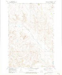 1971 Kiefer Buttes1973 Print · USGSEmmons County prairie land is mapped here in the early 1970s, showcasing a landscape of high buttes and seasonal watercourses. Local history researchers can trace the natural landmarks of the region, from the heights of Kiefer Buttes and Smith Butte to the waters of Becker Lake.
 - 1971 Map of Grassna, 1973 Print
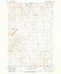 1971 Grassna1973 Print · USGSEmmons County farming country is shown here in the early seventies, centered on the small prairie settlement of Grassna. Researchers can locate the Holy Trinity Ch and trace the paths of Little Beaver Creek and Cattail Creek through the local buttes.
Showing maps 1-25 of 285
Top cities of Emmons County
- Linton historical maps
- Strasburg historical maps
- Hazelton historical maps
- Hague historical maps
- Braddock historical maps
Frequently asked questions
- What are the different types of historical maps available for Emmons County?
- What is the oldest map of Emmons County?
- Where can I purchase historical maps of Emmons County for my home or office?
- Where can I download high-res historical maps of Emmons County?
- Are there historical topographic maps available for Emmons County?
- Is there historical aerial imagery available for Emmons County?
- Where are historical maps of Emmons County sourced from?